FAA INFORMATION EFFECTIVE 18 APRIL 2024
Location
| FAA Identifier: | JNU |
| Lat/Long: | 58-21-16.9625N 134-34-42.4939W
58-21.282708N 134-34.708232W
58.3547118,-134.5784705
(estimated) |
| Elevation: | 25.3 ft. / 8 m (estimated) |
| Variation: | 20E (2015) |
| From city: | 7 miles NW of JUNEAU, AK |
| Time zone: | UTC -8 (UTC -9 during Standard Time) |
| Zip code: | 99801 |
Airport Operations
| Airport use: | Open to the public |
| Activation date: | 11/1941 |
| Control tower: | yes |
| ARTCC: | ANCHORAGE CENTER |
| FSS: | JUNEAU FLIGHT SERVICE STATION (on field) [907-586-7380]
CTC JUNEAU FSS FOR AIRPORT ADVISORY SERVICE ON 118.7 WHEN TOWER IS CLSD. |
| NOTAMs facility: | JNU (NOTAM-D service available) |
| Attendance: | CONTINUOUS |
| Wind indicator: | lighted |
| Segmented circle: | yes |
| Lights: | FOR HIRL RWY 08/26, MALSF RWY 08 & REIL RWY 26 CTC JNU ATCT ON FREQ 118.7. WHEN ATCT CLSD CTC JNU FSS ON FREQ 118.7. VASI RWY 08 & PAPI RWY 26 OPER 24 HRS. |
| Beacon: | white-green (lighted land airport)
Operates sunset to sunrise. |
| Landing fee: | yes |
| Fire and rescue: | ARFF index C |
| International operations: | international airport of entry |
Airport Communications
| CTAF: | 118.7 |
| UNICOM: | 122.95 |
| ATIS: | 135.2 |
| WX ASOS: | PHONE 907-789-1243 |
| JUNEAU GROUND: | 121.9 [1 APR - SEP 30 0600 - 2300, 1 OCT - MAR 31, 0700 - 2000.] |
| JUNEAU TOWER: | 118.7 278.3 120.7 ;SEASONAL USE ONLY [1 APR - SEP 30 0600 - 2300, 1 OCT - MAR 31, 0700 - 2000.] |
| CLEARANCE DELIVERY: | 121.9 |
| NG OPS: | 124.65 64.7 |
- APCH/DEP SVC PRVDD BY ANCHORAGE ARTCC ON FREQ 133.9 (MOUNT ROBERT BARRON RCAG).
- JUNEAU INTL SEAPLANE BASIN CONTACT JUNEAU TWR ON FREQ 118.7 FOR TAXI; TAKE-OFF; AND LANDING INSTRUCTIONS. WATERLANE CONTROLLED BY JUNEAU ATCT. TAXING ACFT SHOULD TAXI CLOCKWISE AROUND THE OUTER EDGE OF FLOAT POND.
- BTN MAY & SEP AN ADDITIONAL LC FREQ OF 120.7 WILL BE IN USE. ITS USE WILL BE ANNOUNCED VIA THE ATIS. ALL OTR TIME USE 118.7 AS LC.
- CTC JUNEAU FSS ON 118.7 FOR ADVISORY SVC WHEN JNU TWR CLSD.
- COMMUNICATIONS PRVDD BY JUNEAU FSS ON FREQ 122.2.
Nearby radio navigation aids
| VOR radial/distance | | VOR name | | Freq | | Var |
|---|
| SSRr044/24.0 | | SISTERS ISLAND VORTAC | | 114.00 | | 20E |
Airport Services
| Fuel available: | 100LL JET-A1+
100LL:FUEL AVBL THRU ARPT SVCS ON UNICOM OR 907-789-0055 OR 907-789-5622. |
| Parking: | buoy, hangars and tiedowns |
| Airframe service: | MAJOR
AIRFRAME/POWER PLANT SVC FOR SINGLE/TWIN PROP ENG ACFT TURBIN & AVIONICS. |
| Powerplant service: | MAJOR |
| Bottled oxygen: | NONE |
Runway Information
Runway 8/26
| Dimensions: | 8857 x 150 ft. / 2700 x 46 m |
| Surface: | asphalt/grooved, in good condition |
| Weight bearing capacity: | | PCN 89 /F/C/X/T | | Single wheel: | 120.0 | | Double wheel: | 250.0 | | Double tandem: | 550.0 |
|
| Runway edge lights: | high intensity |
| RUNWAY 8 | | RUNWAY 26 |
| Latitude: | 58-21.470833N | | 58-21.098000N |
| Longitude: | 134-35.818167W | | 134-33.143833W |
| Elevation: | 25.0 ft. | | 23.4 ft. |
| Traffic pattern: | right | | left |
| Runway heading: | 085 magnetic, 105 true | | 265 magnetic, 285 true |
| Declared distances: | TORA:8857 TODA:8857 ASDA:8457 LDA:8457 | | TORA:8857 TODA:8857 ASDA:8457 LDA:8457 |
| Markings: | nonprecision, in fair condition | | nonprecision, in fair condition |
| Visual slope indicator: | 2-box VASI on left (3.50 degrees glide path)
VASI ALIGNED APRXLY 13 DEGS RIGHT OF RY CNTRLN AND IS NOT VISIBLE ON RY CNTRL. VASI UNUSBL BYD 06 DEGS LEFT OF CRS. | | 4-light PAPI on left (3.50 degrees glide path)
RY 26 PAPI UNUSBL BYD 2 NM DUE TO TERRAIN. |
| RVR equipment: | touchdown, rollout | | touchdown, rollout |
| Approach lights: | MALSF: 1,400 foot medium intensity approach lighting system with sequenced flashers
RLLS LGTS: ( JNUB BATTLESHIP ISLAND, JNUA ENGINEERS CUT, JNU WETLANDS/FLATS) | | MALS: 1,400 foot medium intensity approach lighting system
RY 26 MALS NSTD; LENGTH 800 FT. |
| Runway end identifier lights: | yes | | yes |
| Centerline lights: | yes | | yes |
| Touchdown point: | yes, no lights | | yes, no lights |
| Instrument approach: | LDA/DME | | |
| Obstructions: | 573 ft. tower, marked and lighted, 7600 ft. from runway, 900 ft. left of centerline, 12:1 slope to clear | | none |
Runway 8W/26W
| Dimensions: | 4800 x 150 ft. / 1463 x 46 m |
| Surface: | water |
| RUNWAY 8W | | RUNWAY 26W |
| Latitude: | 58-21.380333N | | 58-21.178500N |
| Longitude: | 134-35.870500W | | 134-34.421000W |
| Traffic pattern: | left | | left |
Airport Ownership and Management from official FAA records
| Ownership: | Publicly-owned |
| Owner: | CITY OF JUNEAU
155 S SEWARD
JUNEAU, AK 99801
Phone 907-789-7821 |
| Manager: | PATTY WAHTO
1873 SHELL SIMMONS DR, SUITE 200
JUNEAU, AK 99801
Phone 907-789-7821 |
Airport Operational Statistics
| Aircraft based on the field: | | 275 | | Single engine airplanes: | | 239 | | Multi engine airplanes: | | 4 | | Jet airplanes: | | 1 | | Helicopters: | | 28 | | Military aircraft: | | 3 |
| |  | |
| Aircraft operations: avg 259/day * | | 79% | air taxi | | 9% | commercial | | 8% | transient general aviation | | 2% | local general aviation | | <1% | military | | * for 12-month period ending 31 December 2022 | |
Additional Remarks
| - | FOR LCL CALL TO JUNEAU FSS CALL 907-789-7380. |
| - | TRANSIENT DOCK AVBL FOR PUBLIC USE FOR UP TO SIX ACFT, SW CORNER. |
| - | SEE SPECIAL NOTICES AND GENERAL NOTICES FOR ADDITIONAL INFORMATION ON OPNS IN JUNEAU AREA. |
| - | LENA POINT, PEDERSON HILL AND SISTERS ISLAND WX CAMERAS AVBL ON INTERNET AT HTTPS://WEATHERCAMS.FAA.GOV |
| - | RY 08/26 SAND USED TO ENHANCE RY FRICTION MAY NOT MEET FAA SPECS. |
| - | COLD TEMPERATURE AIRPORT. ALTITUDE CORRECTION REQUIRED AT OR BELOW -0C. |
| - | APRON TERMINAL RAMP CLSD TO ROTORCRAFT. APRON US CUSTOMS RAMP CLSD TO ACFT WITH WINGSPAN MORE THAN 79 FT INTL ACFT WITH WINGSPAN MORE THAN 79 FT AND ALL INTL ROTORCRAFT USE E-1 RAMP (NTL GUARD RAMP). |
| - | NATIONAL GUARD 24 HR PPR DUE TO LIMITED PARKING C907-789-3366. 0730-1600 WEEKDAYS CONTACT GUARD OPS 10 MIN PRIOR TO LANDING ON 124.65. |
| - | WILDLIFE & BIRDS ON & INVOF ARPT. |
| - | BATTLESHIP ISLAND RLLS GROUPING; CENTER LIGHT 582132.88N 1344012.22W. IJDL-LOCALIZER RLLS GROUPING; CENTER LIGHT 582132.02N 1343810.39W. |
| - | INCREASED HELICOPTER/LIGH ACFT ACTIVITY APR 15-OCT 1 ENTIRE LENGTH ON GASTINEAU CHANNEL & WITHIN 5 MILES OF ARPT. |
| - | PARAGLIDING ACTIVITY 3 MILES N OF ARPT INVOF THUNDER MOUNTAIN & OVER GASTINEAU CHANNEL NEARS DOWNTOWN APR 15-OCT 1 6000 FT & BLO. |
| - | TPA 1500 AGL FOR LARGE TURBINE ACFT; 1000 FT AGL FOR FIXED WING ACFT; 500 FT AGL FOR HELICOPTERS. |
Instrument Procedures
NOTE: All procedures below are presented as PDF files. If you need a reader for these files, you should download the free Adobe Reader.NOT FOR NAVIGATION. Please procure official charts for flight.
FAA instrument procedures published for use from 18 April 2024 at 0901Z to 16 May 2024 at 0900Z.
IAPs - Instrument Approach Procedures |
|---|
| RNAV (GPS) V RWY 08 | |
download (456KB) |
| LDA X RWY 08 | |
download (464KB) |
| NOTE: Special Alternate Minimums apply | |
download (172KB) |
Departure Procedures |
|---|
| ASORT TWO | |
download (355KB) |
|
|---|
| JUNEAU SIX (OBSTACLE) | |
2 pages:
[1] [2] (646KB) |
| NOTE: Special Take-Off Minimums/Departure Procedures apply | |
download (150KB) |
Other nearby airports with instrument procedures:
PAGS - Gustavus Airport (36 nm W)
PASI - Sitka Rocky Gutierrez Airport (82 nm S)
PAFE - Kake Airport (86 nm S)
|
|

Road maps at:
MapQuest
Bing
Google
| Aerial photo |
|---|
WARNING: Photo may not be current or correct
 Taken in 2014
looking north.
Taken in 2014
looking north.
Do you have a better or more recent aerial photo of Juneau International Airport that you would like to share? If so, please send us your photo.
|
| Sectional chart |
|---|
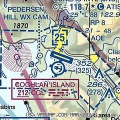
|
 Download PDF
of official airport diagram from the FAA
| Airport distance calculator |
|---|
|
|
| Sunrise and sunset |
|---|
|
Times for 23-Apr-2024
| | Local
(UTC-8) | | Zulu
(UTC) |
|---|
| Morning civil twilight | | 04:36 | | 12:36 |
| Sunrise | | 05:23 | | 13:23 |
| Sunset | | 20:30 | | 04:30 |
| Evening civil twilight | | 21:17 | | 05:17 |
|
| Current date and time |
|---|
| Zulu (UTC) | 23-Apr-2024 22:53:27 |
|---|
| Local (UTC-8) | 23-Apr-2024 14:53:27 |
|---|
|
| METAR |
|---|
| PAJN | 232153Z 25006KT 10SM FEW041 BKN050 OVC065 11/01 A2985 RMK AO2 SLP109 T01110006
|
|
| TAF |
|---|
| PAJN | 231722Z 2318/2418 VRB04KT P6SM SCT050 OVC100 FM232300 24009KT P6SM OVC050 FM240500 VRB04KT P6SM SCT050
|
|
| NOTAMs |
|---|
NOTAMs are issued by the DoD/FAA and will open in a separate window not controlled by AirNav.
|
|


