FAA INFORMATION EFFECTIVE 18 APRIL 2024
Location
| FAA Identifier: | PSF |
| Lat/Long: | 42-25-39.4324N 073-17-27.0233W
42-25.657207N 073-17.450388W
42.4276201,-73.2908398
(estimated) |
| Elevation: | 1188.4 ft. / 362.2 m (surveyed) |
| Variation: | 15W (2000) |
| From city: | 2 miles W of PITTSFIELD, MA |
| Time zone: | UTC -4 (UTC -5 during Standard Time) |
| Zip code: | 01201 |
Airport Operations
| Airport use: | Open to the public |
| Activation date: | 05/1941 |
| Control tower: | no |
| ARTCC: | BOSTON CENTER |
| FSS: | BURLINGTON FLIGHT SERVICE STATION |
| NOTAMs facility: | PSF (NOTAM-D service available) |
| Attendance: | 0700-1500 |
| Wind indicator: | yes |
| Segmented circle: | yes |
| Lights: | ACTVT REIL RWY 26; PAPI RWY 26; MIRL RWY 08/26 & 14/32 - CTAF. |
| Beacon: | white-green (lighted land airport)
Operates sunset to sunrise. |
| Landing fee: | yes |
| International operations: | customs landing rights airport
LDG & PRKG FEES. |
Airport Communications
| CTAF/UNICOM: | 122.7 |
| WX ASOS: | 135.375 (413-499-3273) |
| ALBANY APPROACH: | 132.825 |
| ALBANY DEPARTURE: | 132.825 |
| CLEARANCE DELIVERY: | 128.6 |
| WX ASOS at AQW (17 nm N): | 134.775 (413-664-6658) |
Nearby radio navigation aids
| VOR radial/distance | | VOR name | | Freq | | Var |
|---|
| CTRr311/17.2 | | CHESTER VOR/DME | | 115.10 | | 13W |
| ALBr143/29.7 | | ALBANY VORTAC | | 115.30 | | 13W |
| BAFr316/30.1 | | BARNES VORTAC | | 113.00 | | 14W |
| CAMr190/34.1 | | CAMBRIDGE VOR/DME | | 115.00 | | 14W |
| NDB name | | Hdg/Dist | | Freq | | Var | | ID |
|---|
| PHILMONT | | 074/21.9 | | 272 | | 13W | | PFH | .--. ..-. .... |
| HUNTER | | 146/38.2 | | 356 | | 14W | | HEU | .... . ..- |
Airport Services
| Fuel available: | 100LL JET-A JET-A+ |
| Parking: | hangars and tiedowns |
| Airframe service: | MAJOR |
| Powerplant service: | MAJOR |
| Bottled oxygen: | LOW |
| Bulk oxygen: | NONE |
Runway Information
Runway 8/26
| Dimensions: | 5791 x 100 ft. / 1765 x 30 m |
| Surface: | asphalt/grooved, in good condition |
| Weight bearing capacity: | | PCN 43 /F/D/X/T | | Single wheel: | 44.0 | | Double wheel: | 54.0 |
|
| Runway edge lights: | medium intensity |
| RUNWAY 8 | | RUNWAY 26 |
| Latitude: | 42-25.474108N | | 42-25.888037N |
| Longitude: | 073-18.014193W | | 073-16.855080W |
| Elevation: | 1188.4 ft. | | 1132.1 ft. |
| Traffic pattern: | left | | right |
| Runway heading: | 079 magnetic, 064 true | | 259 magnetic, 244 true |
| Markings: | precision, in good condition | | precision, in good condition |
| Visual slope indicator: | | | 4-light PAPI on left (3.00 degrees glide path) |
| Runway end identifier lights: | no | | yes |
| Touchdown point: | yes, no lights | | yes, no lights |
| Instrument approach: | | | LOC/DME |
| Obstructions: | 35 ft. trees, lighted, 750 ft. from runway, 350 ft. left of centerline, 15:1 slope to clear | | none |
Runway 14/32
| Dimensions: | 3496 x 100 ft. / 1066 x 30 m |
| Surface: | asphalt, in good condition |
| Weight bearing capacity: | | PCN 7 /F/D/X/T | | Single wheel: | 25.0 |
|
| Runway edge lights: | medium intensity |
| RUNWAY 14 | | RUNWAY 32 |
| Latitude: | 42-25.773522N | | 42-25.461830N |
| Longitude: | 073-17.802963W | | 073-17.150000W |
| Elevation: | 1170.3 ft. | | 1141.8 ft. |
| Traffic pattern: | left | | right |
| Runway heading: | 138 magnetic, 123 true | | 318 magnetic, 303 true |
| Markings: | basic, in good condition | | basic, in good condition |
| Runway end identifier lights: | no | | no |
| Touchdown point: | yes, no lights | | yes, no lights |
| Obstructions: | 50 ft. trees, 1000 ft. from runway, 125 ft. left of centerline, 16:1 slope to clear | | 20 ft. trees, 600 ft. from runway, 120 ft. left of centerline, 20:1 slope to clear |
Airport Ownership and Management from official FAA records
| Ownership: | Publicly-owned |
| Owner: | CITY OF PITTSFIELD
70 ALLEN ST
PITTSFIELD, MA 01201
Phone 413-448-9790 |
| Manager: | DANIEL SHEARER
PITTSFIELD MUNICIPAL AIRPORT, 832 TAMARACK RD
PITTSFIELD, MA 01201
Phone 413-448-9790 |
Airport Operational Statistics
| Aircraft based on the field: | | 30 | | Single engine airplanes: | | 16 | | Multi engine airplanes: | | 4 | | Jet airplanes: | | 9 | | Helicopters: | | 1 |
| |  | |
| Aircraft operations: avg 128/day * | | 60% | local general aviation | | 27% | transient general aviation | | 11% | air taxi | | 2% | military | | * for 12-month period ending 28 August 2018 | |
Additional Remarks
| - | OBSTN LGTD POLES 0.9 NM SE AT 1960 FT; 1.1 NM SE AT 1470 FT; 1.7 NM SW AT 2171 FT (OTS INDEFLY); 1.3 NM NE AT 1330 FT; 2.3 NM NW AT 1890 FT (OTS INDEFLY). |
| - | FOR CD CTC ALBANY APCH AT 518-862-2299. |
| - | FBO ATNDD MON-FRI 0800-1800, SAT-SUN 0800-1700. FOR FUEL AFT HRS CALL 413-443-6700. |
| - | RWY 14-32 CK NOTAMS FOR CHGS TO LEN & WID. |
| - | BIRDS & WILDLIFE ON & INVOF ARPT. |
| - | ALL ACFT USE TWY A, C & D FOR RWY 08-26. TWY A USE LTD TO ACFT WITH WINGSPAN LESS THAN 79 FT. AFT BACK TAX RWY 26 USE TWY D TO TURN ARND. |
| - | CK NOTAMS FOR ARPT COND. AIRFIELD SFC COND NOT MNT & SNOW REMOVAL NOT GUARANTEED BTN 1500-0700. |
| - | NOISE ABATEMENT PROCS IN EFCT 2300-0700. |
Instrument Procedures
NOTE: All procedures below are presented as PDF files. If you need a reader for these files, you should download the free Adobe Reader.NOT FOR NAVIGATION. Please procure official charts for flight.
FAA instrument procedures published for use from 18 April 2024 at 0901Z to 16 May 2024 at 0900Z.
IAPs - Instrument Approach Procedures |
|---|
| RNAV (GPS) RWY 08 | |
download (228KB) |
| RNAV (GPS) RWY 26 | |
download (253KB) |
| LOC RWY 26 | |
download (243KB) |
| NOTE: Special Alternate Minimums apply | |
download (153KB) |
| NOTE: Special Take-Off Minimums/Departure Procedures apply | |
download (362KB) |
Other nearby airports with instrument procedures:
KGBR - Walter J Koladza Airport (15 nm S)
KAQW - Harriman-and-West Airport (17 nm N)
1B1 - Columbia County Airport (20 nm SW)
4B0 - South Albany Airport (25 nm W)
KDDH - William H Morse State Airport (28 nm N)
|
|

Road maps at:
MapQuest
Bing
Google
| Aerial photo |
|---|
WARNING: Photo may not be current or correct
 Photo courtesy of AirNav, LLC
Photo taken 12-May-2014
looking north.
Photo courtesy of AirNav, LLC
Photo taken 12-May-2014
looking north.
Do you have a better or more recent aerial photo of Pittsfield Municipal Airport that you would like to share? If so, please send us your photo.
|
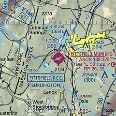
| Sectional chart |
|---|
|
| Airport distance calculator |
|---|
|
|
| Sunrise and sunset |
|---|
|
Times for 19-Apr-2024
| | Local
(UTC-4) | | Zulu
(UTC) |
|---|
| Morning civil twilight | | 05:36 | | 09:36 |
| Sunrise | | 06:05 | | 10:05 |
| Sunset | | 19:39 | | 23:39 |
| Evening civil twilight | | 20:09 | | 00:09 |
|
| Current date and time |
|---|
| Zulu (UTC) | 20-Apr-2024 01:09:01 |
|---|
| Local (UTC-4) | 19-Apr-2024 21:09:01 |
|---|
|
| METAR |
|---|
| KPSF | 200054Z AUTO 00000KT 10SM OVC029 09/03 A3001 RMK AO2 SLP157 T00940028
|
KAQW
17nm N | 200052Z AUTO 00000KT 10SM OVC036 12/03 A3000 RMK AO2 SLP163 T01220028
|
|
| TAF |
|---|
| KPSF | 192019Z 1920/2018 17013G23KT P6SM BKN035 OVC150 FM200300 19009KT 6SM -SHRA BR SCT015 OVC025 FM200600 23006KT 5SM -SHRA BR SCT008 OVC015 FM201200 28006KT P6SM OVC035 FM201600 29014G25KT P6SM SCT040 BKN100
|
|
| NOTAMs |
|---|
NOTAMs are issued by the DoD/FAA and will open in a separate window not controlled by AirNav.
|
|

