FAA INFORMATION EFFECTIVE 18 APRIL 2024
Location
| FAA Identifier: | 29D |
| Lat/Long: | 41-08-45.7000N 080-10-03.9000W
41-08.761667N 080-10.065000W
41.1460278,-80.1677500
(estimated) |
| Elevation: | 1370.6 ft. / 417.8 m (surveyed) |
| Variation: | 09W (2010) |
| From city: | 3 miles W of GROVE CITY, PA |
| Time zone: | UTC -4 (UTC -5 during Standard Time) |
| Zip code: | 16137 |
Airport Operations
| Airport use: | Open to the public |
| Activation date: | 02/1975 |
| Control tower: | no |
| ARTCC: | CLEVELAND CENTER |
| FSS: | ALTOONA FLIGHT SERVICE STATION |
| NOTAMs facility: | AOO (NOTAM-D service available) |
| Attendance: | MON-FRI 0800-1600
UNATNDD THANKSGIVING, CHRISTMAS & NEW YEAR'S DAY. |
| Wind indicator: | lighted |
| Segmented circle: | no |
| Lights: | ACTVT PAPI RWY 10 & 28; MIRL RWY 10/28 - CTAF. |
| Beacon: | white-green (lighted land airport)
Operates sunset to sunrise. |
Airport Communications
| CTAF/UNICOM: | 122.725 |
| YOUNGSTOWN APPROACH: | 133.95 |
| YOUNGSTOWN DEPARTURE: | 133.95 |
| WX AWOS-3PT at UCP (13 nm SW): | 124.175 ((724) 652-4184) |
| WX AWOS-3PT at FKL (20 nm NE): | 118.175 ((814) 437-2066) |
- APCH/DEP SVC PRVDD BY CLEVELAND ARTCC (ZOB) ON FREQS 126.725/291.65 (DUBOIS RCAG) WHEN YOUNGSTOWN APCH CTL CLSD.
- COMMUNICATIONS PRVDD BY ALTOONA RADIO ON FREQS 122.1R/115.8T (ELLWOOD CITY RCO).
Nearby radio navigation aids
| VOR radial/distance | | VOR name | | Freq | | Var |
|---|
| EWCr014/19.4 | | ELLWOOD CITY VOR/DME | | 115.80 | | 08W |
| FKLr225/(22.5) | | FRANKLIN VOR | | 109.60 | | 06W |
| YNGr121/25.4 | | YOUNGSTOWN VORTAC | | 109.00 | | 05W |
| NDB name | | Hdg/Dist | | Freq | | Var | | ID |
|---|
| CASTLE | | 066/13.4 | | 272 | | 09W | | UCP | ..- -.-. .--. |
Airport Services
| Fuel available: | 100LL JET-A JET-A+
100LL:24 HR FUEL AVBL WITH CREDIT CARD.
A:JET-A ANTI-ICE INHIBITOR AVBL ON REQ. |
| Parking: | hangars and tiedowns |
| Bottled oxygen: | NONE |
Runway Information
Runway 10/28
| Dimensions: | 4500 x 75 ft. / 1372 x 23 m |
| Surface: | asphalt, in good condition |
| Weight bearing capacity: | |
| Runway edge lights: | medium intensity |
| RUNWAY 10 | | RUNWAY 28 |
| Latitude: | 41-08.776833N | | 41-08.748333N |
| Longitude: | 080-10.555333W | | 080-09.575667W |
| Elevation: | 1370.0 ft. | | 1297.0 ft. |
| Traffic pattern: | left | | left |
| Runway heading: | 101 magnetic, 092 true | | 281 magnetic, 272 true |
| Markings: | nonprecision, in good condition | | nonprecision, in good condition |
| Visual slope indicator: | 2-light PAPI on left (3.80 degrees glide path)
RWY 10 PAPI UNUSABLE BEYOND 5 DEGREES LEFT OF RUNWAY CENTERLINE. | | 2-light PAPI on left (3.00 degrees glide path) |
| Runway end identifier lights: | yes | | yes |
| Touchdown point: | yes, no lights | | yes, no lights |
| Obstructions: | 129 ft. trees, 2727 ft. from runway, 453 ft. left of centerline, 19:1 slope to clear | | none |
Airport Ownership and Management from official FAA records
| Ownership: | Publicly-owned |
| Owner: | BOROUGH OF GROVE CITY
123 W MAIN ST. P.O. BOX 110
GROVE CITY, PA 16127
Phone 724-458-7060 |
| Manager: | MICHAEL BAUN
GROVE CITY AIRPORT, 40 OAKLEY KELLY DRIVE
MERCER, PA 16137-8411
Phone 724-748-5530 |
Airport Operational Statistics
| Aircraft based on the field: | | 29 | | Single engine airplanes: | | 19 | | Multi engine airplanes: | | 2 | | Jet airplanes: | | 6 | | Helicopters: | | 2 |
| |  | |
| Aircraft operations: avg 35/day * | | 59% | transient general aviation | | 39% | local general aviation | | 2% | air taxi | | <1% | military | | * for 12-month period ending 22 September 2020 | |
Additional Remarks
| - | DEER & GEESE ON AND INVOF ARPT. |
| - | DRAINAGE RAVINE 15 FT DEEP LCTD IN SAFETY AREA NORTH OF RY 10. |
| - | TWY LGTS STUB TO APRON. |
| - | AVOID OVERFLYING FLD DURG DALGT VFR BECAUSE OF PARACHUTE JUMPING ACTIVITY NW CORNER OF FLD. |
| - | FOR CD CTC YOUNGSTOWN APCH AT 330-856-4806, WHEN APCH CLSD CTC CLEVELAND ARTCC AT 440-774-0234. |
| - | PORTABLE GROUND PWR UNIT AVBL. |
Instrument Procedures
NOTE: All procedures below are presented as PDF files. If you need a reader for these files, you should download the free Adobe Reader.NOT FOR NAVIGATION. Please procure official charts for flight.
FAA instrument procedures published for use from 18 April 2024 at 0901Z to 16 May 2024 at 0900Z.
IAPs - Instrument Approach Procedures |
|---|
| RNAV (GPS) RWY 10 | |
download (192KB) |
| RNAV (GPS) RWY 28 | |
download (200KB) |
| NOTE: Special Take-Off Minimums/Departure Procedures apply | |
download (477KB) |
Other nearby airports with instrument procedures:
KUCP - New Castle Municipal Airport (13 nm SW)
KFKL - Venango Regional Airport (20 nm NE)
KPJC - Zelienople Municipal Airport (21 nm S)
4G1 - Greenville Municipal Airport (21 nm NW)
KYNG - Youngstown/Warren Regional Airport (24 nm W)
|
|

Road maps at:
MapQuest
Bing
Google
| Aerial photo |
|---|
WARNING: Photo may not be current or correct
 Photo by Bill Pixley
Photo taken 20-Aug-2017
looking west-northwest.
Photo by Bill Pixley
Photo taken 20-Aug-2017
looking west-northwest.
Do you have a better or more recent aerial photo of Grove City Airport that you would like to share? If so, please send us your photo.
|
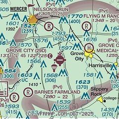
| Sectional chart |
|---|
|
| Airport distance calculator |
|---|
|
|
| Sunrise and sunset |
|---|
|
Times for 24-Apr-2024
| | Local
(UTC-4) | | Zulu
(UTC) |
|---|
| Morning civil twilight | | 05:58 | | 09:58 |
| Sunrise | | 06:28 | | 10:28 |
| Sunset | | 20:10 | | 00:10 |
| Evening civil twilight | | 20:39 | | 00:39 |
|
| Current date and time |
|---|
| Zulu (UTC) | 24-Apr-2024 09:43:41 |
|---|
| Local (UTC-4) | 24-Apr-2024 05:43:41 |
|---|
|
| METAR |
|---|
KUCP
13nm SW | 240856Z AUTO 23004KT 10SM OVC015 10/09 A2987 RMK AO2 SLP130 T01000094 50002
|
KFKL
19nm NE | 240909Z AUTO 27007KT 10SM BKN008 OVC100 08/ A2985 RMK AO2 CIG 007V012
|
KPJC
21nm S | 240915Z AUTO 00000KT 10SM -RA BKN120 10/08 A2986 RMK AO2
|
KYNG
23nm W | 240851Z 21005KT 7SM FEW030 SCT080 SCT110 08/07 A2984 RMK AO2 RAB01E22 SLP106 P0000 60000 T00830072 58006
|
KBTP
25nm SE | 240856Z AUTO 27005KT 10SM OVC014 09/09 A2988 RMK AO2 SLP123 60000 T00940089 51003 TSNO $
|
KBVI
25nm SW | 240915Z AUTO 00000KT 10SM SCT017 BKN065 OVC080 11/08 A2986 RMK AO2 T01050082
|
|
| TAF |
|---|
KFKL
19nm NE | 240808Z 2408/2506 26010KT P6SM -RA OVC010 FM242100 35010KT P6SM OVC010 FM250400 03010KT P6SM SCT010
|
KYNG
23nm W | 240756Z 2408/2506 26008KT 6SM BR VCSH BKN018 TEMPO 2415/2419 OVC008 FM241900 32010KT P6SM OVC008 FM242300 36010KT P6SM BKN015 FM250400 01004KT P6SM SCT020
|
|
| NOTAMs |
|---|
NOTAMs are issued by the DoD/FAA and will open in a separate window not controlled by AirNav.
|
|
