FAA INFORMATION EFFECTIVE 18 APRIL 2024
Location
| FAA Identifier: | VBT |
| Lat/Long: | 36-20-43.2070N 094-13-10.2120W
36-20.720117N 094-13.170200W
36.3453353,-94.2195033
(estimated) |
| Elevation: | 1298.1 ft. / 395.7 m (surveyed) |
| Variation: | 01E (2020) |
| From city: | 2 miles S of BENTONVILLE, AR |
| Time zone: | UTC -5 (UTC -6 during Standard Time) |
| Zip code: | 72712 |
Airport Operations
| Airport use: | Open to the public |
| Activation date: | 09/1946 |
| Control tower: | no |
| ARTCC: | MEMPHIS CENTER |
| FSS: | JONESBORO FLIGHT SERVICE STATION |
| NOTAMs facility: | VBT (NOTAM-D service available) |
| Attendance: | OCT-MAR 0800-1700, APR-SEP 0700-1900
FOR SVC AFT HRS CALL 479-367-9800. |
| Wind indicator: | lighted |
| Segmented circle: | no |
| Lights: | ACTVT MIRL RWY 18/36, PAPI RWY 18/36 - CTAF. |
| Beacon: | white-green (lighted land airport)
Operates sunset to sunrise. |
Airport Communications
| CTAF/UNICOM: | 122.975 |
| WX AWOS-3PT: | 134.975 (479-273-9198) |
| RAZORBACK APPROACH: | 121.0 |
| RAZORBACK DEPARTURE: | 121.0 |
| CLEARANCE DELIVERY: | 121.05 |
| WX AWOS-3PT at ROG (6 nm E): | 134.375 (479-631-9196) |
| WX ASOS at XNA (6 nm SW): | 119.425 (479-203-0109) |
| WX AWOS-3 at ASG (11 nm SE): | 124.675 (479-750-2967) |
| WX AWOS-3PT at SLG (16 nm SW): | 118.375 (479-524-9893) |
- APCH/DEP SVC PRVDD BY MEMPHIS ARTCC ON FREQS126.1/269.0 (FAYETTEVILLE RCAG) WHEN RAZORBACK APCH CTL CLSD.
Nearby radio navigation aids
| VOR radial/distance | | VOR name | | Freq | | Var |
|---|
| RZCr317/7.6 | | RAZORBACK VORTAC | | 116.40 | | 04E |
| NDB name | | Hdg/Dist | | Freq | | Var | | ID |
|---|
| SILOAM SPRINGS | | 050/16.0 | | 284 | | 04E | | SLG | ... .-.. --. |
Airport Services
| Fuel available: | 100LL JET-A |
| Parking: | hangars and tiedowns |
| Airframe service: | MAJOR |
| Powerplant service: | MAJOR |
| Bottled oxygen: | HIGH |
| Bulk oxygen: | NONE |
Runway Information
Runway 18/36
| Dimensions: | 4426 x 75 ft. / 1349 x 23 m |
| Surface: | asphalt, in fair condition |
| Weight bearing capacity: | | Single wheel: | 30.0 | | Double wheel: | 59.0 |
|
| Runway edge lights: | medium intensity |
| Runway edge markings: | MKGS FADED. |
| RUNWAY 18 | | RUNWAY 36 |
| Latitude: | 36-21.079725N | | 36-20.350382N |
| Longitude: | 094-13.156780W | | 094-13.163385W |
| Elevation: | 1289.3 ft. | | 1292.6 ft. |
| Traffic pattern: | left | | left |
| Runway heading: | 179 magnetic, 180 true | | 359 magnetic, 000 true |
| Displaced threshold: | 230 ft. | | no |
| Declared distances: | LDA:4196 | | ASDA:4196 LDA:4196 |
| Markings: | nonprecision, in poor condition | | nonprecision, in poor condition |
| Visual slope indicator: | 2-light PAPI on left (3.00 degrees glide path) | | 2-light PAPI on right (3.00 degrees glide path) |
| Runway end identifier lights: | yes | | yes |
| Touchdown point: | yes, no lights | | yes, no lights |
| Obstructions: | 19 ft. brush, 510 ft. from runway, 285 ft. right of centerline, 16:1 slope to clear
APCH RATIO 38:1 TO DTHR. | | 12 ft. pole, 615 ft. from runway, 170 ft. left of centerline, 34:1 slope to clear |
Runway 17/35
| Dimensions: | 2448 x 75 ft. / 746 x 23 m |
| Surface: | turf |
| RUNWAY 17 | | RUNWAY 35 |
| Latitude: | 36-20.931000N | | 36-20.527500N |
| Longitude: | 094-13.186667W | | 094-13.190333W |
| Elevation: | 1288.7 ft. | | 1292.5 ft. |
| Traffic pattern: | left | | left |
| Runway heading: | 179 magnetic, 180 true | | 359 magnetic, 000 true |
| Declared distances: | TORA:2448 TODA:2448 | | TORA:2448 TODA:2448 |
Airport Ownership and Management from official FAA records
| Ownership: | Publicly-owned |
| Owner: | CITY OF BENTONVILLE
305 SW A STREET
BENTONVILLE, AR 72712
Phone 479-271-3112 |
| Manager: | DEBBIE GRIFFIN
305 SW A ST
BENTONVILLE, AR 72712
Phone 479-254-2028 |
Airport Operational Statistics
| Aircraft based on the field: | | 49 | | Single engine airplanes: | | 42 | | Multi engine airplanes: | | 4 | | Jet airplanes: | | 1 | | Helicopters: | | 2 |
| |  | |
| Aircraft operations: avg 88/day * | | 65% | local general aviation | | 34% | transient general aviation | | <1% | air taxi | | <1% | military | | * for 12-month period ending 28 February 2023 | |
Additional Remarks
| A39-18/36 | PCR VALUE: 214/F/D/X/T |
| - | BEGINNING 60 FT BYD NORTH END OF RY 18 PAVEMENT, GND HAS APROXLY 12 FT DROP OVER 60 FT LENGTH TO POND. |
| - | FOR CD CTC RAZORBACK APCH 479-649-2416, WHEN APCH CLSD CTC MEMPHIS ARTCC AT 901-368-8453/8449. |
| - | MIGRATORY BIRDS ON & INVOF ARPT |
| - | RWY 17/35 VFR DALGT OPNS ONLY. |
| - | SIMUL USE OF RWYS 17/35 AND 18/36 NA. |
Instrument Procedures
NOTE: All procedures below are presented as PDF files. If you need a reader for these files, you should download the free Adobe Reader.NOT FOR NAVIGATION. Please procure official charts for flight.
FAA instrument procedures published for use from 18 April 2024 at 0901Z to 16 May 2024 at 0900Z.
IAPs - Instrument Approach Procedures |
|---|
| RNAV (GPS) RWY 18 | |
download (232KB) |
| RNAV (GPS) RWY 36 | |
download (247KB) |
| NOTE: Special Alternate Minimums apply | |
download (123KB) |
Departure Procedures |
|---|
| BENTON SEVEN | |
download (191KB) |
| NOTE: Special Take-Off Minimums/Departure Procedures apply | |
download (390KB) |
Other nearby airports with instrument procedures:
KROG - Rogers Executive Airport - Carter Field (6 nm E)
KXNA - Northwest Arkansas National Airport (6 nm SW)
5M5 - Crystal Lake Airport (11 nm W)
KASG - Springdale Municipal Airport (11 nm SE)
KSLG - Smith Field Airport (16 nm SW)
|
|

Road maps at:
MapQuest
Bing
Google
| Aerial photo |
|---|
WARNING: Photo may not be current or correct
 Photo courtesy of the Arkansas Department of Aeronautics
Taken in the Spring of 2007
Photo courtesy of the Arkansas Department of Aeronautics
Taken in the Spring of 2007
Do you have a better or more recent aerial photo of Bentonville Municipal Airport/Louise M Thaden Field that you would like to share? If so, please send us your photo.
|
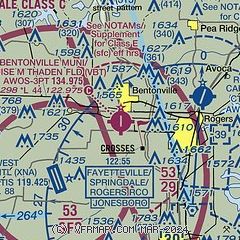
| Sectional chart |
|---|
|
CAUTION: Diagram may not be current

| Airport distance calculator |
|---|
|
|
| Sunrise and sunset |
|---|
|
Times for 20-Apr-2024
| | Local
(UTC-5) | | Zulu
(UTC) |
|---|
| Morning civil twilight | | 06:10 | | 11:10 |
| Sunrise | | 06:37 | | 11:37 |
| Sunset | | 19:55 | | 00:55 |
| Evening civil twilight | | 20:22 | | 01:22 |
|
| Current date and time |
|---|
| Zulu (UTC) | 20-Apr-2024 15:33:55 |
|---|
| Local (UTC-5) | 20-Apr-2024 10:33:55 |
|---|
|
| METAR |
|---|
| KVBT | 201456Z AUTO 07009KT 10SM CLR 12/00 A3034 RMK AO2 SLP275 T01170000 51010 $
|
KXNA
5nm SW | 201453Z 06011KT 10SM CLR 12/00 A3032 RMK AO2 SLP263 T01220000 51012
|
KROG
7nm E | 201458Z AUTO 06010KT 10SM CLR 11/00 A3033 RMK AO2 SLP268 T01110000 52011 TSNO
|
KASG
12nm SE | 201448Z 06010G18KT 10SM CLR 11/03 A3031
|
KSLG
15nm SW | 201456Z AUTO 07008G14KT 10SM CLR 12/01 A3032 RMK AO2 SLP265 T01170006 51014
|
KFYV
20nm S | 201453Z VRB03KT 10SM CLR 12/02 A3031 RMK AO2 SLP259 T01170017 51012
|
|
| TAF |
|---|
KXNA
5nm SW | 201120Z 2012/2112 05010KT P6SM BKN250 FM210300 01006KT P6SM OVC100
|
KROG
7nm E | 201120Z 2012/2112 05008KT P6SM OVC250 FM202100 02006KT P6SM OVC100
|
KFYV
20nm S | 201120Z 2012/2112 05006KT P6SM OVC100 FM210000 01005KT P6SM OVC100
|
|
| NOTAMs |
|---|
NOTAMs are issued by the DoD/FAA and will open in a separate window not controlled by AirNav.
|
|


