FAA INFORMATION EFFECTIVE 18 APRIL 2024
Location
| FAA Identifier: | LLU |
| Lat/Long: | 37-29-09.5000N 094-18-43.2000W
37-29.158333N 094-18.720000W
37.4859722,-94.3120000
(estimated) |
| Elevation: | 1009.8 ft. / 307.8 m (surveyed) |
| Variation: | 02E (2015) |
| From city: | 2 miles SW of LAMAR, MO |
| Time zone: | UTC -5 (UTC -6 during Standard Time) |
| Zip code: | 64759 |
Airport Operations
| Airport use: | Open to the public |
| Activation date: | 03/1951 |
| Control tower: | no |
| ARTCC: | KANSAS CITY CENTER |
| FSS: | COLUMBIA FLIGHT SERVICE STATION |
| NOTAMs facility: | COU (NOTAM-D service available) |
| Attendance: | UNATNDD |
| Wind indicator: | lighted |
| Segmented circle: | yes |
| Lights: | ACTVT MIRL RYS 03/21 & 17/35, PAPI RYS 17 & 35 - CTAF. |
| Beacon: | white-green (lighted land airport)
Operates sunset to sunrise. |
Airport Communications
- APCH/DEP SVC PRVDD BY KANSAS CITY ARTCC ON FREQ 128.6/282.325 (EDNA RCAG).
Airport Services
| Fuel available: | 100LL JET-A
100LL:FOR FUEL CTC NUMBER POSTED AT FUELING AREA. |
| Parking: | tiedowns |
| Powerplant service: | NONE |
| Bottled oxygen: | NONE |
| Bulk oxygen: | NONE |
Runway Information
Runway 17/35
| Dimensions: | 4000 x 75 ft. / 1219 x 23 m |
| Surface: | concrete, in excellent condition |
| Runway edge lights: | medium intensity |
| RUNWAY 17 | | RUNWAY 35 |
| Latitude: | 37-29.328240N | | 37-28.680443N |
| Longitude: | 094-18.818775W | | 094-18.667035W |
| Elevation: | 1009.8 ft. | | 990.0 ft. |
| Traffic pattern: | left | | left |
| Runway heading: | 167 magnetic, 169 true | | 347 magnetic, 349 true |
| Markings: | nonprecision, in good condition | | nonprecision, in good condition |
| Visual slope indicator: | 4-light PAPI on left (3.00 degrees glide path) | | 4-light PAPI on left (3.00 degrees glide path) |
| Runway end identifier lights: | yes | | yes |
| Touchdown point: | yes, no lights | | yes, no lights |
Runway 3/21
| Dimensions: | 2900 x 60 ft. / 884 x 18 m |
| Surface: | asphalt/concrete/aggregate friction seal coat, in good condition |
| Weight bearing capacity: | |
| Runway edge lights: | medium intensity |
| RUNWAY 3 | | RUNWAY 21 |
| Latitude: | 37-29.168377N | | 37-29.570903N |
| Longitude: | 094-18.851648W | | 094-18.528687W |
| Elevation: | 1004.6 ft. | | 997.8 ft. |
| Traffic pattern: | left | | left |
| Runway heading: | 031 magnetic, 033 true | | 211 magnetic, 213 true |
| Markings: | nonprecision, in good condition | | nonprecision, in good condition |
| Touchdown point: | yes, no lights | | yes, no lights |
Airport Ownership and Management from official FAA records
| Ownership: | Publicly-owned |
| Owner: | CITY OF LAMAR
132 WEST 10TH
LAMAR, MO 64759
Phone 417 682-5554 |
| Manager: | RUSS WORSLEY
132 WEST 10TH
LAMAR, MO 64759
Phone 417-682-5554 |
Airport Operational Statistics
| Aircraft based on the field: | | 20 | | Single engine airplanes: | | 20 |
- ULTRALIGHT ACTIVITY ON & INVOF ARPT.
| |  | |
| Aircraft operations: avg 102/week * | | 60% | local general aviation | | 34% | transient general aviation | | 6% | air taxi | | <1% | military | | * for 12-month period ending 31 December 2019 | |
Additional Remarks
| - | FOR CD CTC KANSAS CITY ARTCC AT 913-254-8508. |
Instrument Procedures
NOTE: All procedures below are presented as PDF files. If you need a reader for these files, you should download the free Adobe Reader.NOT FOR NAVIGATION. Please procure official charts for flight.
FAA instrument procedures published for use from 18 April 2024 at 0901Z to 16 May 2024 at 0900Z.
IAPs - Instrument Approach Procedures |
|---|
| RNAV (GPS) RWY 03 | |
download (202KB) |
| RNAV (GPS) RWY 17 | |
download (189KB) |
| RNAV (GPS) RWY 35 | |
download (208KB) |
| NOTE: Special Take-Off Minimums/Departure Procedures apply | |
download |
Other nearby airports with instrument procedures:
KPTS - Atkinson Municipal Airport (20 nm W)
KJLN - Joplin Regional Airport (22 nm SW)
KNVD - Nevada Municipal Airport (22 nm N)
MO3 - Stockton Municipal Airport (26 nm NE)
KFSK - Fort Scott Municipal Airport (29 nm NW)
|
|

Road maps at:
MapQuest
Bing
Google
| Aerial photo |
|---|
WARNING: Photo may not be current or correct

Do you have a better or more recent aerial photo of Lamar Municipal Airport that you would like to share? If so, please send us your photo.
|
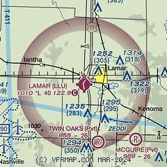
| Sectional chart |
|---|
|
| Airport distance calculator |
|---|
|
|
| Sunrise and sunset |
|---|
|
Times for 25-Apr-2024
| | Local
(UTC-5) | | Zulu
(UTC) |
|---|
| Morning civil twilight | | 06:01 | | 11:01 |
| Sunrise | | 06:29 | | 11:29 |
| Sunset | | 20:01 | | 01:01 |
| Evening civil twilight | | 20:29 | | 01:29 |
|
| Current date and time |
|---|
| Zulu (UTC) | 25-Apr-2024 12:55:48 |
|---|
| Local (UTC-5) | 25-Apr-2024 07:55:48 |
|---|
|
| METAR |
|---|
KPTS
20nm W | 251235Z AUTO 06009KT 10SM OVC028 13/11 A3006 RMK AO2 LTG DSNT SW THRU NE T01300111 PWINO
|
KJLN
22nm SW | 251239Z 08008KT 10SM BKN027 BKN038 OVC048 14/10 A3006 RMK AO2 T01390100
|
KFSK
29nm NW | 251235Z AUTO 09011G17KT 4SM +RA BR SCT022 BKN039 OVC047 11/10 A3008 RMK AO2 P0041 T01130105
|
KHFJ
38nm S | 251235Z AUTO 12010G14KT 10SM SCT060 BKN080 OVC100 13/07 A3008 RMK AO2 LTG DSNT SE W AND NW
|
|
| TAF |
|---|
KJLN
22nm SW | 251157Z 2512/2612 11010KT P6SM VCSH OVC050 FM251400 13015G20KT 4SM TSRA BR OVC015CB FM251700 13018G25KT 4SM RA BR OVC008 TEMPO 2518/2522 2SM TSRA BR OVC005CB FM252200 13016G25KT 4SM TSRA BR OVC015CB PROB30 2522/2601 2SM TSRA BR OVC009CB FM260200 16017G25KT 4SM SHRA VCTS OVC015CB FM260500 16017G25KT P6SM VCSH OVC015 WS020/18050KT
|
|
| NOTAMs |
|---|
NOTAMs are issued by the DoD/FAA and will open in a separate window not controlled by AirNav.
|
|

