FAA INFORMATION EFFECTIVE 11 JUNE 2026
Location
| FAA Identifier: | PQI |
| Lat/Long: | 46-41-20.2700N 068-02-41.2490W
46-41.337833N 068-02.687483W
46.6889639,-68.0447914
(estimated) |
| Elevation: | 534 ft. / 162.8 m (surveyed) |
| Variation: | 17W (2020) |
| From city: | 1 mile NW of PRESQUE ISLE, ME |
| Time zone: | UTC -4 (UTC -5 during Standard Time) |
| Zip code: | 04769 |
Airport Operations
| Airport use: | Open to the public |
| Activation date: | 04/1940 |
| Control tower: | no |
| ARTCC: | BOSTON CENTER |
| FSS: | BANGOR FLIGHT SERVICE STATION |
| NOTAMs facility: | PQI (NOTAM-D service available) |
| Attendance: | 0600-1900 |
| Wind indicator: | lighted |
| Segmented circle: | yes |
| Lights: | ACTVT MALSR RWY 01; REIL RWY 19; PAPI RWY 19 & 28; HIRL RWY 01/19; MIRL RWY 10/28 - 122.6. |
| Beacon: | white-green (lighted land airport)
Operates sunset to sunrise. |
| Fire and rescue: | ARFF index B |
| Airline operations: | CLSD TO UNSKED ACR OPS WITH MORE THAN 30 PAX SEATS, EXCP PPR CALL AMGR 207-764-2550. |
| International operations: | customs landing rights airport |
Airport Communications
| CTAF/UNICOM: | 122.8 |
| WX AWOS-3PT: | 118.025 (207-764-7248) |
| WX ASOS at CAR (11 nm N): | 135.125 (207-544-7089) |
- APCH/DEP SVC PRVDD BY BOSTON ARTCC ON FREQS 124.75/239.05 (CARIBOU RCAG).
- CLNC DEL PRVDD BY BOSTON ARTCC ON FREQ 121.6.
Nearby radio navigation aids
| VOR radial/distance | | VOR name | | Freq | | Var |
|---|
| PQIr179/5.5 | | PRESQUE ISLE VOR/DME | | 116.40 | | 21W |
Airport Services
| Fuel available: | 100LL JET-A |
| Parking: | hangars and tiedowns |
| Airframe service: | MINOR |
| Powerplant service: | MINOR |
| Bottled oxygen: | NONE |
| Bulk oxygen: | NONE |
Runway Information
Runway 1/19
| Dimensions: | 7441 x 150 ft. / 2268 x 46 m |
| Surface: | asphalt, in good condition |
| Weight bearing capacity: | | Single wheel: | 61.0 | | Double wheel: | 96.0 | | Double tandem: | 168.0 |
|
| Runway edge lights: | high intensity |
| RUNWAY 1 | | RUNWAY 19 |
| Latitude: | 46-40.872640N | | 46-42.058610N |
| Longitude: | 068-02.734905W | | 068-03.174652W |
| Elevation: | 455.0 ft. | | 534.0 ft. |
| Traffic pattern: | left | | left |
| Runway heading: | 003 magnetic, 346 true | | 183 magnetic, 166 true |
| Declared distances: | TORA:7441 TODA:7441 ASDA:7441 LDA:7441 | | TORA:7441 TODA:7441 ASDA:7441 LDA:7441 |
| Markings: | precision, in good condition | | precision, in good condition |
| Visual slope indicator: | | | 4-light PAPI on left (3.70 degrees glide path)
PAPI VISUAL GA NON-STD. |
| Approach lights: | MALSR: 1,400 foot medium intensity approach lighting system with runway alignment indicator lights | | |
| Runway end identifier lights: | no | | yes |
| Touchdown point: | yes, no lights | | yes, no lights |
| Instrument approach: | ILS | | |
| Obstructions: | none | | 115 ft. trees, 2500 ft. from runway, 425 ft. left of centerline, 20:1 slope to clear |
Runway 10/28
| Dimensions: | 6000 x 100 ft. / 1829 x 30 m |
| Surface: | asphalt, in excellent condition |
| Weight bearing capacity: | | Single wheel: | 61.0 | | Double wheel: | 96.0 | | Double tandem: | 168.0 |
|
| Runway edge lights: | medium intensity |
| RUNWAY 10 | | RUNWAY 28 |
| Latitude: | 46-41.057325N | | 46-41.301313N |
| Longitude: | 068-03.050972W | | 068-01.661195W |
| Elevation: | 473.2 ft. | | 473.2 ft. |
| Traffic pattern: | left | | left |
| Runway heading: | 093 magnetic, 076 true | | 273 magnetic, 256 true |
| Declared distances: | TORA:6000 TODA:6000 ASDA:6000 LDA:6000 | | TORA:6000 TODA:6000 ASDA:6000 LDA:6000 |
| Markings: | nonprecision, in good condition | | nonprecision, in good condition |
| Visual slope indicator: | | | 4-light PAPI on left (3.00 degrees glide path) |
| Runway end identifier lights: | no | | no |
| Touchdown point: | yes, no lights | | yes, no lights |
| Obstructions: | 44 ft. tree, 1300 ft. from runway, 25:1 slope to clear | | 31 ft. rr, 1200 ft. from runway, 34:1 slope to clear |
Airport Ownership and Management from official FAA records
| Ownership: | Publicly-owned |
| Owner: | CITY OF PRESQUE ISLE
12 SECOND ST
PRESQUE ISLE, ME 04769
Phone 207-764-4485 |
| Manager: | SCOTT WARDWELL
650 AIRPORT DR SUITE 11
PRESQUE ISLE, ME 04769
Phone 207-764-2550 |
Additional Remarks
| A39-01/19 | PCR VALUE: 220/F/B/X/U |
| A39-10/28 | PCR VALUE: 220/F/B/X/U |
| - | PAEW ADJ TO RWYS & TWYS (MOWING) MAY 1 THRU NOV 1. |
| - | FOR CD CTC BOSTON ARTCC AT 603-879-6859. |
| - | CTN SML UAS ACT FM SFC TO 400 FT AGL (1040-MSL) 3.5 NM S OF ARPT DUR DALGT HRS. |
| - | COLD TEMPERATURE AIRPORT. ALTITUDE CORRECTION REQUIRED AT OR BELOW -36C. |
Instrument Procedures
NOTE: All procedures below are presented as PDF files. If you need a reader for these files, you should download the free Adobe Reader.NOT FOR NAVIGATION. Please procure official charts for flight.
FAA instrument procedures published for use from 11 June 2026 at 0901Z to 09 July 2026 at 0900z.
IAPs - Instrument Approach Procedures |
|---|
| ILS OR LOC RWY 01 **CHANGED** | |
download (301KB) |
| RNAV (GPS) RWY 01 **CHANGED** | |
download (306KB) |
| RNAV (GPS) RWY 19 **CHANGED** | |
download (304KB) |
| RNAV (GPS) RWY 28 **CHANGED** | |
download (308KB) |
| VOR RWY 19 **CHANGED** | |
download (300KB) |
| NOTE: Special Alternate Minimums apply | |
download (153KB) |
| NOTE: Special Take-Off Minimums/Departure Procedures apply | |
download (492KB) |
Other nearby airports with instrument procedures:
KCAR - Caribou Municipal Airport (11 nm N)
KHUL - Houlton International Airport (35 nm S)
KFVE - Northern Aroostook Regional Airport (37 nm N)
KMLT - Millinocket Municipal Airport (68 nm SW)
KLRG - Lincoln Regional Airport (82 nm S)
|
|

Road maps at:
MapQuest
Bing
Google
| Aerial photo |
|---|
WARNING: Photo may not be current or correct

Do you have a better or more recent aerial photo of Presque Isle International Airport that you would like to share? If so, please send us your photo.
|
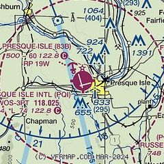
| Sectional chart |
|---|
|
| Airport distance calculator |
|---|
|
|
| Sunrise and sunset |
|---|
|
Times for 22-Jun-2026
| | Local
(UTC-4) | | Zulu
(UTC) |
|---|
| Morning civil twilight | | 04:00 | | 08:00 |
| Sunrise | | 04:40 | | 08:40 |
| Sunset | | 20:29 | | 00:29 |
| Evening civil twilight | | 21:08 | | 01:08 |
|
| Current date and time |
|---|
| Zulu (UTC) | 22-Jun-2026 07:35:19 |
|---|
| Local (UTC-4) | 22-Jun-2026 03:35:19 |
|---|
|
| METAR |
|---|
| KPQI | 220724Z AUTO 00000KT 1 1/2SM BR SCT001 09/09 A2999 RMK AO2 VIS 1/2V5
|
KCAR
11nm N | 220654Z AUTO 08003KT 10SM CLR 11/11 A2996 RMK AO2 SLP148 T01060106 $
|
|
| TAF |
|---|
| KPQI | 220539Z 2206/2306 00000KT P6SM SCT200 FM220800 VRB03KT P6SM BKN008 FM221200 16004KT P6SM SCT015 FM221800 17007KT P6SM VCSH BKN040
|
KCAR
11nm N | 220539Z 2206/2306 VRB03KT P6SM FEW250 FM220900 14004KT P6SM BKN008 FM221300 17006KT P6SM SCT015 FM221800 17007KT P6SM VCSH BKN035
|
|
| NOTAMs |
|---|
NOTAMs are issued by the DoD/FAA and will open in a separate window not controlled by AirNav.
|
|

