FAA INFORMATION EFFECTIVE 14 MAY 2026
Location
| FAA Identifier: | ILI |
| Lat/Long: | 59-45-20.0812N 154-55-03.9081W
59-45.334687N 154-55.065135W
59.7555781,-154.9177523
(estimated) |
| Elevation: | 192.4 ft. / 58.6 m (surveyed) |
| Variation: | 14E (2020) |
| From city: | 2 miles NW of ILIAMNA, AK |
| Time zone: | UTC -8 (UTC -9 during Standard Time) |
Airport Operations
| Airport use: | Open to the public |
| Activation date: | 08/1947 |
| Control tower: | no |
| ARTCC: | ANCHORAGE CENTER |
| FSS: | ILIAMNA FLIGHT SERVICE STATION (on field) [907-571-1240] |
| Alternate FSS: | ENA KENAI FLIGHT SERVICE STATION [1-866-864-1737] |
| NOTAMs facility: | ILI (NOTAM-D service available) |
| Attendance: | OCT-MAY M-F 0800-1630, JUN-SEP M-W 0600-1630, JUNE-SEP TH 0600-1400 |
| Wind indicator: | yes |
| Segmented circle: | yes |
| Lights: | WHEN FSS CLSD ACTVT REIL RWY 26 & 36; PAPI RWY 18, 36, 08, & 26; MIRL RWY 08/26; 18/36 - CTAF. |
| Beacon: | white-green (lighted land airport) |
Airport Communications
| CTAF: | 123.6 |
| WX ASOS: | 134.95 (907-621-7977) |
- APCH/DEP SVC PRVDD BY ANCHORAGE ARTCC ON FREQ 118.8 (ILIAMNA RCAG).
- ILI AFIS ON 134.95. OPRS SAME HRS AS ILI FSS, 0545-2145; 15 MAY-15 OCT; OTR TIMES CTC KENAI FSS.
- COMMUNICATIONS PRVDD BY ILIAMNA FSS ON FREQ 123.6 (CTAF).
Nearby radio navigation aids
| NDB name | | Hdg/Dist | | Freq | | Var | | ID |
|---|
| ILIAMNA | | at field | | 411 | | 14E | | ILI | .. .-.. .. |
Airport Services
| Fuel available: | 100LL JET-A |
| Parking: | tiedowns |
Runway Information
Runway 8/26
| Dimensions: | 5086 x 100 ft. / 1550 x 30 m
TUNDRA WHEEL GRVL SFC 275 FT PRIOR TO ASPH BOTH END; DALGT OPS ONLY. |
| Surface: | asphalt/grooved, in good condition |
| Runway edge lights: | medium intensity |
| RUNWAY 8 | | RUNWAY 26 |
| Latitude: | 59-45.113130N | | 59-45.078245N |
| Longitude: | 154-55.443395W | | 154-53.790570W |
| Elevation: | 192.4 ft. | | 144.2 ft. |
| Traffic pattern: | left | | left |
| Runway heading: | 078 magnetic, 092 true | | 258 magnetic, 272 true |
| Markings: | nonprecision, in fair condition | | nonprecision, in fair condition |
| Visual slope indicator: | 4-light PAPI on left (3.00 degrees glide path) | | 4-light PAPI on left (3.00 degrees glide path) |
| Runway end identifier lights: | | | yes |
| Touchdown point: | yes, no lights | | yes, no lights |
| Obstructions: | 10 ft. brush, 200 ft. from runway, 215 ft. left and right of centerline | | 12 ft. brush, 200 ft. from runway, 187 ft. left and right of centerline |
Runway 18/36
| Dimensions: | 4800 x 100 ft. / 1463 x 30 m |
| Surface: | asphalt/grooved, in good condition |
| Runway edge lights: | medium intensity |
| RUNWAY 18 | | RUNWAY 36 |
| Latitude: | 59-45.757208N | | 59-44.979132N |
| Longitude: | 154-54.576960W | | 154-54.822982W |
| Elevation: | 183.0 ft. | | 174.5 ft. |
| Traffic pattern: | left | | left |
| Runway heading: | 175 magnetic, 189 true | | 355 magnetic, 009 true |
| Markings: | nonprecision, in fair condition | | nonprecision, in fair condition |
| Visual slope indicator: | 4-light PAPI on left (3.00 degrees glide path) | | 4-light PAPI on left (3.00 degrees glide path) |
| Runway end identifier lights: | | | yes |
| Touchdown point: | yes, no lights | | yes, no lights |
| Obstructions: | 12 ft. brush, 200 ft. from runway, 195 ft. left of centerline | | 4 ft. brush, 200 ft. from runway, 165 ft. right of centerline |
Runway E/W
| Dimensions: | 2998 x 400 ft. / 914 x 122 m |
| Surface: | water, in excellent condition |
| RUNWAY E | | RUNWAY W |
| Latitude: | 59-45.616667N | | 59-45.550000N |
| Longitude: | 154-56.216667W | | 154-55.250000W |
| Elevation: | 170.0 ft. | | 170.0 ft. |
| Traffic pattern: | left | | left |
Runway N/S
| Dimensions: | 2892 x 400 ft. / 881 x 122 m |
| Surface: | water, in excellent condition |
| RUNWAY N | | RUNWAY S |
| Latitude: | 59-45.216667N | | 59-45.666667N |
| Longitude: | 154-55.916667W | | 154-55.616667W |
| Elevation: | 170.0 ft. | | 170.0 ft. |
| Traffic pattern: | left | | right |
Airport Ownership and Management from official FAA records
| Ownership: | Publicly-owned |
| Owner: | ALASKA DOT&PF SOUTHCOAST REGION
PO BOX 112506
JUNEAU, AK 99811-2506
Phone (907) 465-1779 |
| Manager: | TREFIM ANDREW
BOX 187
ILIAMNA, AK 99606
Phone 907-571-1261 |
Additional Remarks
| - | SNOW & ICE REMOVAL & HAZ RPRTNG DURG DUTY HR; EXC PPR IN WRITING - AMGR. |
| - | SAFETY AREAS SOFT. |
| - | MULT AIRSTRIPS & FLOAT PLANE BASINS INVOF ARPT; LOW-LEVEL HEL SLING LOAD OPS WI 25 NM W-NW; MNT CTAF & SELF ANNOUNCE UPON ENTRY. |
| - | BE ALERT: NO LINE OF SIGHT BTN ILIAMNA, PIKE LAKE & EAST WIND LAKE/STRIP; TFC PAT & VFR ARR & DEP PROC SEE SECTION C NOTICE. |
| - | TSNT PRKG MKD WITH GREEN CONES. |
| - | WX CAMERAS AVBL ON INTERNET AT HTTPS://WEATHERCAMS.FAA.GOV/. |
| - | ARPT SAND LRGR THAN FAA RCMDD/SEE AC150/5200-30. |
| - | WX OBS 16 OCT-14 MAY 0545-2145 - ILIAMNA WX 133.75 OR 907-571-1240. |
| - | COLD TEMPERATURE AIRPORT. ALTITUDE CORRECTION REQUIRED AT OR BELOW -26C. |
| - | TAXI ON ACTIVE RWYS; LOCKED BRAKE TURNS ON RWYS NA. |
| - | PSNL & EQPT MAY BE ON RWY. |
Instrument Procedures
NOTE: All procedures below are presented as PDF files. If you need a reader for these files, you should download the free Adobe Reader.NOT FOR NAVIGATION. Please procure official charts for flight.
FAA instrument procedures published for use from 14 May 2026 at 0901Z to 11 June 2026 at 0900Z.
IAPs - Instrument Approach Procedures |
|---|
| RNAV (GPS) RWY 08 | |
download (287KB) |
| RNAV (GPS) RWY 18 | |
download (367KB) |
| RNAV (GPS) RWY 26 | |
download (347KB) |
| RNAV (GPS) RWY 36 | |
download (264KB) |
| NDB RWY 36 | |
download (267KB) |
| NOTE: Special Alternate Minimums apply | |
download (172KB) |
| NOTE: Special Take-Off Minimums/Departure Procedures apply | |
download (293KB) |
Other nearby airports with instrument procedures:
PANO - Nondalton Airport (14 nm N)
PFKK - Kokhanok Airport (20 nm S)
PAKX - Wilder Runway Airport (32 nm NE)
PAIG - Igiugig Airport (40 nm SW)
PAJZ - Koliganek Airport (71 nm W)
|
|

Road maps at:
MapQuest
Bing
Google
| Aerial photo |
|---|
WARNING: Photo may not be current or correct

Do you have a better or more recent aerial photo of Iliamna Airport that you would like to share? If so, please send us your photo.
|
| Sectional chart |
|---|
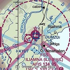
|
CAUTION: Diagram may not be current

| Airport distance calculator |
|---|
|
|
| Sunrise and sunset |
|---|
|
Times for 30-May-2026
| | Local
(UTC-8) | | Zulu
(UTC) |
|---|
| Morning civil twilight | | 03:56 | | 11:56 |
| Sunrise | | 05:15 | | 13:15 |
| Sunset | | 23:20 | | 07:20 |
| Evening civil twilight | | 00:39 | | 08:39 |
|
| Current date and time |
|---|
| Zulu (UTC) | 30-May-2026 16:57:00 |
|---|
| Local (UTC-8) | 30-May-2026 08:57:00 |
|---|
|
| METAR |
|---|
| PAIL | 301553Z 00000KT 10SM CLR 07/04 A3002 RMK AO2 SLP168 T00670039
|
|
| TAF |
|---|
| PAIL | 301125Z 3012/3112 VRB04KT P6SM VCFG SKC FM301800 13008KT P6SM VCSH BKN060 FM310300 11006KT P6SM SKC
|
|
| NOTAMs |
|---|
NOTAMs are issued by the DoD/FAA and will open in a separate window not controlled by AirNav.
|
|


