FAA INFORMATION EFFECTIVE 09 JULY 2026
Location
| FAA Identifier: | ALI |
| Lat/Long: | 27-44-27.2000N 098-01-37.0000W
27-44.453333N 098-01.616667W
27.7408889,-98.0269444
(estimated) |
| Elevation: | 178.2 ft. / 54.3 m (surveyed) |
| Variation: | 06E (2000) |
| From city: | 3 miles SE of ALICE, TX |
| Time zone: | UTC -5 (UTC -6 during Standard Time) |
| Zip code: | 78332 |
Airport Operations
| Airport use: | Open to the public |
| Activation date: | 02/1943 |
| Control tower: | no |
| ARTCC: | HOUSTON CENTER |
| FSS: | SAN ANGELO FLIGHT SERVICE STATION |
| NOTAMs facility: | ALI (NOTAM-D service available) |
| Attendance: | 0800-1700
AFT HRS SVC, CALL 361-664-2656. |
| Wind indicator: | yes |
| Segmented circle: | yes |
| Lights: | ACTVT MALS RWY 31; REILS RWY 13; PAPI RWY 17 & 35 - CTAF. MIRL RWYS 13/31 & 17/35 PRESET LOW INTST DUSK-2300; TO INCR INTST OR ACTVT AFT 2300 - CTAF. |
| Beacon: | white-green (lighted land airport)
Operates sunset to sunrise. |
Airport Communications
| CTAF/UNICOM: | 123.0 |
| WX ASOS: | 119.225 (361-668-0069) |
| KINGSVILLE APPROACH: | 119.9 |
| KINGSVILLE DEPARTURE: | 119.9 |
| WX AWOS-3P at IKG (11 nm S): | 119.075 (361-592-9152) |
| WX AWOS-3 at RBO (18 nm E): | 118.175 (361-767-1982) |
- APCH/DEP SVC PRVDD BY HOUSTON ARTCC (ZHU) ON FREQS 128.15/350.3 (SARITA RCAG) WHEN KINGSVILLE APCH CLSD.
Nearby radio navigation aids
| VOR radial/distance | | VOR name | | Freq | | Var |
|---|
| ALI at field | | ALICE VOR | | 114.50 | | 06E |
| CRPr243/32.4 | | CORPUS CHRISTI VORTAC | | 115.50 | | 09E |
Airport Services
| Fuel available: | 100LL JET-A
100LL:100LL AVBL 24 HRS AT SELF-SVC PUMP. |
| Parking: | hangars and tiedowns |
| Bottled oxygen: | HIGH/LOW |
| Bulk oxygen: | HIGH/LOW |
Runway Information
Runway 13/31
| Dimensions: | 5997 x 100 ft. / 1828 x 30 m |
| Surface: | asphalt, in good condition |
| Weight bearing capacity: | |
| Runway edge lights: | medium intensity |
| Runway edge markings: | RWY MKGS DISCOLORED. |
| RUNWAY 13 | | RUNWAY 31 |
| Latitude: | 27-44.718962N | | 27-44.025390N |
| Longitude: | 098-02.033605W | | 098-01.240005W |
| Elevation: | 177.6 ft. | | 166.5 ft. |
| Traffic pattern: | left | | left |
| Runway heading: | 128 magnetic, 134 true | | 308 magnetic, 314 true |
| Markings: | nonprecision, in fair condition | | precision, in fair condition |
| Visual slope indicator: | 4-light PAPI on left (3.00 degrees glide path) | | |
| Approach lights: | | | MALS: 1,400 foot medium intensity approach lighting system |
| Runway end identifier lights: | yes | | |
| Touchdown point: | yes, no lights | | yes, no lights |
| Instrument approach: | | | LOC/DME |
| Obstructions: | 15 ft. road, 690 ft. from runway, 570 ft. right of centerline, 32:1 slope to clear | | none |
Runway 17/35
| Dimensions: | 4490 x 100 ft. / 1369 x 30 m |
| Surface: | asphalt, in good condition |
| Weight bearing capacity: | |
| Runway edge lights: | medium intensity |
| RUNWAY 17 | | RUNWAY 35 |
| Latitude: | 27-44.706810N | | 27-43.965778N |
| Longitude: | 098-01.609515W | | 098-01.601173W |
| Elevation: | 173.3 ft. | | 171.5 ft. |
| Traffic pattern: | left | | left |
| Runway heading: | 173 magnetic, 179 true | | 353 magnetic, 359 true |
| Markings: | nonprecision, in fair condition | | nonprecision, in fair condition |
| Visual slope indicator: | 2-light PAPI on left (3.00 degrees glide path) | | 2-light PAPI on left (3.00 degrees glide path) |
| Touchdown point: | yes, no lights | | yes, no lights |
| Obstructions: | none | | 30 ft. pline, 1300 ft. from runway, 36:1 slope to clear |
Airport Ownership and Management from official FAA records
| Ownership: | Publicly-owned |
| Owner: | CITY OF ALICE & JIM WELLS CO
PO DRAWER 3229
ALICE, TX 78333
Phone 361-668-7210 |
| Manager: | MICHAEL ESPARZA
PO DRAWER 3229
ALICE, TX 78333
Phone 361-453-1721
CITY/ARPT MGR. ON SITE MGR TIM THOMPSON 361-453-1731. |
Additional Remarks
| - | FOR CD IF UNA TO CTC ON FSS FREQ, CTC HOUSTON ARTCC AT 281-230-5622. |
Instrument Procedures
NOTE: All procedures below are presented as PDF files. If you need a reader for these files, you should download the free Adobe Reader.NOT FOR NAVIGATION. Please procure official charts for flight.
FAA instrument procedures published for use from 09 July 2026 at 0901Z to 06 August 2026 at 0900Z.
IAPs - Instrument Approach Procedures |
|---|
| RNAV (GPS) RWY 13 | |
download (235KB) |
| RNAV (GPS) RWY 31 | |
download (251KB) |
| LOC/DME RWY 31 | |
download (229KB) |
| NOTE: Special Alternate Minimums apply **CHANGED** | |
download (138KB) |
| NOTE: Special Take-Off Minimums/Departure Procedures apply | |
download (297KB) |
Other nearby airports with instrument procedures:
KNOG - Orange Grove Naval Auxiliary Field (9 nm N)
KIKG - Kleberg County Airport (11 nm S)
KRBO - Nueces County Airport (18 nm E)
KNQI - Kingsville Naval Air Station (18 nm SE)
KCRP - Corpus Christi International Airport (28 nm E)
|
|

Road maps at:
MapQuest
Bing
Google
| Aerial photo |
|---|
WARNING: Photo may not be current or correct
 Photo courtesy of KALI Aviation Staff
Photo taken 05-Dec-2015
looking south.
Photo courtesy of KALI Aviation Staff
Photo taken 05-Dec-2015
looking south.
Do you have a better or more recent aerial photo of Alice International Airport that you would like to share? If so, please send us your photo.
|
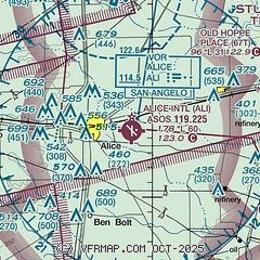
| Sectional chart |
|---|
|
| Airport distance calculator |
|---|
|
|
| Sunrise and sunset |
|---|
|
Times for 23-Jul-2026
| | Local
(UTC-5) | | Zulu
(UTC) |
|---|
| Morning civil twilight | | 06:25 | | 11:25 |
| Sunrise | | 06:51 | | 11:51 |
| Sunset | | 20:26 | | 01:26 |
| Evening civil twilight | | 20:52 | | 01:52 |
|
| Current date and time |
|---|
| Zulu (UTC) | 24-Jul-2026 00:55:56 |
|---|
| Local (UTC-5) | 23-Jul-2026 19:55:56 |
|---|
|
| METAR |
|---|
| KALI | 232353Z AUTO 17008KT 8SM -RA SCT080 BKN100 OVC120 25/23 A2986 RMK AO2 RAE2254B23 SLP108 P0000 60000 T02500228 10350 20250 50008
|
KNOG
10nm N | 232356Z AUTO 16011KT 10SM SCT047 OVC080 25/22 A2987 RMK AO2 RAE16 SLP095 P0000 60000 T02500222 10361 20250 50006 $
|
KIKG
11nm S | 240035Z AUTO 12004KT 7SM -RA SCT050 BKN075 OVC080 25/23 A2987 RMK AO2 P0001 T02460232
|
KRBO
18nm E | 240035Z AUTO 18007KT A2986 RMK AO2 LTG DSNT N AND NE P0001 PWINO
|
KNQI
18nm SE | 232356Z 16006KT 3SM RA BR FEW042 BKN065 OVC080 24/23 A2986 RMK AO2 SFC VIS 5 SLP107 T2 SET P0025 60031 T02440233 10333 20239 50006 $
|
|
| TAF |
|---|
| KALI | 231736Z 2318/2418 VRB06KT P6SM SCT070 OVC250 FM232300 15010KT P6SM -SHRA VCTS BKN040CB OVC100 PROB30 2401/2407 VRB20G30KT 4SM TSRA BR FEW008 OVC025CB FM241000 13005KT P6SM OVC050
|
KNQI
18nm SE | 2323/2423 14010KT 9999 VCTS SCT060CB BKN100 OVC200 651709 QNH2982INS TEMPO 2323/2402 VRB20G35KT 3200 TSRA BR SCT012 BKN025CB OVC090 FM240400 18008KT 9999 VCSH SCT040 BKN100 BKN180 BKN250 611809 QNH2983INS BECMG 2407/2409 13007KT 9999 NSW BKN040 BKN180 BKN250 600000 QNH2984INS FM241400 17015G20KT 9999 FEW040 SCT180 BKN250 QNH2992INS FM241900 14018G26KT 9999 FEW050 FEW180 SCT250 510003 QNH2993INS AUTOMATED SENSOR METWATCH 2405 TIL 2412 TX33/2420Z TN25/2412Z FN20042
|
|
| NOTAMs |
|---|
NOTAMs are issued by the DoD/FAA and will open in a separate window not controlled by AirNav.
|
|

