FAA INFORMATION EFFECTIVE 11 JUNE 2026
Location
| FAA Identifier: | LXT |
| Lat/Long: | 38-57-32.7480N 094-22-18.8210W
38-57.545800N 094-22.313683W
38.9590967,-94.3718947
(estimated) |
| Elevation: | 1004.1 ft. / 306.0 m (surveyed) |
| Variation: | 02E (2010) |
| From city: | 3 miles N of LEE'S SUMMIT, MO |
| Time zone: | UTC -5 (UTC -6 during Standard Time) |
| Zip code: | 64064 |
Airport Operations
| Airport use: | Open to the public |
| Activation date: | 04/1972 |
| Control tower: | no |
| ARTCC: | KANSAS CITY CENTER |
| FSS: | COLUMBIA FLIGHT SERVICE STATION |
| NOTAMs facility: | LXT (NOTAM-D service available) |
| Attendance: | 0600-2000 |
| Pattern altitude: | 2004.1 ft. MSL
TPA ACFT UNDER 6,000 LBS 1000 FT AGL, ACFT OVER 6,000 LBS 1,500 FT AGL. |
| Wind indicator: | lighted |
| Segmented circle: | yes |
| Lights: | ACTVT REIL RWY 18 & 36, 11 & 29; MIRL RWY 11 & 29, 18 & 36 - CTAF. PAPI RWY 11 & 29, 18 & 36 OPR CONSLY. |
| Beacon: | white-green (lighted land airport)
Operates sunset to sunrise. |
Airport Communications
| CTAF/UNICOM: | 122.8 |
| WX ASOS: | 124.175 (816-347-9807) |
| KANSAS CITY APPROACH: | 118.4 [OPR 1300-0500Z++ MON-FRI; 1400-2300Z++ SAT-SUN; CLSD HOL.] |
| KANSAS CITY DEPARTURE: | 118.4 [OPR 1300-0500Z++ MON-FRI; 1400-2300Z++ SAT-SUN; CLSD HOL.] |
| CLEARANCE DELIVERY: | 118.45 |
| BRAYMER STAR: | 120.95 |
| JHAWK STAR: | 120.95 |
| TYGER STAR: | 120.95 |
| WX ASOS at MKC (14 nm NW): | 120.75 (816-329-2843) |
| WX ASOS at OJC (18 nm W): | PHONE 913-361-8893 |
Nearby radio navigation aids
| VOR radial/distance | | VOR name | | Freq | | Var |
|---|
| ANXr227/14.0 | | NAPOLEON VORTAC | | 115.15 | | 07E |
| MCIr134/25.9 | | KANSAS CITY VORTAC | | 113.25 | | 05E |
Airport Services
| Fuel available: | 100LL JET-A MOGAS
100LL:24 HR SELF SERVICE FUEL 100LL & MOGAS. MOBILE FUEL JET A AND 100LL. AFTER HRS FUEL CALL 816-969-1186. CALL OUT FEE. |
| Parking: | hangars and tiedowns |
| Airframe service: | MAJOR |
| Powerplant service: | MAJOR |
| Bottled oxygen: | LOW |
| Bulk oxygen: | NONE |
Runway Information
Runway 18/36
| Dimensions: | 5501 x 100 ft. / 1677 x 30 m |
| Surface: | concrete/grooved, in excellent condition |
| Weight bearing capacity: | | PCN 22 /R/C/W/T | | Single wheel: | 40.0 | | Double wheel: | 60.0 |
|
| Runway edge lights: | medium intensity |
| RUNWAY 18 | | RUNWAY 36 |
| Latitude: | 38-58.036888N | | 38-57.132352N |
| Longitude: | 094-22.404197W | | 094-22.472813W |
| Elevation: | 995.0 ft. | | 986.0 ft. |
| Traffic pattern: | left | | right |
| Runway heading: | 181 magnetic, 183 true | | 001 magnetic, 003 true |
| Markings: | nonprecision, in good condition | | nonprecision, in good condition |
| Visual slope indicator: | 4-light PAPI on left (3.00 degrees glide path) | | 4-light PAPI on left (3.00 degrees glide path) |
| Runway end identifier lights: | yes | | yes |
| Touchdown point: | yes, no lights | | yes, no lights |
Runway 11/29
| Dimensions: | 4000 x 75 ft. / 1219 x 23 m |
| Surface: | concrete, in good condition |
| Weight bearing capacity: | | Single wheel: | 30.0 | | Double wheel: | 30.0 |
|
| Runway edge lights: | medium intensity |
| RUNWAY 11 | | RUNWAY 29 |
| Latitude: | 38-57.623210N | | 38-57.361565N |
| Longitude: | 094-22.529323W | | 094-21.754747W |
| Elevation: | 991.9 ft. | | 1001.6 ft. |
| Traffic pattern: | right | | left |
| Runway heading: | 111 magnetic, 113 true | | 291 magnetic, 293 true |
| Markings: | nonprecision, in good condition | | nonprecision, in good condition |
| Visual slope indicator: | 4-light PAPI on left (3.00 degrees glide path) | | 4-light PAPI on right (3.00 degrees glide path) |
| Runway end identifier lights: | yes | | yes |
| Touchdown point: | yes, no lights | | yes, no lights |
Airport Ownership and Management from official FAA records
| Ownership: | Publicly-owned |
| Owner: | CITY OF LEE'S SUMMIT
220 SE GREEN, P.O. BOX 1600
LEES SUMMIT, MO 64063
Phone 816-969-1000 |
| Manager: | JOEL ARRINGTON
2720 NE HAGAN RD
LEES SUMMIT, MO 64064
Phone 816-969-1186 |
Additional Remarks
| - | NO RIGHT TURNS UNDER 2500 FT MSL OR WITHIN 3 MI OF ARPT WHEN DEPARTING ON RWY 29. |
| - | FOR CD CTC KANSAS CITY APCH 118.45 OR 816-329-2710. |
| - | NO TOUCH-AND-GOES BTN 10 P.M. AND 7 A.M. |
| - | REPEATED TKOF AND LNDGS BTN 10 P.M. AND 7 A.M. NEED TO BE TO A FULL STOP AND TAXI BACK. |
| - | NO MID-FLD/INT DEP |
| - | FLT TRNG ACFT ON RWY 36 MAKE CROSSWIND TURN AT 1500 MSL OR PRIOR TO WOODS CHAPEL RD, WHICHEVER OCCURS FIRST |
| - | FLT TRNG ACFT ON RWY 18 MAKE CROSSWIND TURN AT 1500 MSL OR PRIOR TO HOSPITAL, WHICHEVER OCCURS FIRST. |
| - | WILDLIFE ON & INVOF ARPT. |
| - | WHEN WINDS ARE LESS THAN 5 KNOTS USE RWY 18. |
| - | AER 18,36 & 29 ARE NOT MUTUALLY VSB DUE TO TRRN. |
| - | ARPT TRML BLDG OPEN 24 HRS. |
| - | RWY 18/36 GRAD 0.16%, RWY 11/29 GRAD 0.24% |
Instrument Procedures
NOTE: All procedures below are presented as PDF files. If you need a reader for these files, you should download the free Adobe Reader.NOT FOR NAVIGATION. Please procure official charts for flight.
FAA instrument procedures published for use from 11 June 2026 at 0901Z to 09 July 2026 at 0900z.
STARs - Standard Terminal Arrivals |
|---|
| BRAYMER EIGHT **NEW** | |
2 pages:
[1] [2] (343KB) |
| JHAWK EIGHT **NEW** | |
download (220KB) |
| TYGER SEVEN **NEW** | |
2 pages:
[1] [2] (288KB) |
IAPs - Instrument Approach Procedures |
|---|
| RNAV (GPS) RWY 11 | |
download (183KB) |
| RNAV (GPS) RWY 18 | |
download (237KB) |
| RNAV (GPS) RWY 29 | |
download (222KB) |
| RNAV (GPS) RWY 36 | |
download (251KB) |
| VOR-A | |
download (179KB) |
| NOTE: Special Alternate Minimums apply | |
download (146KB) |
Departure Procedures |
|---|
| CHIEF NINE | |
download (153KB) |
| LAKES FIVE | |
download (211KB) |
| RACER EIGHT | |
download (198KB) |
| ROYAL TWO | |
download (179KB) |
| TIFTO EIGHT | |
download (134KB) |
| WILDCAT SIX | |
download (179KB) |
| NOTE: Special Take-Off Minimums/Departure Procedures apply | |
download (425KB) |
Other nearby airports with instrument procedures:
3GV - East Kansas City Airport (8 nm NE)
KMKC - Kansas City Downtown Airport-Wheeler Field (14 nm NW)
KOJC - Johnson County Executive Airport (18 nm W)
KLRY - Lawrence Smith Memorial Airport (21 nm S)
KGPH - Midwest National Air Center Airport (23 nm N)
|
|

Road maps at:
MapQuest
Bing
Google
| Aerial photo |
|---|
WARNING: Photo may not be current or correct
 Photo by William R.
Taken in the Winter of 2020
looking north.
Photo by William R.
Taken in the Winter of 2020
looking north.
Do you have a better or more recent aerial photo of Kansas City/Lee's Summit Regional Airport that you would like to share? If so, please send us your photo.
|
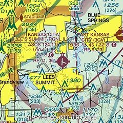
| Sectional chart |
|---|
|
CAUTION: Diagram may not be current
 Download PDF
of official airport diagram from the FAA
| Airport distance calculator |
|---|
|
|
| Sunrise and sunset |
|---|
|
Times for 29-Jun-2026
| | Local
(UTC-5) | | Zulu
(UTC) |
|---|
| Morning civil twilight | | 05:24 | | 10:24 |
| Sunrise | | 05:56 | | 10:56 |
| Sunset | | 20:46 | | 01:46 |
| Evening civil twilight | | 21:18 | | 02:18 |
|
| Current date and time |
|---|
| Zulu (UTC) | 29-Jun-2026 23:48:23 |
|---|
| Local (UTC-5) | 29-Jun-2026 18:48:23 |
|---|
|
| METAR |
|---|
| KLXT | 292253Z AUTO 19018G27KT 10SM FEW039 32/24 A2983 RMK AO2 PK WND 20032/2210 SLP087 T03220244
|
KMKC
14nm NW | 292254Z 18017G27KT 10SM CLR 33/24 A2979 RMK AO2 PK WND 20029/2238 SLP078 T03330244
|
KOJC
18nm W | 292253Z 18011G25KT 10SM FEW036 32/24 A2982 RMK AO2 PK WND 18028/2209 SLP082 T03220244
|
|
| TAF |
|---|
KMKC
14nm NW | 292115Z 2921/3018 18015G30KT P6SM SCT040 FM300000 19013G25KT P6SM SCT240 FM301300 20011G22KT P6SM FEW090 FEW250
|
|
| NOTAMs |
|---|
NOTAMs are issued by the DoD/FAA and will open in a separate window not controlled by AirNav.
|
|


