FAA INFORMATION EFFECTIVE 19 FEBRUARY 2026
Location
| FAA Identifier: | ROC |
| Lat/Long: | 43-07-08.9170N 077-40-18.7280W
43-07.148617N 077-40.312133W
43.1191436,-77.6718689
(estimated) |
| Elevation: | 558.9 ft. / 170.4 m (surveyed) |
| Variation: | 12W (2015) |
| From city: | 3 miles SW of ROCHESTER, NY |
| Time zone: | UTC -5 (UTC -4 during Daylight Saving Time) |
| Zip code: | 14624 |
Airport Operations
| Airport use: | Open to the public |
| Activation date: | 03/1940 |
| Control tower: | yes |
| ARTCC: | CLEVELAND CENTER |
| FSS: | BUFFALO FLIGHT SERVICE STATION |
| NOTAMs facility: | ROC (NOTAM-D service available) |
| Attendance: | CONTINUOUS |
| Pattern altitude: | 1399.9 ft. MSL
TPA: 841 FT AGL SINGL ENG, 1441 FT AGL MULT ENG/TURBOPROP/JET. |
| Wind indicator: | lighted |
| Segmented circle: | no |
| Beacon: | white-green (lighted land airport)
Operates sunset to sunrise. |
| Landing fee: | yes |
| Fire and rescue: | ARFF index C |
| International operations: | international airport of entry
FLIGHT NOTIFICATION SERVICE (ADCUS ) AVAILABLE. |
Airport Communications
| UNICOM: | 122.95 |
| ATIS: | 124.825 |
| WX ASOS: | 124.825 (585-205-7835) |
| ROCHESTER GROUND: | 121.7 |
| ROCHESTER TOWER: | 118.3 254.3 |
| ROCHESTER APPROACH: | 119.55 ;330-160 123.7 ;161-329 269.6 ;330-160 322.3 ;161-329 |
| ROCHESTER DEPARTURE: | 119.55 ;330-160 123.7 ;161-329 269.6 ;330-160 322.3 ;161-329 127.325 |
| CLEARANCE DELIVERY: | 118.8 343.65 |
| PRE-TAXI CLEARANCE: | 118.8 |
| CLASS C: | 119.55 ;330-160 123.7 ;161-329 269.6 ;330-160 322.3 ;161-329 |
| EMERG: | 121.5 243.0 |
| IC: | 119.55 ;330-160 269.6 ;330-160 |
| WX AWOS-3P at IUA (20 nm SE): | 118.675 (585-396-5861) |
Nearby radio navigation aids
| VOR radial/distance | | VOR name | | Freq | | Var |
|---|
| ROC at field | | ROCHESTER VOR/DME | | 110.00 | | 12W |
| GEEr018/17.3 | | GENESEO VOR/DME | | 108.20 | | 09W |
Airport Services
| Fuel available: | 100LL JET-A J8
J8:FOR DOD ACFT. |
| Parking: | hangars and tiedowns |
| Airframe service: | MAJOR |
| Powerplant service: | MAJOR |
| Bottled oxygen: | HIGH/LOW |
| Bulk oxygen: | HIGH/LOW |
Runway Information
Runway 4/22
| Dimensions: | 8001 x 150 ft. / 2439 x 46 m |
| Surface: | asphalt/grooved, in good condition |
| Weight bearing capacity: | | Single wheel: | 126.0 | | Double wheel: | 160.0 | | Double tandem: | 265.0 |
|
| Runway edge lights: | high intensity |
| RUNWAY 4 | | RUNWAY 22 |
| Latitude: | 43-06.412800N | | 43-07.534003N |
| Longitude: | 077-41.262557W | | 077-40.319335W |
| Elevation: | 527.4 ft. | | 558.9 ft. |
| Traffic pattern: | left | | right |
| Runway heading: | 044 magnetic, 032 true | | 224 magnetic, 212 true |
| Declared distances: | TORA:8001 TODA:8001 ASDA:8001 LDA:8001 | | TORA:8001 TODA:8001 ASDA:8001 LDA:8001 |
| Markings: | precision, in good condition | | precision, in good condition |
| Visual slope indicator: | 4-light PAPI on left (3.00 degrees glide path) | | 4-light PAPI on left (3.00 degrees glide path) |
| RVR equipment: | touchdown, rollout | | touchdown, rollout |
| Approach lights: | ALSF2: standard 2,400 foot high intensity approach lighting system with centerline sequenced flashers (category II or III) | | MALSR: 1,400 foot medium intensity approach lighting system with runway alignment indicator lights |
| Centerline lights: | yes | | yes |
| Touchdown point: | yes, lighted | | yes, no lights |
| Instrument approach: | ILS | | ILS |
| Obstructions: | 89 ft. trees, 3080 ft. from runway, 760 ft. right of centerline, 32:1 slope to clear | | 54 ft. tree, 2080 ft. from runway, 520 ft. right of centerline, 34:1 slope to clear |
Runway 10/28
| Dimensions: | 6402 x 150 ft. / 1951 x 46 m |
| Surface: | asphalt/grooved, in good condition |
| Weight bearing capacity: | | Single wheel: | 126.0 | | Double wheel: | 160.0 | | Double tandem: | 265.0 |
|
| Runway edge lights: | high intensity |
| RUNWAY 10 | | RUNWAY 28 |
| Latitude: | 43-07.366753N | | 43-07.409788N |
| Longitude: | 077-40.657383W | | 077-39.219928W |
| Elevation: | 554.9 ft. | | 541.4 ft. |
| Traffic pattern: | right | | left |
| Runway heading: | 100 magnetic, 088 true | | 280 magnetic, 268 true |
| Displaced threshold: | 298 ft. | | 600 ft. |
| Declared distances: | TORA:6402 TODA:6402 ASDA:5802 LDA:5502 | | TORA:6402 TODA:6402 ASDA:6402 LDA:5802 |
| Markings: | nonprecision, in good condition | | precision, in good condition |
| Visual slope indicator: | 4-light PAPI on left (3.00 degrees glide path) | | 4-light PAPI on left (3.00 degrees glide path) |
| RVR equipment: | touchdown, rollout | | touchdown, rollout |
| Approach lights: | | | MALSR: 1,400 foot medium intensity approach lighting system with runway alignment indicator lights |
| Runway end identifier lights: | yes
RY 10 REIL CONTROLLED BY ATCT BUT NOT MONITORED. | | |
| Touchdown point: | yes, no lights | | yes, no lights |
| Instrument approach: | | | ILS/DME |
| Obstructions: | 62 ft. trees, 1330 ft. from runway, 460 ft. left of centerline, 18:1 slope to clear
RWY 10 APCH RATIO 26:1 TO DSPLCD THLD. | | 68 ft. trees, 1213 ft. from runway, 663 ft. right of centerline, 14:1 slope to clear
RWY 28 APCH RATIO 26:1 TO DSPLCD THLD. |
Runway 7/25
| Dimensions: | 4000 x 100 ft. / 1219 x 30 m |
| Surface: | asphalt, in excellent condition |
| Weight bearing capacity: | | PCN 95 /F/C/X/T | | Single wheel: | 32.0 | | Double wheel: | 42.0 |
|
| Runway edge lights: | medium intensity |
| Operational restrictions: | RWY 07/25 NOT AVBL FOR PART 121/PART 380 OPS WITH SKED PAX CARRYING OPS MORE THAN 9 PAX SEATS AND NON-SKED PAX CARRYING OPS MORE THAN 30 PAX SEATS. |
| RUNWAY 7 | | RUNWAY 25 |
| Latitude: | 43-06.970130N | | 43-07.260548N |
| Longitude: | 077-40.355300W | | 077-39.548542W |
| Elevation: | 545.0 ft. | | 536.0 ft. |
| Traffic pattern: | right | | left |
| Runway heading: | 076 magnetic, 064 true | | 256 magnetic, 244 true |
| Declared distances: | TORA:4000 TODA:4000 ASDA:4000 LDA:4000 | | TORA:4000 TODA:4000 ASDA:4000 LDA:4000 |
| Markings: | nonprecision, in good condition | | nonprecision, in good condition |
| Visual slope indicator: | | | 4-light PAPI on right (3.00 degrees glide path) |
| Runway end identifier lights: | yes
RY 07 REIL CONTROLLED BY ATCT BUT NOT MONITORED. | | yes
RY 25 REIL CONTROLLED BY ATCT BUT NOT MONITORED. |
| Touchdown point: | yes, no lights | | yes, no lights |
| Obstructions: | 58 ft. pole, lighted, 1740 ft. from runway, 320 ft. right of centerline, 26:1 slope to clear | | 82 ft. tree, 2720 ft. from runway, 430 ft. right of centerline, 30:1 slope to clear |
Airport Ownership and Management from official FAA records
| Ownership: | Publicly-owned |
| Owner: | COUNTY OF MONROE
COUNTY OFFICE BLDG
ROCHESTER, NY 14614
Phone 585-753-7020 |
| Manager: | ANDREW MOORE
1200 BROOKS AVE
ROCHESTER, NY 14624
Phone 585-753-7056 |
Additional Remarks
| A39-04/22 | PCR VALUE: 740/R/B/W/T |
| A39-10/28 | PCR VALUE: 1190/F/C/X/T |
| E60-28 | ENGINEERED MATERIALS ARRESTING SYSTEM (EMAS) 368 FT IN LENGTH BY 160 FT IN WIDTH LCTD AT THE DER 28. |
| - | NO PRACTICE APCHS OR MAINT ENG RUN-UPS BTN 2300-0600. |
| - | MULTIPLE UNSHIELDED LGTS IN FINAL APCH AREA RY 28. |
| - | TWY "A2" CLSD TO HEAVY ACFT. |
| - | TWY "F" FROM TWY "F1" TO RY 07 CLSD TO ACFT W/WINGSPAN GREATER THAN 100 FT. |
| - | PAPI RWY 22; PAPI RWY 10, RWY 25 AND RWY 28 OPERATE 24 HRS. |
| - | TERMINAL RAMP IS UNCONTROLLED. DO NOT CALL FOR PUSH/POWER BACK. ADVISE GROUND CONTROL WHEN READY TO TAXI FOR DEPARTURE. |
| - | BE ALERT DURG LNDG/TKOF RYS 25 & 28 - THLDS IN CLOSE PROXIMITY TO EACH OTHER. |
| - | BIRDS; DEER & COYOTE ON & INVOF ARPT. |
| - | 80 FT OBST LGTD TWR 1250 FT WEST OF RY 04/22 CNTRLN 1000 FT SOUTH OF EXTDD CNTRLN RY 10/28. |
Instrument Procedures
NOTE: All procedures below are presented as PDF files. If you need a reader for these files, you should download the free Adobe Reader.NOT FOR NAVIGATION. Please procure official charts for flight.
FAA instrument procedures published for use from 19 February 2026 at 0901Z to 19 March 2026 at 0900Z.
IAPs - Instrument Approach Procedures |
|---|
| ILS OR LOC RWY 04 | |
download (268KB) |
| ILS OR LOC RWY 22 | |
download (293KB) |
| ILS OR LOC RWY 28 | |
download (347KB) |
| ILS RWY 04 (SA CAT I) | |
download (256KB) |
| ILS RWY 04 (CAT II) | |
download (246KB) |
| RNAV (GPS) RWY 04 | |
download (220KB) |
| RNAV (GPS) RWY 07 | |
download (198KB) |
| RNAV (GPS) RWY 10 | |
download (216KB) |
| RNAV (GPS) RWY 22 | |
download (249KB) |
| RNAV (GPS) RWY 25 | |
download (205KB) |
| RNAV (GPS) RWY 28 | |
download (247KB) |
| VOR RWY 04 | |
download (219KB) |
| NOTE: Special Alternate Minimums apply | |
download (145KB) |
Departure Procedures |
|---|
| XEROX EIGHT | |
2 pages:
[1] [2] (344KB) |
| NOTE: Special Take-Off Minimums/Departure Procedures apply | |
download (441KB) |
Other nearby airports with instrument procedures:
7G0 - Ledgedale Airpark (11 nm W)
5G0 - Le Roy Airport (14 nm SW)
KIUA - Canandaigua Airport (20 nm SE)
KGVQ - Genesee County Airport (22 nm W)
KSDC - Williamson/Sodus Airport (25 nm E)
|
|

Road maps at:
MapQuest
Bing
Google
| Aerial photo |
|---|
WARNING: Photo may not be current or correct
 Photo courtesy of AirNav, LLC
Photo taken 28-Jul-2011
looking north.
Photo courtesy of AirNav, LLC
Photo taken 28-Jul-2011
looking north.
Do you have a better or more recent aerial photo of Frederick Douglass/Greater Rochester International Airport that you would like to share? If so, please send us your photo.
|
| Sectional chart |
|---|
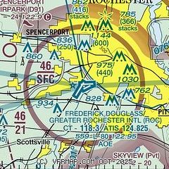
|
CAUTION: Diagram may not be current
 Download PDF
of official airport diagram from the FAA
| Airport distance calculator |
|---|
|
|
| Sunrise and sunset |
|---|
|
Times for 02-Mar-2026
| | Local
(UTC-5) | | Zulu
(UTC) |
|---|
| Morning civil twilight | | 06:18 | | 11:18 |
| Sunrise | | 06:46 | | 11:46 |
| Sunset | | 18:00 | | 23:00 |
| Evening civil twilight | | 18:28 | | 23:28 |
|
| Current date and time |
|---|
| Zulu (UTC) | 03-Mar-2026 03:26:01 |
|---|
| Local (UTC-5) | 02-Mar-2026 22:26:01 |
|---|
|
| METAR |
|---|
| KROC | 030254Z 14005KT 10SM CLR M06/M12 A3048 RMK AO2 SLP334 T10561117 58012 $
|
KIUA
20nm SE | 030255Z AUTO 14004KT 10SM CLR M07/M11 A3047 RMK AO2 T10711113
|
|
| TAF |
|---|
| KROC | 021733Z 0218/0318 VRB03KT P6SM FEW250 FM031700 17005KT P6SM BKN030 PROB30 0317/0318 4SM -RA OVC030
|
|
| NOTAMs |
|---|
NOTAMs are issued by the DoD/FAA and will open in a separate window not controlled by AirNav.
|
|


