FAA INFORMATION EFFECTIVE 19 MARCH 2026
Location
| FAA Identifier: | DKB |
| Lat/Long: | 41-56-01.8033N 088-42-20.4710W
41-56.030055N 088-42.341183W
41.9338342,-88.7056864
(estimated) |
| Elevation: | 912.6 ft. / 278.2 m (surveyed) |
| Variation: | 02W (2005) |
| From city: | 2 miles E of DE KALB, IL |
| Time zone: | UTC -5 (UTC -6 during Standard Time) |
| Zip code: | 60115 |
Airport Operations
| Airport use: | Open to the public |
| Activation date: | 04/1944 |
| Control tower: | no |
| ARTCC: | CHICAGO CENTER |
| FSS: | KANKAKEE FLIGHT SERVICE STATION |
| NOTAMs facility: | DKB (NOTAM-D service available) |
| Attendance: | NOV-FEB 0800-1600, MAR-OCT 0800-1700 |
| Wind indicator: | lighted |
| Segmented circle: | no |
| Lights: | MIRL RWY 02/20 PRESET LOW INTST, TO INCR INTST & ACTVT MIRL RWY 09/27, PAPI RWYS 09 & 27, REIL RWYS 09, 27, & 20, AND MALSR RWY 02 - CTAF. PAPI RWYS 02 & 20 OPERATE 24 HRS. |
| Beacon: | white-green (lighted land airport)
Operates sunset to sunrise. |
Airport Communications
| CTAF/UNICOM: | 122.7 |
| WX AWOS-3: | 119.075 (815-748-2350) |
| CHICAGO APPROACH: | 133.5 |
| CHICAGO DEPARTURE: | 133.5 |
| WX ASOS at ARR (14 nm SE): | PHONE 630-466-5649 |
| WX AWOS-3 at RPJ (17 nm W): | 125.2 (815-562-2955) |
Nearby radio navigation aids
| VOR radial/distance | | VOR name | | Freq | | Var |
|---|
| DPAr277/16.1 | | DUPAGE VOR/DME | | 114.55 | | 02E |
| JOTr321/29.0 | | JOLIET VOR/DME | | 112.30 | | 02E |
| OBKr245/37.8 | | NORTHBROOK VOR/DME | | 113.00 | | 02W |
Airport Services
| Fuel available: | 100LL JET-A1+
100LL:100LL 24 HR SELF SERVE WITH CREDIT CARD |
| Parking: | hangars and tiedowns |
| Airframe service: | MAJOR |
| Powerplant service: | MAJOR |
| Bottled oxygen: | LOW |
Runway Information
Runway 2/20
| Dimensions: | 7026 x 100 ft. / 2142 x 30 m |
| Surface: | asphalt/grooved, in excellent condition |
| Weight bearing capacity: | | Single wheel: | 25.0 | | Double wheel: | 80.0 |
|
| Runway edge lights: | medium intensity |
| RUNWAY 2 | | RUNWAY 20 |
| Latitude: | 41-55.657932N | | 41-56.748457N |
| Longitude: | 088-42.407085W | | 088-41.889903W |
| Elevation: | 912.6 ft. | | 903.7 ft. |
| Traffic pattern: | left | | left |
| Runway heading: | 021 magnetic, 019 true | | 201 magnetic, 199 true |
| Markings: | precision, in good condition | | nonprecision, in fair condition |
| Visual slope indicator: | 4-light PAPI on left (3.00 degrees glide path) | | 4-light PAPI on left (3.00 degrees glide path) |
| Approach lights: | MALSR: 1,400 foot medium intensity approach lighting system with runway alignment indicator lights | | |
| Runway end identifier lights: | no | | yes |
| Touchdown point: | yes, no lights | | yes, no lights |
| Instrument approach: | ILS/DME | | |
| Obstructions: | 21 ft. rr, 1237 ft. from runway, 650 ft. right of centerline | | none |
Runway 9/27
| Dimensions: | 4201 x 75 ft. / 1280 x 23 m |
| Surface: | asphalt/grooved, in excellent condition |
| Weight bearing capacity: | | Single wheel: | 25.0 | | Double wheel: | 80.0 |
|
| Runway edge lights: | medium intensity |
| RUNWAY 9 | | RUNWAY 27 |
| Latitude: | 41-55.739763N | | 41-55.741208N |
| Longitude: | 088-43.126602W | | 088-42.200298W |
| Elevation: | 911.4 ft. | | 911.7 ft. |
| Traffic pattern: | left | | left |
| Runway heading: | 092 magnetic, 090 true | | 272 magnetic, 270 true |
| Markings: | nonprecision, in good condition | | nonprecision, in fair condition |
| Visual slope indicator: | 4-light PAPI on left (3.00 degrees glide path) | | 4-light PAPI on left (3.00 degrees glide path) |
| Runway end identifier lights: | yes | | yes |
| Touchdown point: | yes, no lights | | yes, no lights |
| Obstructions: | none | | 40 ft. tree, 1464 ft. from runway, 170 ft. right of centerline, 31:1 slope to clear |
Airport Ownership and Management from official FAA records
| Ownership: | Publicly-owned |
| Owner: | CITY OF DEKALB
164 EAST LINCOLN HWY
DEKALB, IL 60115
Phone 815-748-2000 |
| Manager: | BENJAMIN TROMPETER
3232 PLEASANT STREET
DEKALB, IL 60115
Phone 815-748-8102 |
Additional Remarks
| - | FOR CD CTC CHICAGO APCH AT 847-289-0926. |
| - | PRFERED CALM WIND RWY 02 |
Instrument Procedures
NOTE: All procedures below are presented as PDF files. If you need a reader for these files, you should download the free Adobe Reader.NOT FOR NAVIGATION. Please procure official charts for flight.
FAA instrument procedures published for use from 19 March 2026 at 0901Z to 16 April 2026 at 0900Z.
IAPs - Instrument Approach Procedures |
|---|
| ILS OR LOC RWY 02 | |
download (292KB) |
| RNAV (GPS) RWY 02 | |
download (275KB) |
| RNAV (GPS) RWY 09 | |
download (251KB) |
| RNAV (GPS) RWY 20 | |
download (275KB) |
| RNAV (GPS) RWY 27 | |
download (243KB) |
| NOTE: Special Alternate Minimums apply | |
download (140KB) |
| NOTE: Special Take-Off Minimums/Departure Procedures apply | |
download |
Other nearby airports with instrument procedures:
KARR - Aurora Municipal Airport (14 nm SE)
KRPJ - Rochelle Municipal Airport/Koritz Field (17 nm W)
KDPA - DuPage Airport (20 nm E)
KRFD - Chicago/Rockford International Airport (23 nm NW)
3CK - Lake in the Hills Airport (24 nm NE)
|
|

Road maps at:
MapQuest
Bing
Google
| Aerial photo |
|---|
WARNING: Photo may not be current or correct
 Photo courtesy of AirNav, LLC
Photo taken 09-Nov-2013
looking north.
Photo courtesy of AirNav, LLC
Photo taken 09-Nov-2013
looking north.
Do you have a better or more recent aerial photo of De Kalb Taylor Municipal Airport that you would like to share? If so, please send us your photo.
|
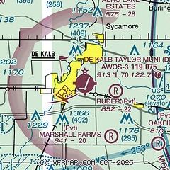
| Sectional chart |
|---|
|
| Airport distance calculator |
|---|
|
|
| Sunrise and sunset |
|---|
|
Times for 09-Apr-2026
| | Local
(UTC-5) | | Zulu
(UTC) |
|---|
| Morning civil twilight | | 05:57 | | 10:57 |
| Sunrise | | 06:25 | | 11:25 |
| Sunset | | 19:28 | | 00:28 |
| Evening civil twilight | | 19:56 | | 00:56 |
|
| Current date and time |
|---|
| Zulu (UTC) | 10-Apr-2026 00:49:58 |
|---|
| Local (UTC-5) | 09-Apr-2026 19:49:58 |
|---|
|
| METAR |
|---|
| KDKB | 100035Z AUTO 34006KT 10SM SCT075 OVC090 13/08 A3012 RMK AO2 T01300075
|
KARR
14nm SE | 092352Z 34014KT 8SM -RA BKN075 OVC095 14/08 A3014 RMK AO2 RAB2255 SLP205 P0001 60001 T01440083 10211 20144 53007
|
KRPJ
16nm W | 100035Z AUTO 35008KT 10SM -RA OVC095 12/07 A3011 RMK AO2 T01220066
|
|
| TAF |
|---|
KDPA
20nm E | 092101Z 0921/1018 26008KT P6SM VCSH SCT080 BKN120 TEMPO 0923/1001 5SM -SHRA SCT020 OVC035 FM100100 05009KT 6SM -SHRA SCT035 BKN070 FM100600 05007KT 6SM -RA SCT007 BKN015 TEMPO 1007/1010 3SM RA BKN008 OVC015 FM101000 01009KT P6SM VCSH FEW005 BKN008 FM101500 02012KT P6SM FEW009 BKN015 OVC025
|
KRFD
24nm NW | 092101Z 0921/1018 25008KT P6SM SCT060 BKN100 TEMPO 0922/1002 05009KT -SHRA SCT030 OVC060 FM100200 04009KT 6SM -SHRA BKN012 OVC060 FM100500 04009KT 3SM -RA VCTS OVC008CB FM100800 05009KT 6SM -SHRA BKN008 FM101300 01012KT P6SM BKN015
|
|
| NOTAMs |
|---|
NOTAMs are issued by the DoD/FAA and will open in a separate window not controlled by AirNav.
|
|


