FAA INFORMATION EFFECTIVE 14 MAY 2026
Location
| FAA Identifier: | LNS |
| Lat/Long: | 40-07-20.5000N 076-17-39.7000W
40-07.341667N 076-17.661667W
40.1223611,-76.2943611
(estimated) |
| Elevation: | 402.6 ft. / 122.7 m (surveyed) |
| Variation: | 09W (1965) |
| From city: | 4 miles N of LANCASTER, PA |
| Time zone: | UTC -4 (UTC -5 during Standard Time) |
| Zip code: | 17543 |
Airport Operations
| Airport use: | Open to the public |
| Control tower: | yes |
| ARTCC: | NEW YORK CENTER |
| FSS: | WILLIAMSPORT FLIGHT SERVICE STATION |
| NOTAMs facility: | LNS (NOTAM-D service available) |
| Attendance: | DAILY 0700-2100 |
| Wind indicator: | lighted |
| Segmented circle: | no |
| Lights: | WHEN ATCT CLSD ACTVT MALSR RWY 08; REIL RWY 31; HIRL 08/26; MIRL RWY 13/31; TWY LGTS - CTAF. |
| Beacon: | white-green (lighted land airport)
Operates sunset to sunrise. |
| Fire and rescue: | ARFF index B |
| Airline operations: | ARFF AVBL FM 0600-2100 MON-FRI, 0600-1800 SAT, 0800-2100 SUN. EMERGS OUTSIDE ATCT OPN HRS & ARFF HRS CALL MANHEIM TOWNSHIP EMERG SVCS AT 911. |
Airport Communications
| CTAF: | 120.9 |
| UNICOM: | 122.95 |
| ATIS: | 125.675 |
| WX ASOS: | 125.675 (717-568-6942) |
| LANCASTER GROUND: | 121.8 [0600-2300] |
| LANCASTER TOWER: | 120.9 251.1 [0600-2300] |
| HARRISBURG APPROACH: | 126.45 |
| HARRISBURG DEPARTURE: | 126.45 |
| EMERG: | 121.5 243.0 |
| WX AWOS-2 at 9D4 (14 nm N): | 118.45 (717-866-2906) |
Nearby radio navigation aids
| VOR radial/distance | | VOR name | | Freq | | Var |
|---|
| LRP at field | | LANCASTER VOR/DME | | 117.30 | | 09W |
| RAVr163/29.4 | | RAVINE VORTAC | | 114.60 | | 11W |
| MXEr302/31.2 | | MODENA VORTAC | | 113.20 | | 09W |
| PTWr269/34.2 | | POTTSTOWN VORTAC | | 116.50 | | 09W |
| HARr117/37.1 | | HARRISBURG VORTAC | | 115.35 | | 10W |
| ETXr234/39.2 | | EAST TEXAS VOR/DME | | 110.20 | | 09W |
| NDB name | | Hdg/Dist | | Freq | | Var | | ID |
|---|
| BELLGROVE | | 158/22.2 | | 328 | | 10W | | BZJ | -... --.. .--- |
Airport Services
| Fuel available: | 100LL JET-A |
| Parking: | hangars and tiedowns |
| Airframe service: | MAJOR |
| Powerplant service: | MAJOR |
| Bottled oxygen: | LOW |
Runway Information
Runway 8/26
| Dimensions: | 6933 x 150 ft. / 2113 x 46 m |
| Surface: | asphalt/grooved, in good condition |
| Weight bearing capacity: | | Single wheel: | 65.0 | | Double wheel: | 92.0 | | Double tandem: | 146.0 |
|
| Runway edge lights: | high intensity |
| RUNWAY 8 | | RUNWAY 26 |
| Latitude: | 40-07.196762N | | 40-07.625008N |
| Longitude: | 076-18.242468W | | 076-16.863498W |
| Elevation: | 396.8 ft. | | 374.7 ft. |
| Traffic pattern: | left | | left |
| Runway heading: | 077 magnetic, 068 true | | 257 magnetic, 248 true |
| Displaced threshold: | 357 ft. | | 59 ft. |
| Declared distances: | TORA:6934 TODA:6934 ASDA:6475 LDA:6118 | | TORA:6934 TODA:6934 ASDA:6177 LDA:6118 |
| Markings: | precision, in good condition | | nonprecision, in good condition |
| Visual slope indicator: | 4-light PAPI on right (3.00 degrees glide path) | | 4-light PAPI on left (3.00 degrees glide path) |
| Approach lights: | MALSR: 1,400 foot medium intensity approach lighting system with runway alignment indicator lights | | |
| Touchdown point: | yes, no lights | | yes, no lights |
| Instrument approach: | ILS | | |
| Obstructions: | 5 ft. road, 297 ft. from runway, 380 ft. left of centerline, 20:1 slope to clear
RWY 08 APCH RATIO 50:1 TO DTHR. | | 40 ft. tree, 1266 ft. from runway, 276 ft. right of centerline, 26:1 slope to clear
RWY 26 APCH RATIO 33:1 TO DTHR. |
Runway 13/31
| Dimensions: | 4102 x 100 ft. / 1250 x 30 m |
| Surface: | asphalt, in good condition |
| Weight bearing capacity: | | Single wheel: | 65.0 | | Double wheel: | 92.0 | | Double tandem: | 146.0 |
|
| Runway edge lights: | medium intensity |
| RUNWAY 13 | | RUNWAY 31 |
| Latitude: | 40-07.390455N | | 40-07.060697N |
| Longitude: | 076-18.227125W | | 076-17.459177W |
| Elevation: | 393.5 ft. | | 398.9 ft. |
| Traffic pattern: | left | | left |
| Runway heading: | 128 magnetic, 119 true | | 308 magnetic, 299 true |
| Declared distances: | TORA:4102 TODA:4102 ASDA:4102 LDA:4102 | | TORA:4102 TODA:4102 ASDA:4102 LDA:4102 |
| Markings: | nonprecision, in good condition | | nonprecision, in good condition |
| Visual slope indicator: | 2-light PAPI on right (3.00 degrees glide path) | | 2-box VASI on left (3.00 degrees glide path) |
| Runway end identifier lights: | | | yes |
| Touchdown point: | yes, no lights | | yes, no lights |
| Obstructions: | 76 ft. tree, 1816 ft. from runway, 477 ft. left of centerline, 21:1 slope to clear | | 30 ft. trees, 958 ft. from runway, 330 ft. left of centerline, 25:1 slope to clear |
Airport Ownership and Management from official FAA records
| Ownership: | Publicly-owned |
| Owner: | LANCASTER ARPT AUTHORITY
500 AIRPORT RD SUITE G
LITITZ, PA 17543-9340
Phone 717-569-1221 |
| Manager: | ED FOSTER
500 AIRPORT RD SUITE G
LITITZ, PA 17543-9340
Phone 717-569-1221 |
Additional Remarks
| A39-08/26 | PCR VALUE: 430/F/D/X/T |
| - | RWY LGTS AND MALSR UNMONITORED WHEN TWR CLSD. |
| - | RWY AND TWY CONDS NOT MNT OUTSIDE OF ARFF COVERAGE HRS. |
| - | FOR CD WHEN ATCT CLSD, CTC HARRISBURG APCH AT 800-932-0712. |
Instrument Procedures
NOTE: All procedures below are presented as PDF files. If you need a reader for these files, you should download the free Adobe Reader.NOT FOR NAVIGATION. Please procure official charts for flight.
FAA instrument procedures published for use from 14 May 2026 at 0901Z to 11 June 2026 at 0900Z.
IAPs - Instrument Approach Procedures |
|---|
| ILS OR LOC RWY 08 **CHANGED** | |
download (383KB) |
| RNAV (GPS) RWY 08 **CHANGED** | |
download (281KB) |
| RNAV (GPS) RWY 13 **CHANGED** | |
download (240KB) |
| RNAV (GPS) RWY 26 **CHANGED** | |
download (225KB) |
| RNAV (GPS) RWY 31 **CHANGED** | |
download (241KB) |
| VOR/DME RWY 08 **CHANGED** | |
download (238KB) |
| VOR/DME RWY 26 **CHANGED** | |
download (220KB) |
| VOR/DME RWY 31 **CHANGED** | |
download (212KB) |
| VOR RWY 08 **CHANGED** | |
download (186KB) |
| VOR RWY 31 **CHANGED** | |
download (175KB) |
| NOTE: Special Alternate Minimums apply | |
download (123KB) |
| NOTE: Special Take-Off Minimums/Departure Procedures apply | |
download (433KB) |
Other nearby airports with instrument procedures:
08N - Keller Brothers Airport (10 nm N)
N71 - Donegal Springs Airpark (13 nm W)
9D4 - Deck Airport (14 nm N)
58N - Reigle Field Airport (16 nm NW)
KMQS - Chester County G O Carlson Airport (21 nm SE)
|
|

Road maps at:
MapQuest
Bing
Google
| Aerial photo |
|---|
WARNING: Photo may not be current or correct
 Photo by David Newcomer
Photo taken 20-Apr-2013
from 3,000' MSL looking east.
Photo by David Newcomer
Photo taken 20-Apr-2013
from 3,000' MSL looking east.
Do you have a better or more recent aerial photo of Lancaster Airport that you would like to share? If so, please send us your photo.
|
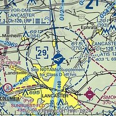
| Sectional chart |
|---|
|
CAUTION: Diagram may not be current
 Download PDF
of official airport diagram from the FAA
| Airport distance calculator |
|---|
|
|
| Sunrise and sunset |
|---|
|
Times for 21-May-2026
| | Local
(UTC-4) | | Zulu
(UTC) |
|---|
| Morning civil twilight | | 05:14 | | 09:14 |
| Sunrise | | 05:46 | | 09:46 |
| Sunset | | 20:18 | | 00:18 |
| Evening civil twilight | | 20:49 | | 00:49 |
|
| Current date and time |
|---|
| Zulu (UTC) | 21-May-2026 07:58:33 |
|---|
| Local (UTC-4) | 21-May-2026 03:58:33 |
|---|
|
| METAR |
|---|
| KLNS | 210753Z AUTO 02007KT 10SM OVC033 17/12 A3011 RMK AO2 SLP193 T01720122
|
|
| TAF |
|---|
| KLNS | 210534Z 2106/2206 02007KT P6SM -RA OVC035 FM211300 03010KT 6SM -RA OVC025 FM211500 04008KT 6SM -RA OVC015 FM211800 04007KT P6SM -RA OVC015 FM212200 06005KT P6SM SCT015 BKN025 OVC050
|
|
| NOTAMs |
|---|
NOTAMs are issued by the DoD/FAA and will open in a separate window not controlled by AirNav.
|
|


