FAA INFORMATION EFFECTIVE 11 JUNE 2026
Location
| FAA Identifier: | WRG |
| Lat/Long: | 56-29-03.6000N 132-22-11.4000W
56-29.060000N 132-22.190000W
56.4843333,-132.3698333
(estimated) |
| Elevation: | 44 ft. / 13.4 m (surveyed) |
| Variation: | 20E (2015) |
| From city: | 1 mile NE of WRANGELL, AK |
| Time zone: | UTC -8 (UTC -9 during Standard Time) |
| Zip code: | 99929 |
Airport Operations
| Airport use: | Open to the public |
| Control tower: | no |
| ARTCC: | ANCHORAGE CENTER |
| FSS: | SITKA FLIGHT SERVICE STATION [907-966-2221] |
| Alternate FSS: | JNU JUNEAU FLIGHT SERVICE STATION [1-866-297-2236] |
| NOTAMs facility: | WRG (NOTAM-D service available) |
| Attendance: | 0600-1700 |
| Wind indicator: | lighted |
| Segmented circle: | yes |
| Lights: | ACTVT REIL RWY 10 & 28; VASI RWY 10 & 28; HIRL RWY 10/28 - CTAF. |
| Beacon: | white-green (lighted land airport)
Operates sunset to sunrise. |
| Fire and rescue: | ARFF index B |
| Airline operations: | ARFF SVC AVBL DURG SKED ACR OPS ONLY. |
| International operations: | international airport of entry |
Airport Communications
| CTAF: | 122.6 |
| WX AWOS-3P: | 128.5 (907-874-2458) |
- APCH/DEP SVC PRVDD BY ANCHORAGE ARTCC ON FREQ 118.0 (LEVEL ISLAND RCAG).
- COMMUNICATIONS PRVDD BY SITKA FSS ON FREQ 122.45 (WRANGELL RCO).
Nearby radio navigation aids
| VOR radial/distance | | VOR name | | Freq | | Var |
|---|
| LVDr068/23.7 | | LEVEL ISLAND VOR/DME | | 116.50 | | 20E |
| NDB name | | Hdg/Dist | | Freq | | Var | | ID |
|---|
| SUMNER STRAIT | | 067/24.1 | | 529 | | 20E | | SQM | ... --.- -- |
Airport Services
| Fuel available: | 100LL JET-A |
| Parking: | hangars |
| Airframe service: | MINOR |
| Powerplant service: | MINOR |
Runway Information
Runway 10/28
| Dimensions: | 6000 x 150 ft. / 1829 x 46 m |
| Surface: | asphalt/grooved, in good condition |
| Weight bearing capacity: | | Single wheel: | 120.0 | | Double wheel: | 217.0 | | Double tandem: | 217.0 |
|
| Runway edge lights: | high intensity |
| RUNWAY 10 | | RUNWAY 28 |
| Latitude: | 56-29.315940N | | 56-28.802897N |
| Longitude: | 132-22.949950W | | 132-21.429763W |
| Elevation: | 27.0 ft. | | 44.0 ft. |
| Traffic pattern: | left | | right |
| Runway heading: | 101 magnetic, 121 true | | 281 magnetic, 301 true |
| Markings: | precision, in good condition | | precision, in good condition |
| Visual slope indicator: | 4-box VASI on left (3.00 degrees glide path)
VASI UNUSBL BYD 2.5 NM; DOES NOT PROVIDE OBSTN CLRNC BYD 2.5 NM. | | 4-box VASI on left (3.00 degrees glide path) |
| Runway end identifier lights: | yes | | yes |
| Touchdown point: | yes, no lights | | yes, no lights |
| Instrument approach: | LDA/DME | | |
| Obstructions: | 270 ft. hill, 700 ft. from runway, 1150 ft. right of centerline, 34:1 slope to clear | | none |
Airport Ownership and Management from official FAA records
| Ownership: | Publicly-owned |
| Owner: | ALASKA DOT&PF SOUTHCOAST REGION
6860 GLACIER HWY
JUNEAU, AK 99801-7999
Phone 907-465-1786 |
| Manager: | GARY ALLEN
BOX 1351
WRANGELL, AK 99929
Phone 907-874-3107 |
Additional Remarks
| A39-10/28 | PCR VALUE: 490/F/A/X/T |
| A30A-10 | CALM WIND RWY. |
| - | PAEW ON RWY. RCMD VISUAL INSP BFR USE. CTC FSS FOR NOTAMS. |
| - | PAJA ON RWY, TWY & PRKG APRON NA. |
| - | LEVEL ISLAND WX CAMERAS AVBL ON INTERNET AT HTTPS://WEATHERCAMS.FAA.GOV |
| - | ARPT SAND LRGR GRADATION THAN FAA RCMDD/SEE AC150/5200-30. |
| - | CLSD TO OPS MORE THAN 30 PAX SEATS EXC PPR. 24 HR PPR CARGO OPS OVER 100K - AMGR. |
| - | TWY B UNDER 12500 LB MAX GROSS TKOF WEIGHT. |
| - | 24 HR PPR FOR SEAPLANE ACES GATE ENTRY DURG ATNDD HR. |
| - | COLD TEMPERATURE AIRPORT. ALTITUDE CORRECTION REQUIRED AT OR BELOW -4C. |
| - | SOLID WASTE PROCESSING 2000 FT SW OF RWY 10 THR. |
| - | WILDLIFE ON & INVOF ARPT. |
| - | FUEL AVBL - 907-874-3276. |
| - | SNOW REMOVAL, WILDLIFE CTL, COND RPRTG & MAINT SVC AVBL DURG DUTY HR; AFT HR OR REQ - AMGR. |
| - | HIGH TRRN IMT S OF RWY. |
Instrument Procedures
NOTE: All procedures below are presented as PDF files. If you need a reader for these files, you should download the free Adobe Reader.NOT FOR NAVIGATION. Please procure official charts for flight.
FAA instrument procedures published for use from 11 June 2026 at 0901Z to 09 July 2026 at 0900z.
IAPs - Instrument Approach Procedures |
|---|
| RNAV (GPS) RWY 10 **CHANGED** | |
download (376KB) |
| LDA-C **CHANGED** | |
download (373KB) |
| LDA-D **CHANGED** | |
download (369KB) |
| NOTE: Special Alternate Minimums apply | |
download |
|
|---|
| LEVEL ISLAND THREE (OBSTACLE) | |
download (217KB) |
| NOTE: Special Take-Off Minimums/Departure Procedures apply | |
download (148KB) |
Other nearby airports with instrument procedures:
PAPG - Petersburg James A Johnson Airport (27 nm NW)
PAFE - Kake Airport (58 nm NW)
PAKW - Klawock Airport (59 nm SW)
PAKT - Ketchikan International Airport (71 nm S)
|
|

Road maps at:
MapQuest
Bing
Google
| Aerial photo |
|---|
WARNING: Photo may not be current or correct
 Photo taken 23-Jul-2007
Do you have a better or more recent aerial photo of Wrangell Airport that you would like to share? If so, please send us your photo.
|
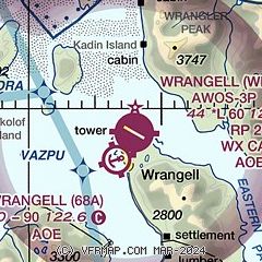
| Sectional chart |
|---|
|
| Airport distance calculator |
|---|
|
|
| Sunrise and sunset |
|---|
|
Times for 28-Jun-2026
| | Local
(UTC-8) | | Zulu
(UTC) |
|---|
| Morning civil twilight | | 02:59 | | 10:59 |
| Sunrise | | 04:03 | | 12:03 |
| Sunset | | 21:42 | | 05:42 |
| Evening civil twilight | | 22:47 | | 06:47 |
|
| Current date and time |
|---|
| Zulu (UTC) | 29-Jun-2026 00:26:16 |
|---|
| Local (UTC-8) | 28-Jun-2026 16:26:16 |
|---|
|
| METAR |
|---|
| PAWG | 282356Z 35005KT 10SM OVC039 14/10 A3019 RMK AO2 SLP225 T01440100 10150 20122 58002 $
|
|
| TAF |
|---|
| PAWG | 281746Z 2818/2918 28007KT P6SM BKN035 OVC060 TEMPO 2818/2820 BKN025 FM290600 VRB03KT 6SM BR SCT020 OVC040
|
|
| NOTAMs |
|---|
NOTAMs are issued by the DoD/FAA and will open in a separate window not controlled by AirNav.
|
|

