FAA INFORMATION EFFECTIVE 09 JULY 2026
Location
| FAA Identifier: | S43 |
| Lat/Long: | 47-54-17.5249N 122-06-09.8770W
47-54.292082N 122-06.164617W
47.9048680,-122.1027436
(estimated) |
| Elevation: | 22.8 ft. / 6.9 m (surveyed) |
| Variation: | 17E (2010) |
| From city: | 1 mile SW of SNOHOMISH, WA |
| Time zone: | UTC -7 (UTC -8 during Standard Time) |
| Zip code: | 98296 |
Airport Operations
| Airport use: | Open to the public |
| Activation date: | 12/1945 |
| Control tower: | no |
| ARTCC: | SEATTLE CENTER |
| FSS: | SEATTLE FLIGHT SERVICE STATION |
| NOTAMs facility: | SEA (NOTAM-D service available) |
| Attendance: | NOV-MAR 0730-1630, APR-OCT 0730-2100 |
| Pattern altitude: | 1006.8 ft. MSL |
| Wind indicator: | yes, ONE WIND CONE ONE TEE. |
| Segmented circle: | no
NON STD TRAFFIC PATTERN INDICATOR LCTD NEAR WIND CONE. |
| Lights: | SS-SR |
Airport Communications
| CTAF/UNICOM: | 123.0 |
| SEATTLE APPROACH: | 128.5 |
| SEATTLE DEPARTURE: | 128.5 |
| WX ASOS at PAE (7 nm W): | PHONE 425-355-6192 |
| WX AWOS-3PT at AWO (16 nm N): | 135.625 (360-435-8045) |
Nearby radio navigation aids
| VOR radial/distance | | VOR name | | Freq | | Var |
|---|
| PAEr077/7.1 | | PAINE VOR/DME | | 110.60 | | 20E |
| SEAr358/29.4 | | SEATTLE VORTAC | | 116.80 | | 19E |
| CVVr110/32.2 | | PENN COVE VOR/DME | | 117.20 | | 19E |
| NDB name | | Hdg/Dist | | Freq | | Var | | ID |
|---|
| WATON | | 152/10.5 | | 382 | | 17E | | AW | .- .-- |
Airport Services
| Fuel available: | 100LL JET-A
100LL:FUEL 24 HR CREDIT CARD SVC AVBL. |
| Parking: | hangars and tiedowns |
| Airframe service: | MAJOR |
| Powerplant service: | MAJOR |
| Bottled oxygen: | NONE |
| Bulk oxygen: | NONE |
Runway Information
Runway 15L/33R
| Dimensions: | 2672 x 36 ft. / 814 x 11 m |
| Surface: | asphalt, in excellent condition |
| Weight bearing capacity: | |
| Runway edge lights: | low intensity
NSTD LIRL; THLD LIGHTS 360 DEGS GREEN. |
| RUNWAY 15L | | RUNWAY 33R |
| Latitude: | 47-54.499840N | | 47-54.075227N |
| Longitude: | 122-06.219597W | | 122-06.051038W |
| Elevation: | 15.3 ft. | | 22.6 ft. |
| Traffic pattern: | right | | left |
| Runway heading: | 148 magnetic, 165 true | | 328 magnetic, 345 true |
| Displaced threshold: | 452 ft. | | 242 ft. |
| Markings: | numbers only, in good condition | | numbers only, in good condition |
| Touchdown point: | yes, no lights | | yes, no lights |
| Obstructions: | 80 ft. trees, 796 ft. from runway, 97 ft. left of centerline, 7:1 slope to clear
HI VOLTAGE P-LINE 22 FT HIGH 32 FT FM AER 15 & 25 FT FM MARKER LINE AT 106 FT, RAILROAD AT 200FT. | | 97 ft. trees, 1537 ft. from runway, 125 ft. right of centerline, 13:1 slope to clear
RD 50' FM THR; +10' FNC POSTS WITH RED LGTS 50' FM THR; 10' LINE WITH LGTS & FLAGS AT 80'. |
Helipad H1
| Dimensions: | 15 x 15 ft. / 5 x 5 m |
| Surface: | concrete |
| Latitude: | 47-54.363167N | | |
| Longitude: | 122-06.031000W | | |
| Elevation: | 10.0 ft. | | |
| Traffic pattern: | left | | left |
Runway 15R/33L
| Dimensions: | 2430 x 100 ft. / 741 x 30 m |
| Surface: | turf, in excellent condition |
| Operational restrictions: | CLOSED NOV 1 - MAY 31. |
| RUNWAY 15R | | RUNWAY 33L |
| Latitude: | 47-54.490167N | | 47-54.104000N |
| Longitude: | 122-06.273500W | | 122-06.120167W |
| Elevation: | 15.4 ft. | | 22.4 ft. |
| Traffic pattern: | right | | left |
| Runway heading: | 148 magnetic, 165 true | | 328 magnetic, 345 true |
| Markings: | none, in fair condition | | none, in fair condition |
| Touchdown point: | yes, no lights | | yes, no lights |
| Obstructions: | 67 ft. trees, 1267 ft. from runway, 125 ft. right of centerline, 18:1 slope to clear
APCH SLOPE 14:1 FM DSPLCD THR. | | 110 ft. trees, 2659 ft. from runway, 24:1 slope to clear
APCH SLOPE 6:1 FROM DSPLCD THLD. |
Airport Ownership and Management from official FAA records
| Ownership: | Privately-owned |
| Owner: | K HARVEY
9900 AIRPORT WAY
SNOHOMISH, WA 98296
Phone 360-568-1541 |
| Manager: | CYNTHIA HENDRICKSON
9900 AIRPORT WAY
SNOHOMISH, WA 98296
Phone 360-568-1541
KANDACEHARVEY@HARVEYFIELD.COM |
Additional Remarks
| - | ADDITIONAL PARACHUTE STUDENT DROP ZONE 1 NM E OF ARPT MKD WITH WHITE 'X'. ARRIVING HELICOPTER TRAFFIC APPROACH HELIPADS FROM NE OR SE TO AVOID STUDENT DROP ZONE. |
| - | RYS 15L & 15R CALM WIND RYS. |
| - | PARACHUTE DROP ZONE BETWEEN RY 15L/33R AND MAIN TWY, LARGE GRAVEL CIRCLE. |
| - | FOR CD CTC SEATTLE APCH AT 206-214-4722. |
| - | NOISE ABATEMENT PROCEDURES IN EFFECT; CTC AMGR 360-568-1541. |
| - | HELICOPTER TRNG WEST OF RYS 500 FT & BLO. |
Instrument Procedures
NOTE: All procedures below are presented as PDF files. If you need a reader for these files, you should download the free Adobe Reader.NOT FOR NAVIGATION. Please procure official charts for flight.
FAA instrument procedures published for use from 09 July 2026 at 0901Z to 06 August 2026 at 0900Z.
IAPs - Instrument Approach Procedures |
|---|
| RNAV (GPS)-A | |
download (209KB) |
| NOTE: Special Take-Off Minimums/Departure Procedures apply | |
download (540KB) |
Other nearby airports with instrument procedures:
KPAE - Seattle Paine Field International Airport (7 nm W)
KAWO - Arlington Municipal Airport (16 nm N)
KBFI - Boeing Field/King County International Airport (24 nm S)
KRNT - Renton Municipal Airport (25 nm S)
KSEA - Seattle-Tacoma International Airport (29 nm S)
|
|

Road maps at:
MapQuest
Bing
Google
| Aerial photo |
|---|
WARNING: Photo may not be current or correct
 Photo courtesy of longbachnguyen.com
Photo taken 21-Mar-2010
Photo courtesy of longbachnguyen.com
Photo taken 21-Mar-2010
Do you have a better or more recent aerial photo of Harvey Field Airport that you would like to share? If so, please send us your photo.
|
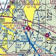
| Sectional chart |
|---|
|
| Airport distance calculator |
|---|
|
|
| Sunrise and sunset |
|---|
|
Times for 25-Jul-2026
| | Local
(UTC-7) | | Zulu
(UTC) |
|---|
| Morning civil twilight | | 05:00 | | 12:00 |
| Sunrise | | 05:37 | | 12:37 |
| Sunset | | 20:52 | | 03:52 |
| Evening civil twilight | | 21:30 | | 04:30 |
|
| Current date and time |
|---|
| Zulu (UTC) | 25-Jul-2026 18:54:10 |
|---|
| Local (UTC-7) | 25-Jul-2026 11:54:10 |
|---|
|
| METAR |
|---|
KPAE
7nm W | 251753Z 19019G27KT 10SM FEW033 BKN065 OVC110 19/10 A2997 RMK AO2 PK WND 19028/1743 SLP148 T01890100 10194 20139 53013
|
KAWO
16nm N | 251756Z AUTO 16014KT 10SM SCT037 OVC070 19/13 A2996 RMK AO2 SLP151 T01940128 10211 20128 53009 $
|
|
| TAF |
|---|
KPAE
7nm W | 251723Z 2518/2618 18013G21KT P6SM SCT022 BKN040 FM252100 20014KT P6SM OVC040 FM260300 17009KT P6SM OVC035 FM261000 16009KT P6SM OVC020 FM261600 18010KT 6SM BR VCSH OVC014
|
|
| NOTAMs |
|---|
NOTAMs are issued by the DoD/FAA and will open in a separate window not controlled by AirNav.
|
|

