FAA INFORMATION EFFECTIVE 14 MAY 2026
Location
| FAA Identifier: | 0Q5 |
| Lat/Long: | 40-01-41.4000N 124-04-27.5000W
40-01.690000N 124-04.458333W
40.0281667,-124.0743056
(estimated) |
| Elevation: | 73.4 ft. / 22.4 m (surveyed) |
| Variation: | 17E (1985) |
| From city: | 1 mile W of SHELTER COVE, CA |
| Time zone: | UTC -7 (UTC -8 during Standard Time) |
| Zip code: | 95589 |
Airport Operations
| Airport use: | Open to the public |
| Activation date: | 06/1950 |
| Control tower: | no |
| ARTCC: | OAKLAND CENTER |
| FSS: | OAKLAND FLIGHT SERVICE STATION |
| NOTAMs facility: | OAK (NOTAM-D service available) |
| Attendance: | UNATNDD |
| Wind indicator: | yes |
| Segmented circle: | yes |
Airport Communications
| CTAF: | 122.9 |
| WX AWOS-2 at O16 (12 nm E): | 133.0 (707-923-4291) |
Nearby radio navigation aids
| VOR radial/distance | | VOR name | | Freq | | Var |
|---|
| FOTr150/39.3 | | FORTUNA VORTAC | | 114.00 | | 19E |
Airport Services
| Parking: | tiedowns |
| Airframe service: | NONE |
| Powerplant service: | NONE |
Runway Information
Runway 12/30
| Dimensions: | 3407 x 60 ft. / 1038 x 18 m |
| Surface: | asphalt, in fair condition |
| Weight bearing capacity: | |
| RUNWAY 12 | | RUNWAY 30 |
| Latitude: | 40-01.902300N | | 40-01.476160N |
| Longitude: | 124-04.696227W | | 124-04.221450W |
| Elevation: | 73.3 ft. | | 54.9 ft. |
| Traffic pattern: | right | | left |
| Displaced threshold: | 106 ft. | | 501 ft. |
| Markings: | basic, in fair condition | | basic, in good condition |
| Runway end identifier lights: | no | | no |
| Touchdown point: | yes, no lights | | yes, no lights |
| Obstructions: | 10 ft. tree, 400 ft. from runway, 150 ft. left of centerline, 20:1 slope to clear | | 60 ft. tree, 1000 ft. from runway, 190 ft. right of centerline, 13:1 slope to clear
APCH RATIO 22:1 TO DSPLCD THLD, 37 FT TREE 191 FT R 341 FT FM EOR.. |
Airport Ownership and Management from official FAA records
| Ownership: | Publicly-owned |
| Owner: | SHELTER COVE RESORT IMP DISTRICT
9126 SHELTER COVE ROAD
WHITEHORN, CA 95589
Phone 707-986-7447 |
| Manager: | CHISTOPHER CHRISTIANSON
9126 SHELTER COVE ROAD
WHITEHORN, CA 95589
Phone (707) 986-7447 |
Additional Remarks
| - | ARPT USE RESTRICTED BY AMGR TO ACFT HAVING A MAXIMUM CERTIFICATED GROSS TKOF WGT OF 12,500 LBS OR LESS; CTC AMGR FOR ADDITIONAL INFO (707)986-7447. |
| - | STUDENT PILOT SOLO FLIGHTS PROHIBITED. |
| - | NO PRACTICE LOW APCHS OR TOUCH AND GO LANDINGS. |
| - | BE ALERT FOR ULTRA-LIGHTS, HANGLIDERS AND PARACHUTERS INVOF ARPT. |
| - | GOLF CARTS OPERATING ON AND INVOF ARPT. |
| - | EXPECT CROSSWINDS, DOWNDRAFTS AND EXTDD PERIODS OF FOG YEAR-ROUND. |
| - | TERRAIN +40 FT DROP OFF LCTD 500 FT NORTH RY 12 END. |
| - | FOR CD CTC OAKLAND ARTCC AT 510-745-3380. |
Instrument Procedures
There are no published instrument procedures at 0Q5.
Some nearby airports with instrument procedures:
KFOT - Rohnerville Airport (32 nm N)
KEKA - Murray Field Airport (47 nm N)
O28 - Willits Municipal Airport - Ells Field (47 nm SE)
KLLR - Little River Airport (48 nm S)
KACV - California Redwood Coast-Humboldt County Airport (57 nm N)
|
|

Road maps at:
MapQuest
Bing
Google
| Aerial photo |
|---|
WARNING: Photo may not be current or correct
 Taken in March 2020
looking north.
Taken in March 2020
looking north.
Do you have a better or more recent aerial photo of Shelter Cove Airport that you would like to share? If so, please send us your photo.
|
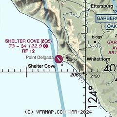
| Sectional chart |
|---|
|
| Airport distance calculator |
|---|
|
|
| Sunrise and sunset |
|---|
|
Times for 30-May-2026
| | Local
(UTC-7) | | Zulu
(UTC) |
|---|
| Morning civil twilight | | 05:19 | | 12:19 |
| Sunrise | | 05:51 | | 12:51 |
| Sunset | | 20:36 | | 03:36 |
| Evening civil twilight | | 21:08 | | 04:08 |
|
| Current date and time |
|---|
| Zulu (UTC) | 30-May-2026 21:18:04 |
|---|
| Local (UTC-7) | 30-May-2026 14:18:04 |
|---|
|
| NOTAMs |
|---|
NOTAMs are issued by the DoD/FAA and will open in a separate window not controlled by AirNav.
|
|

