FAA INFORMATION EFFECTIVE 25 DECEMBER 2025
Location
| FAA Identifier: | NLC |
| Lat/Long: | 36-19-59.2564N 119-57-07.7819W
36-19.987607N 119-57.129698W
36.3331268,-119.9521616
(estimated) |
| Elevation: | 228.3 ft. / 69.6 m (surveyed) |
| Variation: | 14E (2010) |
| From city: | 7 miles W of LEMOORE, CA |
| Time zone: | UTC -8 (UTC -7 during Daylight Saving Time) |
| Zip code: | 93245 |
Airport Operations
| Airport use: | Private use. Permission required prior to landing |
| Control tower: | yes |
| ARTCC: | OAKLAND CENTER |
| FSS: | RANCHO MURIETA FLIGHT SERVICE STATION |
| NOTAMs facility: | NLC (NOTAM-D service available) |
| Attendance: | MON-THU 1600-0800Z++, ALL FRI 1600-0200Z++, ALL SAT-SUN 1800-0200Z++
(0201-0800Z++ VIA NOTAM)
FIELD HOURS SUBJECT TO CHANGE VIA NOTAM. SEE FLIP AP/1 SUPPLEMENTARY ARPT RMK FOR HOL SKED. |
| Segmented circle: | no |
| Lights: | AVBL ONLY DURING HRS OF OPERATION. |
| Beacon: | white-white-green (lighted military airport)
ROT BCN NOT OPR WHEN ARPT CLSD. |
Airport Communications
| ATIS: | 121.575 327.15 |
| WX AWOS-3: | 121.575 (559-998-2336) |
| LEMOORE TOWER GROUND: | 121.65 305.2 [1600-0800Z++ MON-FRI, 1800-0200Z++ SAT-SUN] |
| LEMOORE TOWER TOWER: | 128.3 340.2 ;RWY 14L, 32L 360.2 ;RWY 14R, 32R [1600-0800Z++ MON-FRI, 1800-0200Z++ SAT-SUN] |
| LEMOORE APPROACH: | 118.15 ;SOUTH 124.1 ;NORTH 269.025 [1600-0800Z++ MON-FRI, 1800-0200Z++ SAT-SUN] |
| LEMOORE DEPARTURE: | 118.15 ;RWY 14L, 14R 124.1 ;RWY 32L, 32R 318.8 [1600-0800Z++ MON-FRI, 1800-0200Z++ SAT-SUN] |
| CLEARANCE DELIVERY: | 124.1 371.9 |
| ADZY: | 134.225 ;MOA ADZY 290.325 ;MOA ADZY |
| BASE OPS: | 299.3 |
| EMERG: | 121.5 243.0 |
| NAF OPS: | 6723 |
| PMSV METRO: | 259.0 |
| WX ASOS at HJO (16 nm E): | 134.75 (559-585-8076) |
| WX AWOS-3 at C80 (19 nm SW): | 119.275 (559-935-5960) |
Nearby radio navigation aids
| NDB name | | Hdg/Dist | | Freq | | Var | | ID |
|---|
| SALYER FARMS | | 292/25.9 | | 205 | | 16E | | COR | -.-. --- .-. |
Airport Services
| Airframe service: | NONE |
| Powerplant service: | NONE |
| Bottled oxygen: | NONE |
| Bulk oxygen: | NONE |
Runway Information
Runway 14L/32R
| Dimensions: | 13502 x 200 ft. / 4115 x 61 m |
| Surface: | concrete |
| Weight bearing capacity: | |
| Runway edge lights: | high intensity |
| RUNWAY 14L | | RUNWAY 32R |
| Latitude: | 36-21.849833N | | 36-19.817150N |
| Longitude: | 119-57.642167W | | 119-56.522803W |
| Elevation: | 216.2 ft. | | 221.0 ft. |
| Traffic pattern: | left | | left |
| Runway heading: | 142 magnetic, 156 true | | 322 magnetic, 336 true |
| Approach lights: | OLS | | OLS |
| Runway end identifier lights: | yes | | yes |
| Touchdown point: | yes, no lights | | yes, no lights |
Runway 14R/32L
| Dimensions: | 13501 x 200 ft. / 4115 x 61 m |
| Surface: | concrete |
| Weight bearing capacity: | |
| Runway edge lights: | high intensity |
| RUNWAY 14R | | RUNWAY 32L |
| Latitude: | 36-20.158040N | | 36-18.125377N |
| Longitude: | 119-57.736337W | | 119-56.617643W |
| Elevation: | 227.0 ft. | | 225.7 ft. |
| Traffic pattern: | left | | left |
| Runway heading: | 142 magnetic, 156 true | | 322 magnetic, 336 true |
| Approach lights: | OLS | | ALSF2: standard 2,400 foot high intensity approach lighting system with centerline sequenced flashers (category II or III)
SF, OLS, WAVE-OFF |
| Runway end identifier lights: | yes | | yes |
| Centerline lights: | yes | | yes |
| Touchdown point: | yes, no lights | | yes, no lights |
Airport Ownership and Management from official FAA records
| Ownership: | U.S. Navy |
| Owner: | US NAVY
OCEANOGRAPHIC OFC - CODE 3142
WASHINGTON, DC 20373 |
| Manager: | COMMANDING OFFICER
NAVAL AIR STATION
LEMOORE, CA 93245 |
Additional Remarks
| E60-14L | HOOK E28(B) (1849') |
| E60-32R | HOOK E28(B) (1756') |
| E60-32L | HOOK E28(B) (3495') |
| E60-14R | HOOK E28(B) (1600') |
| - | FLUID: SP PRESAIR OXRB (LOX AVBL 1600-2400Z++ MON-FRI ONLY.) |
| - | TRAN ALERT: LTD TRAN SVC/MAINT AVBL DUR ARPT OPR HR. HI-SPEED FUEL LANES NOT AVBL TO TRAN ACFT. |
| - | RSTD: PPR/AIREVAC C559-364-6620. CIV ACFT LDG PMT (CALP) RQRD DSN 949-1727, C559-998-1727. BASE ACES REQ RQRD FOR NON-MIL TSNT DSN 949-3386, C559-998-3386. PRIOR COORD OR FLT ADVSY RQRD FOR AMC AND SKED AIRLIFTS. 24 HR PN RQRD FOR ACFT WITH HAZ CARGO. |
| - | CAUTION: BIRD HAZ. HI INTS JET OPR 25 NM RAD 0-15,000' MON-FRI. BLACK TOP AREAS ADJ TO TWY AND HGR FOR EROSION CTL ONLY, WILL NOT SUPPORT ACFT. |
| - | TFC PAT: HVY ACFT EXECUTING PRACTICE INST APCH LTD TO LO APCH. REDUCED RWY SEPARATION STD IN EFF USN/USMC ACFT. |
| - | OIL: O-128-133-156. |
| - | SERVICE LGT - CARRIER DECK LGT RWY 14L AND RWY 32L |
| - | MISC: PRIOR COORD REQ FOR PRACTICE INST APCH DSN 949-1099 C559-998-1099. |
| - | JASU: 2(GTC-85) 2(NC-5) 2(NC-8) 1(NCPP-105). |
| - | FUEL: J5. |
Instrument Procedures
NOTE: All procedures below are presented as PDF files. If you need a reader for these files, you should download the free Adobe Reader.NOT FOR NAVIGATION. Please procure official charts for flight.
FAA instrument procedures published for use from 25 December 2025 at 0901z to 22 January 2026 at 0900z.
IAPs - Instrument Approach Procedures |
|---|
| RNAV (GPS) RWY 14L **CHANGED** | |
download (121KB) |
| RNAV (GPS) RWY 14R **CHANGED** | |
download (119KB) |
| RNAV (GPS) RWY 32L **CHANGED** | |
download (132KB) |
| RNAV (GPS) RWY 32R **CHANGED** | |
download (123KB) |
| HI-TACAN X RWY 32L **CHANGED** | |
download (190KB) |
| HI-TACAN Z RWY 14L **CHANGED** | |
download (164KB) |
| HI-TACAN Z RWY 14R **CHANGED** | |
download (175KB) |
| TACAN Y RWY 14L **CHANGED** | |
download (107KB) |
| TACAN Y RWY 14R **CHANGED** | |
download (118KB) |
| TACAN Y RWY 32L **CHANGED** | |
download (116KB) |
| Radar Approach Procedures available | |
download (126KB) |
Departure Procedures |
|---|
| LEMOORE TWO | |
download (116KB) |
| REEVES FIVE | |
download (115KB) |
| NOTE: Special Take-Off Minimums/Departure Procedures apply | |
download (363KB) |
Other nearby airports with instrument procedures:
KHJO - Hanford Municipal Airport (16 nm E)
C80 - New Coalinga Municipal Airport (19 nm SW)
KFCH - Fresno Chandler Executive Airport (25 nm N)
KVIS - Visalia Municipal Airport (27 nm E)
KFAT - Fresno Yosemite International Airport (29 nm NE)
|
|

Road maps at:
MapQuest
Bing
Google
| Aerial photo |
|---|

|
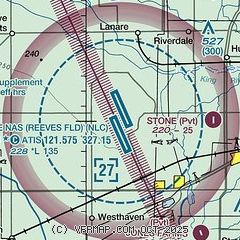
| Sectional chart |
|---|
|
 Download PDF
of official airport diagram from the FAA
| Airport distance calculator |
|---|
|
|
| Sunrise and sunset |
|---|
|
Times for 30-Dec-2025
| | Local
(UTC-8) | | Zulu
(UTC) |
|---|
| Morning civil twilight | | 06:43 | | 14:43 |
| Sunrise | | 07:12 | | 15:12 |
| Sunset | | 16:53 | | 00:53 |
| Evening civil twilight | | 17:21 | | 01:21 |
|
| Current date and time |
|---|
| Zulu (UTC) | 30-Dec-2025 08:09:15 |
|---|
| Local (UTC-8) | 30-Dec-2025 00:09:15 |
|---|
|
| METAR |
|---|
| KNLC | 300756Z 17003KT 1/4SM FG VV003 02/02 A3027 RMK AO2 SLP252 T00170017 401110011 RVRNO
|
KHJO
16nm E | 300802Z AUTO 19005KT 1/4SM FG VV002 02/02 A3028 RMK AO2 T00220022
|
|
| TAF |
|---|
| KNLC | 2923/3023 VRB04KT 9999 FEW020 SCT180 QNH3023INS TEMPO 2923/3001 35007KT 9000 HZ SCT020 BECMG 3005/3007 VRB04KT 4800 BR FEW002 SCT009 BKN210 QNH3025INS BECMG 3015/3017 33009KT 8000 HZ FEW080 BKN140 BKN240 QNH3010INS TX12/3000Z TN04/3014Z LAST NO AMDS AFT 3002 NEXT 3015 COR 2350 FS30206
|
|
| NOTAMs |
|---|
NOTAMs are issued by the DoD/FAA and will open in a separate window not controlled by AirNav.
|
|


