FAA INFORMATION EFFECTIVE 14 MAY 2026
Location
| FAA Identifier: | RCA |
| Lat/Long: | 44-08-42.3400N 103-06-12.8400W
44-08.705667N 103-06.214000W
44.1450944,-103.1035667
(estimated) |
| Elevation: | 3276.3 ft. / 999 m (estimated) |
| Variation: | 08E (2015) |
| From city: | 5 miles SW of RAPID CITY, SD |
| Time zone: | UTC -6 (UTC -7 during Standard Time) |
| Zip code: | 57706 |
Airport Operations
| Airport use: | Private use. Permission required prior to landing |
| Activation date: | 11/1938 |
| Control tower: | yes |
| ARTCC: | DENVER CENTER |
| FSS: | HURON FLIGHT SERVICE STATION |
| NOTAMs facility: | RAP (NOTAM-D service available) |
| Attendance: | FRI 1400-0100Z++, ALL MON-THU 1400-0730Z++
CLSD WKND, HOLS AND GLOBAL STRIKE COMD (GSC) DOWN DAYS. |
| Pattern altitude: | 7776.3 ft. MSL
TPA: RECTANGULAR 4500 FT MSL, 5000 FT MSL OVHD, AVOID OVFT OF BASE PROPER WHEN CRC TO LDG. |
| Segmented circle: | no |
| Lights: | AIRFIELD LIGHTING ONLY AVAILABLE DURING TWR HOURS. |
| Beacon: | white-white-green (lighted military airport)
Operates sunset to sunrise. |
Airport Communications
| ATIS: | 120.625 269.9 |
| ELLSWORTH GROUND: | 121.8 275.8 [1400-0730Z++ MON-THU, 1400-0100Z++ FRI, CLSD SAT, SUN, GLOBAL STRIKE COMD DOWN DAYS, & HOL.] |
| ELLSWORTH TOWER: | 126.05 253.5 [1400-0730Z++ MON-THU, 1400-0100Z++ FRI, CLSD SAT, SUN, GLOBAL STRIKE COMD DOWN DAYS, & HOL.] |
| ELLSWORTH APPROACH: | 119.5 259.1 [H24 1300Z++ MON THRU 0500Z++ SAT, 1300-0500Z++ SAT-SUN, OTHER TIMES CTC DENVER CENTER 127.95 338.2] |
| ELLSWORTH DEPARTURE: | 119.5 289.4 [H24 1300Z++ MON THRU 0500Z++ SAT, 1300-0500Z++ SAT-SUN, OTHER TIMES CTC DENVER CENTER 127.95 338.2] |
| COMD POST: | 321.0 |
| EMERG: | 121.5 243.0 |
| PMSV METRO: | 375.775 |
| PTD: | 372.2 |
| SOF: | 311.0 |
| WX ASOS at RAP (6 nm S): | 118.525 (605-223-0202) |
- RADAR - SEE TERMINAL FLIP FOR RADAR MINIMA.
- APCH/DEP CTL SVC PRVDD BY DENVER ARTCC (ZDV) ON 127.95/338.2 (CRAWFORD RCAG) WHEN ELLSWORTH APCH (RCA) CLSD.
- FULL SVC AVBL 1430-2300Z++ DSN 385-1052, C605-385-1052.
- DIGITAL ASR NO-NOTAM MP: 0500-1100Z++ MON-FRI.
Nearby radio navigation aids
| VOR radial/distance | | VOR name | | Freq | | Var |
|---|
| RAPr326/10.9 | | RAPID CITY VORTAC | | 112.30 | | 13E |
Airport Services
| Airframe service: | MAJOR |
| Powerplant service: | MAJOR |
| Bottled oxygen: | NONE |
| Bulk oxygen: | LOW |
Runway Information
Runway 13/31
| Dimensions: | 13497 x 300 ft. / 4114 x 91 m |
| Surface: | concrete |
| Weight bearing capacity: | |
| Runway edge lights: | high intensity |
| RUNWAY 13 | | RUNWAY 31 |
| Latitude: | 44-09.531802N | | 44-07.879450N |
| Longitude: | 103-07.244683W | | 103-05.183420W |
| Elevation: | 3276.3 ft. | | 3178.5 ft. |
| Traffic pattern: | left | | left |
| Runway heading: | 130 magnetic, 138 true | | 310 magnetic, 318 true |
| Markings: | precision, in good condition | | precision, in good condition |
| Visual slope indicator: | 4-light PAPI on left (3.00 degrees glide path) | | 4-light PAPI on left (3.00 degrees glide path) |
| RVR equipment: | touchdown | | touchdown |
| Approach lights: | ALSF1: standard 2,400 foot high intensity approach lighting system with centerline sequenced flashers (category I) | | ALSF1: standard 2,400 foot high intensity approach lighting system with centerline sequenced flashers (category I) |
| Runway end identifier lights: | no | | no |
| Touchdown point: | yes, no lights | | yes, no lights |
| Instrument approach: | ILS | | ILS |
Airport Ownership and Management from official FAA records
| Ownership: | U.S. Air Force |
| Owner: | U.S. AIR FORCE
44TH CSG, ELLSWORTH AFB
RAPID CITY, SD 57706 |
| Manager: | BASE OPERATIONS
44TH CSG, ELLSWORTH AFB
RAPID CITY, SD 57706
Phone 605-385-1052
BASE OPS V675-1052/2861. |
Additional Remarks
| - | OIL: O-132-133-148 |
| - | SERVICE - TRAN ALERT- SVC AVBL 1400-2300Z++ MON-FRI; CLSD SAT, SUN, HOL, AND GLOBAL STRIKE COMD DOWN DAYS. FLEET SVC AVBL 1400-2300Z++ MON-FRI; CLSD SAT, SUN, HOL, AND GLOBAL STRIKE COMD DOWN DAYS |
| - | RSTD: ALL ACFT MAINT AT OR ABV 7700 FT & 2640 FT HORIZONTAL SEPARATION IN THE IMMED VCNTY OF MT. RUSHMORE; AVOID DEVILS TWR BY 5 NM. PPR ALL FULL STOP ACFT CTC BASE OPS NO EARLIER THAN 72 HR PRIOR TO ETA. FAX DSN 675-1053, C605-385-1053. |
| - | MISC: INBD VIP CODE 7 OR HI, CTC RAYMOND 33 15 MIN PRIOR TO BLOCK TIME WITH NAME, RANK AND PURPOSE OF VISIT. |
| - | FM OBS POINT WX TECHNICIANS UNABLE TO SEE THE TDZ OF BOTH RYS. |
| - | RSTD: PPR MIN 24 HR NTC, CTC DSN 675-1052, C605-385-1052. |
| - | GLOBAL STRIKE COMD RSRS APPLIED TO GLOBAL STRIKE COMD ONLY |
| - | EXTV GENERAL AVN AND COML TFC IN VCNTY OF RAPID CITY ARPT 6.5 NM SE OF ARPT. |
| - | CSTMS/AG/IMG: LTD TO US DOD ACFT ONLY; AVBL WITH 24 HR NOTICE. IMG SERVICE UNAVBL FOR NON-DOD PERS. CTC 28 OSS/OSAA, DSN 675-1052, C605-385-1052. |
| - | RSTD: AIRCREW SHOULD AVOID BEAR BUTTE, DEFINED BY THE RCA 317/25 FIX, BY FLYING NO LOWER THAN 10,000 FT MSL WITHIN 2NM. |
| - | FUEL: A++. HOT REFUEL AVBL TO B-1 AND EA-18 ACFT ONLY. |
| - | CAUTION: MIGRATORY BIRD ACT BASH (PHASE II) MAY AND AUG-OCT OR ACTIVE VIA NOTAM. DEER HAZ, RPT ANY ACT TO TWR/PTD. |
| - | COMSEC ISSUING AND CLASSIFIED MATERIAL STORAGE UNAVBL FROM AMOPS, CTC COMD POST FOR STORAGE. |
| - | MISC: TRAN ACFT REQ FOR APCH AND PATTERN WORK, RQR 24 HR NTC, CTC OPS DSN 675-1052, C605-385-1052. |
| - | OPR 1400-0730Z++ MON-THUR; 1400-0100Z++ FRI. CLSD WKENDS, HOL AND GLOBAL STRIKE COMD DOWN DAYS. |
| - | PRIM FREQ 311.0. |
| - | MISC: WX STN AUGMENTS FOR VIS AT OR BELOW 3 SM WHEN NEEDEDED. VIS LTD NE TO SE DUE TO BLDGS. |
| - | "VERIFY POWDER RIVER TRAINING COMPLEX STATUS BEFORE FILING IFR FPL" VIA SPECIAL USE AIRSPACE SITE: HTTPS://SUA.FAA.GOV/SUA/" |
| - | WHEN ATCT CLSD, FOR CD CTC DENVER ARTCC AT 303-651-4257. |
| - | LGT: RWY 31 NSTD ALSF-1, MISSING FIRST CNTRLN BARRETTE PRIOR TO THLD. |
| - | MISC: ARFF CRITICAL LVL OF SVC (RED) FOR NFPA CAT 9-10 AND USAF VEH SETS 5-6. REDUCED LEVEL OF SVC (YELLOW) FOR NFPA CAT 1-8 AND USAF VEH SETS 1-4. ONLY APPLICABLE WKD EXCLD FEDERAL HOL AND USAF GLOBAL STRIKE FAMILY DAYS. CTC FD C605-385-1113 FOR FURTHER INFO. |
| - | CAUTION: HI POTENTIAL FOR MID-AIR COLLISION EXISTS WITH ACFT FR RAPID CITY ARPT LCTD APRX 6.5 NM SE OF ARPT. |
| - | JASU: (AM32A-95) (A/M32A-86) |
Instrument Procedures
NOTE: All procedures below are presented as PDF files. If you need a reader for these files, you should download the free Adobe Reader.NOT FOR NAVIGATION. Please procure official charts for flight.
FAA instrument procedures published for use from 14 May 2026 at 0901Z to 11 June 2026 at 0900Z.
IAPs - Instrument Approach Procedures |
|---|
| HI-ILS OR LOC Z RWY 13 **CHANGED** | |
download (132KB) |
| HI-ILS OR LOC Z RWY 31 **CHANGED** | |
download (129KB) |
| ILS OR LOC Y RWY 13 **CHANGED** | |
download (136KB) |
| ILS OR LOC Y RWY 31 **CHANGED** | |
download (136KB) |
| HI-TACAN Z RWY 13 **CHANGED** | |
download (114KB) |
| HI-TACAN Z RWY 31 **CHANGED** | |
download (116KB) |
| TACAN Y RWY 13 **CHANGED** | |
download (112KB) |
| TACAN Y RWY 31 **CHANGED** | |
download (114KB) |
| TACAN-A **CHANGED** | |
download (74KB) |
Departure Procedures |
|---|
| ELLSWORTH THREE | |
download (91KB) |
| NOTE: Special Take-Off Minimums/Departure Procedures apply | |
download |
Other nearby airports with instrument procedures:
KRAP - Rapid City Regional Airport (6 nm S)
49B - Sturgis Municipal Airport (20 nm NW)
KSPF - Black Hills Airport-Clyde Ice Field (36 nm NW)
KEFC - Belle Fourche Municipal Airport (48 nm NW)
KHSR - Hot Springs Municipal Airport (48 nm S)
|
|

Road maps at:
MapQuest
Bing
Google
| Aerial photo |
|---|
WARNING: Photo may not be current or correct
 Photo by Andreas Lauschke
Photo taken 14-Sep-2024
from South looking North.
Photo by Andreas Lauschke
Photo taken 14-Sep-2024
from South looking North.
Do you have a better or more recent aerial photo of Ellsworth Air Force Base that you would like to share? If so, please send us your photo.
|
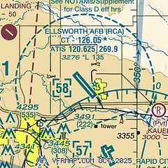
| Sectional chart |
|---|
|
 Download PDF
of official airport diagram from the FAA
| Airport distance calculator |
|---|
|
|
| Sunrise and sunset |
|---|
|
Times for 17-May-2026
| | Local
(UTC-6) | | Zulu
(UTC) |
|---|
| Morning civil twilight | | 04:51 | | 10:51 |
| Sunrise | | 05:25 | | 11:25 |
| Sunset | | 20:13 | | 02:13 |
| Evening civil twilight | | 20:47 | | 02:47 |
|
| Current date and time |
|---|
| Zulu (UTC) | 17-May-2026 21:52:25 |
|---|
| Local (UTC-6) | 17-May-2026 15:52:25 |
|---|
|
| METAR |
|---|
| KRCA | 172055Z AUTO 33024G32KT 10SM SCT042 BKN080 14/02 A2973 RMK AO2 PK WND 31034/00 SLP065 T01350015 51016
|
KRAP
6nm S | 172052Z 34023G37KT 10SM OVC075 14/02 A2975 RMK AO2 PK WND 32038/2042 SLP071 T01440022 50013
|
|
| TAF |
|---|
KRAP
6nm S | 171720Z 1718/1818 33024G32KT P6SM BKN040 TEMPO 1718/1719 5SM -SHRA BKN030 FM172300 35022G35KT P6SM SCT130 FM181000 36017G31KT P6SM OVC030 FM181200 36020G30KT 4SM -SHRA OVC010
|
|
| NOTAMs |
|---|
NOTAMs are issued by the DoD/FAA and will open in a separate window not controlled by AirNav.
|
|


