FAA INFORMATION EFFECTIVE 16 APRIL 2026
Location
| FAA Identifier: | MO5 |
| Lat/Long: | 37-00-33.8000N 091-00-24.8000W
37-00.563333N 091-00.413333W
37.0093889,-91.0068889
(estimated) |
| Elevation: | 652 ft. / 199 m (estimated) |
| Variation: | 03E (1985) |
| From city: | 1 mile N of VAN BUREN, MO |
| Time zone: | UTC -5 (UTC -6 during Standard Time) |
| Zip code: | 63965 |
Airport Operations
| Airport use: | Open to the public |
| Activation date: | 02/1976 |
| Control tower: | no |
| ARTCC: | MEMPHIS CENTER |
| FSS: | SAINT LOUIS FLIGHT SERVICE STATION |
| NOTAMs facility: | STL (NOTAM-D service available) |
| Attendance: | UNATNDD |
| Wind indicator: | no |
| Segmented circle: | yes
POOR CONDITION |
| Beacon: | BEACON OTS INDEFLY. |
Airport Communications
| CTAF: | 122.9 |
| WX AWOS-3PT at PYN (16 nm NE): | 118.475 (573-223-2796) |
Airport Services
Runway Information
Runway 2/20
| Dimensions: | 2600 x 50 ft. / 792 x 15 m |
| Surface: | asphalt, in excellent condition |
| Runway edge markings: | RWY 20 MKGS SVRLY FADED. |
| RUNWAY 2 | | RUNWAY 20 |
| Latitude: | 37-00.374667N | | 37-00.753167N |
| Longitude: | 091-00.539167W | | 091-00.288333W |
| Elevation: | 647.0 ft. | | 652.0 ft. |
| Traffic pattern: | left | | left |
| Markings: | basic, in poor condition | | basic, in poor condition |
| Obstructions: | 13 ft. brush, 278 ft. from runway, 70 ft. left of centerline, 6:1 slope to clear
RWY 02 1-17 FT BRUSH & TREES, TALL WEEDS & HIGH GND, 0-200 FT FM RWY END, L&R. | | 89 ft. trees, 1480 ft. from runway, 250 ft. left and right of centerline, 14:1 slope to clear
RWY 20 +1-33 FT BRUSH & TREES 0-75 FT FM RWY END, 100-120 FT L. |
Airport Ownership and Management from official FAA records
| Ownership: | Publicly-owned |
| Owner: | CITY OF VAN BUREN
PO BOX 40
VAN BUREN, MO 63965
Phone 573-323-4335 |
| Manager: | RON KEENEY
PO BOX 40
VAN BUREN, MO 63965
Phone 573-323-4335
PUBLIC WORKS DIRECTOR. |
Additional Remarks
| - | DEER & WILDLIFE ON & INVOF ARPT. |
| - | NTSD RWY SAFETY AREA ALG SIDES OF RWY AND BYD RWY 20 END. LRG DROP-OFFS, INCOR TRRN GRADS, BRUSH & TREES. |
| - | FOR CD CTC MEMPHIS ARTCC AT 901-368-8453/8449. |
Instrument Procedures
There are no published instrument procedures at MO5.
Some nearby airports with instrument procedures:
KMNF - Mountain View Airport (34 nm W)
KPOF - Poplar Bluff Regional Business Airport (36 nm SE)
4M9 - Corning Municipal Airport (40 nm SE)
KUNO - West Plains Regional Airport (44 nm W)
M70 - Pocahontas Municipal Airport (46 nm S)
|
|

Road maps at:
MapQuest
Bing
Google
| Aerial photo |
|---|
WARNING: Photo may not be current or correct
 Photo by Matt Barnes
Photo taken 07-Jul-2009
Photo by Matt Barnes
Photo taken 07-Jul-2009
Do you have a better or more recent aerial photo of Bollinger-Crass Memorial Airport that you would like to share? If so, please send us your photo.
|
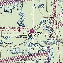
| Sectional chart |
|---|
|
| Airport distance calculator |
|---|
|
|
| Sunrise and sunset |
|---|
|
Times for 13-May-2026
| | Local
(UTC-5) | | Zulu
(UTC) |
|---|
| Morning civil twilight | | 05:30 | | 10:30 |
| Sunrise | | 05:59 | | 10:59 |
| Sunset | | 20:02 | | 01:02 |
| Evening civil twilight | | 20:31 | | 01:31 |
|
| Current date and time |
|---|
| Zulu (UTC) | 13-May-2026 23:17:25 |
|---|
| Local (UTC-5) | 13-May-2026 18:17:25 |
|---|
|
| METAR |
|---|
KPOF
36nm SE | 132253Z AUTO 34013KT 10SM -RA CLR 26/01 A2998 RMK AO2 SLP148 P0000 T02610011
|
K4M9
40nm SE | 132255Z AUTO 34011G18KT 10SM CLR 28/06 A2999 RMK A01
|
KUNO
43nm W | 132253Z AUTO 34007KT 310V020 10SM CLR 23/03 A3005 RMK AO2 SLP168 T02330028
|
|
| NOTAMs |
|---|
NOTAMs are issued by the DoD/FAA and will open in a separate window not controlled by AirNav.
|
|

