FAA INFORMATION EFFECTIVE 16 APRIL 2026
Location
| FAA Identifier: | BRW |
| Lat/Long: | 71-17-05.5000N 156-46-06.9000W
71-17.091667N 156-46.115000W
71.2848611,-156.7685833
(estimated) |
| Elevation: | 48.9 ft. / 14.9 m (surveyed) |
| Variation: | 10E (2025) |
| Time zone: | UTC -8 (UTC -9 during Standard Time) |
| Zip code: | 99723 |
Airport Operations
| Airport use: | Open to the public |
| Control tower: | no |
| ARTCC: | ANCHORAGE CENTER |
| FSS: | BARROW FLIGHT SERVICE STATION (on field) [907-852-2511] |
| Alternate FSS: | FAI FAIRBANKS FLIGHT SERVICE STATION [1-866-248-6516] |
| NOTAMs facility: | BRW (NOTAM-D service available) |
| Attendance: | 0600-2030 |
| Wind indicator: | lighted |
| Segmented circle: | yes |
| Lights: | ACTVT MALSR RWY 08; REIL RWY 26 - CTAF. HIRL RWY 08/26 PRESET LOW INTST - INCR INTST BRW FSS 0600-2200; AFT HR - CTAF. PAPI RWY 08 & 26 ON CONSLY. |
| Beacon: | white-green (lighted land airport)
ROTG BCN ON CONSLY. |
| Fire and rescue: | ARFF index B |
| Airline operations: | CLSD TO ACR OPS MORE THAN 30 PAX SEATS EXCP PPR IN WRITING - AMGR PO BOX 367 BARROW AK 99723. |
Airport Communications
| CTAF: | 123.6 |
| WX ASOS: | 132.150 (907-931-6017) |
- COMMUNICATIONS PRVDD BY BARROW FSS ON FREQ 123.6 (CTAF).
- APCH/DEP SVC PRVDD BY ANCHORAGE ARTCC ON FREQS 135.3/239.25 (BARROW RCAG).
- AFIS FREQUENCY 132.15. OPERATES SAME HRS AS BRW FSS, 0600-2200; OT CTC FAIRBANKS FSS.
Nearby radio navigation aids
| VOR radial/distance | | VOR name | | Freq | | Var |
|---|
| BRW at field | | BARROW VOR/DME | | 116.20 | | 10E |
Airport Services
| Fuel available: | 100LL JET-A1 |
| Parking: | hangars |
| Airframe service: | MINOR |
| Powerplant service: | MINOR |
Runway Information
Runway 8/26
| Dimensions: | 7100 x 150 ft. / 2164 x 46 m |
| Surface: | asphalt/grooved, in fair condition |
| Weight bearing capacity: | | Single wheel: | 75.0 | | Double wheel: | 160.0 | | Double tandem: | 300.0 |
|
| Runway edge lights: | high intensity |
| RUNWAY 8 | | RUNWAY 26 |
| Latitude: | 71-17.092092N | | 71-17.092678N |
| Longitude: | 156-47.926612W | | 156-44.302297W |
| Elevation: | 48.6 ft. | | 37.4 ft. |
| Traffic pattern: | right | | left |
| Runway heading: | 080 magnetic, 090 true | | 260 magnetic, 270 true |
| Displaced threshold: | 600 ft. | | 600 ft. |
| Declared distances: | TORA:7100 TODA:7100 ASDA:6500 LDA:5900 | | TORA:7100 TODA:7100 ASDA:6500 LDA:5900 |
| Markings: | precision, in good condition | | precision, in good condition |
| Visual slope indicator: | 4-light PAPI on right (3.00 degrees glide path) | | 4-light PAPI on left (3.00 degrees glide path) |
| RVR equipment: | touchdown | | rollout |
| Approach lights: | MALSR: 1,400 foot medium intensity approach lighting system with runway alignment indicator lights | | |
| Runway end identifier lights: | | | yes |
| Touchdown point: | yes, no lights | | yes, no lights |
| Instrument approach: | ILS/DME | | |
| Obstructions: | none | | 9 ft. ant, lighted, 380 ft. from runway, 200 ft. right of centerline, 20:1 slope to clear |
Airport Ownership and Management from official FAA records
| Ownership: | Publicly-owned |
| Owner: | ALASKA DOT&PF NORTHERN REGION
2301 PEGER RD
FAIRBANKS, AK 99701
Phone 907-451-2200 |
| Manager: | JOHN OLSEN
30651 EMAIKSOUN ROAD
UTQIAGVIK, AK 99723
Phone 907-852-5851 |
Additional Remarks
| A39-08/26 | PCR VALUE: 458/F/C/X/U |
| - | SNOW REMOVAL, WILDLIFE CTL, COND RPRTG & ARPT MAINT SVC AVBL DURG MAINT DUTY HR 0600-2030; AFT HR - AMGR. |
| - | MAIN RAMP TXL NON STD WINGTIP CLNC; RWY BACK TAXI WHEN LRG ACFT PRKD ON MAIN RAMP. |
| - | TSA REG ARPT; SEE 49 CFR 1542. GATES & DOORS MUST BE SECURED ALL TIMES. TSNT - AMGR OR BRW FSS FOR INFO. |
| - | WATERFOWL INVOF ARPT SPRING-FALL. |
| - | ARPT SAND LRGR GRADATION THAN FAA RCMDD/SEE AC150/5200-30. |
| - | RCMD LRGR ACFT USE ELEPHANT EAR TO TURN AROUND. |
| - | WX CAMERA AVBL ON INTERNET AT HTTPS://WEATHERCAMS.FAA.GOV |
| - | WSO - 907-852-6484. |
Instrument Procedures
NOTE: All procedures below are presented as PDF files. If you need a reader for these files, you should download the free Adobe Reader.NOT FOR NAVIGATION. Please procure official charts for flight.
FAA instrument procedures published for use from 16 April 2026 at 0901Z to 14 May 2026 at 0900Z.
IAPs - Instrument Approach Procedures |
|---|
| ILS OR LOC RWY 08 | |
download (238KB) |
| RNAV (GPS) RWY 08 | |
download (228KB) |
| RNAV (GPS) RWY 26 | |
download (221KB) |
| LOC BC RWY 26 | |
download (277KB) |
| VOR RWY 26 | |
download (269KB) |
| NOTE: Special Alternate Minimums apply | |
download (150KB) |
| NOTE: Special Take-Off Minimums/Departure Procedures apply | |
download (404KB) |
Other nearby airports with instrument procedures:
PATQ - Atqasuk Edward Burnell Sr. Memorial Airport (51 nm S)
PAWI - Wainwright Airport (74 nm SW)
|
|

Road maps at:
MapQuest
Bing
Google
| Aerial photo |
|---|
WARNING: Photo may not be current or correct
 Photo taken 24-Jul-2006
Do you have a better or more recent aerial photo of Wiley Post-Will Rogers Memorial Airport that you would like to share? If so, please send us your photo.
|
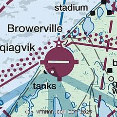
| Sectional chart |
|---|
|
| Airport distance calculator |
|---|
|
|
| Sunrise and sunset |
|---|
|
Times for 22-Apr-2026
| | Local
(UTC-8) | | Zulu
(UTC) |
|---|
| Morning civil twilight | | 03:14 | | 11:14 |
| Sunrise | | 05:32 | | 13:32 |
| Sunset | | 23:20 | | 07:20 |
| Evening civil twilight | | 01:37 | | 09:37 |
|
| Current date and time |
|---|
| Zulu (UTC) | 22-Apr-2026 08:24:35 |
|---|
| Local (UTC-8) | 22-Apr-2026 00:24:35 |
|---|
|
| METAR |
|---|
| PABR | 220753Z AUTO 03008KT 10SM OVC011 M19/M22 A3034 RMK AO2 SLP277 T11941222 TSNO $
|
|
| TAF |
|---|
| PABR | 220526Z 2206/2306 03007KT P6SM BKN013 BKN060 FM221200 02009KT 6SM BR OVC010 FM221800 03005KT P6SM SCT025 BKN100
|
|
| NOTAMs |
|---|
NOTAMs are issued by the DoD/FAA and will open in a separate window not controlled by AirNav.
|
|

