FAA INFORMATION EFFECTIVE 14 MAY 2026
Location
| FAA Identifier: | SIT |
| Lat/Long: | 57-02-48.6037N 135-21-39.8473W
57-02.810062N 135-21.664122W
57.0468344,-135.3610687
(estimated) |
| Elevation: | 26.5 ft. / 8 m (estimated) |
| Variation: | 20E (2015) |
| Time zone: | UTC -8 (UTC -9 during Standard Time) |
| Zip code: | 99835 |
Airport Operations
| Airport use: | Open to the public |
| Activation date: | 12/1969 |
| Control tower: | no |
| ARTCC: | ANCHORAGE CENTER |
| FSS: | SITKA FLIGHT SERVICE STATION (on field) [907-966-2221] |
| Alternate FSS: | JNU JUNEAU FLIGHT SERVICE STATION [1-866-297-2236] |
| NOTAMs facility: | SIT (NOTAM-D service available) |
| Attendance: | 0500-2300 |
| Wind indicator: | lighted |
| Segmented circle: | yes |
| Lights: | ACTVT REIL RWY 11 & 29; HIRL RWY 11/29 - SITKA FSS OR 907-966-2221. WHEN SITKA FSS CLSD ACTVT REIL RWY 11 & 29; HIRL RWY 11/29 - CTAF. VASI RWY 11 & 29 OPR CONSLY. |
| Beacon: | white-green (lighted land airport)
Operates sunset to sunrise. |
| Fire and rescue: | ARFF index B |
| Airline operations: | ARFF AVBL DURG SKED ACR OPS. CLSD TO ACR OPS MORE THAN 30 PAX SEATS EXC 24 HR PPR IN WRITING - AMGR 605 AIRPORT ROAD SITKA AK 99835. |
| International operations: | customs landing rights airport |
Airport Communications
| CTAF: | 123.6 |
| UNICOM: | 122.95 |
| WX ASOS: | 135.9 (907-966-2209) |
- APCH/DEP SVC PRVDD BY ANCHORAGE ARTCC ON FREQS 126.1/335.5 (BIORKA ISLAND RCAG).
- COAST GUARD AIR OPERATIONS (SITKA AIR) VHF FM-21A 121.05 OR MAINTENANCE CONTROL 345.0 OTHER CG FREQS AVBL O/R.
- SIT AFIS ON FREQUENCY 135.9.
- COMMUNICATIONS PRVDD BY SITKA FSS ON FREQS 122.2 & 123.6 (CTAF).
Nearby radio navigation aids
| VOR radial/distance | | VOR name | | Freq | | Var |
|---|
| BKAr009/12.9 | | BIORKA ISLAND VORTAC | | 113.80 | | 20E |
Airport Services
| Fuel available: | 100 JET-A1+ |
| Parking: | tiedowns |
| Airframe service: | MAJOR |
| Powerplant service: | MAJOR |
Runway Information
Runway 11/29
| Dimensions: | 7200 x 150 ft. / 2195 x 46 m |
| Surface: | asphalt/grooved, in good condition |
| Weight bearing capacity: | | Single wheel: | 114.0 | | Double wheel: | 190.0 | | Double tandem: | 321.0 |
|
| Runway edge lights: | high intensity |
| Operational restrictions: | LOCKED WHEEL TURNS NA. SAFETY AREA ARMOR ROCK MIDDLE 1600 FT S SIDE. |
| RUNWAY 11 | | RUNWAY 29 |
| Latitude: | 57-03.231938N | | 57-02.388185N |
| Longitude: | 135-22.424027W | | 135-20.904217W |
| Elevation: | 24.2 ft. | | 26.5 ft. |
| Traffic pattern: | right | | left |
| Runway heading: | 116 magnetic, 136 true | | 296 magnetic, 316 true |
| Displaced threshold: | 200 ft. | | 180 ft. |
| Declared distances: | TORA:7200 TODA:7200 ASDA:6720 LDA:6500 | | TORA:7200 TODA:7200 ASDA:6700 LDA:6500 |
| Markings: | precision, in fair condition | | precision, in fair condition |
| Visual slope indicator: | 4-box VASI on left (3.00 degrees glide path) | | 4-box VASI on right (3.00 degrees glide path)
RWY 29 VASI DOES NOT PRVD OBSTN CLNC BYD 3.0 NM FM THR. |
| Runway end identifier lights: | yes | | yes |
| Touchdown point: | yes, no lights | | yes, no lights |
| Instrument approach: | LDA/DME | | |
| Obstructions: | 57 ft. tree, 2700 ft. from runway, 43:1 slope to clear | | 112 ft. tree, 2240 ft. from runway, 500 ft. left of centerline, 18:1 slope to clear |
Airport Ownership and Management from official FAA records
| Ownership: | Publicly-owned |
| Owner: | ALASKA DOT&PF SOUTHCOAST REGION
6860 GLACIER HIGHWAY
JUNEAU, AK 99801-7999
Phone 907-465-1786 |
| Manager: | KELLY BODDY
605 AIRPORT RD
SITKA, AK 99835
Phone 907-966-2960 |
Additional Remarks
| A39-11/29 | PCR VALUE: 461/F/B/X/T |
| - | PAJA TO RWY, TWY OR PRKG APRON NA. |
| - | ARR CTC SITKA AIR 10 MIN PRIOR TO LNDG - 121.05, 345.0 OR FSS. |
| - | SITKA ROCKY GUTIERREZ & LEVEL ISLAND WX CAMERA AVBL ON INTERNET AT HTTPS://WEATHERCAMS.FAA.GOV |
| - | ARPT SAND LRGR GRADATION THAN FAA RCMDD/SEE AC150/5200-30. |
| - | MAINT DUTY HR 0500-2300; SNOW REMOVAL, WILDLIFE CTL, COND RPRT & OTR MAINT AVBL; AFT HR - AMGR. |
| - | GA PORTION PCN 13/F/B/Y/T; N MOST SECTION OF FAC. |
| - | AFT HR FUEL - 122.95 OR 907-747-7222. |
| - | BIRDS ON & INVOF ARPT. |
| - | SITKA WX 2200-0600 - 966-2913 OR 122.45. |
| - | TSNT PRKG W SIDE OF APRON ONLY. |
Instrument Procedures
NOTE: All procedures below are presented as PDF files. If you need a reader for these files, you should download the free Adobe Reader.NOT FOR NAVIGATION. Please procure official charts for flight.
FAA instrument procedures published for use from 14 May 2026 at 0901Z to 11 June 2026 at 0900Z.
IAPs - Instrument Approach Procedures |
|---|
| RNAV (GPS) RWY 11 | |
download (379KB) |
| RNAV (GPS)-B | |
download (389KB) |
| LDA RWY 11 | |
download (482KB) |
| NOTE: Special Alternate Minimums apply | |
download (171KB) |
Departure Procedures |
|---|
| SITKA ONE | |
download (146KB) |
| SITKA ONE | |
download (146KB) |
|
|---|
| BIORKA FOUR (OBSTACLE) | |
download (335KB) |
| NOTE: Special Take-Off Minimums/Departure Procedures apply | |
download (148KB) |
Other nearby airports with instrument procedures:
PAFE - Kake Airport (48 nm E)
PAPG - Petersburg James A Johnson Airport (80 nm E)
PAJN - Juneau International Airport (82 nm N)
PAGS - Gustavus Airport (83 nm N)
|
|

Road maps at:
MapQuest
Bing
Google
| Aerial photo |
|---|
WARNING: Photo may not be current or correct
 Photo by Sonny Cropley
Photo taken 19-Mar-2017
looking north.
Photo by Sonny Cropley
Photo taken 19-Mar-2017
looking north.
Do you have a better or more recent aerial photo of Sitka Rocky Gutierrez Airport that you would like to share? If so, please send us your photo.
|
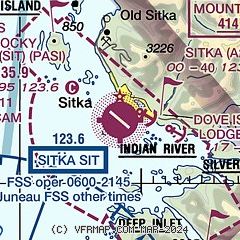
| Sectional chart |
|---|
|
| Airport distance calculator |
|---|
|
|
| Sunrise and sunset |
|---|
|
Times for 07-Jun-2026
| | Local
(UTC-8) | | Zulu
(UTC) |
|---|
| Morning civil twilight | | 03:06 | | 11:06 |
| Sunrise | | 04:11 | | 12:11 |
| Sunset | | 21:50 | | 05:50 |
| Evening civil twilight | | 22:55 | | 06:55 |
|
| Current date and time |
|---|
| Zulu (UTC) | 08-Jun-2026 01:16:32 |
|---|
| Local (UTC-8) | 07-Jun-2026 17:16:32 |
|---|
|
| METAR |
|---|
| PASI | 080053Z 00000KT 6SM -RA BKN042 OVC055 12/09 A2970 RMK AO2 SLP057 P0001 T01170089 $
|
|
| TAF |
|---|
| PASI | 071737Z 0718/0818 VRB06KT P6SM FEW025 OVC040 FM072100 18007KT P6SM -SHRA SCT025 OVC040 TEMPO 0802/0806 11005KT P6SM -RA SCT020 OVC035 FM080600 10004KT P6SM OVC050 PROB30 0812/0818 6SM -RA BR OVC025
|
|
| NOTAMs |
|---|
NOTAMs are issued by the DoD/FAA and will open in a separate window not controlled by AirNav.
|
|

