FAA INFORMATION EFFECTIVE 27 NOVEMBER 2025
Location
| FAA Identifier: | SEG |
| Lat/Long: | 40-49-16.4450N 076-51-51.0200W
40-49.274083N 076-51.850333W
40.8212347,-76.8641722
(estimated) |
| Elevation: | 463.5 ft. / 141.3 m (surveyed) |
| Variation: | 11W (2000) |
| From city: | 1 mile N of SELINSGROVE, PA |
| Time zone: | UTC -5 (UTC -4 during Daylight Saving Time) |
| Zip code: | 17870 |
Airport Operations
| Airport use: | Open to the public |
| Activation date: | 05/1945 |
| Control tower: | no |
| ARTCC: | NEW YORK CENTER |
| FSS: | WILLIAMSPORT FLIGHT SERVICE STATION |
| NOTAMs facility: | SEG (NOTAM-D service available) |
| Attendance: | MON-FRI 0800-1800, ALL SAT-SUN 0800-1600 |
| Wind indicator: | lighted |
| Segmented circle: | no |
| Lights: | ACTVT REIL RWY 17/35; PAPI RWY 35; MIRL RWY 17/35 - CTAF. |
| Beacon: | white-green (lighted land airport)
Operates sunset to sunrise. |
| Landing fee: | yes, RAMP FEE FOR TWIN ENG & LRGR ACFT UNLESS FUEL PURCHASED. |
Airport Communications
| CTAF/UNICOM: | 122.7 |
| WX ASOS: | 123.975 (570-374-4099) |
| HARRISBURG APPROACH: | 118.25 |
| HARRISBURG DEPARTURE: | 118.25 |
| WX AWOS-3 at N79 (14 nm E): | 119.175 (570-672-0389) |
| WX AWOS-3 at 79PN (15 nm NE): | 118.075 (570-271-8192) |
Nearby radio navigation aids
| VOR radial/distance | | VOR name | | Freq | | Var |
|---|
| SEGr034/2.0 | | SELINSGROVE VOR/DME | | 110.40 | | 08W |
| MIPr226/15.1 | | MILTON VORTAC | | 109.20 | | 09W |
| RAVr334/20.1 | | RAVINE VORTAC | | 114.60 | | 11W |
| FQMr196/31.3 | | WILLIAMSPORT VOR/DME | | 114.40 | | 09W |
| HARr027/32.5 | | HARRISBURG VORTAC | | 115.35 | | 10W |
| NDB name | | Hdg/Dist | | Freq | | Var | | ID |
|---|
| BELLGROVE | | 339/27.1 | | 328 | | 10W | | BZJ | -... --.. .--- |
Airport Services
| Fuel available: | 100LL JET-A |
| Parking: | hangars and tiedowns |
| Airframe service: | MINOR |
| Powerplant service: | MINOR |
| Bottled oxygen: | NONE |
| Bulk oxygen: | NONE |
Runway Information
Runway 17/35
| Dimensions: | 4760 x 75 ft. / 1451 x 23 m |
| Surface: | asphalt, in excellent condition |
| Weight bearing capacity: | | Single wheel: | 27.0 | | Double wheel: | 27.0 |
|
| Runway edge lights: | medium intensity |
| RUNWAY 17 | | RUNWAY 35 |
| Latitude: | 40-49.639618N | | 40-48.908812N |
| Longitude: | 076-52.035822W | | 076-51.662827W |
| Elevation: | 463.5 ft. | | 441.9 ft. |
| Traffic pattern: | left | | left |
| Runway heading: | 170 magnetic, 159 true | | 350 magnetic, 339 true |
| Displaced threshold: | 388 ft. | | 250 ft. |
| Markings: | nonprecision, in good condition | | nonprecision, in good condition |
| Visual slope indicator: | | | 4-light PAPI on left (3.50 degrees glide path) |
| Runway end identifier lights: | yes | | yes |
| Touchdown point: | yes, no lights | | yes, no lights |
| Obstructions: | 28 ft. tree, 525 ft. from runway, 48 ft. right of centerline, 11:1 slope to clear
31:1 APCH SLP TO DTHR. | | 31 ft. trees, 409 ft. from runway, 156 ft. right of centerline, 6:1 slope to clear
APCH SLP 21:1 TO DTHR. |
Airport Ownership and Management from official FAA records
| Ownership: | Publicly-owned |
| Owner: | PENN VALLEY AIRPORT AUTH
100 AIRPORT RD
SELINSGROVE, PA 17870
Phone 570-374-7671 |
| Manager: | STEPHEN BOWERS
100 AIRPORT RD
SELINSGROVE, PA 17870
Phone 570-809-4701
AFT HOURS CTC 570-809-4701. |
Additional Remarks
| - | FOR CD CTC HARRISBURG APCH AT 800-932-0712. |
| - | DEER & BIRDS ON AND INVOF ARPT. |
| - | RISING TERRAIN BOTH SIDES OF APCH TO RWY 17.. |
| - | COLD TEMPERATURE AIRPORT. ALTITUDE CORRECTION REQUIRED AT OR BELOW -13C. |
Instrument Procedures
NOTE: All procedures below are presented as PDF files. If you need a reader for these files, you should download the free Adobe Reader.NOT FOR NAVIGATION. Please procure official charts for flight.
FAA instrument procedures published for use from 27 November 2025 at 0901Z to 25 December 2025 at 0900Z.
IAPs - Instrument Approach Procedures |
|---|
| RNAV (GPS) RWY 17 | |
download (230KB) |
| RNAV (GPS) RWY 35 | |
download (218KB) |
| VOR-A | |
download (163KB) |
| NOTE: Special Alternate Minimums apply | |
download (147KB) |
| NOTE: Special Take-Off Minimums/Departure Procedures apply | |
download (243KB) |
Other nearby airports with instrument procedures:
8N8 - Danville Airport (13 nm NE)
N79 - Northumberland County Airport (14 nm E)
74N - Bendigo Airport (21 nm SE)
N13 - Bloomsburg Municipal Airport (22 nm NE)
KZER - Schuylkill County/Joe Zerbey Airport (23 nm E)
|
|

Road maps at:
MapQuest
Bing
Google
| Aerial photo |
|---|
WARNING: Photo may not be current or correct
 Photo courtesy of NEPA Aerial Photography
Taken in November 2017
looking north.
Photo courtesy of NEPA Aerial Photography
Taken in November 2017
looking north.
Do you have a better or more recent aerial photo of Penn Valley Airport that you would like to share? If so, please send us your photo.
|
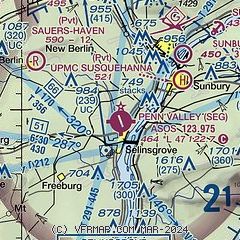
| Sectional chart |
|---|
|
| Airport distance calculator |
|---|
|
|
| Sunrise and sunset |
|---|
|
Times for 19-Dec-2025
| | Local
(UTC-5) | | Zulu
(UTC) |
|---|
| Morning civil twilight | | 06:57 | | 11:57 |
| Sunrise | | 07:28 | | 12:28 |
| Sunset | | 16:41 | | 21:41 |
| Evening civil twilight | | 17:12 | | 22:12 |
|
| Current date and time |
|---|
| Zulu (UTC) | 19-Dec-2025 23:40:07 |
|---|
| Local (UTC-5) | 19-Dec-2025 18:40:07 |
|---|
|
| METAR |
|---|
| KSEG | 192253Z AUTO 28014G33KT 240V310 10SM OVC047 M01/M10 A2978 RMK AO2 PK WND 29033/2253 SNB05E15 SLP087 P0000 T10111100
|
|
| TAF |
|---|
KIPT
26nm N | 191731Z 1918/2018 27015G25KT P6SM -SHRA OVC050 FM191900 27025G40KT 6SM -SHRASN OVC035 FM200000 28020G30KT P6SM BKN040 FM200600 29015G25KT P6SM BKN040 FM201200 27005KT P6SM SCT040 FM201700 09007KT P6SM BKN100
|
KMUI
28nm SE | 191730Z 1917/2017 26010G15KT 9999 -RA SCT015 BKN040 QNH2935INS TEMPO 1917/1922 28025G35KT 520009 BECMG 2004/2005 30015G25KT 9999 NSW FEW030 QNH3004INS BECMG 2009/2010 30010G15KT 9999 FEW030 QNH3009INS TX11/1919Z TNM03/2004Z LAST NO AMDS AFT 1918 NEXT 2211
|
|
| NOTAMs |
|---|
NOTAMs are issued by the DoD/FAA and will open in a separate window not controlled by AirNav.
|
|

