FAA INFORMATION EFFECTIVE 09 JULY 2026
Location
| FAA Identifier: | SGF |
| Lat/Long: | 37-14-44.3810N 093-23-19.0570W
37-14.739683N 093-23.317617W
37.2456614,-93.3886269
(estimated) |
| Elevation: | 1268.3 ft. / 386.6 m (surveyed) |
| Variation: | 03E (2000) |
| From city: | 5 miles NW of SPRINGFIELD, MO |
| Time zone: | UTC -5 (UTC -6 during Standard Time) |
| Zip code: | 65803 |
Airport Operations
| Airport use: | Open to the public |
| Control tower: | yes |
| ARTCC: | KANSAS CITY CENTER |
| FSS: | COLUMBIA FLIGHT SERVICE STATION |
| NOTAMs facility: | SGF (NOTAM-D service available) |
| Attendance: | CONTINUOUS |
| Pattern altitude: | 2268.3 ft. MSL |
| Wind indicator: | lighted |
| Segmented circle: | no |
| Lights: | SS-SR |
| Beacon: | white-green (lighted land airport)
Operates sunset to sunrise. |
| Fire and rescue: | ARFF index B |
| Airline operations: | PPR 24 HRS FOR UNSKED ACR OPNS WITH MORE THAN 30 PSGR SEATS CALL SGF 417-868-0590. ARFF INDEX C & D AVBL ON REQUEST. |
| International operations: | customs landing rights airport |
Airport Communications
| UNICOM: | 122.95 |
| ATIS: | 135.125 |
| WX ASOS: | PHONE 417-869-4491 |
| SPRINGFIELD GROUND: | 121.9 251.15 |
| SPRINGFIELD TOWER: | 119.9 257.8 |
| SPRINGFIELD APPROACH: | 121.1 ;020-199 124.95 ;200-019 290.5 ;020-199 318.2 ;200-019 |
| SPRINGFIELD DEPARTURE: | 121.1 ;020-199 124.95 ;200-019 290.5 ;020-199 318.2 ;200-019 |
| CLEARANCE DELIVERY: | 123.675 |
| ARNG OPS: | 138.75 ;BEARS DEN 245.6 ;BEARS DEN 38.525 ;BEARS DEN |
| CLASS C: | 121.1 ;020-199 124.95 ;200-019 290.5 ;020-199 318.2 ;200-019 |
| IC: | 124.95 ;200-019 290.5 ;020-199 |
- APCH/DEP HRS CHG ALSO EFFECTS THE FLWG ARPTS; OZARK AIR PARK SOUTH; MONETT MUNI; POINT LOOKOUT M GRAHM CLARK; CASSIVLLE MUNI; AURORA MEML MUNI.
- SPRINGFIELD APCH CTL HAS TWO APCH/DEP CALLS
Nearby radio navigation aids
| VOR radial/distance | | VOR name | | Freq | | Var |
|---|
| SGFr197/7.1 | | SPRINGFIELD VORTAC | | 116.90 | | 04E |
| DGDr298/27.9 | | DOGWOOD VORTAC | | 109.40 | | 01E |
Airport Services
| Fuel available: | 100LL JET-A |
| Parking: | hangars and tiedowns |
| Airframe service: | MAJOR |
| Powerplant service: | MAJOR |
| Bottled oxygen: | NONE |
| Bulk oxygen: | HIGH/LOW
OXYGEN AVBL MON-FRI 0800-1700. |
Runway Information
Runway 14/32
| Dimensions: | 8000 x 150 ft. / 2438 x 46 m |
| Surface: | concrete/grooved, in excellent condition |
| Weight bearing capacity: | | Single wheel: | 135.0 | | Double wheel: | 170.0 | | Double tandem: | 300.0 |
|
| Runway edge lights: | high intensity |
| RUNWAY 14 | | RUNWAY 32 |
| Latitude: | 37-15.314355N | | 37-14.278628N |
| Longitude: | 093-24.030602W | | 093-23.010593W |
| Elevation: | 1260.2 ft. | | 1268.2 ft. |
| Traffic pattern: | left | | left |
| Runway heading: | 139 magnetic, 142 true | | 319 magnetic, 322 true |
| Declared distances: | TORA:8000 TODA:8000 ASDA:8000 LDA:8000 | | TORA:8000 TODA:8000 ASDA:8000 LDA:8000 |
| Markings: | precision, in good condition | | nonprecision, in good condition |
| Visual slope indicator: | 4-light PAPI on right (3.00 degrees glide path) | | 4-light PAPI on left (3.00 degrees glide path) |
| RVR equipment: | touchdown | | rollout |
| Approach lights: | MALSR: 1,400 foot medium intensity approach lighting system with runway alignment indicator lights | | |
| Runway end identifier lights: | no | | yes |
| Touchdown point: | yes, no lights | | yes, no lights |
| Instrument approach: | ILS/DME | | |
Runway 2/20
| Dimensions: | 7003 x 150 ft. / 2135 x 46 m |
| Surface: | concrete/grooved, in good condition |
| Weight bearing capacity: | | Single wheel: | 135.0 | | Double wheel: | 170.0 | | Double tandem: | 300.0 |
|
| Runway edge lights: | high intensity |
| RUNWAY 2 | | RUNWAY 20 |
| Latitude: | 37-14.139062N | | 37-15.210442N |
| Longitude: | 093-23.353747W | | 093-22.817815W |
| Elevation: | 1263.9 ft. | | 1261.9 ft. |
| Traffic pattern: | left | | left |
| Runway heading: | 019 magnetic, 022 true | | 199 magnetic, 202 true |
| Declared distances: | TORA:7003 TODA:7003 ASDA:7003 LDA:7003 | | TORA:7003 TODA:7003 ASDA:7003 LDA:7003 |
| Markings: | precision, in good condition | | precision, in good condition |
| Visual slope indicator: | 4-box VASI on left (3.00 degrees glide path) | | 4-light PAPI on left (3.00 degrees glide path) |
| RVR equipment: | touchdown | | rollout |
| Approach lights: | MALSR: 1,400 foot medium intensity approach lighting system with runway alignment indicator lights | | MALS: 1,400 foot medium intensity approach lighting system |
| Touchdown point: | yes, no lights | | yes, no lights |
| Instrument approach: | ILS/DME | | |
Airport Ownership and Management from official FAA records
| Ownership: | Publicly-owned |
| Owner: | CITY OF SPRINGFIELD
2300 N AIRPORT BLVD, SUITE 100
SPRINGFIELD, MO 65802
Phone 417-868-0500 |
| Manager: | MR. BRIAN C WEILER, A.A.E.
2300 N AIRPORT BLVD, SUITE 100
SPRINGFIELD, MO 65802
Phone 417-868-0500
DIRECTOR OF AVIATION. |
Additional Remarks
| A39-02/20 | PCR VALUE: 780/R/D/W/T |
| A39-14/32 | PCR VALUE: 780/R/D/W/T |
| - | ARNG - MO-AVCRAD FAC OPR 1300-2100Z++ MON-FRI EXC HOL. MAINT ASST AVBL DUR NML DUTY HR. FLT ACT OPR 1400-2130Z++ MON-FRI EXC HOL. EXTN HR ON TUES, WED, THU 1400-0200Z++. DUR DST EXTN HR ONLY ON WED, THUR 1400-0500Z++. ARNG-24 HR PPR REQ, VALID 1 HR +/- ETA. FOR PPR, CTC FLT OPS AT C417-874-8460 DUR NML DUTY HR. ALL ACFT RQR CTC BEARS DEN ON 38.525, 138.75 AND 245.6 DEP ACFT RQR TO CTC BEARS DEN TO ADHERE TO ARPT SECURITY MEASURES. TRAN ACFT SHALL ARR AND DEP FR TWY G OR TWY J. A++ FUEL AVBL FOR SUPPORTED AVCRAD ACFT. RWY - ALL RWY GROOVED. RWY 02 RVR-T. TWY 20 RVR-R. RWY 14 RVR-T. RWY 32 RVR-R. |
| - | BIRDS & WILDLIFE ON & INVOF ARPT. |
| - | TWY N SOUTH OF RY 14-32 CLSD TO A-321, B727-200, ALL MD 80 SERIES, B-757 AND LARGER ACFT. |
| - | COMPASS ROSE NORTH OF TWY D AT THE APCH END RWY 32 RESTRICTED TO ACFT WITH FLUX VALVE & STBY COMPASS OF 5.5 FT IN HGT OR HYR. |
| - | GROUP IV ACFT OR LRGR ON TWY D FROM THE AER 32 TO TWY N AND TWY U ALG CARGO APN MUST PERFORM JUDGMENTAL OVERSTEERING INSTEAD OF COCKPIT OVER CNTRLN WHEN TAX. |
Instrument Procedures
NOTE: All procedures below are presented as PDF files. If you need a reader for these files, you should download the free Adobe Reader.NOT FOR NAVIGATION. Please procure official charts for flight.
FAA instrument procedures published for use from 09 July 2026 at 0901Z to 06 August 2026 at 0900Z.
IAPs - Instrument Approach Procedures |
|---|
| ILS OR LOC RWY 02 | |
download (291KB) |
| ILS OR LOC RWY 14 | |
download (319KB) |
| RNAV (GPS) RWY 02 | |
download (287KB) |
| RNAV (GPS) RWY 14 **CHANGED** | |
download (270KB) |
| RNAV (GPS) RWY 20 | |
download (274KB) |
| RNAV (GPS) RWY 32 | |
download (254KB) |
| VOR/DME OR TACAN RWY 02 **CHANGED** | |
download (268KB) |
| VOR OR TACAN RWY 20 | |
download (273KB) |
| HI-TACAN RWY 20 **CHANGED** | |
download (143KB) |
| NOTE: Special Alternate Minimums apply **CHANGED** | |
download (146KB) |
| NOTE: Special Take-Off Minimums/Departure Procedures apply | |
download (426KB) |
Other nearby airports with instrument procedures:
3DW - Downtown Airport (7 nm E)
M17 - Bolivar Municipal Airport (21 nm N)
2H2 - Jerry Sumners Sr. Aurora Municipal Airport (22 nm SW)
MO3 - Stockton Lake Airport (32 nm NW)
KFWB - Branson West Municipal Airport/Emerson Field (33 nm S)
|
|

Road maps at:
MapQuest
Bing
Google
| Aerial photo |
|---|
WARNING: Photo may not be current or correct

Do you have a better or more recent aerial photo of Springfield-Branson National Airport that you would like to share? If so, please send us your photo.
|
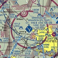
| Sectional chart |
|---|
|
CAUTION: Diagram may not be current
 Download PDF
of official airport diagram from the FAA
| Airport distance calculator |
|---|
|
|
| Sunrise and sunset |
|---|
|
Times for 31-Jul-2026
| | Local
(UTC-5) | | Zulu
(UTC) |
|---|
| Morning civil twilight | | 05:49 | | 10:49 |
| Sunrise | | 06:18 | | 11:18 |
| Sunset | | 20:21 | | 01:21 |
| Evening civil twilight | | 20:50 | | 01:50 |
|
| Current date and time |
|---|
| Zulu (UTC) | 31-Jul-2026 21:03:46 |
|---|
| Local (UTC-5) | 31-Jul-2026 16:03:46 |
|---|
|
| METAR |
|---|
| KSGF | 312052Z AUTO 24012G23KT 10SM CLR 34/22 A2983 RMK AO2 SLP084 T03390222 56016
|
|
| TAF |
|---|
| KSGF | 311720Z 3118/0118 19012G17KT P6SM FEW070 SCT150 FM312000 24014G20KT P6SM SCT060 FM312300 32012G20KT P6SM BKN150 PROB30 3123/0103 2SM TSRA SCT025 BKN050CB FM010300 31010KT P6SM SKC FM011200 34015G22KT P6SM FEW250
|
|
| NOTAMs |
|---|
NOTAMs are issued by the DoD/FAA and will open in a separate window not controlled by AirNav.
|
|


