FAA INFORMATION EFFECTIVE 16 APRIL 2026
Location
| FAA Identifier: | 0S9 |
| Lat/Long: | 48-03-13.7000N 122-48-38.3000W
48-03.228333N 122-48.638333W
48.0538056,-122.8106389
(estimated) |
| Elevation: | 110.1 ft. / 33.6 m (surveyed) |
| Variation: | 16E (2015) |
| From city: | 6 miles SW of PORT TOWNSEND, WA |
| Time zone: | UTC -7 (UTC -8 during Standard Time) |
| Zip code: | 98368 |
Airport Operations
| Airport use: | Open to the public |
| Activation date: | 01/1939 |
| Control tower: | no |
| ARTCC: | SEATTLE CENTER |
| FSS: | SEATTLE FLIGHT SERVICE STATION |
| NOTAMs facility: | SEA (NOTAM-D service available) |
| Attendance: | 0900-1800 |
| Pattern altitude: | 1000.1 ft. MSL |
| Wind indicator: | lighted |
| Segmented circle: | yes |
| Lights: | ACTVT REIL RWY 09; PAPI RWY 09 & 27; MIRL RWY 09/27 - CTAF. |
| Beacon: | white-green (lighted land airport)
Operates sunset to sunrise. |
| International operations: | international airport of entry |
Airport Communications
| CTAF/UNICOM: | 123.0 |
| WX AWOS-3P: | 119.025 (360-379-1199) |
| WHIDBEY APPROACH: | 118.2 |
| WHIDBEY DEPARTURE: | 118.2 |
| WX AWOS-3 at OKH (13 nm NE): | 132.775 (360-675-8431) |
| WX ASOS at NUW (19 nm N): | PHONE 360-257-8813 |
Nearby radio navigation aids
| VOR radial/distance | | VOR name | | Freq | | Var |
|---|
| CVVr178/12.0 | | PENN COVE VOR/DME | | 117.20 | | 19E |
| PAEr271/22.9 | | PAINE VOR/DME | | 110.60 | | 20E |
| NDB name | | Hdg/Dist | | Freq | | Var | | ID |
|---|
| FRIDAY HARBOR | | 146/28.8 | | 284 | | 17E | | FHR | ..-. .... .-. |
Airport Services
| Fuel available: | 100LL
100LL:100LL AVAILABLE 24 HRS WITH CREDIT CARD. NO CASH SALES. |
| Parking: | tiedowns |
| Airframe service: | MAJOR |
| Powerplant service: | MAJOR |
| Bottled oxygen: | NONE |
| Bulk oxygen: | NONE |
Runway Information
Runway 9/27
| Dimensions: | 3000 x 75 ft. / 914 x 23 m |
| Surface: | asphalt, in excellent condition |
| Weight bearing capacity: | |
| Runway edge lights: | medium intensity |
| RUNWAY 9 | | RUNWAY 27 |
| Latitude: | 48-03.286453N | | 48-03.170058N |
| Longitude: | 122-48.995422W | | 122-48.280232W |
| Elevation: | 108.8 ft. | | 106.1 ft. |
| Traffic pattern: | right | | left |
| Runway heading: | 088 magnetic, 104 true | | 268 magnetic, 284 true |
| Markings: | basic, in fair condition | | basic, in fair condition |
| Visual slope indicator: | 2-light PAPI on left (4.25 degrees glide path)
RWY 09 ARE BAFFLED BYD 6.5 DEG LEFT OF RWY CNTRLN DUE TO TRRN. | | 2-light PAPI on right (4.25 degrees glide path)
RWY 27 ARE BAFFLED BYD 6.5 DEG RIGHT OF RWY CNTRLN DUE TO TRRN. |
| Runway end identifier lights: | yes | | yes |
| Touchdown point: | yes, no lights | | yes, no lights |
| Obstructions: | 81 ft. trees, 1815 ft. from runway, 19:1 slope to clear | | 76 ft. tree, 1939 ft. from runway, 91 ft. left of centerline, 22:1 slope to clear |
Helipad H1
| Dimensions: | 65 x 65 ft. / 20 x 20 m |
| Surface: | asphalt, in fair condition |
| Latitude: | 48-03.382000N | | |
| Longitude: | 122-48.513833W | | |
| Elevation: | 120.0 ft. | | |
| Traffic pattern: | left | | left |
Airport Ownership and Management from official FAA records
| Ownership: | Publicly-owned |
| Owner: | PORT OF PORT TOWNSEND
P O BOX 1180
PORT TOWNSEND, WA 98368
Phone 360-385-0656 |
| Manager: | ERON BERG, EXECUTIVE DIRECTOR
PO BOX 1180
PORT TOWNSEND, WA 98368
Phone 360-385-0656
EMAIL: KRISTEN.LONG@TADERA.COM |
Additional Remarks
| - | NOISE ABATEMENT PROCS IN EFCT CTC ARPT MGR 360-385-0656. TKOF AND LNDG PROHIBITED ON TURF NEXT TO RWY. |
| - | FOR CD CTC WHIDBEY APCH AT 360-257-3310. |
| - | DEER INVOF RWY. |
Instrument Procedures
NOTE: All procedures below are presented as PDF files. If you need a reader for these files, you should download the free Adobe Reader.NOT FOR NAVIGATION. Please procure official charts for flight.
FAA instrument procedures published for use from 16 April 2026 at 0901Z to 14 May 2026 at 0900Z.
IAPs - Instrument Approach Procedures |
|---|
| RNAV (GPS)-A | |
download (383KB) |
| NOTE: Special Alternate Minimums apply | |
download (210KB) |
| NOTE: Special Take-Off Minimums/Departure Procedures apply | |
download (232KB) |
Other nearby airports with instrument procedures:
KOKH - DeLaurentis Airport (13 nm NE)
KNUW - Whidbey Island Naval Air Station (Ault Field) Airport (19 nm N)
KPAE - Seattle Paine Field International Airport (23 nm E)
KNOW - Port Angeles Coast Guard Air Station Airport (25 nm W)
KAWO - Arlington Municipal Airport (27 nm E)
|
|

Road maps at:
MapQuest
Bing
Google
| Aerial photo |
|---|
WARNING: Photo may not be current or correct
 Photo courtesy of longbachnguyen.com
Photo taken 24-Feb-2010
Photo courtesy of longbachnguyen.com
Photo taken 24-Feb-2010
Do you have a better or more recent aerial photo of Jefferson County International Airport that you would like to share? If so, please send us your photo.
|
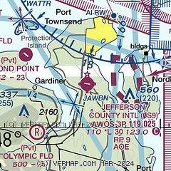
| Sectional chart |
|---|
|
| Airport distance calculator |
|---|
|
|
| Sunrise and sunset |
|---|
|
Times for 27-Apr-2026
| | Local
(UTC-7) | | Zulu
(UTC) |
|---|
| Morning civil twilight | | 05:26 | | 12:26 |
| Sunrise | | 06:00 | | 13:00 |
| Sunset | | 20:17 | | 03:17 |
| Evening civil twilight | | 20:52 | | 03:52 |
|
| Current date and time |
|---|
| Zulu (UTC) | 27-Apr-2026 21:51:22 |
|---|
| Local (UTC-7) | 27-Apr-2026 14:51:22 |
|---|
|
| METAR |
|---|
| K0S9 | 272135Z AUTO 09005KT 10SM BKN023 OVC028 13/09 A3001 RMK AO2
|
KNRA
11nm NE | 272125Z AUTO VRB05KT 10SM OVC030 13/08 A3003 RMK AO2 T01280078 TSNO
|
KOKH
13nm NE | 272133Z AUTO 11006KT 10SM BKN020 BKN028 OVC034 13/08 A3003 RMK AO2
|
KNUW
19nm N | 272053Z 14010KT 10SM SCT014 SCT019 BKN034 13/09 A3003 RMK AO2 RAB10E19 SLP171 P0000 60000 T01280089 50004 $
|
|
| TAF |
|---|
KNUW
19nm N | 271500Z 2715/2815 16008KT 9999 BKN025 OVC040 QNH2986INS TEMPO 2715/2720 VRB06KT 8000 BR BKN010 OVC025 FM272000 20012KT 9999 BKN050 QNH2990INS FM280700 18009KT 9999 MIFG BKN035 QNH2992INS TEMPO 2809/2815 VRB06KT 8000 BR BKN020 TX13/2723Z TN05/2813Z FS30028
|
KPAE
23nm E | 271739Z 2718/2818 16011KT 4SM BR OVC015 TEMPO 2718/2720 OVC006 FM272100 21009KT P6SM BKN040 FM280100 18006KT P6SM BKN050 FM280900 16008KT P6SM SCT015 OVC027 FM281600 17007KT P6SM SCT012 OVC018
|
|
| NOTAMs |
|---|
NOTAMs are issued by the DoD/FAA and will open in a separate window not controlled by AirNav.
|
|

