FAA INFORMATION EFFECTIVE 09 JULY 2026
Location
| FAA Identifier: | JYO |
| Lat/Long: | 39-04-40.7000N 077-33-27.0000W
39-04.678333N 077-33.450000W
39.0779722,-77.5575000
(estimated) |
| Elevation: | 389.5 ft. / 118.7 m (surveyed) |
| Variation: | 10W (1995) |
| From city: | 3 miles S of LEESBURG, VA |
| Time zone: | UTC -4 (UTC -5 during Standard Time) |
| Zip code: | 20175 |
Airport Operations
| Airport use: | Open to the public |
| Activation date: | 10/1964 |
| Control tower: | yes |
| ARTCC: | WASHINGTON CENTER |
| FSS: | LEESBURG FLIGHT SERVICE STATION |
| NOTAMs facility: | JYO (NOTAM-D service available) |
| Attendance: | 0600-2100 |
| Pattern altitude: | 1199.5 ft. MSL |
| Wind indicator: | yes |
| Segmented circle: | yes |
| Lights: | WHEN ATCT CLSD ACTVT ODALS RWY 17; REIL RWY 17 & 35; PAPI RWY 17 & 35; HIRL RWY 17/35 - CTAF. |
| Beacon: | white-green (lighted land airport)
Operates sunset to sunrise. |
| International operations: | customs landing rights airport
US CUST AVBL MON-SUN 0600-2100. CALL COMMAND CNTR
703-661-2800 FOR APNTMT. 24 HR NOTICE RQRD. |
Airport Communications
| CTAF: | 127.5 |
| UNICOM: | 122.975 |
| WX AWOS-3: | 125.225 (703-777-3781) |
| LEESBURG TOWER GROUND: | 120.5 [1300-2300Z++] |
| LEESBURG TOWER TOWER: | 127.5 [1300-2300Z++] |
| POTOMAC APPROACH: | 125.05 |
| POTOMAC DEPARTURE: | 125.05 |
| CLEARANCE DELIVERY: | 118.55 ;WHEN JYO TWR CLSD 120.5 |
| CLTCH DP: | 125.05 |
| COATT STAR: | 128.525 |
| GIBBZ STAR: | 120.45 |
| HYPER STAR: | 133.0 |
| JDUBB DP: | 125.05 |
| PTOMC DP: | 125.05 |
| SCRAM DP: | 125.05 |
| TRSTN STAR: | 126.75 |
| WX ASOS at IAD (9 nm SE): | 134.85 (571-250-7817) |
| WX AWOS-3PT at GAI (19 nm E): | 128.275 (301-977-2971) |
- TWR OPNS CURRENTLY SUPPORTED BY MOBILE/REMOTE ATCT SYS.
Nearby radio navigation aids
| VOR radial/distance | | VOR name | | Freq | | Var |
|---|
| AMLr342/9.6 | | ARMEL VOR/DME | | 113.50 | | 08W |
| FDKr211/21.8 | | FREDERICK VOR/DME | | 116.85 | | 08W |
| MRBr151/22.9 | | MARTINSBURG VORTAC | | 112.10 | | 07W |
| DCAr307/27.6 | | WASHINGTON VOR/DME | | 111.00 | | 09W |
| CSNr035/29.9 | | CASANOVA VORTAC | | 116.30 | | 06W |
| LDNr072/33.1 | | LINDEN VORTAC | | 114.30 | | 06W |
| ADWr307/36.1 | | ANDREWS VORTAC | | 113.10 | | 10W |
| EMIr235/36.7 | | WESTMINSTER VORTAC | | 117.90 | | 08W |
| HGRr167/(39.7) | | HAGERSTOWN VOR | | 109.80 | | 07W |
| NDB name | | Hdg/Dist | | Freq | | Var | | ID |
|---|
| GEORGETOWN | | 303/22.1 | | 323 | | 09W | | GTN | --. - -. |
| ELLICOTT | | 262/38.4 | | 371 | | 11W | | FND | ..-. -. -.. |
Airport Services
| Fuel available: | 100LL JET-A |
| Parking: | hangars and tiedowns |
| Airframe service: | MAJOR |
| Powerplant service: | MAJOR |
| Bottled oxygen: | LOW |
| Bulk oxygen: | NONE |
Runway Information
Runway 17/35
| Dimensions: | 5500 x 100 ft. / 1676 x 30 m |
| Surface: | asphalt/grooved, in good condition |
| Weight bearing capacity: | | PCN 63 /F/A/W/U | | Single wheel: | 30.0 | | Double wheel: | 70.0 |
|
| Runway edge lights: | high intensity |
| RUNWAY 17 | | RUNWAY 35 |
| Latitude: | 39-05.107107N | | 39-04.249002N |
| Longitude: | 077-33.636410W | | 077-33.263382W |
| Elevation: | 377.6 ft. | | 387.2 ft. |
| Traffic pattern: | left | | left |
| Runway heading: | 171 magnetic, 161 true | | 351 magnetic, 341 true |
| Markings: | precision, in good condition | | nonprecision, in good condition |
| Visual slope indicator: | 4-light PAPI on left (3.00 degrees glide path) | | 4-light PAPI on left (3.00 degrees glide path) |
| Approach lights: | ODALS: omnidirectional approach lighting system
NSTD ODALS, 3 LGT CONFIGURATION. | | |
| Runway end identifier lights: | yes | | yes |
| Touchdown point: | yes, no lights | | yes, no lights |
| Instrument approach: | ILS/DME | | |
| Obstructions: | 30 ft. tree, 724 ft. from runway, 520 ft. left of centerline, 17:1 slope to clear | | 43 ft. pole, 1325 ft. from runway, 272 ft. right of centerline, 26:1 slope to clear |
Airport Ownership and Management from official FAA records
| Ownership: | Publicly-owned |
| Owner: | TOWN OF LEESBURG
25 WEST MARKET ST., 25 WEST MARKET ST.
LEESBURG, VA 20176
Phone 703-777-2420 |
| Manager: | SCOTT COFFMAN
1001 SYCOLIN ROAD, SE, SUITE 7
LEESBURG, VA 20175
Phone 703-737-7125 |
Additional Remarks
| - | RAMP FENCE S/W SIDE RAMPS LEAD IN LINES ON WEST RAMP NA. |
| - | PSBL THERMAL PLUMES FM PWR PLANT 1.3 NM SSE. |
| - | FOR CD WHEN ATCT CLSD, CTC POTOMAC APCH 118.55 OR 866-709-4993. |
| - | BIRDS & DEER ON & INVOF ARPT. |
| - | HEL ACT ON & INVOF ARPT. |
| - | CALM WIND USE RWY 17. |
Instrument Procedures
NOTE: All procedures below are presented as PDF files. If you need a reader for these files, you should download the free Adobe Reader.NOT FOR NAVIGATION. Please procure official charts for flight.
FAA instrument procedures published for use from 09 July 2026 at 0901Z to 06 August 2026 at 0900Z.
STARs - Standard Terminal Arrivals |
|---|
| GIBBZ SIX (RNAV) **NEW** | |
2 pages:
[1] [2] (562KB) |
| HYPER ONE (RNAV) **NEW** | |
2 pages:
[1] [2] (401KB) |
| HYPER ONE (RNAV), CONT.2 **NEW** | |
download (220KB) |
| PRIVO THREE **CHANGED** | |
2 pages:
[1] [2] (266KB) |
| PRTZL TWO (RNAV) **NEW** | |
2 pages:
[1] [2] (335KB) |
| PRTZL TWO (RNAV), CONT.2 **NEW** | |
download (217KB) |
| TRSTN FOUR (RNAV) **CHANGED** | |
2 pages:
[1] [2] (318KB) |
| WAYNZ TWO (RNAV) **NEW** | |
2 pages:
[1] [2] (427KB) |
IAPs - Instrument Approach Procedures |
|---|
| ILS OR LOC RWY 17 | |
download (387KB) |
| RNAV (GPS) RWY 17 **CHANGED** | |
download (262KB) |
| NOTE: Special Alternate Minimums apply | |
download (166KB) |
Departure Procedures |
|---|
| CLTCH THREE (RNAV) | |
download (185KB) |
| JDUBB FOUR (RNAV) | |
download (188KB) |
| PTOMC TWO (RNAV) | |
download (201KB) |
| SCRAM SIX (RNAV) | |
download (176KB) |
| NOTE: Special Take-Off Minimums/Departure Procedures apply | |
download (366KB) |
Other nearby airports with instrument procedures:
KIAD - Washington Dulles International Airport (9 nm SE)
9VA5 - Bluegrass Heliport (16 nm W)
KGAI - Montgomery County Airpark (19 nm E)
W50 - Davis Airport (21 nm NE)
KHEF - Washington Manassas Airport/Harry P Davis Field (22 nm S)
|
|

Road maps at:
MapQuest
Bing
Google
| Aerial photo |
|---|
WARNING: Photo may not be current or correct
 Photographer: Leo Schefer
Pilot: Charles Schefer
Photo taken 20-Sep-2009
Do you have a better or more recent aerial photo of Leesburg Executive Airport that you would like to share? If so, please send us your photo.
|
| Sectional chart |
|---|
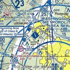
|
CAUTION: Diagram may not be current
 Download PDF
of official airport diagram from the FAA
| Airport distance calculator |
|---|
|
|
| Sunrise and sunset |
|---|
|
Times for 27-Jul-2026
| | Local
(UTC-4) | | Zulu
(UTC) |
|---|
| Morning civil twilight | | 05:37 | | 09:37 |
| Sunrise | | 06:07 | | 10:07 |
| Sunset | | 20:26 | | 00:26 |
| Evening civil twilight | | 20:56 | | 00:56 |
|
| Current date and time |
|---|
| Zulu (UTC) | 27-Jul-2026 04:21:15 |
|---|
| Local (UTC-4) | 27-Jul-2026 00:21:15 |
|---|
|
| METAR |
|---|
| KJYO | 270355Z AUTO 24004KT 10SM BKN070 OVC080 21/21 A2988 RMK AO2 LTG DSNT S
|
KIAD
10nm SE | 270352Z 18005KT 10SM SCT060 OVC085 24/21 A2986 RMK AO2 SLP110 T02390206 $
|
KGAI
19nm E | 270356Z AUTO 17003KT 10SM BKN060 OVC080 24/21 A2989 RMK AO2 SLP129 T02390206 403000172
|
|
| TAF |
|---|
KIAD
10nm SE | 270155Z 2702/2806 16004KT P6SM FEW050 SCT080 SCT250 TEMPO 2702/2703 30020G35KT 2SM TSRA OVC040CB FM270900 00000KT 5SM BR FEW190 FM271200 00000KT P6SM SCT210 FM271500 33003KT P6SM SCT210 FM271800 23004KT P6SM SCT080 PROB30 2718/2722 4SM -TSRA BKN050CB FM272200 16003KT P6SM SCT130
|
|
| NOTAMs |
|---|
NOTAMs are issued by the DoD/FAA and will open in a separate window not controlled by AirNav.
|
|


