FAA INFORMATION EFFECTIVE 09 JULY 2026
Location
| FAA Identifier: | MRB |
| Lat/Long: | 39-24-08.4880N 077-58-58.8000W
39-24.141467N 077-58.980000W
39.4023578,-77.9830000
(estimated) |
| Elevation: | 564.8 ft. / 172.2 m (surveyed) |
| Variation: | 08W (1980) |
| From city: | 4 miles S of MARTINSBURG, WV |
| Time zone: | UTC -4 (UTC -5 during Standard Time) |
| Zip code: | 25401 |
Airport Operations
| Airport use: | Open to the public |
| Activation date: | 06/1938 |
| Control tower: | yes |
| ARTCC: | WASHINGTON CENTER |
| FSS: | LEESBURG FLIGHT SERVICE STATION |
| NOTAMs facility: | MRB (NOTAM-D service available) |
| Attendance: | 0700-1900 |
| Pattern altitude: | TPA: RECTANGULAR 1600 FT MSL (1035 FT AGL) LGT AND ROTARY WING ACFT; 2100 FT MSL (1535 FT AGL) FOR HVY ACFT; OVERHEAD 2100 FT MSL (1535 FT AGL). |
| Wind indicator: | lighted |
| Segmented circle: | yes |
| Lights: | WHEN ATCT CLSD, ACTVT MALSR RWY 26; REIL RWY 08; PAPI RWY 08 & 26; HIRL RWY 08/26 - CTAF. |
| Beacon: | white-green (lighted land airport)
Operates sunset to sunrise. |
| Landing fee: | yes, LDG FEE FOR ACFT GTR THAN 5000 LBS GWT (MIL, FED, STATE, BASED ACFT EXEMPT). |
Airport Communications
| CTAF: | 124.3 |
| UNICOM: | 122.95 |
| WX ASOS: | 119.925 (304-264-0988) |
| MARTINSBURG GROUND: | 121.8 257.65 [1200-0400Z++; OT BY NOTAM] |
| MARTINSBURG TOWER: | 124.3 233.7 [1200-0400Z++; OT BY NOTAM] |
| POTOMAC APPROACH: | 126.825 |
| POTOMAC DEPARTURE: | 126.825 |
| CLEARANCE DELIVERY: | 132.075 ;WHEN MRB TWR CLSD 121.8 257.65 |
| ANG COMD POST: | 297.9 |
| ANG OPS: | 297.9 |
| CLTCH DP: | 126.825 |
| EMERG: | 121.5 243.0 |
| HYPER STAR: | 133.0 |
| JDUBB DP: | 126.825 |
| SCRAM DP: | 126.825 |
| TRSTN STAR: | 126.75 |
| WX AWOS-3 at OKV (17 nm SW): | 124.85 (540-662-6970) |
Nearby radio navigation aids
| VOR radial/distance | | VOR name | | Freq | | Var |
|---|
| MRBr286/6.3 | | MARTINSBURG VORTAC | | 112.10 | | 07W |
| HGRr205/(18.7) | | HAGERSTOWN VOR | | 109.80 | | 07W |
| FDKr277/28.2 | | FREDERICK VOR/DME | | 116.85 | | 08W |
| LDNr023/34.5 | | LINDEN VORTAC | | 114.30 | | 06W |
| AMLr327/36.9 | | ARMEL VOR/DME | | 113.50 | | 08W |
Airport Services
| Fuel available: | 100LL JET-A JET-A++
100LL:FULL SVC 0700-1900, AFTER HRS CALL 304-262-2507. 24/7 SELF SVC.
A:FULL SVC 0700-1900, AFTER HRS CALL 304-262-2507.
A++:FULL SVC 0700-1900, AFTER HRS CALL 304-262-2507. |
| Parking: | hangars and tiedowns |
| Airframe service: | MAJOR |
| Powerplant service: | MAJOR |
| Bottled oxygen: | HIGH |
| Bulk oxygen: | NONE |
Runway Information
Runway 8/26
| Dimensions: | 8815 x 150 ft. / 2687 x 46 m |
| Surface: | asphalt/concrete/grooved, in good condition
RWY 26 FIRST 590 FT CONC, MIDDLE 7125 FT ASPH, LAST 1100 FT CONC. |
| Weight bearing capacity: | | PCN 56 /R/B/W/T | | Single wheel: | 120.0, SEE GEN RMK FOR ADDNL WT BRGS. | | Double wheel: | 195.0 | | Double tandem: | 339.0 | | Dual double tandem: | 830.0 |
|
| Runway edge lights: | high intensity |
| RUNWAY 8 | | RUNWAY 26 |
| Latitude: | 39-23.900832N | | 39-24.381985N |
| Longitude: | 077-59.862837W | | 077-58.097053W |
| Elevation: | 564.8 ft. | | 549.6 ft. |
| Traffic pattern: | left | | left |
| Runway heading: | 079 magnetic, 071 true | | 259 magnetic, 251 true |
| Displaced threshold: | no | | 1000 ft. |
| Declared distances: | TORA:8815 TODA:8815 ASDA:8215 LDA:8215 | | TORA:8815 TODA:8815 ASDA:8815 LDA:7815 |
| Markings: | precision, in good condition | | precision, in good condition |
| Visual slope indicator: | 4-light PAPI on left (3.00 degrees glide path) | | 4-light PAPI on left (3.00 degrees glide path) |
| Approach lights: | | | MALSR: 1,400 foot medium intensity approach lighting system with runway alignment indicator lights |
| Runway end identifier lights: | yes | | |
| Touchdown point: | yes, no lights | | yes, no lights |
| Instrument approach: | | | ILS |
| Obstructions: | none | | 64 ft. tree, 768 ft. from runway, 230 ft. left of centerline, 8:1 slope to clear
APCH RATIO 34:1 AT DTHR. |
Airport Ownership and Management from official FAA records
| Ownership: | Publicly-owned |
| Owner: | EASTERN WVA REG ARPT AUTH
170 AVIATION WAY RM 105
MARTINSBURG, WV 25405
Phone 304-263-2106 |
| Manager: | WILLIAM E. WALKUP
170 AVIATION WAY, STE 105
MARTINSBURG, WV 25405
Phone 304-263-2106 |
Additional Remarks
| - | TWY B CLSD FM FUEL FARM S. |
| - | MILITARY: ANG: ALL MIL ACFT MUST CTC PIKESIDE (297.9) 20 MIN PRIOR TO LDG AND PRIOR TO ENGINE START. DSN 242-5205, C 304-616-5205. FLT PLANS MAY BE FILED BY EFB OR OTHER FLIGHT PLAN FILING SOFTWARE. SEND TO 167.AW.AIRFIELD.MANAGEMENT@US.AF.MIL. |
| - | ADDNL RWY 08/26 WT BRGS: 2S-175; 2D/D1-568; 2T-585; C5-840. |
| - | TWY D CLSD PAST PVT HGR 1750 FT S OF TWY E. |
| - | FOR CD WHEN ATCT CLSD, CTC POTOMAC APCH ON 132.075 OR IF UNA 866-709-4993. |
| - | FAA ARFF INDEX D/NFPA CAT 8; INDEX E/CAT 10 EQUIP AVBL. |
| - | MILITARY: CAUTION: BASH PHASE II IN EFCT FM 1 OCT TO 30 APR. |
| - | RWY 26 MIL ASSAULT LDG ZONE & PIR MKGS. |
| - | MILITARY: ANG: QUIET HRS 0400-1200Z++MON-FRI, 2100-1300Z++SAT-SUN. |
| - | NO GRASS LANDINGS. |
| - | MILITARY: CSTMS/AG/IMG: CSTMS NOT AVBL, NOT A PORT OF ENTRY. |
| - | MILITARY: MISC: ALL TRAN AIRCREWS SHALL STORE ALL CLASSIFIED MATERIALS UP TO SECRET WITH WG COMD POST. |
| - | DEER & BIRDS ON & INVOF ARPT. |
Instrument Procedures
NOTE: All procedures below are presented as PDF files. If you need a reader for these files, you should download the free Adobe Reader.NOT FOR NAVIGATION. Please procure official charts for flight.
FAA instrument procedures published for use from 09 July 2026 at 0901Z to 06 August 2026 at 0900Z.
STARs - Standard Terminal Arrivals |
|---|
| HYPER ONE (RNAV) **NEW** | |
2 pages:
[1] [2] (401KB) |
| HYPER ONE (RNAV), CONT.2 **NEW** | |
download (220KB) |
| PRIVO THREE **CHANGED** | |
2 pages:
[1] [2] (266KB) |
| PRTZL TWO (RNAV) **NEW** | |
2 pages:
[1] [2] (335KB) |
| PRTZL TWO (RNAV), CONT.2 **NEW** | |
download (217KB) |
| TRSTN FOUR (RNAV) **CHANGED** | |
2 pages:
[1] [2] (318KB) |
| WAYNZ TWO (RNAV) **NEW** | |
2 pages:
[1] [2] (427KB) |
IAPs - Instrument Approach Procedures |
|---|
| ILS OR LOC RWY 26 | |
download (271KB) |
| RNAV (GPS) RWY 08 | |
download (241KB) |
| RNAV (GPS) RWY 26 | |
download (295KB) |
| VOR-A | |
download (229KB) |
| NOTE: Special Alternate Minimums apply | |
download (147KB) |
Departure Procedures |
|---|
| CLTCH THREE (RNAV) | |
download (213KB) |
| JDUBB FOUR (RNAV) | |
download (216KB) |
| SCRAM SIX (RNAV) | |
download (207KB) |
| TRIXY FIVE | |
download (201KB) |
| NOTE: Special Take-Off Minimums/Departure Procedures apply | |
download (428KB) |
Other nearby airports with instrument procedures:
KOKV - Winchester Regional Airport (17 nm SW)
W35 - Potomac Airpark (19 nm NW)
9VA5 - Bluegrass Heliport (21 nm S)
KHGR - Hagerstown Regional Airport-Richard A Henson Field (22 nm NE)
KJYO - Leesburg Executive Airport (28 nm SE)
|
|

Road maps at:
MapQuest
Bing
Google
| Aerial photo |
|---|
WARNING: Photo may not be current or correct
 Photo by Andrew Stover - Jet A Aviation Photography
Photo taken 21-Aug-2020
looking west from 2000
Photo by Andrew Stover - Jet A Aviation Photography
Photo taken 21-Aug-2020
looking west from 2000
Do you have a better or more recent aerial photo of Eastern WV Regional Airport/Shepherd Field that you would like to share? If so, please send us your photo.
|
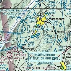
| Sectional chart |
|---|
|
CAUTION: Diagram may not be current

| Airport distance calculator |
|---|
|
|
| Sunrise and sunset |
|---|
|
Times for 12-Jul-2026
| | Local
(UTC-4) | | Zulu
(UTC) |
|---|
| Morning civil twilight | | 05:25 | | 09:25 |
| Sunrise | | 05:56 | | 09:56 |
| Sunset | | 20:39 | | 00:39 |
| Evening civil twilight | | 21:10 | | 01:10 |
|
| Current date and time |
|---|
| Zulu (UTC) | 12-Jul-2026 05:08:10 |
|---|
| Local (UTC-4) | 12-Jul-2026 01:08:10 |
|---|
|
| METAR |
|---|
| KMRB | 120453Z AUTO 01005KT 10SM SCT090 OVC110 23/21 A3005 RMK AO2 SLP169 T02280206 403060189
|
KOKV
18nm SW | 120455Z AUTO 00000KT 10SM SCT110 22/18 A3005 RMK AO2
|
|
| TAF |
|---|
| KMRB | 120054Z 1201/1224 36007KT 6SM -SHRA SCT040 BKN250 PROB30 1201/1202 4SM -TSRA OVC030CB FM120200 05003KT P6SM BKN050 FM120800 02003KT 6SM BR OVC020 FM121300 08005KT P6SM BKN020 FM121600 10005KT P6SM OVC050 FM122300 13005KT P6SM OVC100
|
|
| NOTAMs |
|---|
NOTAMs are issued by the DoD/FAA and will open in a separate window not controlled by AirNav.
|
|


