FAA INFORMATION EFFECTIVE 09 JULY 2026
Location
| FAA Identifier: | 3JC |
| Lat/Long: | 39-02-36.0000N 096-50-35.8000W
39-02.600000N 096-50.596667W
39.0433333,-96.8432778
(estimated) |
| Elevation: | 1101.6 ft. / 335.8 m (surveyed) |
| Variation: | 05E (2000) |
| From city: | 1 mile NW of JUNCTION CITY, KS |
| Time zone: | UTC -5 (UTC -6 during Standard Time) |
| Zip code: | 66441 |
Airport Operations
| Airport use: | Open to the public |
| Activation date: | 09/1949 |
| Control tower: | no |
| ARTCC: | KANSAS CITY CENTER |
| FSS: | WICHITA FLIGHT SERVICE STATION |
| NOTAMs facility: | ICT (NOTAM-D service available) |
| Attendance: | 0800-1700 |
| Wind indicator: | lighted |
| Segmented circle: | yes |
| Lights: | ACTVT PAPI RWY 36; MIRL RWY 18/36 - CTAF. |
| Beacon: | white-green (lighted land airport)
Operates sunset to sunrise. |
Airport Communications
| CTAF/UNICOM: | 122.8 |
| MARSHALL AAF GCA APPROACH: | 121.25 |
| MARSHALL AAF GCA DEPARTURE: | 121.25 |
| WX ASOS at MHK (10 nm NE): | 119.075 (785-537-1035) |
- APCH/DEP CTL SVC PRVDD BY KANSAS CITY ARTCC (ZKC) ON FREQS 127.35/257.975 (MANHATTAN RCAG) WHEN MARSHALL APCH CTL (FRI) CLSD.
Nearby radio navigation aids
| VOR radial/distance | | VOR name | | Freq | | Var |
|---|
| FRIr005/(4.5) | | FORT RILEY VOR | | 109.40 | | 06E |
| MHKr229/10.2 | | MANHATTAN VOR/DME | | 110.20 | | 04E |
| SLNr072/37.0 | | SALINA VORTAC | | 117.10 | | 07E |
| NDB name | | Hdg/Dist | | Freq | | Var | | ID |
|---|
| HERINGTON | | 350/21.1 | | 407 | | 06E | | HRU | .... .-. ..- |
Airport Services
| Fuel available: | 100LL JET-A |
| Parking: | hangars and tiedowns |
| Airframe service: | MAJOR |
| Powerplant service: | MAJOR |
| Bottled oxygen: | NONE |
| Bulk oxygen: | NONE |
Runway Information
Runway 18/36
| Dimensions: | 3498 x 75 ft. / 1066 x 23 m |
| Surface: | asphalt, in fair condition |
| Weight bearing capacity: | | PCN 5 /F/C/Y/U | | Single wheel: | 10.0 |
|
| Runway edge lights: | medium intensity |
| RUNWAY 18 | | RUNWAY 36 |
| Latitude: | 39-02.947262N | | 39-02.387353N |
| Longitude: | 096-50.584798W | | 096-50.759207W |
| Elevation: | 1086.2 ft. | | 1101.6 ft. |
| Traffic pattern: | left | | left |
| Runway heading: | 189 magnetic, 194 true | | 009 magnetic, 014 true |
| Markings: | basic, in fair condition | | nonprecision, in fair condition |
| Visual slope indicator: | 2-light PAPI on left (3.00 degrees glide path) | | 2-light PAPI on left (3.50 degrees glide path) |
| Touchdown point: | yes, no lights | | yes, no lights |
| Obstructions: | 25 ft. tree, lighted, 245 ft. from runway, 235 ft. right of centerline, 1:1 slope to clear
10 FT BRUSH ALONG FENCE, 0-199 FT DSTC, 240 R. | | 60 ft. trees, lighted, 777 ft. from runway, 215 ft. left of centerline, 9:1 slope to clear |
Runway 13/31
| Dimensions: | 1903 x 140 ft. / 580 x 43 m |
| Surface: | turf, in fair condition |
| Runway edge markings: | THLD MKD W/TIRES & BLUE & WHITE BARRELS. |
| RUNWAY 13 | | RUNWAY 31 |
| Latitude: | 39-02.625572N | | 39-02.385430N |
| Longitude: | 096-50.650458W | | 096-50.392147W |
| Elevation: | 1093.5 ft. | | 1094.1 ft. |
| Traffic pattern: | left | | left |
| Runway heading: | 135 magnetic, 140 true | | 315 magnetic, 320 true |
| Touchdown point: | yes, no lights | | yes, no lights |
| Obstructions: | 40 ft. trees, 328 ft. from runway, 70 ft. left of centerline, 8:1 slope to clear
75 FT LIGHT POLES, 900 FT TO THLD, 280 FT R OF CL. | | 75 ft. trees, 1530 ft. from runway, 20:1 slope to clear |
Runway 5/23
| Dimensions: | 1834 x 200 ft. / 559 x 61 m |
| Surface: | turf, in fair condition |
| Runway edge markings: | THLD MKD W/BLUE & WHITE PLASTIC BARRELS. |
| RUNWAY 5 | | RUNWAY 23 |
| Latitude: | 39-02.483915N | | 39-02.651422N |
| Longitude: | 096-50.692425W | | 096-50.370093W |
| Elevation: | 1097.4 ft. | | 1088.1 ft. |
| Traffic pattern: | left | | left |
| Runway heading: | 052 magnetic, 057 true | | 232 magnetic, 237 true |
| Touchdown point: | yes, no lights | | yes, no lights |
| Obstructions: | 25 ft. tree, 80 ft. from runway, 115 ft. right of centerline, 3:1 slope to clear | | 32 ft. pole, 231 ft. from runway, 130 ft. right of centerline, 7:1 slope to clear |
Airport Ownership and Management from official FAA records
| Ownership: | Publicly-owned |
| Owner: | CITY OF JUNCTION CITY
700 N JEFFERSON, P O BOX 2897
JUNCTION CITY, KS 66441
Phone 785-238-3103 |
| Manager: | MARVIN HORNBOSTEL
RAVEN AREO SERVICES, 540 W 18 THS ST
JUNCTION CITY, KS 66441
Phone 785-761-7692
FBO PHONE 785-761-7692 |
Additional Remarks
| - | TURF SOFT WHEN WET. |
| - | RWY 5/23 AND RWY 13/31 THLDS MKD WITH SVRL 12-INCH DIA RAISED STEEL PLATES AS RWY NMBRS ON CL - UNSUITABLE TO TAXI OVER. |
| - | NON-STD ATC MINIMA APPLIED IFR ARVLS WITH RESPECT TO HI-PERFORMANCE-ACFT OPNS CONDUCTED WITHIN CFNS OF R-3602. |
| - | WATERFOWL ON & INVOF ARPT. |
| - | FOR CD CTC MARSHALL APCH AT 785-239-2118. WHEN MARSHALL APCH IS CLSD, CTC KANSAS CITY ARTCC AT 913-254-8508. |
| - | COLD TEMPERATURE AIRPORT. ALTITUDE CORRECTION REQUIRED AT OR BELOW -22C. |
| - | BASEBALL FIELD LGT POLES 918 FT TO 1303 FT FM RWY END, 338 FT TO 672 FT RIGHT, 1175 FT AMSL. |
| - | RWY 13 THLD, 4 FT GRADE CHANGE BETWEEN 13 THLD & RWY 18/36. NOT SUITABLE FOR ACFT. MKD W/TIRES. |
Instrument Procedures
NOTE: All procedures below are presented as PDF files. If you need a reader for these files, you should download the free Adobe Reader.NOT FOR NAVIGATION. Please procure official charts for flight.
FAA instrument procedures published for use from 09 July 2026 at 0901Z to 06 August 2026 at 0900Z.
IAPs - Instrument Approach Procedures |
|---|
| RNAV (GPS) RWY 36 | |
download (196KB) |
| NOTE: Special Take-Off Minimums/Departure Procedures apply | |
download (358KB) |
Other nearby airports with instrument procedures:
KFRI - Marshall Army Airfield (4 nm E)
KMHK - Manhattan Regional Airport (10 nm NE)
K78 - Abilene Municipal Airport (20 nm SW)
KHRU - Herington Regional Airport (21 nm S)
KCYW - Clay Center Municipal Airport (25 nm NW)
|
|

Road maps at:
MapQuest
Bing
Google
| Aerial photo |
|---|
WARNING: Photo may not be current or correct
 Photo by Lewis Thomas
Photo taken 01-Apr-2007
Photo by Lewis Thomas
Photo taken 01-Apr-2007
Do you have a better or more recent aerial photo of Freeman Field Airport that you would like to share? If so, please send us your photo.
|
| Sectional chart |
|---|
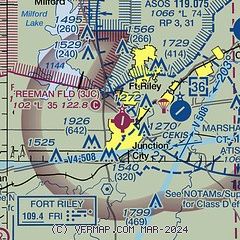
|
| Airport distance calculator |
|---|
|
|
| Sunrise and sunset |
|---|
|
Times for 28-Jul-2026
| | Local
(UTC-5) | | Zulu
(UTC) |
|---|
| Morning civil twilight | | 05:55 | | 10:55 |
| Sunrise | | 06:25 | | 11:25 |
| Sunset | | 20:42 | | 01:42 |
| Evening civil twilight | | 21:12 | | 02:12 |
|
| Current date and time |
|---|
| Zulu (UTC) | 28-Jul-2026 22:46:05 |
|---|
| Local (UTC-5) | 28-Jul-2026 17:46:05 |
|---|
|
| METAR |
|---|
KFRI
4nm E | 282155Z AUTO 06009KT 10SM CLR 33/25 A2986 RMK AO2 SLP097 T03320251 $
|
KMHK
9nm NE | 282152Z AUTO 08006KT 10SM CLR 32/25 A2988 RMK AO2 SLP105 T03170250
|
|
| TAF |
|---|
KFRI
4nm E | 282000Z 2820/3002 VRB05KT 9999 SCT150 QNH2983INS BECMG 2907/2908 11005KT 8000 -SHRA VCTS SCT060 BKN100 QNH2987INS TEMPO 2908/2914 VRB12G20KT 6000 -TSRA BKN060 BKN100CB BECMG 2914/2915 13010G15KT 9999 NSW BKN100 BKN180 QNH2985INS TX34/2821Z TN24/2912Z
|
KMHK
9nm NE | 281720Z 2818/2918 09006KT P6SM BKN140 PROB30 2908/2912 4SM -TSRA OVC025CB
|
|
| NOTAMs |
|---|
NOTAMs are issued by the DoD/FAA and will open in a separate window not controlled by AirNav.
|
|

