FAA INFORMATION EFFECTIVE 09 JULY 2026
Location
| FAA Identifier: | F34 |
| Lat/Long: | 36-51-35.9590N 120-27-52.0830W
36-51.599317N 120-27.868050W
36.8599886,-120.4644675
(estimated) |
| Elevation: | 157.2 ft. / 47.9 m (surveyed) |
| Variation: | 16E (1980) |
| From city: | 1 mile W of FIREBAUGH, CA |
| Time zone: | UTC -7 (UTC -8 during Standard Time) |
| Zip code: | 93622 |
Airport Operations
| Airport use: | Open to the public |
| Activation date: | 11/1973 |
| Control tower: | no |
| ARTCC: | OAKLAND CENTER |
| FSS: | RANCHO MURIETA FLIGHT SERVICE STATION |
| NOTAMs facility: | RIU (NOTAM-D service available) |
| Attendance: | UNATNDD |
| Pattern altitude: | 1007.2 ft. MSL |
| Wind indicator: | lighted |
| Segmented circle: | yes |
| Lights: | ACTVT MIRL RY 12/30 AND VASI RY 30 - CTAF. |
| Beacon: | white-green (lighted land airport)
Operates sunset to sunrise. |
Airport Communications
| CTAF: | 122.9 |
| NORCAL APPROACH: | 120.95 |
| NORCAL DEPARTURE: | 120.95 |
| WX ASOS at MAE (19 nm NE): | 134.725 (559-674-1781) |
- COMMUNICATIONS PRVDD BY FRESNO RADIO ON FREQ 122.1R (PANOCHE RCO).
Nearby radio navigation aids
| VOR radial/distance | | VOR name | | Freq | | Var |
|---|
| PXNr044/17.4 | | PANOCHE VORTAC | | 112.60 | | 16E |
| HYPr173/21.8 | | EL NIDO VOR/DME | | 113.85 | | 15E |
Airport Services
| Parking: | tiedowns |
| Airframe service: | NONE |
| Powerplant service: | NONE |
| Bottled oxygen: | NONE |
| Bulk oxygen: | NONE |
Runway Information
Runway 12/30
| Dimensions: | 3102 x 60 ft. / 945 x 18 m |
| Surface: | asphalt, in good condition |
| Weight bearing capacity: | |
| Runway edge lights: | medium intensity |
| RUNWAY 12 | | RUNWAY 30 |
| Latitude: | 36-51.794000N | | 36-51.404617N |
| Longitude: | 120-28.074217W | | 120-27.661917W |
| Elevation: | 156.9 ft. | | 157.0 ft. |
| Traffic pattern: | right | | left |
| Runway heading: | 124 magnetic, 140 true | | 304 magnetic, 320 true |
| Markings: | basic, in fair condition | | basic, in fair condition |
| Visual slope indicator: | | | 2-box VASI on left (3.00 degrees glide path) |
| Runway end identifier lights: | no | | no |
| Touchdown point: | yes, no lights | | yes, no lights |
| Obstructions: | 10 ft. road, 400 ft. from runway, 20:1 slope to clear
RWY 12 +2' BERM, 6' FENCE & 5' DITCH 80'-140' FM RWY END 125'L TO 125'R. | | 15 ft. road, 700 ft. from runway, 33:1 slope to clear |
Airport Ownership and Management from official FAA records
| Ownership: | Publicly-owned |
| Owner: | CITY OF FIREBAUGH
1133 P STREET
FIREBAUGH, CA 93622
Phone 559-659-2043 |
| Manager: | BEN GALLEGOS
1133 P STREET
FIREBAUGH, CA 93622
Phone 559-659-2043
CITY MGR. MAINTENANCE CONTACT PUBLIC WORKS, BEN GALLEGOS 559-659-2043 |
Additional Remarks
| - | FOR CD CTC NORCAL APCH AT 916-361-6874. |
| - | RWY SAFETY AREA 140 FT BYD RWY 30 END. |
Instrument Procedures
NOTE: All procedures below are presented as PDF files. If you need a reader for these files, you should download the free Adobe Reader.NOT FOR NAVIGATION. Please procure official charts for flight.
FAA instrument procedures published for use from 09 July 2026 at 0901Z to 06 August 2026 at 0900Z.
IAPs - Instrument Approach Procedures |
|---|
| RNAV (GPS)-B | |
download (150KB) |
| NOTE: Special Take-Off Minimums/Departure Procedures apply | |
download (128KB) |
Other nearby airports with instrument procedures:
KMAE - Madera Municipal Airport (19 nm NE)
KLSN - Los Banos Municipal Airport (23 nm NW)
KMCE - Merced Yosemite Regional Airport (26 nm N)
KMER - Castle Airport (32 nm N)
KFCH - Fresno Chandler Executive Airport (32 nm E)
|
|

Road maps at:
MapQuest
Bing
Google
| Aerial photo |
|---|
WARNING: Photo may not be current or correct
 Photo courtesy of David Sievert - Airphoto Designs
Photo taken 08-Oct-2006
Photo courtesy of David Sievert - Airphoto Designs
Photo taken 08-Oct-2006
Do you have a better or more recent aerial photo of Firebaugh Airport that you would like to share? If so, please send us your photo.
|
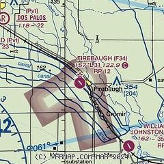
| Sectional chart |
|---|
|
| Airport distance calculator |
|---|
|
|
| Sunrise and sunset |
|---|
|
Times for 31-Jul-2026
| | Local
(UTC-7) | | Zulu
(UTC) |
|---|
| Morning civil twilight | | 05:39 | | 12:39 |
| Sunrise | | 06:08 | | 13:08 |
| Sunset | | 20:09 | | 03:09 |
| Evening civil twilight | | 20:38 | | 03:38 |
|
| Current date and time |
|---|
| Zulu (UTC) | 01-Aug-2026 03:03:59 |
|---|
| Local (UTC-7) | 31-Jul-2026 20:03:59 |
|---|
|
| METAR |
|---|
KMAE
18nm NE | 010255Z AUTO 34007KT 10SM CLR 32/11 A2989 RMK AO2 SLP118 T03220106 55003 $
|
KMCE
25nm N | 010253Z AUTO 34007KT 10SM CLR 33/11 A2988 RMK AO2 SLP116 T03280106 55002
|
KMER
32nm N | 010155Z 36010KT 10SM CLR
|
KFCH
32nm E | 010255Z AUTO 30007KT 10SM CLR 36/04 A2989 RMK A01
|
KFAT
36nm E | 010253Z 31008KT 10SM CLR 37/03 A2988 RMK AO2 SLP114 T03670033 55002
|
|
| TAF |
|---|
KMCE
25nm N | 311720Z 3118/0118 32009KT P6SM SKC FM010600 VRB04KT P6SM SKC
|
|
| NOTAMs |
|---|
NOTAMs are issued by the DoD/FAA and will open in a separate window not controlled by AirNav.
|
|

