FAA INFORMATION EFFECTIVE 16 APRIL 2026
Location
| FAA Identifier: | IPJ |
| Lat/Long: | 35-28-59.3100N 081-09-41.4200W
35-28.988500N 081-09.690333W
35.4831417,-81.1615056
(estimated) |
| Elevation: | 877.9 ft. / 267.6 m (surveyed) |
| Variation: | 06W (1995) |
| From city: | 5 miles E of LINCOLNTON, NC |
| Time zone: | UTC -4 (UTC -5 during Standard Time) |
| Zip code: | 28092 |
Airport Operations
| Airport use: | Open to the public |
| Activation date: | 07/1986 |
| Control tower: | no |
| ARTCC: | ATLANTA CENTER |
| FSS: | RALEIGH FLIGHT SERVICE STATION |
| NOTAMs facility: | IPJ (NOTAM-D service available) |
| Attendance: | APR-OCT 0800-1900, NOV-MAR 0800-1700
UNATNDD THANKSGIVING AND CHRISTMAS DAY. |
| Wind indicator: | lighted |
| Segmented circle: | yes |
| Lights: | TO ACTVT REIL RWY 05 & 23 DUSK-DAWN - CTAF; TO ACTVT PAPI RWY 05 & 23 - CTAF. MIRL RWY 05/23 DUSK TO 2200 PRESET LOW INTST; TO INCR INTST DUSK TO 2200 AND TO ACTVT MIRL RWY 05/23 BETWEEN 2200-DAWN - CTAF. |
| Beacon: | white-green (lighted land airport)
Operates sunset to sunrise. |
Airport Communications
| CTAF/UNICOM: | 123.05 |
| WX AWOS-3: | 119.675 (704-735-6954) |
| CHARLOTTE APPROACH: | 134.75 |
| CHARLOTTE DEPARTURE: | 134.75 |
| CLEARANCE DELIVERY: | 124.9 |
| BARMY DP: | 134.75 |
| BEAVY DP: | 134.75 |
| BOBZY DP: | 134.75 |
| ESTRR DP: | 134.75 |
| ICONS DP: | 134.75 |
| JOJJO DP: | 134.75 |
| JOOLS STAR: | 135.6 |
| KERMIT DP: | 134.75 |
| KILNS DP: | 134.75 |
| KNIGHTS DP: | 134.75 |
| KWEEN DP: | 134.75 |
| LILLS DP: | 134.75 |
| RASLN STAR: | 126.15 |
| WEAZL DP: | 134.75 |
| WX ASOS at AKH (17 nm S): | 135.725 (704-868-9034) |
| WX ASOS at HKY (19 nm NW): | 118.325 (828-322-2996) |
| WX ASOS at CLT (19 nm SE): | PHONE 704-255-5973 |
| WX AWOS-3 at SVH (20 nm NE): | 119.225 (704-873-1978) |
Nearby radio navigation aids
| VOR radial/distance | | VOR name | | Freq | | Var |
|---|
| CLTr335/20.4 | | CHARLOTTE VOR/DME | | 115.00 | | 05W |
| BZMr177/23.5 | | BARRETTS MOUNTAIN VOR/DME | | 113.75 | | 06W |
| NDB name | | Hdg/Dist | | Freq | | Var | | ID |
|---|
| STONIA | | 005/17.5 | | 260 | | 06W | | GHJ | --. .... .--- |
| FIRST RIVER | | 063/25.5 | | 417 | | 06W | | SLP | ... .-.. .--. |
| FIDDLERS | | 126/28.4 | | 391 | | 07W | | FIQ | ..-. .. --.- |
Airport Services
| Fuel available: | 100LL JET-A1+ |
| Parking: | tiedowns |
| Airframe service: | MAJOR |
| Powerplant service: | MAJOR |
| Bottled oxygen: | LOW |
| Bulk oxygen: | LOW |
Runway Information
Runway 5/23
| Dimensions: | 5700 x 100 ft. / 1737 x 30 m
200 FT SWY SW END HAS BEEN REMARKED AS 200 FT DSPLCD THR FOR RWY 5. |
| Surface: | asphalt, in excellent condition |
| Weight bearing capacity: | | Single wheel: | 30.0 | | Double wheel: | 60.0 |
|
| Runway edge lights: | medium intensity |
| RUNWAY 5 | | RUNWAY 23 |
| Latitude: | 35-28.669000N | | 35-29.307900N |
| Longitude: | 081-10.111483W | | 081-09.269143W |
| Elevation: | 877.9 ft. | | 863.1 ft. |
| Traffic pattern: | left | | left |
| Runway heading: | 053 magnetic, 047 true | | 233 magnetic, 227 true |
| Displaced threshold: | 200 ft. | | 199 ft. |
| Markings: | precision, in good condition | | precision, in good condition |
| Visual slope indicator: | 2-light PAPI on left (3.40 degrees glide path) | | 2-light PAPI on left (3.00 degrees glide path) |
| Runway end identifier lights: | yes | | yes |
| Touchdown point: | yes, no lights | | yes, no lights |
| Instrument approach: | | | ILS/DME |
| Obstructions: | 110 ft. trees, 2468 ft. from runway, 386 ft. left of centerline, 20:1 slope to clear
APCH SLOPE 18:1 AT DSPLCD THR. | | 30 ft. trees, 1327 ft. from runway, 449 ft. left of centerline, 37:1 slope to clear
DUE TO 11 FT BRUSH 104 FT FR RWY END OFFSET 10-173 FT RIGHT OF CNTRLN; DUE TO 13 FT BRUSH 31-115 FT FR RWY END OFFSET 143-164 FT LEFT OF CNTRLN. |
Airport Ownership and Management from official FAA records
| Ownership: | Publicly-owned |
| Owner: | LINCOLN COUNTY
714 JACK DELLINGER DRIVE
IRON STATION, NC 28080
Phone 704-735-6002 |
| Manager: | SCOTT MAHLER
714 JACK DELLINGER DRIVE
IRON STATION, NC 28080
Phone 704-764-1100 |
Additional Remarks
| - | RWY 23 HAS A 90 FT DROP-OFF 100 FT FM PVMT END AND 90 FT DROP-OFF FIRST 200 FT 160 FT BOTH SIDES OF CNTRLN. |
| - | FOR CD IF UNA VIA GCO CTC CHARLOTTE APCH AT 704-359-0241. |
| - | GCO AVBL ON FREQ 124.900 THRU CHARLOTTE APCH; KEY MIKE 4 TIMES SLOWLY, WAIT FOR DIAL TONE AND RING. |
| - | ARPT PHONE NR 704-735-0602. |
| - | DEER, COYOTE & BIRDS ON & INVOF ARPT. |
Instrument Procedures
NOTE: All procedures below are presented as PDF files. If you need a reader for these files, you should download the free Adobe Reader.NOT FOR NAVIGATION. Please procure official charts for flight.
FAA instrument procedures published for use from 16 April 2026 at 0901Z to 14 May 2026 at 0900Z.
STARs - Standard Terminal Arrivals |
|---|
| JOOLS ONE (RNAV) | |
download (272KB) |
| LIINN THREE | |
2 pages:
[1] [2] (281KB) |
| MAJIC FOUR | |
download (234KB) |
| RASLN THREE | |
download (177KB) |
IAPs - Instrument Approach Procedures |
|---|
| ILS Y OR LOC Y RWY 23 | |
download (319KB) |
| ILS Z OR LOC Z RWY 23 | |
download (325KB) |
| RNAV (GPS) RWY 05 | |
download (278KB) |
| RNAV (GPS) RWY 23 | |
download (320KB) |
| NOTE: Special Alternate Minimums apply | |
download (168KB) |
Departure Procedures |
|---|
| BARMY FIVE (RNAV) | |
download (226KB) |
| BEAVY SIX (RNAV) | |
download (210KB) |
| BOBZY FIVE (RNAV) | |
download (228KB) |
| ESTRR FIVE (RNAV) | |
download (196KB) |
| ICONS FIVE (RNAV) | |
download (199KB) |
| JOJJO FIVE (RNAV) | |
download (248KB) |
| KERMIT FOUR | |
2 pages:
[1] [2] (386KB) |
| KILNS FIVE (RNAV) | |
download (203KB) |
| KNIGHTS THREE | |
2 pages:
[1] [2] (383KB) |
| KRITR SIX (RNAV) | |
download (201KB) |
| KWEEN FIVE (RNAV) | |
download (200KB) |
| LILLS THREE (RNAV) | |
download (179KB) |
| WEAZL FIVE (RNAV) | |
download (180KB) |
| NOTE: Special Take-Off Minimums/Departure Procedures apply | |
download (391KB) |
Other nearby airports with instrument procedures:
14A - Lake Norman Airpark (15 nm NE)
KAKH - Gastonia Municipal Airport (17 nm S)
KHKY - Hickory Regional Airport (19 nm NW)
KCLT - Charlotte/Douglas International Airport (19 nm SE)
KSVH - Statesville Regional Airport (20 nm NE)
|
|

Road maps at:
MapQuest
Bing
Google
| Aerial photo |
|---|
WARNING: Photo may not be current or correct
 Photo by Race City Flight Operations
Photo taken 21-May-2019
looking northeast.
Photo by Race City Flight Operations
Photo taken 21-May-2019
looking northeast.
Do you have a better or more recent aerial photo of Lincoln County Regional Airport that you would like to share? If so, please send us your photo.
|
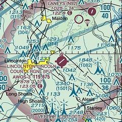
| Sectional chart |
|---|
|
| Airport distance calculator |
|---|
|
|
| Sunrise and sunset |
|---|
|
Times for 17-Apr-2026
| | Local
(UTC-4) | | Zulu
(UTC) |
|---|
| Morning civil twilight | | 06:24 | | 10:24 |
| Sunrise | | 06:51 | | 10:51 |
| Sunset | | 19:58 | | 23:58 |
| Evening civil twilight | | 20:24 | | 00:24 |
|
| Current date and time |
|---|
| Zulu (UTC) | 18-Apr-2026 03:38:52 |
|---|
| Local (UTC-4) | 17-Apr-2026 23:38:52 |
|---|
|
| METAR |
|---|
| KIPJ | 180315Z AUTO 00000KT 10SM CLR 16/14 A2998 RMK AO2 T01580138
|
KAKH
17nm S | 180254Z AUTO 00000KT 10SM CLR 18/12 A2997 RMK AO2 SLP142 T01780122 53005
|
KCLT
19nm SE | 180252Z 18003KT 10SM FEW250 23/12 A2997 RMK AO2 SLP154 T02280117 53004
|
KSVH
19nm NE | 180315Z AUTO 00000KT 10SM CLR 18/12 A2999 RMK AO2 T01750120
|
KHKY
19nm NW | 180253Z AUTO 00000KT 10SM CLR 21/10 A2998 RMK AO2 SLP131 T02060100 53005 PWINO $
|
|
| TAF |
|---|
KCLT
19nm SE | 172153Z 1722/1824 25006KT P6SM SCT070 SCT250 FM180000 00000KT P6SM SCT250 FM181400 20007KT P6SM FEW060 FM181900 22010G18KT P6SM SCT060
|
KHKY
19nm NW | 171730Z 1718/1818 VRB04KT P6SM SCT060 FM180000 00000KT P6SM SCT250 FM181600 21007KT P6SM SCT060
|
|
| NOTAMs |
|---|
NOTAMs are issued by the DoD/FAA and will open in a separate window not controlled by AirNav.
|
|

