FAA INFORMATION EFFECTIVE 16 APRIL 2026
Location
| FAA Identifier: | FLV |
| Lat/Long: | 39-22-03.2720N 094-54-51.6230W
39-22.054533N 094-54.860383W
39.3675756,-94.9143397
(estimated) |
| Elevation: | 771 ft. / 235.0 m (surveyed) |
| Variation: | 04E (2000) |
| From city: | 3 miles N of FORT LEAVENWORTH, KS |
| Time zone: | UTC -5 (UTC -6 during Standard Time) |
| Zip code: | 66027 |
Airport Operations
| Airport use: | Open to the public |
| Activation date: | 05/1941 |
| Control tower: | no |
| ARTCC: | KANSAS CITY CENTER |
| FSS: | WICHITA FLIGHT SERVICE STATION |
| NOTAMs facility: | ICT (NOTAM-D service available) |
| Attendance: | M-F 0730-1630 (MIL), ALL 0900-1800 (GA)
LIMITED SCV OT AND FED HOL. RSTD-MILITARY RAMP 24 HOUR PPR, CALL DSN 552-6041/39/41 OR C913-684-6041/39/41. |
| Pattern altitude: | 1469 ft. MSL
TPA: ROTARY WING 698 FT AGL, TURBINE FIXED WING ACFT 1028 FT AGL. |
| Wind indicator: | yes |
| Segmented circle: | no |
| Lights: | ACTVT PAPI RWYS 16 & 34; HIRL RWY 16/34; & TWY LGTS - CTAF. |
| Beacon: | white-white-green (lighted military airport)
Operates sunset to sunrise. |
Airport Communications
| CTAF: | 126.2 |
| KANSAS CITY APPROACH: | 124.7 |
| KANSAS CITY DEPARTURE: | 124.7 |
| BRAYMER STAR: | 120.95 |
| JHAWK STAR: | 120.95 |
| TYGER STAR: | 120.95 |
| WX ASOS at MCI (10 nm SE): | PHONE 816-601-1486 |
| WX AWOS-3PT at K59 (17 nm NW): | 123.675 (913-367-1449) |
Nearby radio navigation aids
| VOR radial/distance | | VOR name | | Freq | | Var |
|---|
| MCIr296/9.6 | | KANSAS CITY VORTAC | | 113.25 | | 05E |
| TOPr060/32.6 | | TOPEKA VORTAC | | 117.80 | | 05E |
| STJr171/35.6 | | ST JOSEPH VORTAC | | 115.50 | | 08E |
| ANXr287/40.0 | | NAPOLEON VORTAC | | 115.15 | | 07E |
| NDB name | | Hdg/Dist | | Freq | | Var | | ID |
|---|
| AMAZON | | 177/31.0 | | 233 | | 04E | | AZN | .- --.. -. |
Airport Services
| Fuel available: | 100LL JET-A JET-A1+
100LL:MIL FUEL JET A ONLY AVBL 1330-2230Z. 24 HR PPR. SVC OTR TIMES FOR CODE 4 & ABV. |
| Parking: | hangars and tiedowns |
| Airframe service: | NONE |
| Powerplant service: | NONE |
| Bottled oxygen: | NONE |
| Bulk oxygen: | NONE |
Runway Information
Runway 16/34
| Dimensions: | 5318 x 102 ft. / 1621 x 31 m |
| Surface: | asphalt/concrete/grooved, in good condition |
| Weight bearing capacity: | |
| Runway edge lights: | high intensity |
| RUNWAY 16 | | RUNWAY 34 |
| Latitude: | 39-22.464550N | | 39-21.644517N |
| Longitude: | 094-55.058967W | | 094-54.661800W |
| Elevation: | 770.6 ft. | | 766.3 ft. |
| Traffic pattern: | left | | right |
| Runway heading: | 155 magnetic, 159 true | | 335 magnetic, 339 true |
| Declared distances: | TORA:5518 TODA:5518 ASDA:5518 LDA:5318 | | TORA:5518 TODA:5518 ASDA:5913 LDA:5518 |
| Markings: | nonprecision, in good condition | | nonprecision, in good condition |
| Visual slope indicator: | 4-light PAPI on left (3.00 degrees glide path) | | 4-light PAPI on left (3.00 degrees glide path) |
| Touchdown point: | yes, no lights | | yes, no lights |
| Obstructions: | 19 ft. berm, 780 ft. from runway, 30:1 slope to clear | | 7 ft. road, 273 ft. from runway, 256 ft. right of centerline, 10:1 slope to clear |
Airport Ownership and Management from official FAA records
| Ownership: | U.S. Army
U.S. ARMY AIRFIELD/CIVILIAN RAMP LEASED TO CITY. |
| Owner: | U S ARMY, ARMY AVIATION DIV
DIR OF PLANS, TRNG & OPS, 290 GRANT AVE., UNIT 3
FT LEAVENWORTH, KS 66027-1254
Phone 913-684-6040
FAX: 913-684-6043. |
| Manager: | AIRFIELD OPS
1000 CHIEF JOSEPH LOOP
FT. LEAVENWORTH, KS 66027-1254
Phone 913-684-6040
ALT: 913-684-6039; FAX: 913-684-6040; FOR GENERAL AVIATION CONTACT CITY OF LEAVENWORTH AIRPORT OFFICE, PHONE 913-651-0111, FAX: 913-682-1592. |
Additional Remarks
| - | RSTD: NO HAZARDOUS CARGO PAD. |
| - | RSTD: MILITARY RAMP 24 HOUR PPR, CALL DSN 552-6041 OR C913-684-6041. |
| - | +19 FT LGTD LEVEE 780 FT FROM AER 16, OB (PVT ROAD ON TOP OF +9 FT LEVEE). |
| - | FOR CD CTC KANSAS CITY APCH AT 816-329-2710. |
| - | WILDLIFE ON & INVOF RY. |
| - | GA RAMP ATTENDED 1500-0000Z++, CALL 913-651-0111. FUEL AVBL 1500-0200Z++ AND AFT HRS BY REQ. JOINT USE AIRFIELD, FBO ATTENDED MON-FRI 1500-0000Z++; |
| - | POTENTIAL BIRD HAZARD ON & NEAR RY EARLY MORNING & EVENING. |
| - | NUMEROUS MIGRATORY BIRDS ON & INVOF ARPT OCT-APR. |
| - | MISC: BASE OPS 0730-1630L MON-FRI, EXC HOL; OT CODE 4 AND ABV BY PPR. AIRFIELD CONDITIONS UNMONITORED AND UNREPORTED OUTSIDE OF POSTED OPERATING HOURS. NO TRAN ALERT, LAVATORY SVC OR DE-ICE CAPABILITY. ALL ACFT WITH CODE 4 VIP OR ABV CTC SHERMAN BASE OPS (126.2) AT LEAST 20 MIN PRIOR TO LDG. |
| - | MISC: CIV ACFT ON NON-GOVT BUS USE CITY OF LEAVENWORTH RAMP C913-651-0111 ON S END OF FLD OPR 0900-1800L. |
| - | CALM WIND USE RY 16. |
Instrument Procedures
NOTE: All procedures below are presented as PDF files. If you need a reader for these files, you should download the free Adobe Reader.NOT FOR NAVIGATION. Please procure official charts for flight.
FAA instrument procedures published for use from 16 April 2026 at 0901Z to 14 May 2026 at 0900Z.
STARs - Standard Terminal Arrivals |
|---|
| BRAYMER EIGHT | |
2 pages:
[1] [2] (346KB) |
| JHAWK EIGHT | |
download (222KB) |
| TYGER SEVEN | |
2 pages:
[1] [2] (292KB) |
IAPs - Instrument Approach Procedures |
|---|
| RNAV (GPS) RWY 16 | |
download (206KB) |
| RNAV (GPS) RWY 34 | |
download (202KB) |
| VOR-A | |
download (170KB) |
Departure Procedures |
|---|
| CHIEF NINE | |
download (181KB) |
| LAKES FIVE | |
download (236KB) |
| RACER EIGHT | |
download (223KB) |
| ROYAL TWO | |
download (203KB) |
| TIFTO EIGHT | |
download (157KB) |
| WILDCAT SIX | |
download (201KB) |
| NOTE: Special Take-Off Minimums/Departure Procedures apply | |
download (147KB) |
Other nearby airports with instrument procedures:
KMCI - Kansas City International Airport (10 nm SE)
KMKC - Kansas City Downtown Airport-Wheeler Field (21 nm SE)
KSTJ - Rosecrans Memorial Airport (24 nm N)
KLWC - Lawrence Regional Airport (26 nm SW)
KGPH - Midwest National Air Center Airport (28 nm E)
|
|

Road maps at:
MapQuest
Bing
Google
| Aerial photo |
|---|
WARNING: Photo may not be current or correct
 Photo taken 24-Sep-2017
looking north.
Photo taken 24-Sep-2017
looking north.
Do you have a better or more recent aerial photo of Sherman Army Airfield that you would like to share? If so, please send us your photo.
|
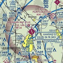
| Sectional chart |
|---|
|
| Airport distance calculator |
|---|
|
|
| Sunrise and sunset |
|---|
|
Times for 30-Apr-2026
| | Local
(UTC-5) | | Zulu
(UTC) |
|---|
| Morning civil twilight | | 05:54 | | 10:54 |
| Sunrise | | 06:23 | | 11:23 |
| Sunset | | 20:11 | | 01:11 |
| Evening civil twilight | | 20:40 | | 01:40 |
|
| Current date and time |
|---|
| Zulu (UTC) | 30-Apr-2026 07:48:27 |
|---|
| Local (UTC-5) | 30-Apr-2026 02:48:27 |
|---|
|
| METAR |
|---|
KMCI
9nm SE | 300653Z 20006KT 10SM FEW100 07/03 A3008 RMK AO2 SLP187 T00720028
|
|
| TAF |
|---|
KMCI
9nm SE | 300520Z 3006/0106 VRB04KT P6SM FEW250 FM301400 25010KT P6SM BKN070 FM302100 33009KT P6SM OVC050 PROB30 3022/3024 5SM -TSRA OVC050CB FM010100 02006KT P6SM BKN050
|
|
| NOTAMs |
|---|
NOTAMs are issued by the DoD/FAA and will open in a separate window not controlled by AirNav.
|
|

