FAA INFORMATION EFFECTIVE 14 MAY 2026
Location
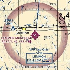
| FAA Identifier: | LEM |
| Lat/Long: | 45-55-06.1699N 102-06-19.9312W
45-55.102832N 102-06.332187W
45.9183805,-102.1055364
(estimated) |
| Elevation: | 2572.8 ft. / 784.2 m (surveyed) |
| Variation: | 06E (2025) |
| From city: | 3 miles SE of LEMMON, SD |
| Time zone: | UTC -6 (UTC -7 during Standard Time) |
| Zip code: | 57638 |
Airport Operations
| Airport use: | Open to the public |
| Activation date: | 02/1947 |
| Control tower: | no |
| ARTCC: | MINNEAPOLIS CENTER |
| FSS: | HURON FLIGHT SERVICE STATION |
| NOTAMs facility: | HON (NOTAM-D service available) |
| Attendance: | UNATNDD |
| Wind indicator: | lighted |
| Segmented circle: | no |
| Lights: | ACTVT PAPI RWY 12 & 30; MIRL RWY 12/30 - CTAF. |
| Beacon: | white-green (lighted land airport)
Operates sunset to sunrise. |
Airport Communications
- AUTOMATED UNICOM.
- APCH/DEP SVC PRVDD BY MINNEAPOLIS ARTCC ON FREQS 124.25/236.825 (DICKINSON RCAG).
Nearby radio navigation aids
| VOR radial/distance | | VOR name | | Freq | | Var |
|---|
| LEM at field | | LEMMON VOR | | 111.40 | | 06E |
Airport Services
| Fuel available: | 100LL JET-A
100LL:FUEL AVBL 24 HOURS WITH CREDIT CARD.
A:FUEL AVBL 24 HOURS WITH CREDIT CARD. |
| Parking: | hangars and tiedowns |
| Airframe service: | MINOR |
| Powerplant service: | MINOR |
| Bottled oxygen: | NONE |
| Bulk oxygen: | NONE |
Runway Information
Runway 12/30
| Dimensions: | 4499 x 75 ft. / 1371 x 23 m |
| Surface: | asphalt, in excellent condition |
| Weight bearing capacity: | |
| Runway edge lights: | medium intensity |
| RUNWAY 12 | | RUNWAY 30 |
| Latitude: | 45-55.364570N | | 45-54.930562N |
| Longitude: | 102-06.732378W | | 102-05.873462W |
| Elevation: | 2567.9 ft. | | 2570.1 ft. |
| Traffic pattern: | left | | left |
| Runway heading: | 120 magnetic, 126 true | | 300 magnetic, 306 true |
| Markings: | nonprecision, in good condition | | nonprecision, in good condition |
| Visual slope indicator: | 2-light PAPI on left (3.00 degrees glide path) | | 2-light PAPI on left (3.00 degrees glide path) |
| Runway end identifier lights: | no | | no |
| Touchdown point: | yes, no lights | | yes, no lights |
| Obstructions: | 13 ft. road, 600 ft. from runway, 30:1 slope to clear | | none |
Runway 6/24
| Dimensions: | 3277 x 120 ft. / 999 x 37 m |
| Surface: | turf, in good condition |
| Runway edge markings: | RWY 06/24 MKD WITH BLACK AND WHITE MKR CONES. |
| RUNWAY 6 | | RUNWAY 24 |
| Latitude: | 45-54.915410N | | 45-55.167423N |
| Longitude: | 102-06.713818W | | 102-06.030912W |
| Elevation: | 2564.9 ft. | | 2570.0 ft. |
| Traffic pattern: | left | | left |
| Runway heading: | 056 magnetic, 062 true | | 236 magnetic, 242 true |
| Touchdown point: | yes, no lights | | yes, no lights |
Airport Ownership and Management from official FAA records
| Ownership: | Publicly-owned |
| Owner: | CITY OF LEMMON
303 1ST AVE WEST
LEMMON, SD 57638
Phone 605-374-5681 |
| Manager: | MIKE GINTHER
10216 AIRPORT RD
LEMMON, SD 57638
Phone 605-848-0577 |
Additional Remarks
| - | WILDLIFE ON AND INVOF ARPT. |
| - | FOR CD CTC MINNEAPOLIS ARTCC AT 651-463-5588. |
Instrument Procedures
NOTE: All procedures below are presented as PDF files. If you need a reader for these files, you should download the free Adobe Reader.NOT FOR NAVIGATION. Please procure official charts for flight.
FAA instrument procedures published for use from 14 May 2026 at 0901Z to 11 June 2026 at 0900Z.
IAPs - Instrument Approach Procedures |
|---|
| RNAV (GPS) RWY 30 **CHANGED** | |
download (195KB) |
| NOTE: Special Take-Off Minimums/Departure Procedures apply | |
download (404KB) |
Other nearby airports with instrument procedures:
KHEI - Hettinger/JB Lindquist Regional Airport (24 nm W)
3P3 - Mott Municipal Airport (28 nm N)
KBWW - Bowman Regional Airport (52 nm W)
D57 - Glen Ullin Regional Airport (55 nm N)
KDIK - Dickinson/Theodore Roosevelt Regional Airport (60 nm NW)
|
|

Road maps at:
MapQuest
Bing
Google
| Aerial photo |
|---|
WARNING: Photo may not be current or correct
 Photo by Steve Hamilton
Photo taken 26-Aug-2011
looking south.
Photo by Steve Hamilton
Photo taken 26-Aug-2011
looking south.
Do you have a better or more recent aerial photo of Lemmon Municipal Airport that you would like to share? If so, please send us your photo.
|
| Sectional chart |
|---|
|
| Airport distance calculator |
|---|
|
|
| Sunrise and sunset |
|---|
|
Times for 28-May-2026
| | Local
(UTC-6) | | Zulu
(UTC) |
|---|
| Morning civil twilight | | 04:28 | | 10:28 |
| Sunrise | | 05:05 | | 11:05 |
| Sunset | | 20:26 | | 02:26 |
| Evening civil twilight | | 21:03 | | 03:03 |
|
| Current date and time |
|---|
| Zulu (UTC) | 28-May-2026 18:33:43 |
|---|
| Local (UTC-6) | 28-May-2026 12:33:43 |
|---|
|
| NOTAMs |
|---|
NOTAMs are issued by the DoD/FAA and will open in a separate window not controlled by AirNav.
|
|

