FAA INFORMATION EFFECTIVE 19 MARCH 2026
Location
| FAA Identifier: | TOR |
| Lat/Long: | 42-03-51.9170N 104-09-09.6460W
42-03.865283N 104-09.160767W
42.0644214,-104.1526794
(estimated) |
| Elevation: | 4206.9 ft. / 1282.3 m (surveyed) |
| Variation: | 07E (2025) |
| From city: | 2 miles E of TORRINGTON, WY |
| Time zone: | UTC -6 (UTC -7 during Standard Time) |
| Zip code: | 82240 |
Airport Operations
| Airport use: | Open to the public |
| Control tower: | no |
| ARTCC: | DENVER CENTER |
| FSS: | CASPER FLIGHT SERVICE STATION |
| NOTAMs facility: | TOR (NOTAM-D service available) |
| Attendance: | 0800-1700
EXC NTL HOLS. |
| Wind indicator: | lighted |
| Segmented circle: | yes |
| Lights: | ACTVT REIL RWY 28; PAPI RWY 10 & 28; MIRL RWY 10/28 - CTAF. |
| Beacon: | white-green (lighted land airport)
Operates sunset to sunrise. |
Airport Communications
| CTAF/UNICOM: | 122.8 |
| WX ASOS: | 118.375 (307-532-8958) |
- APCH/DEP CTL SVC PRVDD BY DENVER ARTCC (ZDV) ON FREQS 127.95/338.2 (CRAWFORD RCAG).
Nearby radio navigation aids
| VOR radial/distance | | VOR name | | Freq | | Var |
|---|
| BFFr276/31.6 | | SCOTTSBLUFF VORTAC | | 112.60 | | 13E |
Airport Services
| Fuel available: | 100LL JET-A+
100LL:FOR FUEL AFT HRS CALL 307-338-8835. |
| Parking: | hangars and tiedowns |
| Airframe service: | MAJOR |
| Powerplant service: | NONE |
| Bottled oxygen: | NONE |
| Bulk oxygen: | NONE |
Runway Information
Runway 10/28
| Dimensions: | 5703 x 75 ft. / 1738 x 23 m |
| Surface: | asphalt, in good condition |
| Weight bearing capacity: | | PCN 9 /F/B/X/T | | Single wheel: | 33.0 | | Double wheel: | 45.0 |
|
| Runway edge lights: | medium intensity |
| RUNWAY 10 | | RUNWAY 28 |
| Latitude: | 42-04.029638N | | 42-03.626320N |
| Longitude: | 104-09.838282W | | 104-08.700570W |
| Elevation: | 4204.8 ft. | | 4196.5 ft. |
| Traffic pattern: | left | | left |
| Runway heading: | 108 magnetic, 115 true | | 288 magnetic, 295 true |
| Markings: | nonprecision, in good condition | | nonprecision, in good condition |
| Visual slope indicator: | 2-light PAPI on left (3.00 degrees glide path) | | 2-light PAPI on left (3.00 degrees glide path) |
| Runway end identifier lights: | no | | yes
REIL OTS INDEFLY. |
| Touchdown point: | yes, no lights | | yes, no lights |
| Obstructions: | none | | 13 ft. hill, 666 ft. from runway, 53 ft. right of centerline, 35:1 slope to clear |
Runway 2/20
| Dimensions: | 3401 x 60 ft. / 1037 x 18 m |
| Surface: | asphalt, in good condition |
| RUNWAY 2 | | RUNWAY 20 |
| Latitude: | 42-03.681815N | | 42-04.173765N |
| Longitude: | 104-09.157912W | | 104-08.799287W |
| Elevation: | 4197.5 ft. | | 4194.7 ft. |
| Traffic pattern: | right | | left |
| Runway heading: | 022 magnetic, 029 true | | 202 magnetic, 209 true |
| Markings: | basic, in good condition | | basic, in good condition |
| Touchdown point: | yes, no lights | | yes, no lights |
Airport Ownership and Management from official FAA records
| Ownership: | Publicly-owned |
| Owner: | CITY OF TORRINGTON
PO BOX 250
TORRINGTON, WY 82240
Phone 307-532-5666 |
| Manager: | MIKE RICHEY
2000 E 20TH AVE.
TORRINGTON, WY 82240
Phone 307-532-8551 |
Additional Remarks
| - | DEER & WATERFOWL ON & INVOF ARPT. |
| - | FOR CD CTC DENVER ARTCC AT 303-651-4257. |
Instrument Procedures
NOTE: All procedures below are presented as PDF files. If you need a reader for these files, you should download the free Adobe Reader.NOT FOR NAVIGATION. Please procure official charts for flight.
FAA instrument procedures published for use from 19 March 2026 at 0901Z to 16 April 2026 at 0900Z.
IAPs - Instrument Approach Procedures |
|---|
| RNAV (GPS) RWY 10 | |
download (203KB) |
| RNAV (GPS) RWY 28 | |
download (201KB) |
| NDB RWY 10 | |
download (177KB) |
| NDB RWY 28 | |
download (182KB) |
| NOTE: Special Alternate Minimums apply | |
download (211KB) |
| NOTE: Special Take-Off Minimums/Departure Procedures apply | |
download (560KB) |
Other nearby airports with instrument procedures:
KBFF - Scottsbluff (Western Nebraska Regional Airport) William B Heilig Field (27 nm SE)
KGUR - Camp Guernsey Airport (28 nm NW)
KEAN - Phifer Airfield (35 nm W)
82V - Pine Bluffs Municipal Airport (55 nm S)
KIBM - Kimball Municipal Airport/Robert E Arraj Field (57 nm S)
|
|

Road maps at:
MapQuest
Bing
Google
| Aerial photo |
|---|
WARNING: Photo may not be current or correct
 Photo by Gary Gerhard
Do you have a better or more recent aerial photo of Torrington Municipal Airport that you would like to share? If so, please send us your photo.
|
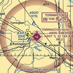
| Sectional chart |
|---|
|
| Airport distance calculator |
|---|
|
|
| Sunrise and sunset |
|---|
|
Times for 13-Apr-2026
| | Local
(UTC-6) | | Zulu
(UTC) |
|---|
| Morning civil twilight | | 05:51 | | 11:51 |
| Sunrise | | 06:20 | | 12:20 |
| Sunset | | 19:34 | | 01:34 |
| Evening civil twilight | | 20:03 | | 02:03 |
|
| Current date and time |
|---|
| Zulu (UTC) | 13-Apr-2026 12:55:17 |
|---|
| Local (UTC-6) | 13-Apr-2026 06:55:17 |
|---|
|
| METAR |
|---|
| KTOR | 131153Z AUTO 30007KT 10SM CLR 09/M07 A2979 RMK AO2 SLP054 T00941067 10156 20072 51018 $
|
|
| TAF |
|---|
KBFF
28nm SE | 131120Z 1312/1412 28011KT P6SM SCT150 FM131500 27022G32KT P6SM FEW150 FM132300 30017G25KT P6SM SCT150 FM140200 VRB06KT P6SM OVC150
|
|
| NOTAMs |
|---|
NOTAMs are issued by the DoD/FAA and will open in a separate window not controlled by AirNav.
|
|

