FAA INFORMATION EFFECTIVE 16 APRIL 2026
Location
| FAA Identifier: | MDH |
| Lat/Long: | 37-46-41.1000N 089-15-07.3000W
37-46.685000N 089-15.121667W
37.7780833,-89.2520278
(estimated) |
| Elevation: | 411.2 ft. / 125.3 m (surveyed) |
| Variation: | 01W (2010) |
| From city: | 3 miles NW of central business district of the associated city |
| Time zone: | UTC -5 (UTC -6 during Standard Time) |
| Zip code: | 62966 |
Airport Operations
| Airport use: | Open to the public |
| Activation date: | 09/1950 |
| Control tower: | yes |
| ARTCC: | KANSAS CITY CENTER |
| FSS: | SAINT LOUIS FLIGHT SERVICE STATION |
| NOTAMs facility: | MDH (NOTAM-D service available) |
| Attendance: | CONTINUOUS |
| Wind indicator: | lighted |
| Segmented circle: | yes |
| Lights: | ACTVT MALSR RWY 18L; VASI RWY 06; PAPI RWY 24 & 36R; MIRL RWY 06/24; HIRL RWY 18L/36R - CTAF. WHEN ATCT CLSD HIRL RWY 18L/36R PRESET MED INTST; INCREASE INTST - CTAF. WHEN ATCT CLSD 18R/36L LTG BY REQUEST ONLY - CALL 618-534-3662. |
| Beacon: | white-green (lighted land airport)
Operates sunset to sunrise. |
| Fire and rescue: | ARFF index A |
| Airline operations: | CLSD TO SKED ACR OPS GTR THAN 9 PSGR SEATS. UNSKED ACR OPS GTR THAN 30 PSGR SEATS RQR 24 HR PPR - CALL AMGR MON-FRI. |
Airport Communications
| CTAF: | 125.35 |
| UNICOM: | 122.95 |
| ATIS: | 119.725 |
| WX ASOS: | PHONE 618-529-1821 |
| SOUTHERN GROUND: | 121.8 [0700-2100] |
| SOUTHERN TOWER: | 125.35 322.4 126.25 [0700-2100] |
| WX AWOS-3P at MWA (12 nm E): | 119.675 (618-942-8877) |
- APCH/DEP SVC PRVDD BY KANSAS CITY ARTCC ON FREQS 127.475/346.275 (MARION RCAG).
Nearby radio navigation aids
| VOR radial/distance | | VOR name | | Freq | | Var |
|---|
| ENLr183/38.8 | | CENTRALIA VORTAC | | 115.00 | | 04E |
| NDB name | | Hdg/Dist | | Freq | | Var | | ID |
|---|
| CABBI | | 184/5.5 | | 388 | | 01W | | MD | -- -.. |
| JONNY | | 254/13.8 | | 382 | | 01E | | MW | -- .-- |
Airport Services
| Fuel available: | 100LL JET-A |
| Parking: | hangars and tiedowns |
| Airframe service: | MAJOR |
| Powerplant service: | MAJOR |
| Bottled oxygen: | NONE |
| Bulk oxygen: | NONE |
Runway Information
Runway 18L/36R
| Dimensions: | 6506 x 100 ft. / 1983 x 30 m |
| Surface: | asphalt/grooved, in excellent condition |
| Runway edge lights: | high intensity |
| RUNWAY 18L | | RUNWAY 36R |
| Latitude: | 37-47.314420N | | 37-46.242712N |
| Longitude: | 089-14.876038W | | 089-14.904883W |
| Elevation: | 404.1 ft. | | 397.2 ft. |
| Traffic pattern: | left | | left |
| Runway heading: | 182 magnetic, 181 true | | 002 magnetic, 001 true |
| Declared distances: | TORA:6506 TODA:6506 ASDA:6506 LDA:6506 | | TORA:6506 TODA:6506 ASDA:6506 LDA:6506 |
| Markings: | precision, in good condition | | nonprecision, in good condition |
| Visual slope indicator: | | | 4-light PAPI on left (3.00 degrees glide path) |
| Approach lights: | MALSR: 1,400 foot medium intensity approach lighting system with runway alignment indicator lights | | |
| Runway end identifier lights: | | | yes |
| Touchdown point: | yes, no lights | | yes, no lights |
| Instrument approach: | ILS | | |
Runway 6/24
| Dimensions: | 4163 x 100 ft. / 1269 x 30 m |
| Surface: | asphalt/porous friction courses, in fair condition |
| Weight bearing capacity: | | Single wheel: | 86.0, RSTRD TO ACFT 12500 LBS OR LESS UNLESS PPR WITH ATCT. | | Double wheel: | 110.0 | | Double tandem: | 167.0 |
|
| Runway edge lights: | medium intensity |
| Operational restrictions: | RWY 06/24 NOT AVBL FOR PART 121/PART 380 OPS WITH SKED PAX CARRYING OPS MORE THAN 9 PAX SEATS AND NON-SKED PAX CARRYING OPS MORE THAN 30 PAX SEATS. |
| RUNWAY 6 | | RUNWAY 24 |
| Latitude: | 37-46.531425N | | 37-46.867433N |
| Longitude: | 089-15.528102W | | 089-14.774630W |
| Elevation: | 410.9 ft. | | 405.0 ft. |
| Traffic pattern: | left | | left |
| Runway heading: | 062 magnetic, 061 true | | 242 magnetic, 241 true |
| Declared distances: | TORA:4163 TODA:4163 ASDA:4163 LDA:4163 | | TORA:4163 TODA:4163 ASDA:4163 LDA:4163 |
| Markings: | basic, in good condition | | basic, in good condition |
| Visual slope indicator: | 4-box VASI on left (3.50 degrees glide path) | | 4-light PAPI on right (3.50 degrees glide path) |
| Runway end identifier lights: | yes | | yes |
| Touchdown point: | yes, no lights | | yes, no lights |
Runway 18R/36L
| Dimensions: | 3498 x 60 ft. / 1066 x 18 m |
| Surface: | asphalt, in excellent condition |
| Runway edge lights: | medium intensity |
| Operational restrictions: | RWY 18R/36L NOT AVBL FOR PART 121/PART 380 OPS WITH SKED PAX CARRYING OPS MORE THAN 9 PAX SEATS AND NON-SKED PAX CARRYING OPS MORE THAN 30 PAX SEATS. |
| RUNWAY 18R | | RUNWAY 36L |
| Latitude: | 37-46.784187N | | 37-46.207928N |
| Longitude: | 089-15.508673W | | 089-15.524003W |
| Elevation: | 404.8 ft. | | 409.9 ft. |
| Traffic pattern: | left | | left |
| Runway heading: | 182 magnetic, 181 true | | 002 magnetic, 001 true |
| Declared distances: | TORA:3498 TODA:3498 ASDA:3498 LDA:3498 | | TORA:3498 TODA:3498 ASDA:3498 LDA:3498 |
| Markings: | basic, in good condition | | basic, in good condition |
| Visual slope indicator: | pulsating/steady burning VASI on left (3.00 degrees glide path)
UNUSBL BYD 6 DEG RIGHT OF COURSE. PVASI OTS INDEF. | | pulsating/steady burning VASI on left (3.00 degrees glide path) |
| Touchdown point: | yes, no lights | | yes, no lights |
Airport Ownership and Management from official FAA records
| Ownership: | Publicly-owned |
| Owner: | SOUTHERN ILLINOIS ARPT AUTH
PO BOX 1086
CARBONDALE, IL 62903
Phone 618-529-1721 |
| Manager: | ALYSSA CONNELL
P O BOX 1086
CARBONDALE, IL 62903
Phone 618-529-1721 |
Additional Remarks
| A39-18R/36L | PCR VALUE: 40/F/D/X/T |
| A39-06/24 | PCR VALUE: 350/F/D/X/T |
| A39-18L/36R | PCR VALUE: 270/F/D/X/T |
| - | BIRDS ON & INVOF ARPT. |
| - | HIGH STUDENT TRNG ACTVTY. |
| - | RWY 6 & RWY 18R-36L INTERSECT; VERIFY CORRECT COMPASS HDG FOR RWY 6 DEP. |
| A52-36R | 39 FT MKD PLINE 1872 FT FM RWY 192 FT L OF CNTRLN. APCH RATIO 42:1. |
Instrument Procedures
NOTE: All procedures below are presented as PDF files. If you need a reader for these files, you should download the free Adobe Reader.NOT FOR NAVIGATION. Please procure official charts for flight.
FAA instrument procedures published for use from 16 April 2026 at 0901Z to 14 May 2026 at 0900Z.
IAPs - Instrument Approach Procedures |
|---|
| ILS OR LOC RWY 18L | |
download (222KB) |
| RNAV (GPS) RWY 18L | |
download (223KB) |
| RNAV (GPS) RWY 36R | |
download (231KB) |
| NDB RWY 18L | |
download (216KB) |
| NOTE: Special Alternate Minimums apply | |
download (149KB) |
| NOTE: Special Take-Off Minimums/Departure Procedures apply | |
download (201KB) |
Other nearby airports with instrument procedures:
KMWA - Veterans Airport of Southern Illinois (12 nm E)
KPJY - Pinckneyville/Du Quoin Airport (13 nm NW)
H96 - Benton Municipal Airport (20 nm NE)
KPCD - Perryville Regional Airport (29 nm W)
KSAR - Sparta Community Airport-Hunter Field (31 nm NW)
|
|

Road maps at:
MapQuest
Bing
Google
| Aerial photo |
|---|
WARNING: Photo may not be current or correct
 As seen circa 2018
looking east.
As seen circa 2018
looking east.
Do you have a better or more recent aerial photo of Southern Illinois Airport that you would like to share? If so, please send us your photo.
|
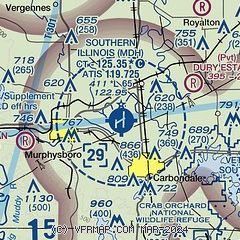
| Sectional chart |
|---|
|
CAUTION: Diagram may not be current
 Download PDF
of official airport diagram from the FAA
| Airport distance calculator |
|---|
|
|
| Sunrise and sunset |
|---|
|
Times for 21-Apr-2026
| | Local
(UTC-5) | | Zulu
(UTC) |
|---|
| Morning civil twilight | | 05:47 | | 10:47 |
| Sunrise | | 06:15 | | 11:15 |
| Sunset | | 19:37 | | 00:37 |
| Evening civil twilight | | 20:04 | | 01:04 |
|
| Current date and time |
|---|
| Zulu (UTC) | 22-Apr-2026 00:45:14 |
|---|
| Local (UTC-5) | 21-Apr-2026 19:45:14 |
|---|
|
| METAR |
|---|
| KMDH | 212352Z 21017G25KT 10SM CLR 23/05 A3004 RMK AO2 PK WND 20027/2257 SLP172 T02330050 10261 20233 56005
|
KMWA
11nm E | 220035Z AUTO 21012G18KT 10SM CLR 22/05 A3007 RMK AO2 T02200046
|
|
| TAF |
|---|
KCGI
36nm SW | 211720Z 2118/2218 22015G25KT P6SM SCT250 FM220000 21010KT P6SM FEW250 FM220600 22006KT P6SM SKC FM221500 23010G15KT P6SM SCT070
|
KMVN
37nm NE | 211720Z 2118/2218 22013KT P6SM SCT250 TEMPO 2118/2122 22015G25KT FM220000 21010KT P6SM FEW250 FM220600 22006KT P6SM FEW250 FM221500 23010G15KT P6SM SCT070 BKN250 TEMPO 2215/2218 BKN070
|
|
| NOTAMs |
|---|
NOTAMs are issued by the DoD/FAA and will open in a separate window not controlled by AirNav.
|
|


