FAA INFORMATION EFFECTIVE 16 APRIL 2026
Location
| FAA Identifier: | N15 |
| Lat/Long: | 39-12-09.5949N 117-04-08.1637W
39-12.159915N 117-04.136062W
39.2026652,-117.0689344
(estimated) |
| Elevation: | 6075 ft. / 1852 m (estimated) |
| Variation: | 15E (2000) |
| From city: | 2 miles E of KINGSTON, NV |
| Time zone: | UTC -7 (UTC -8 during Standard Time) |
| Zip code: | 89310 |
Airport Operations
| Airport use: | Open to the public |
| Activation date: | 11/2002 |
| Control tower: | no |
| ARTCC: | SALT LAKE CITY CENTER |
| FSS: | RENO FLIGHT SERVICE STATION |
| NOTAMs facility: | RNO (NOTAM-D service available) |
| Attendance: | UNATNDD |
| Wind indicator: | yes |
| Segmented circle: | yes |
| Beacon: | white-green-yellow (heliport)
Operates sunset to sunrise. |
Airport Communications
| CTAF: | 122.9 |
| WX AWOS-3PT at TMT (17 nm N): | 132.925 (775-964-1144) |
Airport Services
Runway Information
Helipad H1
| Dimensions: | 30 x 30 ft. / 9 x 9 m |
| Surface: | concrete, in good condition |
| Runway edge lights: | PERI
SS-SR. |
| Runway edge markings: | TLOF MKD BY AMBER REFLECTORS. |
| Latitude: | 39-12.138333N | | |
| Longitude: | 117-04.950000W | | |
| Elevation: | 6086.0 ft. | | |
| Traffic pattern: | left | | left |
| Markings: | basic, in fair condition | | |
| Obstructions: | 20 ft. bldg, lighted, 225 ft. from runway, 28:1 slope to clear | | |
Runway 7/25
| Dimensions: | 3700 x 80 ft. / 1128 x 24 m |
| Surface: | gravel/dirt, in fair condition |
| Runway edge markings: | THLD MKD BY WHITE TIRES. |
| Operational restrictions: | SLOPED; RCMD LND RWY 25 & TKOF RWY 7 IN LIGHT WIND. |
| RUNWAY 7 | | RUNWAY 25 |
| Latitude: | 39-12.145167N | | 39-12.150167N |
| Longitude: | 117-04.709333W | | 117-03.926000W |
| Elevation: | 6075.0 ft. | | 5961.0 ft. |
| Traffic pattern: | left | | left |
| Runway heading: | 075 magnetic, 090 true | | 255 magnetic, 270 true |
| Markings: | NSTD, in fair condition | | NSTD, in fair condition |
| Touchdown point: | yes, no lights | | yes, no lights |
Runway 16/34
| Dimensions: | 3072 x 60 ft. / 936 x 18 m |
| Surface: | gravel/dirt, in fair condition |
| Runway edge markings: | THLD MKD BY WHITE TIRES. |
| RUNWAY 16 | | RUNWAY 34 |
| Latitude: | 39-12.427333N | | 39-11.922000N |
| Longitude: | 117-03.900833W | | 117-03.933833W |
| Elevation: | 5950.0 ft. | | 5950.0 ft. |
| Traffic pattern: | left | | right |
| Runway heading: | 168 magnetic, 183 true | | 348 magnetic, 003 true |
| Markings: | NSTD, in fair condition | | NSTD, in fair condition |
| Touchdown point: | yes, no lights | | yes, no lights |
| Obstructions: | 48 ft. pline, 985 ft. from runway, 20:1 slope to clear | | 48 ft. pline, 920 ft. from runway, 19:1 slope to clear |
Airport Ownership and Management from official FAA records
| Ownership: | Publicly-owned |
| Owner: | US BUREAU OF LAND MANAGEMENT
5665 MORGAN MILL ROAD
CARSON CITY, NV 89701-6400
Phone 775-885-6162 |
| Manager: | TOM ANDERSEN
420 MAIN STREET
NEVADA CITY, CA 95959
Phone 530-615-1346 |
Additional Remarks
| - | HELI FOR EMS OPS ON ARPT. |
| - | HEL PRKG ON HELI PREFERRED FOR DUST. |
| - | APCH & DEP FM EAST IF ABLE. |
| - | HEL LND RWY 25 & TKOF RWY 07 FOR H1 RCMDD. |
| - | FOR CD CTC SALT LAKE ARTCC AT 801-320-2568. |
| - | CALL AHEAD FOR COND - AMGR. |
| - | FOR HELI BCN & LGTD WINDSOCK - 775-412-3792. |
Instrument Procedures
There are no published instrument procedures at N15.
Some nearby airports with instrument procedures:
05U - Eureka Airport (55 nm NE)
KTPH - Tonopah Airport (69 nm S)
KNFL - Fallon Naval Air Station (Van Voorhis Field) Airport (77 nm W)
KFLX - Fallon Municipal Airport (80 nm W)
KHTH - Hawthorne Industrial Airport (83 nm SW)
|
|

Road maps at:
MapQuest
Bing
Google
| Aerial photo |
|---|
WARNING: Photo may not be current or correct
 Photo by Kemp
Do you have a better or more recent aerial photo of Kingston Airport that you would like to share? If so, please send us your photo.
|
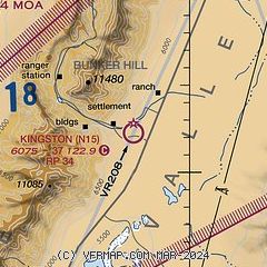
| Sectional chart |
|---|
|
| Airport distance calculator |
|---|
|
|
| Sunrise and sunset |
|---|
|
Times for 06-May-2026
| | Local
(UTC-7) | | Zulu
(UTC) |
|---|
| Morning civil twilight | | 05:16 | | 12:16 |
| Sunrise | | 05:45 | | 12:45 |
| Sunset | | 19:45 | | 02:45 |
| Evening civil twilight | | 20:14 | | 03:14 |
|
| Current date and time |
|---|
| Zulu (UTC) | 07-May-2026 03:38:35 |
|---|
| Local (UTC-7) | 06-May-2026 20:38:35 |
|---|
|
| METAR |
|---|
KTMT
17nm N | 070315Z AUTO 32006KT 10SM CLR 14/03 A3018 RMK AO2 T01370030
|
|
| NOTAMs |
|---|
NOTAMs are issued by the DoD/FAA and will open in a separate window not controlled by AirNav.
|
|

