FAA INFORMATION EFFECTIVE 14 MAY 2026
Location
| FAA Identifier: | O22 |
| Lat/Long: | 38-01-49.5000N 120-24-52.4000W
38-01.825000N 120-24.873333W
38.0304167,-120.4145556
(estimated) |
| Elevation: | 2120.7 ft. / 646.4 m (surveyed) |
| Variation: | 16E (1985) |
| From city: | 1 mile SW of COLUMBIA, CA |
| Time zone: | UTC -7 (UTC -8 during Standard Time) |
| Zip code: | 95310 |
Airport Operations
| Airport use: | Open to the public |
| Activation date: | 04/1940 |
| Control tower: | no |
| ARTCC: | OAKLAND CENTER |
| FSS: | RANCHO MURIETA FLIGHT SERVICE STATION |
| NOTAMs facility: | RIU (NOTAM-D service available) |
| Attendance: | 0800-1700 |
| Pattern altitude: | TPA RWY 11/29 800 FT AGL. |
| Wind indicator: | lighted |
| Segmented circle: | yes |
| Lights: | ACTVT MIRL RY 17/35 & REIL RYS 17 & 35 - CTAF. VASI RY 17 & RY 35 OPER CONTINUOUSLY. |
| Beacon: | white-green (lighted land airport)
ARPT HAS TWO ROTG BCNS; ONE ON THE ARPT AND ONE 6500' SE THR RWY 35. Operates sunset to sunrise. |
| Landing fee: | yes |
Airport Communications
| CTAF/UNICOM: | 122.975 |
| WX AWOS-3: | 124.65 (209-536-9384) |
| NORCAL APPROACH: | 125.1 ;WEST-NORTH |
| NORCAL DEPARTURE: | 125.1 ;WEST-NORTH |
| WX AWOS-3P at CPU (13 nm NW): | 118.525 (209-736-2523) |
- APCH/DEP CTL SVC PRVDD BY OAKLAND ARTCC (ZOA) ON FREQUENCY SECTORIZATION: EAST/SOUTH FREQUENCY 121.25/327.0/322.55 (ANGELS CAMP RCAG).
Nearby radio navigation aids
| VOR radial/distance | | VOR name | | Freq | | Var |
|---|
| LINr078/28.0 | | LINDEN VOR/DME | | 114.80 | | 17E |
| MODr030/35.3 | | MODESTO VOR/DME | | 114.60 | | 17E |
Airport Services
| Fuel available: | 100LL JET-A |
| Parking: | tiedowns |
| Airframe service: | MAJOR |
| Powerplant service: | MAJOR |
| Bottled oxygen: | LOW |
| Bulk oxygen: | LOW |
Runway Information
Runway 17/35
| Dimensions: | 4673 x 75 ft. / 1424 x 23 m
RY END SAFETY AREAS NSTD LENGTH; RY 17 210 FT; RY 35 300 FT. |
| Surface: | asphalt, in good condition |
| Weight bearing capacity: | |
| Runway edge lights: | medium intensity |
| RUNWAY 17 | | RUNWAY 35 |
| Latitude: | 38-02.200460N | | 38-01.442793N |
| Longitude: | 120-24.697398W | | 120-24.869317W |
| Elevation: | 2120.7 ft. | | 2073.6 ft. |
| Traffic pattern: | right | | left |
| Runway heading: | 174 magnetic, 190 true | | 354 magnetic, 010 true |
| Displaced threshold: | 598 ft. | | 384 ft. |
| Markings: | nonprecision, in fair condition | | nonprecision, in fair condition |
| Visual slope indicator: | 2-box VASI on left (4.55 degrees glide path) | | 2-box VASI on left (4.00 degrees glide path)
RY 35 VASI UNUSABLE BYD 5 DEG LEFT AND RIGHT OF RY CNTRLN. |
| Runway end identifier lights: | yes | | yes |
| Touchdown point: | yes, no lights | | yes, no lights |
| Obstructions: | 33 ft. gnd, 450 ft. from runway, 125 ft. right of centerline, 8:1 slope to clear
APCH RATIO FM DSPLCD THLD 31:1. | | 61 ft. trees, 1700 ft. from runway, 350 ft. right of centerline, 24:1 slope to clear
APCH RATIO FM DSPLCD THLD 37:1. |
Runway 11/29
| Dimensions: | 2607 x 50 ft. / 795 x 15 m |
| Surface: | turf, in good condition |
| RUNWAY 11 | | RUNWAY 29 |
| Latitude: | 38-01.981082N | | 38-01.684838N |
| Longitude: | 120-25.231028W | | 120-24.837905W |
| Elevation: | 2100.6 ft. | | 2077.6 ft. |
| Traffic pattern: | right | | left |
| Runway heading: | 118 magnetic, 134 true | | 298 magnetic, 314 true |
| Markings: | none | | numbers only, in good condition |
| Runway end identifier lights: | no | | no |
| Touchdown point: | yes, no lights | | yes, no lights |
| Obstructions: | 135 ft. trees, 2190 ft. from runway, 125 ft. left of centerline, 16:1 slope to clear | | 115 ft. trees, 1600 ft. from runway, 100 ft. right of centerline, 13:1 slope to clear |
Airport Ownership and Management from official FAA records
| Ownership: | Publicly-owned |
| Owner: | COUNTY OF TUOLUMNE
2 SOUTH GREEN ST.
SONORA, CA 95370
Phone 209-533-5685 |
| Manager: | TONYA SCHEFTNER
10723 AIRPORT RD
COLUMBIA, CA 95310
Phone (209) 533-6684 |
Additional Remarks
| - | CALFIRE AIR TANKER OPRS FM ARPT DRG FIRE SEASON. |
| - | LANDING FEE FOR ALL COMMERCIAL OPERATORS REGARDLESS OF SIZE & CORPORATE ACFT OVER 12500 LBS GROSS LANDING WEIGHT. |
| - | HEL PRKNG AREA 300 FT BY 120 FT (4 POSITIONS). |
| - | AVOID FLIGHTS OVER COLUMBIA STATE PARK NE OF ARPT, AND HWY 49 BRIDGE 5 NM SW OF ARPT & VICINITY. |
| - | FOR CD CTC NORCAL APCH AT 916-361-0516. |
| - | VARYING WIND DIRECTION & VELOCITY MAY BE ENCOUNTERED AT MID POINT OF RY 17/35 DUE TO TERRAIN FEATURES & WIND FLOW PATTERNS. |
| - | RY 11 DEPS PROHIBITED DUE TO CONFLICT WITH MAIN RY. |
| - | TURF TWY NORTH SIDE OF RY 11/29 NOT RECOMMENDED FOR USE NOV - MAR |
| - | RY 29 NOT RECOMMENDED FOR USE DURING WINTER MONTHS NOV THROUGH MAR. |
| - | ALL JET ACFT ARE REQUESTED TO LAND RY 35 & DEPART RY 17 WIND & WEATHER PERMITTING. |
Instrument Procedures
NOTE: All procedures below are presented as PDF files. If you need a reader for these files, you should download the free Adobe Reader.NOT FOR NAVIGATION. Please procure official charts for flight.
FAA instrument procedures published for use from 14 May 2026 at 0901Z to 11 June 2026 at 0900Z.
IAPs - Instrument Approach Procedures |
|---|
| RNAV (GPS) RWY 35 **CHANGED** | |
download (188KB) |
| NOTE: Special Alternate Minimums apply | |
download (118KB) |
|
|---|
| FICHU FOUR (OBSTACLE) (RNAV) | |
download (269KB) |
| NOTE: Special Take-Off Minimums/Departure Procedures apply | |
download (373KB) |
Other nearby airports with instrument procedures:
KCPU - Calaveras County Airport/Maury Rasmussen Field (13 nm NW)
E45 - Groveland/Yosemite Airport (15 nm SE)
O27 - Oakdale Airport (25 nm SW)
KJAQ - Westover Field / Amador County Airport (27 nm NW)
KMOD - Modesto City-County Airport-Harry Sham Field (35 nm SW)
|
|

Road maps at:
MapQuest
Bing
Google
| Aerial photo |
|---|
WARNING: Photo may not be current or correct
 Photo taken 21-Sep-2019
looking northwest.
Photo taken 21-Sep-2019
looking northwest.
Do you have a better or more recent aerial photo of Columbia Airport that you would like to share? If so, please send us your photo.
|
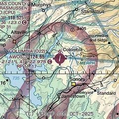
| Sectional chart |
|---|
|
| Airport distance calculator |
|---|
|
|
| Sunrise and sunset |
|---|
|
Times for 30-May-2026
| | Local
(UTC-7) | | Zulu
(UTC) |
|---|
| Morning civil twilight | | 05:12 | | 12:12 |
| Sunrise | | 05:42 | | 12:42 |
| Sunset | | 20:16 | | 03:16 |
| Evening civil twilight | | 20:47 | | 03:47 |
|
| Current date and time |
|---|
| Zulu (UTC) | 30-May-2026 11:27:11 |
|---|
| Local (UTC-7) | 30-May-2026 04:27:11 |
|---|
|
| METAR |
|---|
| KO22 | 301115Z AUTO 00000KT 10SM CLR 09/08 A3008 RMK A01
|
KCPU
13nm NW | 301115Z AUTO 11003KT 10SM CLR 10/08 A3007 RMK AO2 T00960081
|
|
| TAF |
|---|
KMOD
36nm SW | 300520Z 3006/3106 31010KT P6SM FEW250 FM300800 VRB05KT P6SM BKN250 FM301500 30006KT P6SM FEW250
|
KSCK
39nm W | 300520Z 3006/3106 29011KT P6SM FEW250 FM300800 VRB05KT P6SM BKN250 FM301500 30006KT P6SM FEW250
|
|
| NOTAMs |
|---|
NOTAMs are issued by the DoD/FAA and will open in a separate window not controlled by AirNav.
|
|


