FAA INFORMATION EFFECTIVE 04 SEPTEMBER 2025
Location
| FAA Identifier: | BVN |
| Lat/Long: | 41-43-42.8770N 098-03-20.7350W
41-43.714617N 098-03.345583W
41.7285769,-98.0557597
(estimated) |
| Elevation: | 1806.2 ft. / 550.5 m (surveyed) |
| Variation: | 06E (2000) |
| From city: | 3 miles NW of ALBION, NE |
| Time zone: | UTC -5 (UTC -6 during Standard Time) |
| Zip code: | 68620 |
Airport Operations
| Airport use: | Open to the public |
| Control tower: | no |
| ARTCC: | MINNEAPOLIS CENTER |
| FSS: | COLUMBUS FLIGHT SERVICE STATION |
| NOTAMs facility: | BVN (NOTAM-D service available) |
| Attendance: | UNATNDD |
| Wind indicator: | lighted |
| Segmented circle: | yes |
| Lights: | ACTVT MIRL RWY 15/33 - CTAF. |
| Beacon: | white-green (lighted land airport)
Operates sunset to sunrise. |
Airport Communications
| CTAF: | 122.9 |
| WX AWOS-3: | 118.575 (402-395-2052) |
- APCH/DEP SVC PRVDD BY MINNEAPOLIS ARTCC ON FREQS 128.0/257.95 (O'NEILL RCAG).
Nearby radio navigation aids
| VOR radial/distance | | VOR name | | Freq | | Var |
|---|
| OFKr233/31.8 | | NORFOLK VOR/DME | | 114.35 | | 08E |
| OLUr290/36.2 | | COLUMBUS VOR/DME | | 116.95 | | 08E |
| NDB name | | Hdg/Dist | | Freq | | Var | | ID |
|---|
| PLATTE CENTER | | 287/33.3 | | 407 | | 08E | | PLT | .--. .-.. - |
Airport Services
| Fuel available: | 100LL
100LL:SELF SVC FUEL AVBL H24 VIA CREDIT CARD. |
| Parking: | hangars and tiedowns |
| Airframe service: | NONE |
| Powerplant service: | NONE |
| Bottled oxygen: | NONE |
| Bulk oxygen: | NONE |
Runway Information
Runway 15/33
| Dimensions: | 3700 x 60 ft. / 1128 x 18 m |
| Surface: | concrete, in excellent condition |
| Runway edge lights: | medium intensity |
| RUNWAY 15 | | RUNWAY 33 |
| Latitude: | 41-43.987757N | | 41-43.441507N |
| Longitude: | 098-03.525538W | | 098-03.165653W |
| Elevation: | 1806.2 ft. | | 1778.4 ft. |
| Traffic pattern: | left | | left |
| Runway heading: | 148 magnetic, 154 true | | 328 magnetic, 334 true |
| Markings: | nonprecision, in good condition | | nonprecision, in good condition |
| Visual slope indicator: | 2-light PAPI on left (3.00 degrees glide path) | | 2-light PAPI on left (3.00 degrees glide path) |
| Touchdown point: | yes, no lights | | yes, no lights |
| Obstructions: | 66 ft. tree, 1022 ft. from runway, 356 ft. right of centerline, 12:1 slope to clear
RWY 15 APCH; TREE AT 42 FT ABV RWY; 882 FT FM RWY END, 310 FT R; CREATES A 16:1. | | 30 ft. tree, 766 ft. from runway, 252 ft. left of centerline, 18:1 slope to clear |
Airport Ownership and Management from official FAA records
| Ownership: | Publicly-owned |
| Owner: | ALBION ARPT AUTH
P.O. BOX 3
ALBION, NE 68620-0003
Phone (402) 741-1290 |
| Manager: | BOB SANDMAN
P.O. BOX 3
ALBION, NE 68620-0003
Phone 402-741-1290 |
Additional Remarks
| - | FOR CD CTC MINNEAPOLIS ARTCC AT 651-463-5588. |
Instrument Procedures
NOTE: All procedures below are presented as PDF files. If you need a reader for these files, you should download the free Adobe Reader.NOT FOR NAVIGATION. Please procure official charts for flight.
FAA instrument procedures published for use from 04 September 2025 at 0901Z to 02 October 2025 at 0900z.
IAPs - Instrument Approach Procedures |
|---|
| RNAV (GPS) RWY 15 | |
download (230KB) |
| RNAV (GPS) RWY 33 | |
download (237KB) |
| NOTE: Special Alternate Minimums apply | |
download (35KB) |
| NOTE: Special Take-Off Minimums/Departure Procedures apply | |
download (147KB) |
Other nearby airports with instrument procedures:
4V9 - Antelope County Airport (23 nm N)
KOFK - Norfolk Regional Airport/Karl Stefan Memorial Field (32 nm NE)
KOLU - Columbus Municipal Airport (36 nm SE)
07K - Central City Municipal Airport/Larry Reineke Field (37 nm S)
KODX - Evelyn Sharp Field Airport (41 nm W)
|
|

Road maps at:
MapQuest
Bing
Google
| Aerial photo |
|---|
WARNING: Photo may not be current or correct

Do you have a better or more recent aerial photo of Albion Municipal Airport that you would like to share? If so, please send us your photo.
|
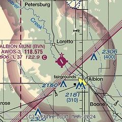
| Sectional chart |
|---|
|
| Airport distance calculator |
|---|
|
|
| Sunrise and sunset |
|---|
|
Times for 12-Sep-2025
| | Local
(UTC-5) | | Zulu
(UTC) |
|---|
| Morning civil twilight | | 06:42 | | 11:42 |
| Sunrise | | 07:10 | | 12:10 |
| Sunset | | 19:47 | | 00:47 |
| Evening civil twilight | | 20:15 | | 01:15 |
|
| Current date and time |
|---|
| Zulu (UTC) | 12-Sep-2025 12:56:44 |
|---|
| Local (UTC-5) | 12-Sep-2025 07:56:44 |
|---|
|
| METAR |
|---|
| KBVN | 121235Z AUTO 15007KT 10SM CLR 20/17 A2993 RMK AO2 T01990172
|
|
| TAF |
|---|
KOFK
32nm NE | 121120Z 1212/1312 15011KT P6SM SCT250 TEMPO 1212/1214 17012KT -TSRA BKN090CB FM121600 18012G20KT P6SM FEW090 SCT200 FM130000 17009KT P6SM FEW250 FM130400 19010KT P6SM FEW250 WS020/22045KT
|
|
| NOTAMs |
|---|
NOTAMs are issued by the DoD/FAA and will open in a separate window not controlled by AirNav.
|
|

