FAA INFORMATION EFFECTIVE 19 MARCH 2026
Location
| FAA Identifier: | HTW |
| Lat/Long: | 38-25-08.8000N 082-29-41.4000W
38-25.146667N 082-29.690000W
38.4191111,-82.4948333
(estimated) |
| Elevation: | 567.1 ft. / 172.9 m (surveyed) |
| Variation: | 05W (1985) |
| From city: | 2 miles W of central business district of the associated city |
| Time zone: | UTC -4 (UTC -5 during Standard Time) |
| Zip code: | 45680 |
Airport Operations
| Airport use: | Open to the public |
| Activation date: | 10/1937 |
| Control tower: | no |
| ARTCC: | INDIANAPOLIS CENTER |
| FSS: | DAYTON FLIGHT SERVICE STATION |
| NOTAMs facility: | DAY (NOTAM-D service available) |
| Attendance: | UNATNDD |
| Pattern altitude: | 1607.1 ft. MSL |
| Wind indicator: | lighted |
| Segmented circle: | no |
| Lights: | ACTVT MIRL RWY 08/26 - CTAF. |
| Beacon: | white-green (lighted land airport)
Operates sunset to sunrise. |
Airport Communications
| CTAF/UNICOM: | 122.7 |
| WX ASOS at HTS (4 nm SW): | PHONE 681-432-1499 |
| WX AWOS-3PT at DWU (14 nm NW): | 132.425 (606-836-2682) |
Nearby radio navigation aids
| VOR radial/distance | | VOR name | | Freq | | Var |
|---|
| HVQr280/34.3 | | CHARLESTON VOR/DME | | 117.40 | | 03W |
Airport Services
| Fuel available: | 100LL
100LL:100LL AVBL H24 SELF SVC VIA CREDIT CARD. |
| Parking: | tiedowns |
| Airframe service: | MINOR |
| Powerplant service: | MINOR |
| Bottled oxygen: | NONE |
| Bulk oxygen: | NONE |
Runway Information
Runway 8/26
| Dimensions: | 2998 x 70 ft. / 914 x 21 m |
| Surface: | asphalt, in excellent condition |
| Runway edge lights: | medium intensity |
| RUNWAY 8 | | RUNWAY 26 |
| Latitude: | 38-25.081323N | | 38-25.213462N |
| Longitude: | 082-29.992505W | | 082-29.387627W |
| Elevation: | 554.9 ft. | | 564.6 ft. |
| Traffic pattern: | left | | left |
| Runway heading: | 080 magnetic, 075 true | | 260 magnetic, 255 true |
| Displaced threshold: | 172 ft. | | no |
| Markings: | basic, in good condition | | basic, in good condition |
| Runway end identifier lights: | no | | no |
| Touchdown point: | yes, no lights | | yes, no lights |
| Obstructions: | 56 ft. trees, 619 ft. from runway, 125 ft. right of centerline, 7:1 slope to clear
+10 FT ROAD, 0 FT DIST, 45 FT R; +12-20 FT TREES, 0-75 FT DIST, 85 FT R; +10-15 FT BRUSH, 85-150 FT DIST, 90 FT L. | | none
+1-8 FT BRUSH & VEGETATION, 63 FT DIST EXTDG TO DROP-OFF, 125 FT L/R. |
Airport Ownership and Management from official FAA records
| Ownership: | Publicly-owned |
| Owner: | LAWRENCE CO BOARD OF COMMISSIONERS
COURTHOUSE, 111 S 4TH ST
IRONTON, OH 45638-1522
Phone 740-533-4300 |
| Manager: | BILL NENNI
304 N 7TH ST
IRONTON, OH 45638-1468
Phone 740-532-3309 |
Additional Remarks
| - | FOR CD CTC HUNTINGTON ATCT AT 304-453-2490. |
Instrument Procedures
There are no published instrument procedures at KHTW.
Some nearby airports with instrument procedures:
KHTS - Tri-State Airport/Milton J. Ferguson Field (4 nm SW)
12V - Ona Airpark (14 nm E)
KDWU - Ashland Regional Airport (14 nm NW)
KGAS - Gallia-Meigs Regional Airport (29 nm NE)
KPMH - Greater Portsmouth Regional Airport (30 nm NW)
|
|

Road maps at:
MapQuest
Bing
Google
| Aerial photo |
|---|
WARNING: Photo may not be current or correct
 Photo taken 19-May-2013
looking east.
Photo taken 19-May-2013
looking east.
Do you have a better or more recent aerial photo of Lawrence County Airpark that you would like to share? If so, please send us your photo.
|
| Sectional chart |
|---|
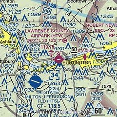
|
CAUTION: Diagram may not be current

| Airport distance calculator |
|---|
|
|
| Sunrise and sunset |
|---|
|
Times for 04-Apr-2026
| | Local
(UTC-4) | | Zulu
(UTC) |
|---|
| Morning civil twilight | | 06:45 | | 10:45 |
| Sunrise | | 07:11 | | 11:11 |
| Sunset | | 19:55 | | 23:55 |
| Evening civil twilight | | 20:22 | | 00:22 |
|
| Current date and time |
|---|
| Zulu (UTC) | 04-Apr-2026 19:59:33 |
|---|
| Local (UTC-4) | 04-Apr-2026 15:59:33 |
|---|
|
| METAR |
|---|
KHTS
4nm SW | 041951Z 19015G28KT 10SM FEW085 SCT110 29/13 A2996 RMK AO2 PK WND 21028/1945 SLP137 T02940133 $
|
KDWU
14nm NW | 041856Z AUTO 22009G19KT 10SM SCT070 BKN090 29/15 A2997 RMK AO2 SLP147 T02940150 $
|
|
| TAF |
|---|
KHTS
4nm SW | 041720Z 0418/0518 20012G25KT P6SM SCT050 TEMPO 0423/0424 4SM -SHRA BR FM050200 22010G25KT P6SM -SHRA VCTS BKN050CB FM050300 24010G25KT P6SM -SHRA VCTS OVC045CB FM050500 25011G18KT P6SM -SHRA VCTS OVC025CB FM050600 27011G18KT P6SM -SHRA OVC020 FM051100 29009G16KT P6SM BKN035
|
|
| NOTAMs |
|---|
NOTAMs are issued by the DoD/FAA and will open in a separate window not controlled by AirNav.
|
|


