FAA INFORMATION EFFECTIVE 09 JULY 2026
Location
| FAA Identifier: | AVP |
| Lat/Long: | 41-20-18.5000N 075-43-24.2000W
41-20.308333N 075-43.403333W
41.3384722,-75.7233889
(estimated) |
| Elevation: | 961.7 ft. / 293.1 m (surveyed) |
| Variation: | 11W (1980) |
| From city: | 5 miles SW of central business district of the associated city |
| Time zone: | UTC -4 (UTC -5 during Standard Time) |
| Zip code: | 18641 |
Airport Operations
| Airport use: | Open to the public |
| Activation date: | 01/1947 |
| Control tower: | yes |
| ARTCC: | NEW YORK CENTER |
| FSS: | WILLIAMSPORT FLIGHT SERVICE STATION |
| NOTAMs facility: | AVP (NOTAM-D service available) |
| Attendance: | CONTINUOUS |
| Wind indicator: | lighted |
| Segmented circle: | no |
| Beacon: | white-green (lighted land airport)
Operates sunset to sunrise. |
| Landing fee: | yes |
| Fire and rescue: | ARFF index B |
| Airline operations: | INDEX "C" ARFF EQUIPMENT AVAILABLE UPON REQUEST CALL 570-602-2040. |
| International operations: | customs landing rights airport |
Airport Communications
| UNICOM: | 122.95 |
| ATIS: | 135.75 |
| WX ASOS: | PHONE 570-456-5433 |
| WILKES-BARRE GROUND: | 121.9 |
| WILKES-BARRE TOWER: | 120.1 257.8 |
| WILKES-BARRE APPROACH: | 120.95 ;280-100 126.3 ;101-279 256.7 |
| WILKES-BARRE DEPARTURE: | 120.95 ;280-100 126.3 ;101-279 256.7 |
| EMERG: | 121.5 243.0 |
| TRSA: | 120.95 ;280-100 126.3 ;101-279 256.7 |
| WX ASOS at MPO (20 nm SE): | 120.275 (570-839-1584) |
Nearby radio navigation aids
| VOR radial/distance | | VOR name | | Freq | | Var |
|---|
| LVZr349/4.2 | | WILKES-BARRE VORTAC | | 111.60 | | 10W |
| FJCr352/38.7 | | ALLENTOWN VORTAC | | 117.50 | | 10W |
Airport Services
| Fuel available: | 100LL JET-A |
| Parking: | hangars and tiedowns |
| Airframe service: | MAJOR |
| Powerplant service: | MINOR |
| Bottled oxygen: | LOW |
| Bulk oxygen: | LOW |
Runway Information
Runway 4/22
| Dimensions: | 7502 x 150 ft. / 2287 x 46 m |
| Surface: | asphalt/grooved, in good condition |
| Weight bearing capacity: | | Single wheel: | 133.0 | | Double wheel: | 173.0 | | Double tandem: | 300.0 |
|
| Runway edge lights: | high intensity |
| Operational restrictions: | PRECIPITOUS DROP-OFF EACH RY END. |
| RUNWAY 4 | | RUNWAY 22 |
| Latitude: | 41-19.721868N | | 41-20.761342N |
| Longitude: | 075-43.891882W | | 075-43.006462W |
| Elevation: | 961.7 ft. | | 911.3 ft. |
| Traffic pattern: | left | | right |
| Runway heading: | 044 magnetic, 033 true | | 224 magnetic, 213 true |
| Declared distances: | TORA:7502 TODA:7502 ASDA:7502 LDA:7502 | | TORA:7502 TODA:7502 ASDA:7502 LDA:7502 |
| Markings: | precision, in good condition | | precision, in good condition |
| Visual slope indicator: | 4-light PAPI on right (3.00 degrees glide path) | | 4-box VASI on left (3.00 degrees glide path) |
| RVR equipment: | touchdown, rollout | | touchdown, rollout |
| Approach lights: | MALSR: 1,400 foot medium intensity approach lighting system with runway alignment indicator lights | | |
| Runway end identifier lights: | | | yes |
| Touchdown point: | yes, no lights | | yes, no lights |
| Instrument approach: | ILS/DME | | ILS/DME |
| Obstructions: | none | | 112 ft. trees, marked and lighted, 4567 ft. from runway, 723 ft. right of centerline, 39:1 slope to clear |
Runway 10/28
| Dimensions: | 4300 x 150 ft. / 1311 x 46 m |
| Surface: | asphalt/grooved, in good condition |
| Weight bearing capacity: | | Single wheel: | 58.0 | | Double wheel: | 80.0 | | Double tandem: | 125.0 |
|
| Runway edge lights: | medium intensity |
| RUNWAY 10 | | RUNWAY 28 |
| Latitude: | 41-20.436100N | | 41-20.414767N |
| Longitude: | 075-43.794357W | | 075-42.855233W |
| Elevation: | 921.9 ft. | | 934.5 ft. |
| Traffic pattern: | right | | right |
| Runway heading: | 103 magnetic, 092 true | | 283 magnetic, 272 true |
| Declared distances: | TORA:4300 TODA:4300 ASDA:4300 LDA:4300 | | TORA:4300 TODA:4300 ASDA:4300 LDA:4300 |
| Markings: | nonprecision, in good condition | | nonprecision, in good condition |
| Visual slope indicator: | 2-light PAPI on left (3.00 degrees glide path) | | |
| Runway end identifier lights: | yes | | yes |
| Touchdown point: | yes, no lights | | yes, no lights |
| Obstructions: | none | | 21 ft. trees, 348 ft. from runway, 234 ft. right of centerline, 7:1 slope to clear |
Airport Ownership and Management from official FAA records
| Ownership: | Publicly-owned |
| Owner: | LUZERNE AND LACKAWANNA CO
100 TERMINAL DRIVE
AVOCA, PA 18641
Phone (570) 602-2040 |
| Manager: | STEPHEN MYKULYN
100 TERMINAL DRIVE
AVOCA, PA 18641
Phone 570-602-2000 |
Additional Remarks
| A39-04/22 | PCR VALUE: 770/F/C/X/T |
| A39-10/28 | PCR VALUE: 480/F/C/X/T |
| E60-22 | ENGINEERED MATERIAL ARRESTING SYSTEM (EMAS) 162 FT IN LENGTH BY 170 FT IN WIDTH LCTD 35 FT OFF DER 22. |
| E60-04 | ENGINEERED MATERIAL ARRESTING SYSTEM (EMAS) 324 FT IN LENGTH BY 170 FT IN WIDTH LCTD 50 FT OFF DER 04. |
| - | DEER & BIRDS ON & INVOF ARPT. |
| - | RY 28 UNLGTD HIGH TERRAIN TREES: 1155 FT MSL .91 MI EAST AER 28; 1463 FT MSL 1.49 MI EAST-SOUTHEAST AER 28; 1667 FT MSL 2.25 MI EAST AER 28; 1920 FT MSL 2.84 MI EAST AER 28. |
| - | UNLGTD TOWER 1130 FT MSL (20 FT AGL) 1.3 MI EAST AER 28; UNLGTD TOWER 1463 FT MSL (20 FT AGL) 1.7 MI EAST AER 28; UNLGTD TOWER 1652 FT MSL (20 FT AGL) 2.4 MI EAST AER 28. |
| - | FOR FBO SERVICE 0000-0500 LOCAL M-F AND 2100-0000 LOCAL SAT-SUN CALL (570) 457-4485. |
Instrument Procedures
NOTE: All procedures below are presented as PDF files. If you need a reader for these files, you should download the free Adobe Reader.NOT FOR NAVIGATION. Please procure official charts for flight.
FAA instrument procedures published for use from 09 July 2026 at 0901Z to 06 August 2026 at 0900Z.
IAPs - Instrument Approach Procedures |
|---|
| ILS OR LOC RWY 04 | |
download (264KB) |
| ILS OR LOC RWY 22 | |
download (253KB) |
| RNAV (GPS) RWY 04 | |
download (253KB) |
| RNAV (GPS) RWY 22 | |
download (239KB) |
| NOTE: Special Alternate Minimums apply | |
download (44KB) |
Departure Procedures |
|---|
| SCRANTON EIGHT | |
download (170KB) |
| NOTE: Special Take-Off Minimums/Departure Procedures apply | |
download (152KB) |
Other nearby airports with instrument procedures:
KWBW - Wilkes-Barre Wyoming Valley Airport (6 nm SW)
9N3 - Seamans Field Airport (15 nm N)
KMPO - Pocono Mountains Regional Airport (20 nm SE)
N30 - Cherry Ridge Airport (24 nm NE)
KHZL - Hazleton Regional Airport (24 nm SW)
|
|

Road maps at:
MapQuest
Bing
Google
| Aerial photo |
|---|
WARNING: Photo may not be current or correct
 Photo by Cathy Vajtay
Photo taken 12-Jun-2018
looking southwest at 4500.
Photo by Cathy Vajtay
Photo taken 12-Jun-2018
looking southwest at 4500.
Do you have a better or more recent aerial photo of Wilkes-Barre/Scranton International Airport that you would like to share? If so, please send us your photo.
|
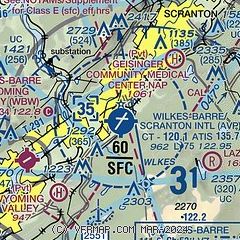
| Sectional chart |
|---|
|
 Download PDF
of official airport diagram from the FAA
| Airport distance calculator |
|---|
|
|
| Sunrise and sunset |
|---|
|
Times for 01-Aug-2026
| | Local
(UTC-4) | | Zulu
(UTC) |
|---|
| Morning civil twilight | | 05:28 | | 09:28 |
| Sunrise | | 05:59 | | 09:59 |
| Sunset | | 20:19 | | 00:19 |
| Evening civil twilight | | 20:51 | | 00:51 |
|
| Current date and time |
|---|
| Zulu (UTC) | 01-Aug-2026 09:38:09 |
|---|
| Local (UTC-4) | 01-Aug-2026 05:38:09 |
|---|
|
| METAR |
|---|
| KAVP | 010854Z 10004KT 10SM CLR 17/16 A2998 RMK AO2 SLP142 T01720156 58001
|
KMPO
20nm SE | 010853Z AUTO 00000KT 10SM CLR 16/14 A3001 RMK AO2 SLP152 T01560139 58002
|
|
| TAF |
|---|
| KAVP | 010520Z 0106/0206 VRB04KT P6SM FEW200 FM011500 19004KT P6SM BKN220
|
|
| NOTAMs |
|---|
NOTAMs are issued by the DoD/FAA and will open in a separate window not controlled by AirNav.
|
|


