FAA INFORMATION EFFECTIVE 16 APRIL 2026
Location
| FAA Identifier: | GJT |
| Lat/Long: | 39-07-17.3970N 108-31-31.7480W
39-07.289950N 108-31.529133W
39.1214992,-108.5254856
(estimated) |
| Elevation: | 4861.4 ft. / 1481.8 m (surveyed) |
| Variation: | 09E (2025) |
| From city: | 3 miles NE of GRAND JUNCTION, CO |
| Time zone: | UTC -6 (UTC -7 during Standard Time) |
| Zip code: | 81506 |
Airport Operations
| Airport use: | Open to the public |
| Activation date: | 04/1940 |
| Control tower: | yes |
| ARTCC: | DENVER CENTER |
| FSS: | DENVER FLIGHT SERVICE STATION |
| NOTAMs facility: | GJT (NOTAM-D service available) |
| Attendance: | 0500-0000L
FOR FUEL AFT HRS CALL 970-243-7500. |
| Wind indicator: | lighted |
| Segmented circle: | yes |
| Lights: | WHEN ATCT CLSD ACTVT MALSF RWY 11; HIRL RWY 11/29; TWY LGTS - CTAF. REIL RWY 29; PAPI RWY 11; VASI RWY 29 ON CONSLY. REIL RWY 04 & 22; PAPI RWY 04; MIRL RWY 04/22 ON CONSLY DURG ATCT OPER HRS AND OFF WHEN ATCT CLSD. |
| Beacon: | white-green (lighted land airport)
Operates sunset to sunrise. |
| Fire and rescue: | ARFF index B |
| Airline operations: | ARFF PRVDD ONLY DURING SCHEDULED PART 121 ACR OPNS EXCEPT BY PPR; CALL AMGR 970-244-9100. |
Airport Communications
| CTAF: | 118.1 |
| UNICOM: | 122.95 |
| ATIS: | 118.55 |
| WX ASOS: | 118.55 (970-462-9228) |
| GRAND JUNCTION GROUND: | 121.7 257.8 [0600-2200] |
| GRAND JUNCTION TOWER: | 118.1 257.8 [0600-2200] |
| DENVER APPROACH: | 119.7 |
| DENVER DEPARTURE: | 119.7 |
| IC: | 121.7 |
| VFR ADZY: | 118.1 |
- FREQ 121.5 NOT AVBL.
- DENVER APCH (D01) PRVDS APCH/DEP CTL SVC FM 0600-2200; DENVER ARTCC (ZDV) PRVDS APCH/DEP CTL SVC FM 2200-0600 ON 134.5/327.8 (GRAND MESA/B/ RCAG).
- COMMUNICATIONS PRVDD BY DENVER RADIO ON FREQ 122.6 (GRAND JUNCTION RCO).
Nearby radio navigation aids
| VOR radial/distance | | VOR name | | Freq | | Var |
|---|
| JNCr058/13.0 | | GRAND JUNCTION VOR/DME | | 112.40 | | 15E |
Airport Services
| Fuel available: | 100LL JET-A |
| Parking: | hangars and tiedowns |
| Airframe service: | MAJOR |
| Powerplant service: | MAJOR |
| Bottled oxygen: | HIGH |
| Bulk oxygen: | HIGH
LIQUID OXY SVC AVBL. |
Runway Information
Runway 11/29
| Dimensions: | 9339 x 150 ft. / 2847 x 46 m |
| Surface: | asphalt/grooved, in excellent condition |
| Weight bearing capacity: | | Single wheel: | 110.0 | | Double wheel: | 180.0 | | Double tandem: | 260.0 |
|
| Runway edge lights: | high intensity |
| RUNWAY 11 | | RUNWAY 29 |
| Latitude: | 39-07.987715N | | 39-07.101548N |
| Longitude: | 108-32.459423W | | 108-30.845460W |
| Elevation: | 4827.9 ft. | | 4861.4 ft. |
| Traffic pattern: | left | | left |
| Runway heading: | 116 magnetic, 125 true | | 296 magnetic, 305 true |
| Declared distances: | TORA:9339 TODA:9339 ASDA:9339 LDA:9339 | | TORA:9339 TODA:9339 ASDA:9339 LDA:9339 |
| Markings: | precision, in fair condition | | precision, in fair condition |
| Visual slope indicator: | 4-light PAPI on left (3.00 degrees glide path) | | 4-box VASI on left (3.00 degrees glide path) |
| RVR equipment: | touchdown | | rollout |
| Approach lights: | MALSF: 1,400 foot medium intensity approach lighting system with sequenced flashers | | |
| Runway end identifier lights: | | | yes |
| Touchdown point: | yes, no lights | | yes, no lights |
| Instrument approach: | ILS/DME | | LDA/DME |
Runway 4/22
| Dimensions: | 5501 x 75 ft. / 1677 x 23 m |
| Surface: | asphalt/grooved, in good condition |
| Weight bearing capacity: | | Single wheel: | 26.0 | | Double wheel: | 26.0 |
|
| Runway edge lights: | medium intensity |
| Operational restrictions: | RWY 04/22 CLSD FM 2200-0600. |
| RUNWAY 4 | | RUNWAY 22 |
| Latitude: | 39-06.594100N | | 39-07.120847N |
| Longitude: | 108-31.793015W | | 108-30.846880W |
| Elevation: | 4787.6 ft. | | 4860.8 ft. |
| Traffic pattern: | left | | left |
| Runway heading: | 045 magnetic, 054 true | | 225 magnetic, 234 true |
| Declared distances: | TORA:5501 TODA:5501 ASDA:5501 LDA:5501 | | TORA:5501 TODA:5501 ASDA:5501 LDA:5501 |
| Markings: | basic, in fair condition | | basic, in fair condition |
| Visual slope indicator: | 4-light PAPI on left (3.00 degrees glide path) | | |
| Runway end identifier lights: | yes | | yes |
| Touchdown point: | yes, no lights | | yes, no lights |
Airport Ownership and Management from official FAA records
| Ownership: | Publicly-owned |
| Owner: | GRAND JUNCTION REG ARPT AUTH
2828 WALKER FLD DR SUITE 301
GRAND JUNCTION, CO 81506
Phone 970-244-9100 |
| Manager: | ANGELA PADALECKI
2828 WALKER FIELD DRIVE SUITE 301
GRAND JUNCTION, CO 81506 |
Additional Remarks
| A39-11/29 | PCR VALUE: 560/F/D/X/T |
| A39-04/22 | PCR VALUE: 99/F/D/X/T |
| - | TWY C1A & TWY C, 150 FT EITHER SIDE OF THE INTXN NOT VSBL FM ATCT. |
| - | CONDITIONS NOT MONITORED 0000-0530 LOCAL TIME EXCEPT BY PPR. |
| - | CD FONE: WHEN TWR CLSD, CTC GRAND JUNCTION APCH 303-342-1916. IFUN, CTC DENVER ARTCC 303-342-4257. |
| - | HEL PRKG AVBL AT FBO; PPR RCMDD. |
| - | FLOCKS OF BIRDS ON & INVOF ARPT. |
| - | NOISE ABATEMENT PROCEDURES IN EFCT, CTC ARPT MGMT FOR DETAILS AT (970) 244-9100. |
| - | JASU: 1(MD-3A), 1(NC-10A/A1/BC), 2(AM32A-60B). |
| - | FLUID: SP, LHOX LOX, LHNIT, DE-ICE(MIL A-8243). |
| - | ARPT OPS NUMBER IS 970-260-7164. PLEASE CALL FOR ANY NOTAMS OR CONCERNS. |
Instrument Procedures
NOTE: All procedures below are presented as PDF files. If you need a reader for these files, you should download the free Adobe Reader.NOT FOR NAVIGATION. Please procure official charts for flight.
FAA instrument procedures published for use from 16 April 2026 at 0901Z to 14 May 2026 at 0900Z.
IAPs - Instrument Approach Procedures |
|---|
| ILS OR LOC RWY 11 **CHANGED** | |
download (778KB) |
| RNAV (RNP) Z RWY 11 **CHANGED** | |
download (388KB) |
| RNAV (GPS) RWY 29 **CHANGED** | |
download (286KB) |
| RNAV (GPS) Y RWY 11 **CHANGED** | |
download (347KB) |
| LDA RWY 29 **CHANGED** | |
download (395KB) |
| NOTE: Special Alternate Minimums apply | |
download (146KB) |
Departure Procedures |
|---|
| GRAND JUNCTION ONE **NEW** | |
download (248KB) |
| GRAND MESA TWO | |
download (275KB) |
| NOKXI TWO (RNAV) | |
download (161KB) |
| RHONE THREE (RNAV) | |
download (192KB) |
|
|---|
| MONUMENT THREE (OBSTACLE) | |
download (239KB) |
| NOTE: Special Take-Off Minimums/Departure Procedures apply | |
download (292KB) |
Other nearby airports with instrument procedures:
KAJZ - Blake Field Airport (30 nm SE)
KRIL - Rifle Garfield County Airport (44 nm NE)
KMTJ - Montrose Regional Airport (47 nm SE)
KAIB - Hopkins Field Airport (53 nm S)
4V0 - Rangely Airport (59 nm N)
|
|

Road maps at:
MapQuest
Bing
Google
| Aerial photo |
|---|
WARNING: Photo may not be current or correct
 Photo by Matt Beyer and Joe Morrey
Taken in October 2020
looking northwest from 9000ft.
Photo by Matt Beyer and Joe Morrey
Taken in October 2020
looking northwest from 9000ft.
Do you have a better or more recent aerial photo of Grand Junction Regional Airport that you would like to share? If so, please send us your photo.
|
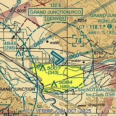
| Sectional chart |
|---|
|
CAUTION: Diagram may not be current
 Download PDF
of official airport diagram from the FAA
| Airport distance calculator |
|---|
|
|
| Sunrise and sunset |
|---|
|
Times for 03-May-2026
| | Local
(UTC-6) | | Zulu
(UTC) |
|---|
| Morning civil twilight | | 05:45 | | 11:45 |
| Sunrise | | 06:14 | | 12:14 |
| Sunset | | 20:08 | | 02:08 |
| Evening civil twilight | | 20:37 | | 02:37 |
|
| Current date and time |
|---|
| Zulu (UTC) | 04-May-2026 03:49:36 |
|---|
| Local (UTC-6) | 03-May-2026 21:49:36 |
|---|
|
| METAR |
|---|
| KGJT | 040253Z 14005KT 10SM CLR 18/M08 A2985 RMK AO2 SLP059 T01831078 55004
|
|
| TAF |
|---|
| KGJT | 031720Z 0318/0418 10009KT P6SM SCT250 FM031900 29007KT P6SM SCT120 SCT200 FM040200 18006KT P6SM FEW110 BKN200 FM040600 11012KT P6SM BKN150 PROB30 0406/0410 P6SM -SHRA BKN080
|
|
| NOTAMs |
|---|
NOTAMs are issued by the DoD/FAA and will open in a separate window not controlled by AirNav.
|
|


