FAA INFORMATION EFFECTIVE 14 MAY 2026
Location
| FAA Identifier: | LAF |
| Lat/Long: | 40-24-44.2960N 086-56-12.8310W
40-24.738267N 086-56.213850W
40.4123044,-86.9368975
(estimated) |
| Elevation: | 605.8 ft. / 184.6 m (surveyed) |
| Variation: | 01W (1985) |
| From city: | 2 miles SW of LAFAYETTE, IN |
| Time zone: | UTC -4 (UTC -5 during Standard Time) |
| Zip code: | 47906 |
Airport Operations
| Airport use: | Open to the public |
| Activation date: | 04/1940 |
| Control tower: | yes |
| ARTCC: | CHICAGO CENTER |
| FSS: | TERRE HAUTE FLIGHT SERVICE STATION |
| NOTAMs facility: | LAF (NOTAM-D service available) |
| Attendance: | MON-FRI 0800-1700 |
| Wind indicator: | lighted |
| Segmented circle: | no |
| Lights: | WHEN ATCT CLSD ACTVT MALSR RWY 10; REIL RWY 5, 23 & 28; MIRL RWY 5/23; HIRL RWY 10/28 - CTAF. |
| Beacon: | white-green (lighted land airport)
Operates sunset to sunrise. |
| Fire and rescue: | ARFF index A |
| Airline operations: | UNSKED ACR OPS GTR THAN 30 PAX SEATS PPR - 765-496-6326 OR 765-496-4057. INDEX B ARFF CPBLY AVBL ON REQ. |
Airport Communications
| CTAF: | 119.6 |
| UNICOM: | 122.95 |
| ATIS: | 127.75 |
| WX ASOS: | PHONE 765-743-9687 |
| LAFAYETTE GROUND: | 121.9 343.625 [0700-2100] |
| LAFAYETTE TOWER: | 119.6 343.625 [0700-2100] |
| GRISSOM APPROACH: | 123.85 |
| GRISSOM DEPARTURE: | 123.85 |
| EMERG: | 243.0 |
| WX AWOS-3 at FKR (19 nm SE): | 124.325 (765-654-0328) |
| WX AWOS-3P at MCX (19 nm NE): | 124.05 (574-583-0531) |
- APCH/DEP SVC PRVDD BY CHICAGO ARTCC ON FREQ 123.85 (LAFAYETTE RCAG) WHEN GRISSOM (GUS) APCH/DEP CON CLSD..
Nearby radio navigation aids
| VOR radial/distance | | VOR name | | Freq | | Var |
|---|
| BVTr144/10.5 | | BOILER VORTAC | | 115.10 | | 01E |
| NDB name | | Hdg/Dist | | Freq | | Var | | ID |
|---|
| EARLE | | 100/5.3 | | 401 | | 01W | | LA | .-.. .- |
| CRAWFORDSVILLE | | 002/25.9 | | 388 | | 04W | | CFJ | -.-. ..-. .--- |
Airport Services
| Fuel available: | 100LL JET-A |
| Parking: | hangars and tiedowns |
| Airframe service: | MAJOR |
| Powerplant service: | MAJOR |
| Bulk oxygen: | HIGH/LOW |
Runway Information
Runway 10/28
| Dimensions: | 6600 x 150 ft. / 2012 x 46 m |
| Surface: | asphalt/grooved, in good condition |
| Weight bearing capacity: | | Single wheel: | 90.0 | | Double wheel: | 110.0 | | Double tandem: | 165.0 |
|
| Runway edge lights: | high intensity |
| RUNWAY 10 | | RUNWAY 28 |
| Latitude: | 40-24.837810N | | 40-24.666007N |
| Longitude: | 086-57.055950W | | 086-55.651887W |
| Elevation: | 600.1 ft. | | 597.8 ft. |
| Traffic pattern: | left | | left |
| Runway heading: | 100 magnetic, 099 true | | 280 magnetic, 279 true |
| Declared distances: | TORA:6600 TODA:6600 ASDA:6600 LDA:6600 | | TORA:6600 TODA:6600 ASDA:6600 LDA:6600 |
| Markings: | precision, in fair condition | | precision, in fair condition |
| Visual slope indicator: | 4-light PAPI on left (3.00 degrees glide path)
PAPI UNUSBL BYD 9 DEGS RIGHT OF CNTRLN. | | 4-box VASI on right (3.00 degrees glide path) |
| Approach lights: | MALSR: 1,400 foot medium intensity approach lighting system with runway alignment indicator lights | | |
| Runway end identifier lights: | no | | yes |
| Touchdown point: | yes, no lights | | yes, no lights |
| Instrument approach: | ILS | | |
| Obstructions: | 97 ft. trees, 3381 ft. from runway, 968 ft. left of centerline, 32:1 slope to clear | | 51 ft. trees, 2057 ft. from runway, 439 ft. right of centerline, 40:1 slope to clear |
Runway 5/23
| Dimensions: | 4225 x 100 ft. / 1288 x 30 m |
| Surface: | asphalt, in good condition |
| Weight bearing capacity: | | Single wheel: | 48.0 | | Double wheel: | 58.0 | | Double tandem: | 90.0 |
|
| Runway edge lights: | medium intensity |
| Operational restrictions: | RWY 05/23 NOT AVBL FOR PART 121/PART 380 OPS WITH SKED PAX CARRYING OPS MORE THAN 9 PAX SEATS AND NON-SKED PAX CARRYING OPS MORE THAN 30 PAX SEATS. WINGSPAN GTR THAN 79 FT NA. |
| RUNWAY 5 | | RUNWAY 23 |
| Latitude: | 40-24.491050N | | 40-24.942690N |
| Longitude: | 086-56.341225W | | 086-55.648830W |
| Elevation: | 592.5 ft. | | 605.7 ft. |
| Traffic pattern: | left | | left |
| Runway heading: | 051 magnetic, 050 true | | 231 magnetic, 230 true |
| Displaced threshold: | no | | 323 ft. |
| Declared distances: | TORA:4225 TODA:4225 ASDA:4225 LDA:4225 | | TORA:4225 TODA:4225 ASDA:4225 LDA:3912 |
| Markings: | basic, in fair condition | | basic, in good condition |
| Visual slope indicator: | 2-light PAPI on left (3.00 degrees glide path) | | 2-light PAPI on left (3.00 degrees glide path) |
| Runway end identifier lights: | yes | | yes |
| Touchdown point: | yes, no lights | | yes, no lights |
| Obstructions: | none | | 11 ft. fence, 287 ft. from runway, 132 ft. left of centerline, 7:1 slope to clear
20:1 AT DSPLCD THR. |
Airport Ownership and Management from official FAA records
| Ownership: | Publicly-owned |
| Owner: | PURDUE UNIVERSITY
1501 AVIATION DRIVE, TRML BLDG ROOM 201
WEST LAFAYETTE, IN 47907
Phone (765) 496-6326 |
| Manager: | ADAM BAXMEYER
1501 AVIATION DRIVE, TRML BLDG ROOM 201
WEST LAFAYETTE, IN 47907
Phone (765) 496-6850 |
Additional Remarks
| A39-05/23 | PCR VALUE: 80/F/D/X/T |
| A39-10/28 | PCR VALUE: 470/F/D/X/T |
| - | TRNG OPS & BIRDS INVOF ARPT. |
| - | SFC COND UNMNT 2200-0600 OR WKEND. |
| - | FOR CD IF UNA TO CTC ON FSS FREQ, CTC CHICAGO ARTCC AT 630-906-8921. |
Instrument Procedures
NOTE: All procedures below are presented as PDF files. If you need a reader for these files, you should download the free Adobe Reader.NOT FOR NAVIGATION. Please procure official charts for flight.
FAA instrument procedures published for use from 14 May 2026 at 0901Z to 11 June 2026 at 0900Z.
IAPs - Instrument Approach Procedures |
|---|
| ILS OR LOC RWY 10 | |
download (233KB) |
| RNAV (GPS) RWY 10 | |
download (280KB) |
| RNAV (GPS) RWY 28 | |
download (268KB) |
| VOR-A | |
download (204KB) |
| NOTE: Special Alternate Minimums apply | |
download (168KB) |
| NOTE: Special Take-Off Minimums/Departure Procedures apply | |
download (478KB) |
Other nearby airports with instrument procedures:
1I9 - Delphi Municipal Airport (14 nm NE)
KFKR - Frankfort Clinton County Regional Airport (19 nm SE)
KMCX - White County Airport (19 nm NE)
KCFJ - Crawfordsville Regional Airport (26 nm S)
50I - Kentland Municipal Airport (31 nm NW)
|
|

Road maps at:
MapQuest
Bing
Google
| Aerial photo |
|---|
WARNING: Photo may not be current or correct
 Photo courtesy of Clinton County Civil Air Patrol
Photo taken 27-Mar-2011
looking north from 2500' MSL.
Photo courtesy of Clinton County Civil Air Patrol
Photo taken 27-Mar-2011
looking north from 2500' MSL.
Do you have a better or more recent aerial photo of Purdue University Airport that you would like to share? If so, please send us your photo.
|
| Sectional chart |
|---|
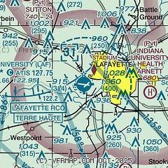
|
 Download PDF
of official airport diagram from the FAA
| Airport distance calculator |
|---|
|
|
| Sunrise and sunset |
|---|
|
Times for 20-May-2026
| | Local
(UTC-4) | | Zulu
(UTC) |
|---|
| Morning civil twilight | | 05:57 | | 09:57 |
| Sunrise | | 06:28 | | 10:28 |
| Sunset | | 21:01 | | 01:01 |
| Evening civil twilight | | 21:32 | | 01:32 |
|
| Current date and time |
|---|
| Zulu (UTC) | 20-May-2026 04:46:43 |
|---|
| Local (UTC-4) | 20-May-2026 00:46:43 |
|---|
|
| METAR |
|---|
| KLAF | 200354Z AUTO 32010KT 10SM FEW018 SCT110 19/16 A3009 RMK AO2 SLP186 T01940156
|
KFKR
19nm SE | 200435Z AUTO 31009KT 10SM OVC110 20/18 A3008 RMK AO2
|
KMCX
19nm NE | 200435Z AUTO 32010KT 10SM SCT065 BKN100 OVC120 18/14 A3011 RMK AO2 T01840136
|
|
| TAF |
|---|
| KLAF | 192023Z 1920/2018 27012G19KT P6SM VCSH BKN050 BKN100 FM192300 26013G20KT P6SM BKN050 PROB30 1923/2001 -TSRA OVC030CB FM200100 33008KT P6SM VCSH BKN050 FM200500 36007KT P6SM OVC015 FM201000 01010KT P6SM SCT015 SCT035
|
|
| NOTAMs |
|---|
NOTAMs are issued by the DoD/FAA and will open in a separate window not controlled by AirNav.
|
|


