FAA INFORMATION EFFECTIVE 16 APRIL 2026
Location
| FAA Identifier: | MKG |
| Lat/Long: | 43-10-03.6220N 086-14-07.5770W
43-10.060367N 086-14.126283W
43.1676728,-86.2354381
(estimated) |
| Elevation: | 628.2 ft. / 191.5 m (surveyed) |
| Variation: | 04W (1995) |
| From city: | 4 miles S of MUSKEGON, MI |
| Time zone: | UTC -4 (UTC -5 during Standard Time) |
| Zip code: | 49441 |
Airport Operations
| Airport use: | Open to the public |
| Activation date: | 04/1940 |
| Control tower: | yes |
| ARTCC: | CHICAGO CENTER |
| FSS: | LANSING FLIGHT SERVICE STATION |
| NOTAMs facility: | MKG (NOTAM-D service available) |
| Attendance: | NOV-MAR MON-FRI 0600-2200, APR-OCT MON-FRI 0500-2100, APR-OCT SAT-SUN 0500-2000, NOV-MAR SAT-SUN 0600-2100
FOR SVC AFT HRS CALL FBO 231-798-2126. |
| Wind indicator: | lighted |
| Segmented circle: | no |
| Lights: | WHEN ATCT CLSD ACTVT MALSR RWY 24; REIL RWY 06; HIRL RWY 06/24 - CTAF. VASI RWY 06 & 24 OPR CONSLY. |
| Beacon: | white-green (lighted land airport)
Operates sunset to sunrise. |
| Landing fee: | yes |
| Fire and rescue: | ARFF index A |
| Airline operations: | 24 HR PPR FOR ARFF INDEX B SVC - CALL AMGR 801-698-8187. |
Airport Communications
| CTAF: | 126.25 |
| UNICOM: | 122.95 |
| ATIS: | 124.3 |
| WX ASOS: | PHONE 231-246-4419 |
| MUSKEGON GROUND: | 121.6 [0600-2300] |
| MUSKEGON TOWER: | 126.25 343.725 [0600-2300] |
| GREAT LAKES APPROACH: | 119.8 ;NORTH 133.825 ;SOUTH |
| GREAT LAKES DEPARTURE: | 119.8 ;NORTH 133.825 ;SOUTH |
| EMERG: | 121.5 243.0 |
| TRSA: | 119.8 ;NORTH 133.825 ;SOUTH |
| WX AWOS-3P at FFX (19 nm NE): | 118.775 (231-928-0715) |
- APCH/DEP SVC PRVDD BY CHICAGO ARTCC ON FREQS 132.275/254.35 (MUSKEGON RCAG) WHEN GREAT LAKES APCH CTL CLSD.
Nearby radio navigation aids
| VOR radial/distance | | VOR name | | Freq | | Var |
|---|
| VIOr309/39.7 | | VICTORY VOR/DME | | 115.95 | | 04W |
Airport Services
| Fuel available: | 100LL JET-A |
| Parking: | hangars and tiedowns |
| Airframe service: | MAJOR |
| Powerplant service: | MAJOR |
| Bottled oxygen: | NONE |
| Bulk oxygen: | LOW |
Runway Information
Runway 6/24
| Dimensions: | 6500 x 150 ft. / 1981 x 46 m |
| Surface: | asphalt/porous friction courses, in fair condition |
| Weight bearing capacity: | | Single wheel: | 120.0 | | Double wheel: | 250.0 | | Double tandem: | 497.0 |
|
| Runway edge lights: | high intensity |
| RUNWAY 6 | | RUNWAY 24 |
| Latitude: | 43-09.697885N | | 43-10.290210N |
| Longitude: | 086-15.053090W | | 086-13.835910W |
| Elevation: | 620.9 ft. | | 626.2 ft. |
| Traffic pattern: | left | | left |
| Runway heading: | 060 magnetic, 056 true | | 240 magnetic, 236 true |
| Declared distances: | TORA:6500 TODA:6500 ASDA:6500 LDA:6500 | | TORA:6500 TODA:6500 ASDA:6500 LDA:6500 |
| Markings: | precision, in fair condition | | precision, in fair condition |
| Visual slope indicator: | 4-box VASI on left (3.00 degrees glide path) | | 4-box VASI on left (3.00 degrees glide path) |
| Approach lights: | | | MALSR: 1,400 foot medium intensity approach lighting system with runway alignment indicator lights |
| Runway end identifier lights: | yes | | |
| Touchdown point: | yes, no lights | | yes, no lights |
| Instrument approach: | | | ILS/DME |
| Obstructions: | 85 ft. trees, 2681 ft. from runway, 192 ft. right of centerline, 29:1 slope to clear | | 90 ft. tree, 3312 ft. from runway, 890 ft. left of centerline, 34:1 slope to clear |
Runway 14/32
| Dimensions: | 6100 x 150 ft. / 1859 x 46 m |
| Surface: | asphalt/porous friction courses, in good condition |
| Weight bearing capacity: | | Single wheel: | 120.0 | | Double wheel: | 230.0 | | Double tandem: | 430.0 |
|
| Runway edge lights: | high intensity |
| Operational restrictions: | CLSD 2300-0600 DLY DUE TO RWY PROTECTION ZONE CONFLICT. |
| RUNWAY 14 | | RUNWAY 32 |
| Latitude: | 43-10.500477N | | 43-09.761492N |
| Longitude: | 086-14.251552W | | 086-13.322855W |
| Elevation: | 627.2 ft. | | 628.2 ft. |
| Traffic pattern: | left | | left |
| Runway heading: | 141 magnetic, 137 true | | 321 magnetic, 317 true |
| Declared distances: | TORA:6100 TODA:6100 ASDA:6100 LDA:6100 | | TORA:6100 TODA:6100 ASDA:6100 LDA:6100 |
| Markings: | precision, in good condition | | precision, in good condition |
| Visual slope indicator: | 4-light PAPI on left (3.00 degrees glide path) | | |
| RVR equipment: | rollout | | touchdown |
| Approach lights: | | | MALSR: 1,400 foot medium intensity approach lighting system with runway alignment indicator lights |
| Runway end identifier lights: | yes | | |
| Touchdown point: | yes, no lights | | yes, no lights |
| Instrument approach: | | | ILS/DME |
Airport Ownership and Management from official FAA records
| Ownership: | Publicly-owned |
| Owner: | MUSKEGON COUNTY
99 SINCLAIR DR
NORTON SHORES, MI 49441-5542
Phone 231-798-4596 |
| Manager: | KENNETH EFTING
99 SINCLAIR DR
NORTON SHORES, MI 49441-5542
Phone 231-798-4596
EXTN 4903. |
Additional Remarks
| A39-06/24 | PCR VALUE: 600/F/C/X/T |
| A39-14/32 | PCR VALUE: 190/F/C/X/T |
| - | DEER & BIRDS ON & INVOF ARPT. |
| - | FOR CD WHEN ATCT CLSD CTC GREAT LAKES APCH AT 269-459-3344, WHEN APCH CLSD CTC CHICAGO ARTCC AT 630-906-8921. |
| - | 24 HR PPR FOR UNSKED ACR OPS GTR THAN 30 PAX SEATS - CALL AMGR 801-698-8187. |
Instrument Procedures
NOTE: All procedures below are presented as PDF files. If you need a reader for these files, you should download the free Adobe Reader.NOT FOR NAVIGATION. Please procure official charts for flight.
FAA instrument procedures published for use from 16 April 2026 at 0901Z to 14 May 2026 at 0900Z.
IAPs - Instrument Approach Procedures |
|---|
| ILS OR LOC RWY 24 | |
download (238KB) |
| ILS OR LOC RWY 32 | |
download (237KB) |
| RNAV (GPS) RWY 06 | |
download (235KB) |
| RNAV (GPS) RWY 14 | |
download (201KB) |
| RNAV (GPS) RWY 24 | |
download (227KB) |
| RNAV (GPS) RWY 32 | |
download (239KB) |
| NOTE: Special Alternate Minimums apply | |
download (160KB) |
| NOTE: Special Take-Off Minimums/Departure Procedures apply | |
download (122KB) |
Other nearby airports with instrument procedures:
3GM - Grand Haven Memorial Airpark (8 nm S)
KFFX - Fremont Municipal Airport (19 nm NE)
8D4 - Paul C Miller/Sparta Airport (24 nm E)
Z98 - Ottawa Executive Airport (25 nm SE)
KBIV - West Michigan Regional Airport (26 nm S)
|
|

Road maps at:
MapQuest
Bing
Google
| Aerial photo |
|---|
WARNING: Photo may not be current or correct
 Looking north.
Do you have a better or more recent aerial photo of Muskegon County Airport that you would like to share? If so, please send us your photo.
|
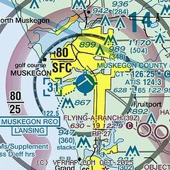
| Sectional chart |
|---|
|
 Download PDF
of official airport diagram from the FAA
| Airport distance calculator |
|---|
|
|
| Sunrise and sunset |
|---|
|
Times for 24-Apr-2026
| | Local
(UTC-4) | | Zulu
(UTC) |
|---|
| Morning civil twilight | | 06:19 | | 10:19 |
| Sunrise | | 06:50 | | 10:50 |
| Sunset | | 20:37 | | 00:37 |
| Evening civil twilight | | 21:07 | | 01:07 |
|
| Current date and time |
|---|
| Zulu (UTC) | 24-Apr-2026 22:03:31 |
|---|
| Local (UTC-4) | 24-Apr-2026 18:03:31 |
|---|
|
| METAR |
|---|
| KMKG | 242155Z 29005KT 10SM OVC055 17/13 A2972 RMK AO2 SLP063 T01720128
|
KFFX
19nm NE | 242155Z AUTO 31013KT 10SM SCT021 BKN027 OVC036 18/14 A2971 RMK AO2
|
|
| TAF |
|---|
| KMKG | 241720Z 2418/2518 21010G18KT P6SM VCSH FEW025 OVC035 TEMPO 2418/2420 6SM -SHRA BR BKN025 FM242000 25009KT P6SM VCSH BKN035 FM250000 30006KT P6SM BKN040 FM251000 33009KT P6SM BKN025 FM251200 36010KT P6SM BKN017
|
|
| NOTAMs |
|---|
NOTAMs are issued by the DoD/FAA and will open in a separate window not controlled by AirNav.
|
|


