FAA INFORMATION EFFECTIVE 14 MAY 2026
Location
| FAA Identifier: | SXL |
| Lat/Long: | 38-13-53.9000N 080-52-14.9000W
38-13.898333N 080-52.248333W
38.2316389,-80.8708056
(estimated) |
| Elevation: | 1819.7 ft. / 554.6 m (surveyed) |
| Variation: | 07W (2000) |
| From city: | 3 miles S of SUMMERSVILLE, WV |
| Time zone: | UTC -4 (UTC -5 during Standard Time) |
| Zip code: | 26651 |
Airport Operations
| Airport use: | Open to the public |
| Control tower: | no |
| ARTCC: | INDIANAPOLIS CENTER |
| FSS: | ELKINS FLIGHT SERVICE STATION [703-724-4288] |
| NOTAMs facility: | EKN (NOTAM-D service available) |
| Attendance: | MON-FRI 0800-1700 |
| Wind indicator: | lighted |
| Segmented circle: | no |
| Lights: | ACTVT MIRL RWY 04/22 - CTAF. PAPI RWY 22 OTS INDFLY. |
| Beacon: | white-green (lighted land airport)
LIGHTHOUSE 2 MI SE. MAY BE MISTAKEN FOR RTG BCN. |
Airport Communications
| CTAF/UNICOM: | 122.8 |
| CHARLESTON APPROACH: | 119.2 |
| CHARLESTON DEPARTURE: | 119.2 |
Airport Services
| Fuel available: | 100LL
100LL:SELF-SERVE. |
| Parking: | tiedowns |
| Airframe service: | NONE |
| Powerplant service: | NONE |
| Bottled oxygen: | NONE |
| Bulk oxygen: | NONE |
Runway Information
Runway 4/22
| Dimensions: | 3015 x 50 ft. / 919 x 15 m |
| Surface: | asphalt, in fair condition |
| Runway edge lights: | medium intensity |
| RUNWAY 4 | | RUNWAY 22 |
| Latitude: | 38-13.698933N | | 38-14.096528N |
| Longitude: | 080-52.437152W | | 080-52.059907W |
| Elevation: | 1807.6 ft. | | 1819.7 ft. |
| Traffic pattern: | left | | left |
| Runway heading: | 044 magnetic, 037 true | | 224 magnetic, 217 true |
| Markings: | nonprecision, in fair condition | | nonprecision, in fair condition |
| Visual slope indicator: | | | 2-light PAPI on left (3.25 degrees glide path) |
| Runway end identifier lights: | yes
REILS OTS INDEFLY. | | yes
REILS OTS INDEFLY. |
| Touchdown point: | yes, no lights | | yes, no lights |
| Instrument approach: | SDF | | |
| Obstructions: | 50 ft. trees, 201 ft. from runway, 150 ft. right of centerline
30 FT TREES; UP TO 120 FT DSTC, APPROX 105 TO 125 FT RIGHT. | | 65 ft. trees, 201 ft. from runway, 150 ft. left of centerline
70 FT TREES, 0 FT DSTC 200 FT L. |
Airport Ownership and Management from official FAA records
| Ownership: | Publicly-owned |
| Owner: | U.S. ARMY CORPS OF ENGINEERS.
502 8TH ST.
HUNTINGTON, WV 25701
Phone 304-399-5890
ARPT LEASED TO NICHOLAS CO. ARPT AUTH. P O BOX 95, SUMMERSVILLE, WV 26651. 304-872-7830. USACE POC TRAVIS BOWMAN. 304-590-9353 CELL PH. |
| Manager: | TIM ADKINS
ATTN: NCAA, PO BOX 95
SUMMERSVILLE, WV 26651-0754
Phone 304-881-1600
ARPT PHYS ADDR. 2506 AIRPORT RD. SUMMERSVILLE, WV 26651. |
Additional Remarks
| - | RWY 04 50 FT DROP-OFF 110 FT FM THR. |
| - | RWY 22 30 FT DROP-OFF 110 FT FM THR. |
| - | FOR CD CTC CHARLESTON APCH AT 304-344-5867 EXT 281. |
Instrument Procedures
NOTE: All procedures below are presented as PDF files. If you need a reader for these files, you should download the free Adobe Reader.NOT FOR NAVIGATION. Please procure official charts for flight.
FAA instrument procedures published for use from 14 May 2026 at 0901Z to 11 June 2026 at 0900Z.
IAPs - Instrument Approach Procedures |
|---|
| RNAV (GPS)-A | |
download (200KB) |
| NOTE: Special Take-Off Minimums/Departure Procedures apply | |
download (283KB) |
Other nearby airports with instrument procedures:
48I - Braxton County Airport (29 nm N)
KBKW - Raleigh County Memorial Airport (29 nm SW)
KLWB - Greenbrier Valley Airport (32 nm SE)
KCRW - West Virginia International Yeager Airport (35 nm W)
KUSW - Boggs Field Airport (42 nm NW)
|
|

Road maps at:
MapQuest
Bing
Google
| Aerial photo |
|---|
WARNING: Photo may not be current or correct
 Photo © Appalachian Aerial Images
Do you have a better or more recent aerial photo of Summersville Airport that you would like to share? If so, please send us your photo.
|
| Sectional chart |
|---|
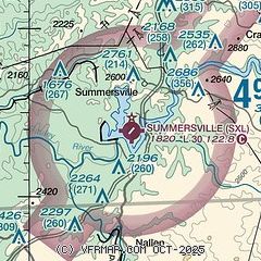
|
| Airport distance calculator |
|---|
|
|
| Sunrise and sunset |
|---|
|
Times for 15-May-2026
| | Local
(UTC-4) | | Zulu
(UTC) |
|---|
| Morning civil twilight | | 05:44 | | 09:44 |
| Sunrise | | 06:14 | | 10:14 |
| Sunset | | 20:26 | | 00:26 |
| Evening civil twilight | | 20:56 | | 00:56 |
|
| Current date and time |
|---|
| Zulu (UTC) | 15-May-2026 14:19:27 |
|---|
| Local (UTC-4) | 15-May-2026 10:19:27 |
|---|
|
| METAR |
|---|
KBKW
28nm SW | 151351Z AUTO 25005KT 10SM CLR 11/04 A3013 RMK AO2 SLP205 T01110044
|
K48I
29nm N | 151355Z AUTO VRB04KT 10SM CLR 11/06 A3011 RMK AO2 T01140061 $
|
KLWB
31nm SE | 151350Z 27006KT 10SM CLR 11/04 A3011
|
KCRW
35nm W | 151354Z 24003KT 10SM SCT200 13/06 A3013 RMK AO2 SLP201 T01280061 $
|
KI16
50nm SW | 151355Z AUTO 10SM CLR 12/08 A3021 RMK AO2 T01200081
|
|
| TAF |
|---|
KBKW
28nm SW | 151120Z 1512/1612 00000KT P6SM SKC FM151500 32007KT P6SM FEW250 FM152300 00000KT P6SM BKN160
|
KLWB
31nm SE | 151120Z 1512/1612 25005KT P6SM SKC FM151500 31008KT P6SM FEW250 FM152200 VRB04KT P6SM BKN200 FM161000 00000KT P6SM FEW150
|
KCRW
35nm W | 151132Z 1512/1612 00000KT 6SM BR FEW250 TEMPO 1512/1513 2SM BR FM151300 00000KT P6SM SKC
|
|
| NOTAMs |
|---|
NOTAMs are issued by the DoD/FAA and will open in a separate window not controlled by AirNav.
|
|

