FAA INFORMATION EFFECTIVE 22 JANUARY 2026
Location
| FAA Identifier: | VOK |
| Lat/Long: | 43-56-21.2630N 090-15-11.3820W
43-56.354383N 090-15.189700W
43.9392397,-90.2531617
(estimated) |
| Elevation: | 912 ft. / 278 m (estimated) |
| Variation: | 00E (1995) |
| From city: | 1 mile N of CAMP DOUGLAS, WI |
| Time zone: | UTC -6 (UTC -5 during Daylight Saving Time) |
| Zip code: | 54618 |
Airport Operations
| Airport use: | Private use. Permission required prior to landing |
| Activation date: | 01/1941 |
| Control tower: | yes |
| ARTCC: | CHICAGO CENTER |
| FSS: | GREEN BAY FLIGHT SERVICE STATION |
| NOTAMs facility: | GRB (NOTAM-D service available) |
| Attendance: | MON-FRI 1400-2200Z++
EXC HOL, CK NOTAM FOR CURRENT AFLD HR. |
| Wind indicator: | yes |
| Segmented circle: | no |
| Lights: | WHEN ATCT CLSD ACTVT MALSR RWY 09; ALSF-1 RWY 27; PAPI RWY 9 & 27; HIRL RWY 09/27 - CTAF OR 239.25. |
| Beacon: | white-green (lighted land airport)
SS-SR. ROTG BCN SCHED SS-SR WHEN TWR OPERATIONAL. |
Airport Communications
| CTAF: | 127.5 |
| ATIS: | 134.35 257.85 |
| VOLK GROUND: | 121.9 275.8 [1400-2200Z++ MON-FRI; EXC HOL, CLOSED OTHER TIMES EXCEPT VALIDATED OVERSEAS OR ANG MSN, CK NOTAM FOR CURRENT AFLD HR.] |
| VOLK TOWER: | 127.5 239.25 [1400-2200Z++ MON-FRI; EXC HOL, CLOSED OTHER TIMES EXCEPT VALIDATED OVERSEAS OR ANG MSN, CK NOTAM FOR CURRENT AFLD HR.] |
| VOLK APPROACH: | 135.25 244.875 [0800-1600 MON-FRI; EXCP HOLS] |
| VOLK DEPARTURE: | 135.25 244.875 [0800-1600 MON-FRI; EXCP HOLS] |
| EMERG: | 121.5 243.0 |
| OPS: | 134.35 ;VOK SUA ACTIVITY |
| PTD: | 372.2 |
| RANGE CTL: | 260.4 ;SHEBOYGAN RANGE 297.75 ;HARDWOOD RANGE 34.2 ;HARDWOOD RANGE 358.8 ;HARDWOOD RANGE |
| WX AWOS-3 at 82C (8 nm SE): | 123.925 (608-562-6153) |
- APCH/DEP SVC PRVDD BY CHICAGO ARTCC (ZAU) ON FREQS 125.05/269.375 (CAMP DOUGLAS RCAG) WHEN VOLK APCH CTL CLSD.
- OTHER TIMES IN SUPPORT OF NGB VALIDATED FLYING.
- RADAR; LTD SRA SVC AVBL, CTC RAPCON AT DSN 871-1779, C608-427-1779.
Nearby radio navigation aids
| VOR radial/distance | | VOR name | | Freq | | Var |
|---|
| DLLr315/31.5 | | DELLS VORTAC | | 117.00 | | 03E |
Airport Services
| Airframe service: | NONE |
| Powerplant service: | NONE |
| Bulk oxygen: | HIGH/LOW |
Runway Information
Runway 9/27
| Dimensions: | 9000 x 150 ft. / 2743 x 46 m |
| Surface: | concrete/grooved |
| Weight bearing capacity: | |
| Runway edge lights: | high intensity |
| RUNWAY 9 | | RUNWAY 27 |
| Latitude: | 43-56.341550N | | 43-56.367067N |
| Longitude: | 090-16.214483W | | 090-14.164917W |
| Elevation: | 912.0 ft. | | 903.7 ft. |
| Traffic pattern: | left | | right |
| Runway heading: | 089 | | 269 |
| Markings: | , in fair condition | | , in fair condition |
| Visual slope indicator: | 4-light PAPI on left (3.00 degrees glide path) | | 4-light PAPI on right (2.85 degrees glide path) |
| Approach lights: | MALSR: 1,400 foot medium intensity approach lighting system with runway alignment indicator lights | | ALSF1: standard 2,400 foot high intensity approach lighting system with centerline sequenced flashers (category I)
SFL NOT AVAILABLE ON PCL, AVAILABLE UPON REQUEST WITH TWR/BASE OPS. |
| Runway end identifier lights: | no | | no |
| Touchdown point: | yes, no lights | | yes, no lights |
| Instrument approach: | | | ILS |
Airport Ownership and Management from official FAA records
| Ownership: | U.S. Air Force |
| Owner: | USAF
HDQTRS WI ANG VOLK FLD CAMP
CAMP DOUGLAS, WI 54618
Phone 608-427-1205 |
| Manager: | BASE OPERATIONS
HDQTRS WI ANG VOLK FLD CAMP
CAMP DOUGLAS, WI 54618
Phone 608-427-1205
DSN 871-1205. |
Additional Remarks
| E60-27 | HOOK BAK-12B(B)(1250') |
| E60-09 | HOOK BAK12B(B)(1260') |
| - | JASU - (AM32A-60A) 6(A/M32A-86). |
| - | FUEL: A++ AVBL LTD, EXP POSSIBLE GND DELAY FOR REQ EXCEEDING 10,000 GAL. |
| - | FLUID - LPOX LOX. |
| - | TRAN ALERT - EXTREMELY LTD. |
| - | MILITARY USE: OPR 1400-2200Z++ MON-FRI EXC HOL, CK NOTAM FOR CURRENT AIRFIELD HR. |
| - | RSTD: PPR CTC VOLK FLD DSN 871-1205, C608-427-1205. ISSUED PPR VALID FOR ETA +/- 1 HR. EARLY/LATE ARR/DEP MUST BE COORD. AFTER HR RE-COORD OR CNL WILL BE PASSED TO BASE OPS SBY PERS C608-343-0104. |
| - | CAUTION - WHEN WIND IS FR S/SW EXP POSSIBLE LOW LEVEL WIND SHEAR 1 TO 3 NM ON FINAL TO RWY 27. DUE TO TACTICAL ACFT RQR, BAK-12 CABLE MAY BE IN POSN FOR RWY 09-27 SIMULTANEOUSLY. |
| - | CAUTION: TWY E, F AND G UNLGTD, UNLTD DAYTIME VFR USE, FOLLOW ME RQR FOR DAY IFR AND NGT IFR/VFR USE. TWY E AND TWY F CLNC VIOLATION - AEROSPACE GND EQPT LCTED WI 58 FT FM TWY CNTLN. |
| - | TFC PAT: COPTER RECTANGULAR 1500'. |
| - | MISC: FIRST 1600 FT RY 09 AND FIRST 1600 FT RY 27 GROOVED CONCRETE, MID 5800 GROOVED ASPHALT. STD USAF RSRS APPLIED. |
| - | RSTD: PPR MUST BE RCV NLT 48 HR IN ADVANCE OF ACFT ARR OR BY 2200Z++ ON FRI FOR THE FOLLOWING MON. |
| - | REMARKS-MISC: BASE OPS DSN 871-1205, C608-427-1205. |
| - | CAUTION: USE EXTREME CAUTION FOR EXTENSIVE UNMANNED AERIAL SYSTEMS (UAS) OPS IN VCNTY. |
| - | REMARKS-CAUTION: BASH PHASE I- ALL DATES NOT DESIGNATED AS PHASE II. PHASE II IN EFFECT 1 SEP TO 30 NOV AND 1 MAR TO 31 MAY. |
| - | CAUTION: NSTD AIRFIELD PAINT MARK NEAR BAK-12 TAPE CONNECTORS AND DONUTS FOR RWY 09/27. THE MARK IS A 4 IN WIDE YELLOW HALF- MOON ARC AROUND THE SHEAVE, WITH ONE MARK AT EACH ENTRANCE. |
| - | MISC: LAVATORY SVC UNAVBL. |
| - | CAUTION: TSNT CREWS BE ADZD ARFF CAT 9 WITH 9700 GALLONS. |
| - | WHEN ATCT CLSD, FOR CD CTC CHICAGO ARTCC AT 630-906-8921. |
| - | RSTD: RECOMMEND USE AS EMERG ARPT ONLY WHEN RQR TO LAND AS SOON AS POSSIBLE. |
| - | CAUTION: NSTD AIRFIELD PAINT MARK ON EAST APR TO ID PRKG SPOTS. NSTD AIRFIELD PAINT MARK ON TWYS E, F, AND WEST END OF TWY A TO ID UAS EQPT PLACEMENT. |
| - | COMSEC UNAVBL, MNM OVNGT CLASSIFIED STORAGE AVBL FOR TSNT AIRCREWS. |
| - | RSTD: TWY F 50 FT WIDE; AIRCREWS MUST CTC AIRFIELD MGMT TO UTILIZE TWY E OR TWY F. |
| - | VFR PAT LTD TO 3 ACFT FR 0559Z - 1400Z+. |
| - | TWY G LTD TO WINGSPAN LESS THAN 44 FT AND HELI TFC. |
| - | LGT: RWY 27 PAPI NSTD, RIGHT SIDE. |
| - | A-GEAR - NML BAK-12B(B) CONFIGURATION: APCH END DOWN, DEP END UP; 20 MIN PN TO RECONNECT APCH END CABLE. |
Instrument Procedures
NOTE: All procedures below are presented as PDF files. If you need a reader for these files, you should download the free Adobe Reader.NOT FOR NAVIGATION. Please procure official charts for flight.
FAA instrument procedures published for use from 22 January 2026 at 0901Z to 19 February 2026 at 0900z.
IAPs - Instrument Approach Procedures |
|---|
| ILS OR LOC/DME RWY 27 | |
download (120KB) |
| RNAV (GPS) RWY 09 | |
download (115KB) |
| HI-TACAN RWY 27 | |
download (115KB) |
| TACAN RWY 09 | |
download (128KB) |
| TACAN RWY 27 | |
download (127KB) |
| NOTE: Special Take-Off Minimums/Departure Procedures apply | |
download (484KB) |
Other nearby airports with instrument procedures:
82C - Mauston/New Lisbon Union Airport (8 nm SE)
KDAF - Necedah Airport (9 nm NE)
Y72 - Bloyer Field Airport (10 nm W)
63C - Adams County Airport-Legion Field (20 nm E)
KCMY - Sparta/Fort Mc Coy Airport (21 nm W)
|
|

Road maps at:
MapQuest
Bing
Google
| Aerial photo |
|---|
WARNING: Photo may not be current or correct
 Photo by Dan Weber
Photo taken 09-Mar-2009
looking northeast.
Photo by Dan Weber
Photo taken 09-Mar-2009
looking northeast.
Do you have a better or more recent aerial photo of Volk Field Airport that you would like to share? If so, please send us your photo.
|
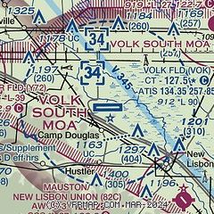
| Sectional chart |
|---|
|
 Download PDF
of official airport diagram from the FAA
| Airport distance calculator |
|---|
|
|
| Sunrise and sunset |
|---|
|
Times for 27-Jan-2026
| | Local
(UTC-6) | | Zulu
(UTC) |
|---|
| Morning civil twilight | | 06:53 | | 12:53 |
| Sunrise | | 07:25 | | 13:25 |
| Sunset | | 17:03 | | 23:03 |
| Evening civil twilight | | 17:34 | | 23:34 |
|
| Current date and time |
|---|
| Zulu (UTC) | 27-Jan-2026 17:56:21 |
|---|
| Local (UTC-6) | 27-Jan-2026 11:56:21 |
|---|
|
| METAR |
|---|
| KVOK | 271655Z 28015KT 10SM FEW030 M13/M22 A3011 RMK AO2A SLP221 T11351222
|
K82C
8nm SE | 271715Z AUTO 29012G18KT 10SM SCT028 SCT033 M13/M21 A3014 RMK AO2 T11311207
|
|
| TAF |
|---|
| KVOK | 271200Z 2712/2815 28010G15KT 9999 SKC QNH2982INS TEMPO 2712/2716 30025G35KT 520003 BECMG 2715/2716 31015G20KT 9999 BKN040 620403 520001 QNH3005INS BECMG 2722/2723 30010G20KT 9999 BKN030 620302 QNH3019INS TXM14/2712Z TNM17/2802Z
|
|
| NOTAMs |
|---|
NOTAMs are issued by the DoD/FAA and will open in a separate window not controlled by AirNav.
|
|


