FAA INFORMATION EFFECTIVE 09 JULY 2026
Location
| FAA Identifier: | RAC |
| Lat/Long: | 42-45-40.2490N 087-48-50.0740W
42-45.670817N 087-48.834567W
42.7611803,-87.8139094
(estimated) |
| Elevation: | 673.6 ft. / 205.3 m (surveyed) |
| Variation: | 02W (1995) |
| From city: | 2 miles NW of RACINE, WI |
| Time zone: | UTC -5 (UTC -6 during Standard Time) |
| Zip code: | 53404 |
Airport Operations
| Airport use: | Open to the public |
| Activation date: | 01/1941 |
| Control tower: | no |
| ARTCC: | CHICAGO CENTER |
| FSS: | GREEN BAY FLIGHT SERVICE STATION |
| NOTAMs facility: | RAC (NOTAM-D service available) |
| Attendance: | 0700-1700 |
| Wind indicator: | lighted |
| Segmented circle: | no |
| Lights: | HIRL RWY 04/22 PRESET TO LOW SS-SR; TO INCR INTST & ACTVT MALSF RWY 04; REIL RWY 22, 14 & 32; PAPI RWY 14; HIRL RWY 04/22; MIRL RWY 14/32 - CTAF. PAPI RWY 04 & 22 OPRS CONSLY. |
| Beacon: | white-green (lighted land airport)
Operates sunset to sunrise. |
| Landing fee: | yes, LNDG FEE FOR JET ACFT. |
| International operations: | customs landing rights airport |
Airport Communications
| CTAF/UNICOM: | 123.075 |
| WX ASOS: | 121.425 (262-635-0959) |
| MILWAUKEE APPROACH: | 135.875 |
| MILWAUKEE DEPARTURE: | 135.875 |
| CLEARANCE DELIVERY: | 120.15 |
| GOPAC STAR: | 126.5 |
| WX ASOS at ENW (11 nm SW): | PHONE 262-652-7730 |
| WX ASOS at MKE (12 nm N): | 126.4 (414-400-9402) |
Nearby radio navigation aids
| VOR radial/distance | | VOR name | | Freq | | Var |
|---|
| BAEr134/29.7 | | BADGER VOR/DME | | 116.40 | | 02E |
| OBKr013/33.0 | | NORTHBROOK VOR/DME | | 113.00 | | 02W |
Airport Services
| Fuel available: | 100LL JET-A JET-A+ |
| Parking: | hangars and tiedowns |
| Airframe service: | MAJOR |
| Powerplant service: | MAJOR |
| Bottled oxygen: | NONE |
| Bulk oxygen: | NONE |
Runway Information
Runway 4/22
| Dimensions: | 6574 x 100 ft. / 2004 x 30 m |
| Surface: | concrete/grooved, in good condition |
| Weight bearing capacity: | | PCN 18 /R/B/W/T | | Single wheel: | 50.0 | | Double wheel: | 65.0 |
|
| Runway edge lights: | high intensity |
| RUNWAY 4 | | RUNWAY 22 |
| Latitude: | 42-45.260925N | | 42-46.126012N |
| Longitude: | 087-49.222773W | | 087-48.340227W |
| Elevation: | 672.4 ft. | | 665.0 ft. |
| Traffic pattern: | left | | left |
| Runway heading: | 039 magnetic, 037 true | | 219 magnetic, 217 true |
| Displaced threshold: | 734 ft. | | 390 ft. |
| Markings: | precision, in good condition | | precision, in good condition |
| Visual slope indicator: | 4-light PAPI on left (3.00 degrees glide path) | | 4-light PAPI on left (3.00 degrees glide path) |
| Approach lights: | MALSF: 1,400 foot medium intensity approach lighting system with sequenced flashers | | |
| Runway end identifier lights: | no | | yes |
| Touchdown point: | yes, no lights | | yes, no lights |
| Instrument approach: | ILS | | |
| Obstructions: | 15 ft. road, 200 ft. from runway, 140 ft. right of centerline
10 FT FENCE 0-90 FT FM RWY END, BOTH SIDES OF CNTRLN; 15 FT RD 0-200 FT FM RWY END, BOTH SIDES OF CNTRLN. | | 8 ft. rr, 200 ft. from runway, 50 ft. left of centerline
23 FT RR 0-200 FT FM RWY END, 60-230 FT L; 20 FT TREE 10 FT FM RWY END, 130 FT L. |
Runway 14/32
| Dimensions: | 4421 x 100 ft. / 1348 x 30 m |
| Surface: | asphalt, in fair condition |
| Weight bearing capacity: | | Single wheel: | 25.0 | | Double wheel: | 35.0 |
|
| Runway edge lights: | medium intensity |
| RUNWAY 14 | | RUNWAY 32 |
| Latitude: | 42-45.886705N | | 42-45.387510N |
| Longitude: | 087-49.272772W | | 087-48.554085W |
| Elevation: | 673.6 ft. | | 658.2 ft. |
| Traffic pattern: | left | | left |
| Runway heading: | 135 magnetic, 133 true | | 315 magnetic, 313 true |
| Displaced threshold: | 807 ft. | | no |
| Markings: | nonprecision, in good condition | | nonprecision, in good condition |
| Visual slope indicator: | 4-light PAPI on left (4.00 degrees glide path) | | |
| Runway end identifier lights: | yes | | yes |
| Touchdown point: | yes, no lights | | yes, no lights |
| Obstructions: | 15 ft. road, 200 ft. from runway, 15 ft. left of centerline
10 FT FENCE 10-200 FT FM RWY END, BOTH SIDES OF CNTRLN; 15 FT RD 0-200 FT FM RWY END, BOTH SIDES OF CNTRLN; 50 FT TREE 110 FT FM RWY END, 175 FT R. | | 31 ft. tree, 770 ft. from runway, 100 ft. left of centerline, 18:1 slope to clear |
Airport Ownership and Management from official FAA records
| Ownership: | Privately-owned |
| Owner: | RACINE COMMERCIAL APRT CORP.
3239 N. GREEN BAY RD
RACINE, WI 53404
Phone 262-631-5620 |
| Manager: | TAMARA SANDBERG
3239 N. GREEN BAY RD
RACINE, WI 53404
Phone 262-631-5620 |
Additional Remarks
| - | MIGRATORY WATERFOWL ON & INVOF ARPT. |
| - | FOR CD CTC CHICAGO ARTCC AT 630-906-8921. |
Instrument Procedures
NOTE: All procedures below are presented as PDF files. If you need a reader for these files, you should download the free Adobe Reader.NOT FOR NAVIGATION. Please procure official charts for flight.
FAA instrument procedures published for use from 09 July 2026 at 0901Z to 06 August 2026 at 0900Z.
STARs - Standard Terminal Arrivals |
|---|
| GOPAC THREE (RNAV) **NEW** | |
download (233KB) |
IAPs - Instrument Approach Procedures |
|---|
| ILS OR LOC RWY 04 | |
download (244KB) |
| RNAV (GPS) RWY 04 | |
download (269KB) |
| RNAV (GPS) RWY 22 | |
download (249KB) |
| RNAV (GPS) RWY 32 | |
download (222KB) |
| NOTE: Special Alternate Minimums apply | |
download (112KB) |
Departure Procedures |
|---|
| ACCRA FIVE (RNAV) | |
download (157KB) |
| UECKR SIX (RNAV) | |
download (174KB) |
| NOTE: Special Take-Off Minimums/Departure Procedures apply | |
download (486KB) |
Other nearby airports with instrument procedures:
KENW - Kenosha Regional Airport (11 nm SW)
KMKE - General Mitchell International Airport (12 nm N)
KUGN - Waukegan National Airport (20 nm S)
KBUU - Burlington Municipal Airport (22 nm W)
KMWC - Lawrence J Timmerman Airport (23 nm NW)
|
|

Road maps at:
MapQuest
Bing
Google
| Aerial photo |
|---|
WARNING: Photo may not be current or correct
 Photo taken 20-Apr-2017
looking north.
Photo taken 20-Apr-2017
looking north.
Do you have a better or more recent aerial photo of Batten International Airport that you would like to share? If so, please send us your photo.
|
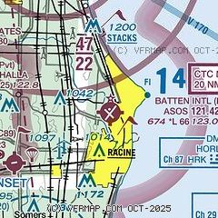
| Sectional chart |
|---|
|
CAUTION: Diagram may not be current

| Airport distance calculator |
|---|
|
|
| Sunrise and sunset |
|---|
|
Times for 22-Jul-2026
| | Local
(UTC-5) | | Zulu
(UTC) |
|---|
| Morning civil twilight | | 05:01 | | 10:01 |
| Sunrise | | 05:34 | | 10:34 |
| Sunset | | 20:22 | | 01:22 |
| Evening civil twilight | | 20:55 | | 01:55 |
|
| Current date and time |
|---|
| Zulu (UTC) | 22-Jul-2026 20:53:42 |
|---|
| Local (UTC-5) | 22-Jul-2026 15:53:42 |
|---|
|
| METAR |
|---|
| KRAC | 221953Z AUTO 06010G16KT 10SM CLR 23/09 A3011 RMK AO2 SLP193 T02280089
|
KENW
11nm SW | 221953Z 11008KT 10SM OVC065 22/09 A3011 RMK AO2 SLP192 T02170094
|
KMKE
12nm N | 221952Z 05008KT 10SM SCT055 BKN075 22/08 A3008 RMK AO2 SLP184 T02220083
|
|
| TAF |
|---|
KENW
11nm SW | 221907Z 2219/2318 08010KT P6SM SCT050 FM230100 VRB05KT P6SM FEW250 FM231600 23011KT P6SM SCT050
|
KMKE
12nm N | 221906Z 2219/2324 07009KT P6SM SCT050 FM230100 VRB05KT P6SM FEW250 FM231400 27009KT P6SM SCT050 FM231700 15012KT P6SM FEW050
|
|
| NOTAMs |
|---|
NOTAMs are issued by the DoD/FAA and will open in a separate window not controlled by AirNav.
|
|


