FAA INFORMATION EFFECTIVE 09 JULY 2026
Location
| FAA Identifier: | RCZ |
| Lat/Long: | 34-53-28.6920N 079-45-34.5520W
34-53.478200N 079-45.575867W
34.8913033,-79.7595978
(estimated) |
| Elevation: | 357.5 ft. / 109.0 m (surveyed) |
| Variation: | 08W (2010) |
| From city: | 3 miles S of ROCKINGHAM, NC |
| Time zone: | UTC -4 (UTC -5 during Standard Time) |
| Zip code: | 28379 |
Airport Operations
| Airport use: | Open to the public |
| Activation date: | 04/1943 |
| Control tower: | no |
| ARTCC: | WASHINGTON CENTER |
| FSS: | RALEIGH FLIGHT SERVICE STATION |
| NOTAMs facility: | RCZ (NOTAM-D service available) |
| Attendance: | MON-FRI 0800-1700
UNATNDD SAT, SUN AND FEDERAL HOLS.
FOR ARPT ATTENDANT NGTS AND SUN CALL 910-997-5071. |
| Wind indicator: | lighted |
| Segmented circle: | yes |
| Lights: | ACTVT DUSK TO DAWN. REIL RWY 32; PAPI RWY 14 & 32; MIRL RWY 14/32 - CTAF. |
| Beacon: | white-green (lighted land airport)
Operates sunset to sunrise. |
Airport Communications
| CTAF/UNICOM: | 122.8 |
| WX AWOS-3: | 118.775 (910-997-4093) |
| FAYETTEVILLE APPROACH: | 127.8 |
| FAYETTEVILLE DEPARTURE: | 127.8 |
| WX AWOS-3 at CQW (14 nm SW): | 124.825 (843-537-3301) |
| WX ASOS at HFF (16 nm NE): | 141.25 (910-396-7804) |
| WX AWOS-3PT at BBP (16 nm S): | 123.825 (843-479-5817) |
| WX AWOS-3 at AFP (17 nm NW): | 119.325 (704-695-0623) |
Nearby radio navigation aids
| VOR radial/distance | | VOR name | | Freq | | Var |
|---|
| SDZr206/21.2 | | SANDHILLS VORTAC | | 111.80 | | 03W |
| CTFr063/29.2 | | CHESTERFIELD VOR/DME | | 114.55 | | 03W |
| FLOr356/39.8 | | FLORENCE VORTAC | | 115.20 | | 03W |
| NDB name | | Hdg/Dist | | Freq | | Var | | ID |
|---|
| HARTSVILLE | | 038/34.1 | | 341 | | 07W | | HVS | .... ...- ... |
Airport Services
| Fuel available: | 100LL JET-A1+
100LL:100LL AND JET A - 24 HR SELF-SERVICE WITH CREDIT CARD. |
| Parking: | tiedowns |
| Airframe service: | NONE |
| Powerplant service: | NONE |
| Bottled oxygen: | NONE |
| Bulk oxygen: | NONE |
Runway Information
Runway 14/32
| Dimensions: | 5001 x 100 ft. / 1524 x 30 m |
| Surface: | asphalt, in good condition |
| Weight bearing capacity: | |
| Runway edge lights: | medium intensity |
| RUNWAY 14 | | RUNWAY 32 |
| Latitude: | 34-53.735585N | | 34-53.244868N |
| Longitude: | 079-45.797918W | | 079-44.993985W |
| Elevation: | 349.8 ft. | | 354.5 ft. |
| Traffic pattern: | left | | left |
| Runway heading: | 135 magnetic, 127 true | | 315 magnetic, 307 true |
| Displaced threshold: | 150 ft. | | 201 ft. |
| Markings: | nonprecision, in good condition | | nonprecision, in good condition |
| Visual slope indicator: | 2-light PAPI on left (3.00 degrees glide path) | | 2-light PAPI on left (3.00 degrees glide path) |
| Runway end identifier lights: | no | | yes |
| Touchdown point: | yes, no lights | | yes, no lights |
| Obstructions: | 14 ft. trees, 207 ft. from runway, 76 ft. right of centerline
APCH SLOPE 9:1 AT DSPLCD THR DUE TO 16 FT TREES 357 FT FROM DSPLCD THR OFFSET 71 FT RIGHT OF CNTRLN. | | 20 ft. rr, 215 ft. from runway, 243 ft. right of centerline
15 FT ROAD, 5 FT FENCE, AND 20 FT RAILROAD ALL 0-200 FT FM RWY END OFFSET BETWEEN 90-200 FT RIGHT OF CNTRLN. |
Runway 4/22
| Dimensions: | 3009 x 490 ft. / 917 x 149 m |
| Surface: | turf, in good condition |
| RUNWAY 4 | | RUNWAY 22 |
| Latitude: | 34-53.268850N | | 34-53.647533N |
| Longitude: | 079-46.069318W | | 079-45.680412W |
| Elevation: | 356.4 ft. | | 348.4 ft. |
| Traffic pattern: | left | | left |
| Runway heading: | 049 magnetic, 041 true | | 229 magnetic, 221 true |
| Markings: | none | | none |
| Touchdown point: | yes, no lights | | yes, no lights |
| Obstructions: | 39 ft. trees, 75 ft. from runway, 66 ft. left of centerline, 1:1 slope to clear | | 78 ft. trees, 1979 ft. from runway, 282 ft. right of centerline, 25:1 slope to clear |
Airport Ownership and Management from official FAA records
| Ownership: | Publicly-owned |
| Owner: | RICHMOND COUNTY
656 AIRPORT ROAD
ROCKINGHAM, NC 28379
Phone 910-997-8211 |
| Manager: | JEFF PRESSLEY
656 AIRPORT ROAD
ROCKINGHAM, NC 28379
Phone 910-206-0419 |
Additional Remarks
| - | RWY 14 HAS 60 FT DROP-OFF 350 FT FROM DSPLCD THR ALL SIDES. |
| - | RWY 04/22 NOT IN USE WHEN WET - TURBINE ENGINE ACFT AND ACFT OVER 10K LBS. CALL 910-997-5071 FOR RUNWAY CONDITIONS BEFORE LANDING. |
| - | FOR CD CTC WASHINGTON ARTCC AT 703-771-3587. |
| - | RWY 32 HAS NUMEROUS OBSTRUCTIONS IN APCH INCLUDING 5 FT FENCE, 12 FT ROAD, AND 20 FT RAILROAD. |
Instrument Procedures
NOTE: All procedures below are presented as PDF files. If you need a reader for these files, you should download the free Adobe Reader.NOT FOR NAVIGATION. Please procure official charts for flight.
FAA instrument procedures published for use from 09 July 2026 at 0901Z to 06 August 2026 at 0900Z.
IAPs - Instrument Approach Procedures |
|---|
| RNAV (GPS) RWY 32 | |
download (263KB) |
| NOTE: Special Alternate Minimums apply | |
download (25KB) |
| NOTE: Special Take-Off Minimums/Departure Procedures apply | |
download (387KB) |
Other nearby airports with instrument procedures:
KCQW - Cheraw Municipal Airport/Lynch Bellinger Field (14 nm SW)
KHFF - Mackall Army Airfield (16 nm NE)
KBBP - Marlboro County Jetport/H E Avent Field Airport (16 nm S)
KAFP - Anson County Airport - Jeff Cloud Field (17 nm NW)
KMEB - Laurinburg/Maxton Airport (20 nm E)
|
|

Road maps at:
MapQuest
Bing
Google
| Aerial photo |
|---|
WARNING: Photo may not be current or correct
 from about 3,000 ft
Do you have a better or more recent aerial photo of Richmond County Airport that you would like to share? If so, please send us your photo.
|
| Sectional chart |
|---|
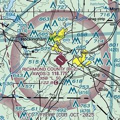
|
| Airport distance calculator |
|---|
|
|
| Sunrise and sunset |
|---|
|
Times for 25-Jul-2026
| | Local
(UTC-4) | | Zulu
(UTC) |
|---|
| Morning civil twilight | | 05:56 | | 09:56 |
| Sunrise | | 06:24 | | 10:24 |
| Sunset | | 20:27 | | 00:27 |
| Evening civil twilight | | 20:55 | | 00:55 |
|
| Current date and time |
|---|
| Zulu (UTC) | 25-Jul-2026 23:44:08 |
|---|
| Local (UTC-4) | 25-Jul-2026 19:44:08 |
|---|
|
| METAR |
|---|
| KRCZ | 252335Z AUTO 00000KT 10SM BKN016 BKN060 25/22 A3001 RMK AO2 T02480218
|
KCQW
14nm SW | 252335Z AUTO 00000KT 10SM FEW020 26/22 A3000 RMK AO2
|
KHFF
15nm NE | 252255Z AUTO 07005KT 10SM FEW013 BKN025 OVC065 24/22 A2999 RMK AO2 SLP155 T02420215 $
|
KBBP
16nm S | 252335Z AUTO 00000KT 10SM SCT060 26/23 A3000 RMK AO2
|
KAFP
17nm NW | 252335Z AUTO 00000KT 10SM BKN050 26/22 A3001 RMK AO2 T02550224
|
|
| TAF |
|---|
KLBT
38nm SE | 251758Z 2518/2618 32005KT P6SM SCT015 OVC050 TEMPO 2518/2521 BKN010 FM252100 VRB04KT P6SM BKN030 TEMPO 2522/2602 BKN015 FM260200 35004KT P6SM BKN012 TEMPO 2602/2606 4SM BR BKN007 FM260600 01004KT 2SM BR OVC004 FM261400 04004KT P6SM OVC025
|
KPOB
40nm NE | 250100Z 2501/2607 02005KT 9600 BR VCSH OVC004 QNH3007INS TEMPO 2503/2509 3200 -DZ BR OVC003 BECMG 2509/2510 32005KT 6000 -SHRA BR VCTS BKN003 OVC005CB QNH3005INS TEMPO 2511/2516 VRB10G20KT 1600 TSRA BR SCT002 OVC006CB BECMG 2516/2517 01006KT 8000 BR OVC005 QNH2999INS TX26/2521Z TN21/2510Z LAST NO AMDS AFT 2502 NEXT 2717
|
KFLO
42nm S | 251725Z 2518/2618 35006KT P6SM BKN010 BKN040 FM252100 VRB05KT P6SM SCT015 BKN030 TEMPO 2600/2604 3SM BR SCT012 FM260500 00000KT 5SM BR BKN010 TEMPO 2605/2609 2SM BR OVC007 FM260900 05003KT 3/4SM BR OVC004 FM261400 07003KT P6SM OVC020
|
KFAY
43nm E | 252111Z 2521/2618 04005KT P6SM BKN015 FM260200 01003KT 5SM BR OVC007 FM260800 00000KT 1 1/2SM BR OVC003 FM261300 04003KT P6SM OVC003 FM261500 02005KT P6SM OVC007 FM261600 03005KT P6SM BKN015
|
KFBG
44nm E | 251910Z 2519/2623 04006KT 9999 OVC008 QNH3003INS BECMG 2521/2522 01006KT 9999 BKN012 QNH3001INS BECMG 2603/2604 VRB03KT 9999 SCT009 QNH3000INS BECMG 2609/2610 00000KT 8000 BR BKN004 QNH2997INS BECMG 2614/2615 00000KT 9999 NSW SCT020 QNH2997INS BECMG 2617/2618 00000KT 9999 SCT030 QNH2992INS TEMPO 2619/2623 VRB03KT 9000 -SHRA BKN030 TX28/2617Z TN20/2610Z
|
|
| NOTAMs |
|---|
NOTAMs are issued by the DoD/FAA and will open in a separate window not controlled by AirNav.
|
|

