FAA INFORMATION EFFECTIVE 11 JUNE 2026
Location
| FAA Identifier: | 1L3 |
| Lat/Long: | 35-26-40.4000N 114-54-33.7000W
35-26.673333N 114-54.561667W
35.4445556,-114.9093611
(estimated) |
| Elevation: | 3413 ft. / 1040.3 m (surveyed) |
| Variation: | 14E (1985) |
| From city: | 1 mile SSE of SEARCHLIGHT, NV |
| Time zone: | UTC -7 (UTC -8 during Standard Time) |
| Zip code: | 89046 |
Airport Operations
| Airport use: | Open to the public |
| Activation date: | 03/1953 |
| Control tower: | no |
| ARTCC: | LOS ANGELES CENTER |
| FSS: | RENO FLIGHT SERVICE STATION |
| NOTAMs facility: | RNO (NOTAM-D service available) |
| Attendance: | UNATNDD |
| Wind indicator: | no |
| Segmented circle: | no |
| Landing fee: | yes |
Airport Communications
Nearby radio navigation aids
| VOR radial/distance | | VOR name | | Freq | | Var |
|---|
| GFSr020/22.9 | | GOFFS VORTAC | | 114.40 | | 15E |
| BLDr169/33.1 | | BOULDER CITY VORTAC | | 116.70 | | 15E |
Airport Services
Runway Information
Runway 16/34
| Dimensions: | 5040 x 70 ft. / 1536 x 21 m |
| Surface: | asphalt, in poor condition
CRACKS IN ASPH. |
| Runway edge markings: | MKGS FADED & BRUSH CVRD. |
| RUNWAY 16 | | RUNWAY 34 |
| Latitude: | 35-27.088338N | | 35-26.259758N |
| Longitude: | 114-54.600907W | | 114-54.523957W |
| Elevation: | 3413.0 ft. | | 3300.0 ft. |
| Traffic pattern: | left | | left |
| Runway heading: | 162 magnetic, 176 true | | 342 magnetic, 356 true |
| Markings: | basic, in poor condition | | basic, in poor condition |
| Runway end identifier lights: | no | | no |
| Obstructions: | 5 ft. fence, 275 ft. from runway, 15:1 slope to clear
5 FT FENCE 83 FT L & PARL TO CNTRLN. | | 5 ft. brush, 200 ft. from runway
2-4 FT BRUSH S END OF RWY IN RSA. |
Helipad H1
| Dimensions: | 46 x 46 ft. / 14 x 14 m |
| Surface: | asphalt, in good condition |
| Latitude: | 35-26.997667N | | |
| Longitude: | 114-54.706333W | | |
| Elevation: | 3403.0 ft. | | |
| Traffic pattern: | left | | left |
| Markings: | NSTD, in poor condition | | |
Helipad H2
| Dimensions: | 46 x 46 ft. / 14 x 14 m |
| Surface: | asphalt, in good condition |
| Latitude: | 35-26.862167N | | |
| Longitude: | 114-54.750833W | | |
| Elevation: | 3396.0 ft. | | |
| Traffic pattern: | left | | left |
| Markings: | NSTD, in poor condition | | |
Airport Ownership and Management from official FAA records
| Ownership: | Privately-owned |
| Owner: | TURNBULL, LLC
GRANITO LTD, 2614 CROYDON RD.
CHARLOTTE, NC 28209
Phone 917-608-5778 |
| Manager: | RUTHANN GRANITO
GRANITO LTD, 2614 CROYDON RD.
CHARLOTTE, NC 28209
Phone 917-608-5778 |
Additional Remarks
| A30A-H1 | TLOF 46X46 FT; FATO 85X85 FT; INGRESS/EGRESS 340/160. |
| A30A-H2 | TLOF 46X46 FT; FATO 85X85 FT; INGRESS/EGRESS 340/160. |
| - | 3481 FT LGTD MTN SW. |
| - | FOR CD CTC LOS ANGELES ARTCC AT 661-575-2079. |
| - | PPR FOR PVT ARPT AREA USE OR INFO - AMGR. |
| - | RWY 16/34 CLSD INDEFLY. |
| - | UNLGTD 165 FT PLINE 3.2 MI SOUTH OF RWY. |
| - | TRRN RISES CNSTNT RATE N FOR 2 MI. |
| - | ARPT COND NOT MNTD - RWY CLSD FOR REPAIRS INDEFLY. |
Instrument Procedures
There are no published instrument procedures at 1L3.
Some nearby airports with instrument procedures:
KIFP - Laughlin/Bullhead International Airport (24 nm SE)
KBVU - Boulder City Municipal Airport (30 nm N)
KHND - Henderson Executive Airport (34 nm N)
KLAS - Harry Reid International Airport (40 nm N)
KEED - Needles Airport (43 nm S)
|
|

Road maps at:
MapQuest
Bing
Google
| Aerial photo |
|---|
WARNING: Photo may not be current or correct
 Provided by PACI, Inc 2018
Photo taken 29-Nov-2017
looking northeast.
Provided by PACI, Inc 2018
Photo taken 29-Nov-2017
looking northeast.
Do you have a better or more recent aerial photo of Searchlight Airport that you would like to share? If so, please send us your photo.
|
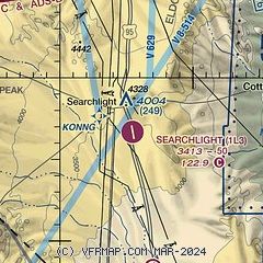
| Sectional chart |
|---|
|
| Airport distance calculator |
|---|
|
|
| Sunrise and sunset |
|---|
|
Times for 11-Jun-2026
| | Local
(UTC-7) | | Zulu
(UTC) |
|---|
| Morning civil twilight | | 04:55 | | 11:55 |
| Sunrise | | 05:25 | | 12:25 |
| Sunset | | 19:54 | | 02:54 |
| Evening civil twilight | | 20:24 | | 03:24 |
|
| Current date and time |
|---|
| Zulu (UTC) | 11-Jun-2026 23:37:10 |
|---|
| Local (UTC-7) | 11-Jun-2026 16:37:10 |
|---|
|
| METAR |
|---|
KBVU
30nm N | 112315Z AUTO 34004KT 10SM CLR 38/M05 A2978 RMK AO2
|
KHND
34nm N | 112256Z 00000KT 10SM CLR 38/M01 A2985 RMK AO2 SLP088 T03781006 $
|
KIFP
35nm SE | 112247Z 34003KT 10SM CLR 42/M04 A2966
|
KLAS
40nm N | 112256Z 02003KT 10SM FEW250 37/M03 A2982 RMK AO2 SLP064 HAZY T03721033
|
KEED
43nm S | 112256Z AUTO VRB03KT 10SM FEW110 43/03 A2969 RMK AO2 SLP014 T04330033
|
KLSV
47nm N | 112255Z 08006KT 10SM CLR 39/M10 A2974 RMK AO2A SLP039 T03891104 $
|
KVGT
47nm N | 112253Z 00000KT 10SM CLR 37/M03 A2981 RMK AO2 SLP079 T03671033
|
KIGM
49nm E | 112251Z AUTO 23012G18KT 10SM CLR 37/01 A2990 RMK AO2 SLP045 T03670006
|
|
| TAF |
|---|
KHND
34nm N | 111723Z 1118/1218 04012KT P6SM SKC FM112200 03005KT P6SM SKC FM120300 18007KT P6SM FEW250
|
KIFP
35nm SE | 111723Z 1118/1218 34008KT P6SM SKC FM112200 19008KT P6SM SKC FM120300 VRB05KT P6SM FEW250 FM121600 16007KT P6SM SCT250
|
KLAS
40nm N | 112045Z 1121/1224 12007KT P6SM SKC FM120300 20008KT P6SM FEW250 FM121500 VRB05KT P6SM FEW250 FM122000 20012G18KT P6SM FEW250
|
|
| NOTAMs |
|---|
NOTAMs are issued by the DoD/FAA and will open in a separate window not controlled by AirNav.
|
|

