FAA INFORMATION EFFECTIVE 16 APRIL 2026
Location
| FAA Identifier: | BLV |
| Lat/Long: | 38-32-42.6230N 089-50-06.6680W
38-32.710383N 089-50.111133W
38.5451731,-89.8351856
(estimated) |
| Elevation: | 459.1 ft. / 139.9 m (surveyed) |
| Variation: | 02W (2020) |
| From city: | 14 miles E of BELLEVILLE, IL |
| Time zone: | UTC -5 (UTC -6 during Standard Time) |
| Zip code: | 62225 |
Airport Operations
| Airport use: | Open to the public |
| Activation date: | 07/1942 |
| Control tower: | yes |
| ARTCC: | KANSAS CITY CENTER |
| FSS: | SAINT LOUIS FLIGHT SERVICE STATION |
| NOTAMs facility: | BLV (NOTAM-D service available) |
| Attendance: | CONTINUOUS |
| Pattern altitude: | TFC PAT: OVHD, FTR ACFT, 2500 FT; RECTANGULAR 2000 FT; LGT ACFT AND COPTER RECTANGULAR 1500 FT. DURG VFR COND; TKOF, LOW APCH, TOUCH AND GO AND CLSD PAT, ACFT WILL NOT EXCEED 2000 FT TIL FLD BDRY TO AVOID OVHD PAT. |
| Wind indicator: | yes |
| Segmented circle: | no |
| Beacon: | white-green (lighted land airport)
Operates sunset to sunrise. |
| Landing fee: | yes, LNDG FEE (N/A FOR MIL AIRCRAFT). |
| Fire and rescue: | ARFF index B |
| Airline operations: | ARFF INDEX C AVBL WITH 72 HRS PRIOR NOTICE 618-566-5233. |
| International operations: | US CUSTOMS USER FEE ARPT. |
Airport Communications
| UNICOM: | 122.95 |
| ATIS: | 128.7 256.7 |
| SCOTT GROUND: | 119.2 275.8 |
| SCOTT TOWER: | 128.25 253.5 236.6 271.3 |
| SAINT LOUIS APPROACH: | 125.2 |
| SAINT LOUIS DEPARTURE: | 125.2 |
| CLEARANCE DELIVERY: | 119.875 263.025 |
| AR OPS: | 49.95 |
| BUUDD STAR: | 119.15 |
| CENTRALIA STAR: | 119.15 |
| COMD POST: | 138.55 ;126 ARW 139.9 ;375 AMW 277.7 ;126 ARW 349.4 ;375 AMW |
| DELMA STAR: | 128.1 |
| DIXEE STAR: | 128.1 |
| FARMR STAR: | 119.15 |
| PMSV METRO: | 239.8 |
| PTD: | 142.3 372.2 |
| WX ASOS at CPS (15 nm W): | PHONE 618-332-0001 |
Nearby radio navigation aids
| VOR radial/distance | | VOR name | | Freq | | Var |
|---|
| TOYr157/12.3 | | TROY VORTAC | | 116.00 | | 04E |
| ENLr279/32.6 | | CENTRALIA VORTAC | | 115.00 | | 04E |
| STLr121/35.7 | | ST LOUIS VORTAC | | 117.40 | | 01E |
| NDB name | | Hdg/Dist | | Freq | | Var | | ID |
|---|
| GOOEY | | 313/6.1 | | 385 | | 02W | | JD | .--- -.. |
| ACORE | | 082/10.6 | | 350 | | 00E | | CP | -.-. .--. |
Airport Services
| Fuel available: | 100LL JET-A+ |
| Parking: | tiedowns |
| Airframe service: | NONE |
| Bottled oxygen: | NONE |
Runway Information
Runway 14L/32R
| Dimensions: | 10000 x 150 ft. / 3048 x 46 m |
| Surface: | concrete/grooved, in good condition |
| Weight bearing capacity: | | Single wheel: | 120.0 | | Double wheel: | 250.0 | | Double tandem: | 483.0 | | Dual double tandem: | 1009.0 |
|
| Runway edge lights: | high intensity |
| RUNWAY 14L | | RUNWAY 32R |
| Latitude: | 38-33.371868N | | 38-32.175712N |
| Longitude: | 089-50.009728W | | 089-48.567317W |
| Elevation: | 441.4 ft. | | 441.8 ft. |
| Traffic pattern: | left | | right |
| Runway heading: | 139 magnetic, 137 true | | 319 magnetic, 317 true |
| Declared distances: | TORA:10000 TODA:10000 ASDA:10000 LDA:10000 | | TORA:10000 TODA:10000 ASDA:10000 LDA:10000 |
| Markings: | precision, in good condition | | precision, in good condition |
| Visual slope indicator: | 4-light PAPI on right (3.00 degrees glide path) | | 4-light PAPI on left (3.00 degrees glide path) |
| RVR equipment: | touchdown, rollout | | touchdown, rollout |
| Approach lights: | | | MALSR: 1,400 foot medium intensity approach lighting system with runway alignment indicator lights |
| Runway end identifier lights: | yes | | |
| Touchdown point: | yes, no lights | | yes, no lights |
| Instrument approach: | ILS/DME | | ILS |
Runway 14R/32L
| Dimensions: | 8006 x 150 ft. / 2440 x 46 m
HAS 1000 FT OVRN NW END. |
| Surface: | asphalt/concrete/grooved
MISC: FIRST 6000 FT OF RY 32L IS ASPH, REMAINING 2001 FT IS CONC; LOCKED WHEEL TURNS ON ASPH PORTION OF RY PROHIBITED. 180 DEG TURNS ON ASPH PORTION OF RY IS AUTHORIZED FOR LGT & MED CATAGORY ACFT ONLY. |
| Weight bearing capacity: | | PCN 69 /R/B/W/T | | Single wheel: | 120.0 | | Double wheel: | 250.0 | | Double tandem: | 550.0 | | Dual double tandem: | 1049.0 |
|
| Runway edge lights: | high intensity |
| RUNWAY 14R | | RUNWAY 32L |
| Latitude: | 38-33.109595N | | 38-32.152322N |
| Longitude: | 089-51.716380W | | 089-50.561365W |
| Elevation: | 459.1 ft. | | 436.9 ft. |
| Traffic pattern: | right | | left |
| Runway heading: | 139 magnetic, 137 true | | 319 magnetic, 317 true |
| Displaced threshold: | no | | 184 ft. |
| Markings: | precision, in good condition | | precision, in good condition |
| Visual slope indicator: | 4-light PAPI on left (3.00 degrees glide path) | | 4-light PAPI on left (3.00 degrees glide path) |
| RVR equipment: | touchdown, rollout | | touchdown, rollout |
| Approach lights: | ALSF1: standard 2,400 foot high intensity approach lighting system with centerline sequenced flashers (category I) | | ALSF1: standard 2,400 foot high intensity approach lighting system with centerline sequenced flashers (category I) |
| Runway end identifier lights: | no | | no |
| Touchdown point: | yes, no lights | | yes, no lights |
| Instrument approach: | LOC/GS | | ILS |
Airport Ownership and Management from official FAA records
| Ownership: | U.S. Air Force |
| Owner: | ST CLAIR COUNTY & USAF
10 PUBLIC SQUARE
BELLEVILLE, IL 62220
Phone 618-825-2203
375AMW SCOTT AFB BELLEVILLE IL 62225. |
| Manager: | DARREN V. JAMES
9656 AIR TERMINAL DR, STE 250
MASCOUTAH, IL 62258-5501
Phone 618-566-5240
USAF BASE OPERATION 618-256-1861/KEITH WOLFE 618-256-4101. |
Additional Remarks
| A39-14L/32R | PCR VALUE: 870/R/B/W/T |
| - | TRANSIENT MIL ACFT PARKING ON CIVILLIAN RAMPS CONTACT MIDAMERICA ON 618-566-5265 OR 618-566-5227 FOR AVBL SVCS & PARKING INFO. |
| - | DEER, BIRDS & WATERFOWL ON & INVOF ARPT. |
| - | SAFB IS UNSUITABLE FOR HAZARDOUS CARGO WITHOUT PRIOR COORDINATION AND SHOULD NOT BE CONSIDERED A ROUTINE LOCATION FOR MISSIONS CARRYING HAZARDOUS CARGO. |
| - | JASU: SCOTT AFB 6(A/M32A-86) 3(AM32-95). MIDAMERICA 2 (A/M 32A-60B) 1 (AM32-95) 2 (A/M 32A-86) 1 (MD-4). |
| - | CIV ACFT FUEL: A+ 100LL (ARPT TRML SVC, AVBL 1400-0200Z++, C618-566-5265.) |
| - | FLUID: SCOTT AFB SP(MIL) PRESAIR(MIL) LHOX(MIL) LOX(MIL). |
| - | OIL: SCOTT AFB O-133-148(MIL) SOAP(MIL) |
| - | TRAN ALERT SCOTT AFB: OPR 1200-0400Z++ WKD; 1400-2300Z++ WKEND; CLSD FEDERAL HOL. MILITARY SVC AT MIDAMERICA (CIVILIAN SIDE) OPR 1400-0200Z++, 24 HR PPR OT. FBO MILITARY SVC LTD TO REFUELING (DLA CONTRACT) AND DE-ICING. CTC FBO AT C618-566-5265 FOR SPECIFIC PRK AND SVC. |
| - | MILITARY USE: SEE FLIP AP/1 SUPPLEMENTARY REMARKS. |
| - | SAFB PPR DSN 576-1861, C618-256-1861, FAX EXTN 6718. ALL INBD PAX/CARGO ACFT MUST CTC 375 COMD POST NO LATER THAN 30 MIN PRIOR TO LDG. AMC ACFT RSTD DUR BASH PHASEII AND WHEN ARPT ENTERS BIRD WATCH CONDITIONS MODERATE OR SEVERE. |
| - | SCOTT AFB RSTD: WHEN ARPT IS CODE MODERATE OR SEVER NO LCL IFR/VFR PAT. WHEN ARPT CODE SEVER, TKOF/LDG PROH WO 375 OG/CC APVL. DUR PHASEII, DLY BASH WINDOWS ARE ESTIMATED AS SR+1-SR-1 AND SS+1, SS-1. |
| - | SCOTT AFB RSTD: DUR BASH WINDOW (WHEN CODE LOW) NO TRANS PAT PERMS; INITIAL TKOF/FULL STOP LDG ARE AT AC DISCRETION. CTC ATIS, PTD, 375 AW COMD POST OR TWR FOR CURRENT CODE. |
| - | DENSE CIV AIR TFC ALL QUAD, ALL ALT. USE CAUTION WHEN UTILIZING TWY G, 0.25 NM E OF RY 14R-32L INT, GRAD CHG OF 3 DEG AND A 70 DEG TURN PRESENT, ON COMING TFC MAY NOT BE VIS DUE TO TERRAIN. |
| - | RSTD; SCOTT AFB IS PPR. THE 375 MIL FLIGHT SVC SECTION IS THE SOLE AGENT FOR ISSUING PPR NRS TO MIL ACFT OPRG ON OR FM THE SCOTT AFB SIDE. |
| - | MIL RAMPS CLSD TO CIVIL ACFT WITHOUTPRIOR COORDINATION AND A LANDING PERMIT NR ON FILE. |
| - | PARKING AT THE 126 ARW RAMP IS OFFICIAL BUSINESS ONLY REQUIRING 48 HRS PPR. PPR CALL DSN 760-4275, C 618-222-4275, OR 126TH CP EXTN 4255. |
| - | ALL INBOUND ACFT ARRIVING SCOTT AFB MUST CTC 375 COMD POST OR 126TH ANG COMD POST NO LATER THAN 30 MIN PRIOR TO LDG. |
| - | ACFT ARRIVING SCOTT AFB WITH MORE THAN 30 PSGR AFTER HRS CTC BASE OPS 24 HRS IN ADVANCE C618-256-1861. |
| - | MIL SUPPORT FROM SAFB MAY NOT BE AVBL ON MIDAMERICA SIDE OF FLD WO PRIOR COORD THRU SCOTT AFB. PPR ISSUED UP TO 7 DAYS PRIOR TO ARR. |
| - | RSTD: FULL WX SVC AVBL H24. COMBAT WX FLIGHT DSN 576-3663, C618-256-3663. BLDG OBST MAY IMPACT PREVAILING VIS 200-320 DEG. ATC WILL ENHANCE SFC OBSN WHEN TWR IS LESS THAN 4 SM AND DIFFERENT THAN RPT VIS.REMOTE BRIEFING SVC AVBL FROM 15 OPERATIONAL SQUADRON, DSN 576-9755, C618-256-9755. |
| - | CIVILIAN FBO AVBL 1400-0200Z++, C618-566-5265 (ATS). OTR TIMES AVBL WITH PRIOR NOTICE. |
| - | LTD DEICING CPBLTY. ACFT CMDRS MUS COORD WITH SAFB COMD POST DSN 576-5891, C618-256-5891 FOR AVAIL AT LEAST 24 HR PRIOR TO DEP. |
| - | SAFB AIRFIELD OPERATIONS OPEN 24/7. |
| - | SERVICE-FUEL: A++(MIL). SCOTT AFB FUEL SVC AVBL 1100Z-0500Z, OT RQR 1 HR PN. |
| - | MISC: EACH RWY HAS DIFFERENT LEVELS OF ARFF SUPPORT. CONSIDER RWY 14L-32R A CIV AIRPORT PROVIDING FAA INDEX B SUPPORT FOR CIV ACFT. ALL MIL ACFT TO EITHER RWY ARE PROVIDED A USAF REDUCED LVL OF SCV FOR CAT LEVELS IAW AFI 32-1001. |
| - | TWY H CLSD. |
| - | H24 WX SVC AVBL AT DSN 576-5905, C618-256-5905. AN/FMQ-19 AUTOMATED OBSERVING SYS IN USE; AUGMENTED BY HUMAN OBSN WHEN NEC. IF WX FLT UNAVBL, REMOTE SVC AVBL FR 15 OPR WX SQUADRON DSN 576-9755, C618-256-9755. |
| - | CAUTION: UNEXP BUMPS OCCURRING ON TWY G BTN RWYS WHEN CROS BRIDGES AND TUNNELS. USE MIN SPEEDS WHEN OPR IN THE AREA. |
| - | MISC: ACARS AVBL. |
| - | SERVICE-TRAN ALERT: HOT PIT REFUL AVBL TO CERTAIN ACFT WITH 3 HR PN AND MAX OF 2 AT A TIME. |
| - | CTC 375 AMW COMD POST 20 MIN PRIOR TO ARR FOR HOT PIT REQ. |
| - | ACFT WITH WINGSPANS MORE THAN 170' ARE PROHIBITED FM TXG ON SCOTT MAIN RAMP TAXI LANE WO AFLD MGMT APVL. |
| - | CUST/AG/IMG - CUST AVBL. CTC BASE OPS 72 HRS PRIOR TO EXP ARR TO COORD. CIV ACFT MUST BE CLEARED BY US CUST IF GIVEN A MIN 72 HR NTC PRIOR TO ACFT ARR. |
| - | MISC: RWY 14L WINDS EST. |
| - | REMARKS: O/S UFN. CTC TWR OR WX FOR MORE INFO. |
| - | TRAIN TRACK LCTD APRX 1650 FT FROM DTHR OF RWY 32L; RWY 32L APCH LGT INTERRUPTED BY PASSING TRAIN. |
| - | SMALL UAS (SUAS) OPR CLASS D AIRSPACE SFC TO 400 FT AGL. |
Instrument Procedures
NOTE: All procedures below are presented as PDF files. If you need a reader for these files, you should download the free Adobe Reader.NOT FOR NAVIGATION. Please procure official charts for flight.
FAA instrument procedures published for use from 16 April 2026 at 0901Z to 14 May 2026 at 0900Z.
STARs - Standard Terminal Arrivals |
|---|
| BUUDD THREE (RNAV) | |
download (297KB) |
| CENTRALIA TWO (RNAV) | |
download (158KB) |
| DELMA FOUR (RNAV) | |
download (267KB) |
| DIXEE THREE (RNAV) | |
download (171KB) |
| FARMR THREE (RNAV) | |
download (209KB) |
IAPs - Instrument Approach Procedures |
|---|
| ILS OR LOC RWY 14L | |
download (227KB) |
| ILS OR LOC RWY 14R | |
download (247KB) |
| ILS OR LOC RWY 32L | |
download (276KB) |
| ILS OR LOC RWY 32R | |
download (251KB) |
| RNAV (RNP) Z RWY 14L | |
download (209KB) |
| RNAV (RNP) Z RWY 14R | |
download (220KB) |
| RNAV (RNP) Z RWY 32L | |
download (215KB) |
| RNAV (RNP) Z RWY 32R | |
download (209KB) |
| RNAV (GPS) Y RWY 14L | |
download (219KB) |
| RNAV (GPS) Y RWY 14R | |
download (208KB) |
| RNAV (GPS) Y RWY 32L | |
download (248KB) |
| RNAV (GPS) Y RWY 32R | |
download (231KB) |
| TACAN RWY 14R | |
download (212KB) |
| TACAN RWY 32L | |
download (213KB) |
| TACAN-A | |
download (211KB) |
| Radar Approach Procedures available | |
download (152KB) |
| NOTE: Special Alternate Minimums apply | |
download (162KB) |
Departure Procedures |
|---|
| GATEWAY ONE | |
2 pages:
[1] [2] (408KB) |
| LINDBERGH NINE | |
download (240KB) |
| OZARK EIGHT | |
download (158KB) |
| PLESS FIVE | |
download (179KB) |
| NOTE: Special Take-Off Minimums/Departure Procedures apply | |
download (472KB) |
Other nearby airports with instrument procedures:
KCPS - St Louis Downtown Airport (15 nm W)
KALN - St Louis Regional Airport (23 nm NW)
KSAR - Sparta Community Airport-Hunter Field (25 nm S)
KGRE - Greenville Airport (28 nm NE)
KSTL - St Louis Lambert International Airport (28 nm NW)
|
|

Road maps at:
MapQuest
Bing
Google
| Aerial photo |
|---|
WARNING: Photo may not be current or correct
 Photo taken 09-Mar-2012
looking north.
Photo taken 09-Mar-2012
looking north.
Do you have a better or more recent aerial photo of Scott Air Force Base/MidAmerica Airport that you would like to share? If so, please send us your photo.
|
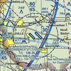
| Sectional chart |
|---|
|
 Download PDF
of official airport diagram from the FAA
| Airport distance calculator |
|---|
|
|
| Sunrise and sunset |
|---|
|
Times for 13-May-2026
| | Local
(UTC-5) | | Zulu
(UTC) |
|---|
| Morning civil twilight | | 05:21 | | 10:21 |
| Sunrise | | 05:50 | | 10:50 |
| Sunset | | 20:01 | | 01:01 |
| Evening civil twilight | | 20:31 | | 01:31 |
|
| Current date and time |
|---|
| Zulu (UTC) | 13-May-2026 23:02:20 |
|---|
| Local (UTC-5) | 13-May-2026 18:02:20 |
|---|
|
| METAR |
|---|
| KBLV | 132155Z AUTO 34010KT 10SM CLR 23/06 A3000 RMK AO2 SLP160 T02310055 $
|
KCPS
15nm W | 132253Z 36015KT 10SM CLR 23/03 A3001 RMK AO2 SLP159 T02280033 $
|
|
| TAF |
|---|
| KBLV | 131600Z 1316/1422 31012G22KT 9999 SKC QNH3001INS BECMG 1401/1402 03006KT 9999 SKC QNH3002INS BECMG 1415/1416 15009KT 9999 SKC QNH3003INS TX25/1320Z TN10/1411Z
|
KCPS
15nm W | 131720Z 1318/1418 32013G23KT P6SM FEW050 FM140100 VRB03KT P6SM SKC FM141500 15005KT P6SM SKC
|
|
| NOTAMs |
|---|
NOTAMs are issued by the DoD/FAA and will open in a separate window not controlled by AirNav.
|
|


