FAA INFORMATION EFFECTIVE 12 JUNE 2025
Location
| FAA Identifier: | COD |
| Lat/Long: | 44-31-12.7000N 109-01-25.7000W
44-31.211667N 109-01.428333W
44.5201944,-109.0238056
(estimated) |
| Elevation: | 5102.3 ft. / 1555.2 m (surveyed) |
| Variation: | 11E (2020) |
| From city: | 2 miles SE of CODY, WY |
| Time zone: | UTC -6 (UTC -7 during Standard Time) |
| Zip code: | 82414 |
Airport Operations
| Airport use: | Open to the public |
| Activation date: | 11/1937 |
| Control tower: | no |
| ARTCC: | SALT LAKE CITY CENTER |
| FSS: | CASPER FLIGHT SERVICE STATION |
| NOTAMs facility: | COD (NOTAM-D service available) |
| Attendance: | 0500-2200 |
| Wind indicator: | lighted |
| Segmented circle: | yes |
| Lights: | ACTVT MALSF RWY 04; MALSR RWY 22; & HIRL RWY 04/22 - CTAF. |
| Beacon: | white-green (lighted land airport)
Operates sunset to sunrise. |
| Landing fee: | yes, LANDING FEE FOR ACFT OVER 9000 LBS |
| Fire and rescue: | ARFF index A |
| Airline operations: | CLSD TO UNSKED ACR OPNS WITH MORE THAN 30 PSGR SEATS EXCP PPR CALL ARPT OPS 307-899-5096. |
Airport Communications
| CTAF/UNICOM: | 122.8 |
| WX AWOS-3PT: | 135.075 (307-527-5197) |
- COMMUNICATIONS PRVDD BY CASPER RADIO ON FREQ 122.3 (CODY RCO).
- APCH/DEP CTL SVC PRVDD BY SALT LAKE ARTCC (ZLC) ON FREQS 127.75/351.9 (BILLINGS RCAG).
Nearby radio navigation aids
| VOR radial/distance | | VOR name | | Freq | | Var |
|---|
| CODr189/6.5 | | CODY VOR/DME | | 111.80 | | 14E |
Airport Services
| Fuel available: | 100 100LL JET-A JET-A+ |
| Parking: | hangars and tiedowns |
| Airframe service: | MAJOR |
| Powerplant service: | MAJOR |
| Bottled oxygen: | NONE |
| Bulk oxygen: | HIGH |
Runway Information
Runway 4/22
| Dimensions: | 8268 x 100 ft. / 2520 x 30 m |
| Surface: | asphalt/grooved, in good condition |
| Weight bearing capacity: | | Single wheel: | 95.0 | | Double wheel: | 124.0 | | Double tandem: | 193.0 |
|
| Runway edge lights: | high intensity |
| RUNWAY 4 | | RUNWAY 22 |
| Latitude: | 44-30.795808N | | 44-31.627432N |
| Longitude: | 109-02.181028W | | 109-00.676327W |
| Elevation: | 5102.3 ft. | | 5075.1 ft. |
| Traffic pattern: | left | | left |
| Runway heading: | 041 magnetic, 052 true | | 221 magnetic, 232 true |
| Displaced threshold: | 690 ft. | | 400 ft. |
| Declared distances: | TORA:8268 TODA:8268 ASDA:7868 LDA:7178 | | TORA:8268 TODA:8268 ASDA:7578 LDA:7178 |
| Markings: | precision, in good condition | | precision, in good condition |
| Visual slope indicator: | 4-light PAPI on left (3.50 degrees glide path)
PAPI UNUSBL BYD 4.0 NM DUE TO RPDLY RSG TRRN N OF FINAL TO RWY 04 | | 4-light PAPI on left (3.00 degrees glide path) |
| Approach lights: | MALSF: 1,400 foot medium intensity approach lighting system with sequenced flashers | | MALSR: 1,400 foot medium intensity approach lighting system with runway alignment indicator lights |
| Runway end identifier lights: | yes | | yes |
| Touchdown point: | yes, no lights | | yes, no lights |
| Obstructions: | 15 ft. pole, 731 ft. from runway, 240 ft. left of centerline, 35:1 slope to clear
+345' POLES ON HILL ON CNTRLN EXTDD. | | 55 ft. gnd, 2087 ft. from runway, 404 ft. left of centerline, 34:1 slope to clear
+84' POLES ON HILL ON CNTRLN EXTDD. |
Airport Ownership and Management from official FAA records
| Ownership: | Publicly-owned |
| Owner: | CITY OF CODY
1338 RUMSEY AVE
CODY, WY 82414
Phone 307-527-7511 |
| Manager: | AARON BUCK
2101 ROGER SEDAM DRIVE, SUITE 1
CODY, WY 82414
Phone 307-587-5096 |
Additional Remarks
| A39-04/22 | PCR VALUE: 300/F/D/X/T |
| - | LOW LEVEL WATERFOWL ON LAKE 1/4 MILE 'SE' OF RY 4 THLD. |
| - | CALL OUT AFTER HRS SVC FM CHOICE AVIATION IS 307-587-9262. |
| - | AIRFIELD SFC CONDS ARE NOT MNTND BTWN HRS OF 2300 - 0500. |
| - | COLD TEMPERATURE AIRPORT. ALTITUDE CORRECTION REQUIRED AT OR BELOW -10C. |
| - | FOR CD IF UNA TO CTC ON FSS FREQ, CTC SALT LAKE ARTCC AT 801-320-2568. |
Instrument Procedures
NOTE: All procedures below are presented as PDF files. If you need a reader for these files, you should download the free Adobe Reader.NOT FOR NAVIGATION. Please procure official charts for flight.
FAA instrument procedures published for use from 12 June 2025 at 0901Z to 10 July 2025 at 0900z.
IAPs - Instrument Approach Procedures |
|---|
| RNAV (GPS) RWY 04 **CHANGED** | |
download (517KB) |
| RNAV (GPS) RWY 22 **CHANGED** | |
download (268KB) |
| RNAV (GPS)-B **CHANGED** | |
download (243KB) |
| VOR-A **CHANGED** | |
download (231KB) |
| NOTE: Special Alternate Minimums apply | |
download (170KB) |
| NOTE: Special Take-Off Minimums/Departure Procedures apply | |
download (647KB) |
Other nearby airports with instrument procedures:
KPOY - Powell Municipal Airport (23 nm NE)
U68 - North Big Horn County Airport (34 nm NE)
KGEY - South Big Horn County Airport (40 nm E)
KHSG - Hot Springs County Airport (56 nm SE)
KWRL - Worland Municipal Airport (57 nm SE)
|
|

Road maps at:
MapQuest
Bing
Google
| Aerial photo |
|---|
WARNING: Photo may not be current or correct
 Photo by David Newcomer
Photo taken 01-Oct-2011
looking northeast.
Photo by David Newcomer
Photo taken 01-Oct-2011
looking northeast.
Do you have a better or more recent aerial photo of Yellowstone Regional Airport that you would like to share? If so, please send us your photo.
|
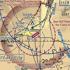
| Sectional chart |
|---|
|
CAUTION: Diagram may not be current

| Airport distance calculator |
|---|
|
|
| Sunrise and sunset |
|---|
|
Times for 27-Jun-2025
| | Local
(UTC-6) | | Zulu
(UTC) |
|---|
| Morning civil twilight | | 04:57 | | 10:57 |
| Sunrise | | 05:34 | | 11:34 |
| Sunset | | 21:04 | | 03:04 |
| Evening civil twilight | | 21:41 | | 03:41 |
|
| Current date and time |
|---|
| Zulu (UTC) | 27-Jun-2025 15:14:10 |
|---|
| Local (UTC-6) | 27-Jun-2025 09:14:10 |
|---|
|
| METAR |
|---|
| KCOD | 271456Z AUTO 00000KT 10SM CLR 20/07 A3003 RMK AO2 SLP113 T02000067 51008
|
|
| TAF |
|---|
| KCOD | 271120Z 2712/2812 19005KT P6SM OVC200 FM271800 21010G15KT P6SM FEW120 FEW200 FM271900 28010G20KT P6SM SCT120 FM280200 30010KT P6SM SCT150 FM280600 21004KT P6SM SCT150
|
|
| NOTAMs |
|---|
NOTAMs are issued by the DoD/FAA and will open in a separate window not controlled by AirNav.
|
|


