FAA INFORMATION EFFECTIVE 14 MAY 2026
Location
| FAA Identifier: | F36 |
| Lat/Long: | 35-17-46.6773N 098-58-03.7763W
35-17.777955N 098-58.062938W
35.2962992,-98.9677156
(estimated) |
| Elevation: | 1589.4 ft. / 484.4 m (surveyed) |
| Variation: | 08E (1985) |
| From city: | 1 mile E of CORDELL, OK |
| Time zone: | UTC -5 (UTC -6 during Standard Time) |
| Zip code: | 73632 |
Airport Operations
| Airport use: | Open to the public |
| Activation date: | 11/1948 |
| Control tower: | no |
| ARTCC: | FORT WORTH CENTER |
| FSS: | MC ALESTER FLIGHT SERVICE STATION |
| NOTAMs facility: | MLC (NOTAM-D service available) |
| Attendance: | INTMT |
| Wind indicator: | lighted |
| Segmented circle: | yes |
| Lights: | ACTVT MIRL RWY 17/35 - CTAF. PAPI RWY 17 & 35 ON CONSLY. |
| Beacon: | white-green (lighted land airport)
Operates sunset to sunrise. |
Airport Communications
| CTAF: | 122.9 |
| WX ASOS at CSM (12 nm W): | 118.450 (580-562-4811) |
| WX AWOS-3 at CLK (15 nm N): | 119.225 (580-323-8477) |
| WX ASOS at HBR (19 nm S): | 133.325 (580-726-6651) |
Nearby radio navigation aids
| VOR radial/distance | | VOR name | | Freq | | Var |
|---|
| BFVr068/12.2 | | BURNS FLAT VORTAC | | 110.00 | | 05E |
| HBRr000/26.2 | | HOBART VORTAC | | 115.85 | | 10E |
Airport Services
| Parking: | tiedowns |
| Airframe service: | NONE |
| Powerplant service: | NONE |
| Bottled oxygen: | NONE |
| Bulk oxygen: | NONE |
Runway Information
Runway 17/35
| Dimensions: | 3430 x 60 ft. / 1045 x 18 m |
| Surface: | asphalt, in good condition |
| Weight bearing capacity: | |
| Runway edge lights: | medium intensity |
| RUNWAY 17 | | RUNWAY 35 |
| Latitude: | 35-18.116397N | | 35-17.551080N |
| Longitude: | 098-58.043250W | | 098-58.043937W |
| Elevation: | 1589.4 ft. | | 1556.1 ft. |
| Traffic pattern: | left | | left |
| Runway heading: | 172 magnetic, 180 true | | 352 magnetic, 000 true |
| Markings: | basic, in good condition | | basic, in good condition |
| Visual slope indicator: | 2-light PAPI on left (3.00 degrees glide path) | | 2-light PAPI on left (3.00 degrees glide path) |
| Touchdown point: | yes, no lights | | yes, no lights |
| Obstructions: | 16 ft. tree, 498 ft. from runway, 124 ft. left of centerline, 18:1 slope to clear | | none |
Runway 4/22
| Dimensions: | 1886 x 100 ft. / 575 x 30 m |
| Surface: | turf, in good condition |
| RUNWAY 4 | | RUNWAY 22 |
| Latitude: | 35-17.567472N | | 35-17.785535N |
| Longitude: | 098-58.233190W | | 098-57.963048W |
| Elevation: | 1550.1 ft. | | 1571.2 ft. |
| Traffic pattern: | left | | left |
| Runway heading: | 037 magnetic, 045 true | | 217 magnetic, 225 true |
| Markings: | none, in poor condition | | none, in poor condition |
| Touchdown point: | yes, no lights | | yes, no lights |
| Obstructions: | 15 ft. tree, 200 ft. from runway, 1 ft. left of centerline, 13:1 slope to clear | | none |
Airport Ownership and Management from official FAA records
| Ownership: | Publicly-owned |
| Owner: | CITY OF CORDELL
CITY HALL 101 E MAIN
CORDELL, OK 73632
Phone 580-832-3825 |
| Manager: | CHARLIE BROWN
525 GREGORY PARK LANE
CORDELL, OK 73632
Phone 580-660-0417 |
Additional Remarks
| - | FOR CD CTC FORT WORTH ARTCC AT 817-858-7584. |
Instrument Procedures
There are no published instrument procedures at F36.
Some nearby airports with instrument procedures:
KCSM - Clinton/Sherman Airport (12 nm W)
KCLK - Clinton Regional Airport (15 nm N)
KHBR - Hobart Regional Airport (19 nm S)
KOJA - Weatherford Stafford Airport (21 nm NE)
KELK - Elk City Regional Business Airport (22 nm W)
|
|

Road maps at:
MapQuest
Bing
Google
| Aerial photo |
|---|
WARNING: Photo may not be current or correct

Do you have a better or more recent aerial photo of Cordell Municipal Airport that you would like to share? If so, please send us your photo.
|
| Sectional chart |
|---|
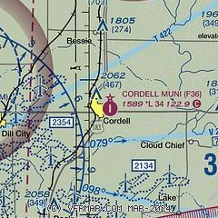
|
| Airport distance calculator |
|---|
|
|
| Sunrise and sunset |
|---|
|
Times for 15-May-2026
| | Local
(UTC-5) | | Zulu
(UTC) |
|---|
| Morning civil twilight | | 06:04 | | 11:04 |
| Sunrise | | 06:33 | | 11:33 |
| Sunset | | 20:32 | | 01:32 |
| Evening civil twilight | | 21:00 | | 02:00 |
|
| Current date and time |
|---|
| Zulu (UTC) | 15-May-2026 18:33:58 |
|---|
| Local (UTC-5) | 15-May-2026 13:33:58 |
|---|
|
| METAR |
|---|
KCSM
12nm W | 151753Z 19020G29KT 10SM CLR 34/11 A2969 RMK AO2 PK WND 19033/1712 SLP023 6//// T03440106 10350 20206 58015 PNO
|
KCLK
14nm N | 151815Z AUTO 19014G17KT 10SM SCT120 31/10 A2970 RMK AO2
|
KHBR
19nm S | 151753Z AUTO 19024G31KT 10SM CLR 36/12 A2969 RMK AO2 PK WND 20032/1740 SLP028 T03610117 10361 20206 56024 $
|
KOJA
21nm NE | 151810Z AUTO 20011G23KT 10SM CLR 32/13 A2970 RMK AO2 T03190129
|
KELK
22nm W | 151815Z AUTO 20017KT 10SM BKN190 33/11 A2967 RMK AO2 T03330106 $
|
|
| TAF |
|---|
KCSM
12nm W | 151720Z 1518/1618 19024G34KT P6SM BKN150 PROB30 1521/1602 VRB50KT 6SM -TSRA BKN080CB FM160300 18023KT P6SM SCT250 WS020/20050KT FM161500 19019G27KT P6SM SKC
|
|
| NOTAMs |
|---|
NOTAMs are issued by the DoD/FAA and will open in a separate window not controlled by AirNav.
|
|

