FAA INFORMATION EFFECTIVE 25 DECEMBER 2025
Location
| FAA Identifier: | HND |
| Lat/Long: | 35-58-22.2780N 115-08-03.7850W
35-58.371300N 115-08.063083W
35.9728550,-115.1343847
(estimated) |
| Elevation: | 2491.4 ft. / 759.4 m (surveyed) |
| Variation: | 13E (2005) |
| From city: | 11 miles S of LAS VEGAS, NV |
| Time zone: | UTC -8 (UTC -7 during Daylight Saving Time) |
| Zip code: | 89052 |
Airport Operations
| Airport use: | Open to the public |
| Activation date: | 10/1970 |
| Control tower: | yes |
| ARTCC: | LOS ANGELES CENTER |
| FSS: | RENO FLIGHT SERVICE STATION |
| NOTAMs facility: | HND (NOTAM-D service available) |
| Attendance: | 0500-2230 |
| Wind indicator: | lighted |
| Segmented circle: | yes |
| Lights: | ACTVT REIL RWY 17R & 35L, 17L & 35R; PAPI RWY 17R & 35L, 17L & 35R; MIRL RWY 17R/35L, 17L/35R - CTAF. |
| Beacon: | white-green (lighted land airport)
Operates sunset to sunrise. |
Airport Communications
| CTAF: | 125.1 |
| UNICOM: | 122.95 |
| ATIS: | 120.775 |
| WX AWOS-3PT: | 120.775 (702-614-4537) |
| HENDERSON GROUND: | 127.8 [0600-2000] |
| HENDERSON TOWER: | 125.1 [0600-2000] |
| LAS VEGAS APPROACH: | 125.475 |
| LAS VEGAS DEPARTURE: | 125.475 |
| CLEARANCE DELIVERY: | 118.425 125.475 ;WHEN TWR CLSD |
| GAMES STAR: | 125.025 |
| NTNDO RNAV STAR: | 125.475 |
| WX ASOS at LAS (7 nm N): | PHONE 702-582-5334 |
| WX AWOS-3 at BVU (13 nm E): | 118.475 (702-293-1532) |
| WX ASOS at VGT (15 nm N): | 118.05 (702-648-6633) |
- COMMUNICATIONS PRVDD BY RENO RADIO ON FREQ 122.6 (MOUNT POTOSI RCO).
Nearby radio navigation aids
| VOR radial/distance | | VOR name | | Freq | | Var |
|---|
| LASr154/6.5 | | LAS VEGAS VORTAC | | 116.90 | | 15E |
| BLDr249/13.2 | | BOULDER CITY VORTAC | | 116.70 | | 15E |
Airport Services
| Fuel available: | 100LL JET-A
100LL:100LL SELF-SVC H24. |
| Parking: | tiedowns |
| Airframe service: | MINOR |
| Powerplant service: | MINOR |
| Bulk oxygen: | HIGH/LOW |
Runway Information
Runway 17R/35L
| Dimensions: | 6501 x 100 ft. / 1982 x 30 m |
| Surface: | asphalt, in excellent condition |
| Weight bearing capacity: | | Single wheel: | 30.0 | | Double wheel: | 60.0 |
|
| Runway edge lights: | medium intensity |
| RUNWAY 17R | | RUNWAY 35L |
| Latitude: | 35-58.853628N | | 35-57.782487N |
| Longitude: | 115-08.118865W | | 115-08.131993W |
| Elevation: | 2401.8 ft. | | 2491.4 ft. |
| Traffic pattern: | left | | left |
| Runway heading: | 168 magnetic, 181 true | | 348 magnetic, 001 true |
| Markings: | nonprecision, in good condition | | nonprecision, in good condition |
| Visual slope indicator: | 4-light PAPI on left (3.00 degrees glide path) | | 4-light PAPI on left (4.30 degrees glide path)
PAPI UNUSBL BYD 3.3 NM FM RWY THR. |
| Runway end identifier lights: | yes | | yes |
| Touchdown point: | yes, no lights | | yes, no lights |
| Obstructions: | none | | 44 ft. road, 1095 ft. from runway, 20:1 slope to clear |
Runway 17L/35R
| Dimensions: | 5001 x 75 ft. / 1524 x 23 m |
| Surface: | asphalt, in excellent condition |
| Weight bearing capacity: | | Single wheel: | 30.0 | | Double wheel: | 30.0 |
|
| Runway edge lights: | medium intensity |
| Operational restrictions: | OPS DLY 1900-0700. |
| RUNWAY 17L | | RUNWAY 35R |
| Latitude: | 35-58.852492N | | 35-58.028512N |
| Longitude: | 115-07.976895W | | 115-07.987140W |
| Elevation: | 2405.9 ft. | | 2474.9 ft. |
| Traffic pattern: | left | | left |
| Runway heading: | 168 magnetic, 181 true | | 348 magnetic, 001 true |
| Markings: | nonprecision, in good condition | | nonprecision, in good condition |
| Visual slope indicator: | 4-light PAPI on left (3.00 degrees glide path) | | 4-light PAPI on left (4.30 degrees glide path)
PAPI UNUSBL BYD 3.5 NM FM RWY THR. |
| Runway end identifier lights: | yes | | yes |
| Touchdown point: | yes, no lights | | yes, no lights |
Airport Ownership and Management from official FAA records
| Ownership: | Publicly-owned |
| Owner: | CLARK COUNTY
3500 EXECUTIVE TERMINAL DR., SUITE 100
HENDERSON, NV 89052
Phone 702-261-4800 |
| Manager: | BRUCE DAUGHERTY
3500 EXECUTIVE TERMINAL DRIVE, SUITE 100
HENDERSON, NV 89052
Phone 702-261-4802
OPS: 702-261-4851. |
Additional Remarks
| - | COML AIR TOUR TFC ARR FM SE DALGT HR. |
| - | CTN: ACFT DEP RWY 17R OR 35L MUST VFY PSN ON RWY NOT ON PARL TWY. |
| - | FOR CD WHEN ATCT CLSD CTC LAS APCH ON 125.475 OR PH 725-200-4432. |
| - | WHEN SPL EVENT PRKG PPR PROGRAM NOTAM IS ACTV, TSNT ACFT OPERS NOT PERM BASED NEED TO OBTAIN A PPR NR FM AN FBO FOR EA LDG. PPR APPVL & CONFIRMATION NRS CAN BE OBTAINED FM THE SEL FBO AT 702-261-7775. PPR CONFIRMATION NRS SHOULD BE ENTERED IN THE RMKS SECTION OF EACH FLT PLAN. |
Instrument Procedures
NOTE: All procedures below are presented as PDF files. If you need a reader for these files, you should download the free Adobe Reader.NOT FOR NAVIGATION. Please procure official charts for flight.
FAA instrument procedures published for use from 25 December 2025 at 0901z to 22 January 2026 at 0900z.
STARs - Standard Terminal Arrivals |
|---|
| BOEGY TWO (RNAV) | |
download (143KB) |
| GAMES TWO (RNAV) | |
download (157KB) |
| NTNDO ONE (RNAV) | |
download (185KB) |
| PUMLE ONE | |
download (176KB) |
IAPs - Instrument Approach Procedures |
|---|
| RNAV (GPS)-B | |
download (308KB) |
| VOR-C | |
download (305KB) |
| NOTE: Special Alternate Minimums apply | |
download (120KB) |
Departure Procedures |
|---|
| OYODA TWO (RNAV) | |
2 pages:
[1] [2] (365KB) |
| SCAMR FOUR (RNAV) | |
2 pages:
[1] [2] (382KB) |
| NOTE: Special Take-Off Minimums/Departure Procedures apply | |
download (357KB) |
Other nearby airports with instrument procedures:
KLAS - Harry Reid International Airport (7 nm N)
KBVU - Boulder City Municipal Airport (13 nm E)
KVGT - North Las Vegas Airport (15 nm N)
KLSV - Nellis Air Force Base (17 nm N)
KIFP - Laughlin/Bullhead International Airport (57 nm SE)
|
|

Road maps at:
MapQuest
Bing
Google
| Aerial photo |
|---|
WARNING: Photo may not be current or correct
 Photo by focalflight.com
Photo taken 09-Dec-2015
looking south.
Photo by focalflight.com
Photo taken 09-Dec-2015
looking south.
Do you have a better or more recent aerial photo of Henderson Executive Airport that you would like to share? If so, please send us your photo.
|
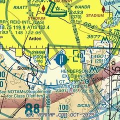
| Sectional chart |
|---|
|
CAUTION: Diagram may not be current
 Download PDF
of official airport diagram from the FAA
| Airport distance calculator |
|---|
|
|
| Sunrise and sunset |
|---|
|
Times for 20-Jan-2026
| | Local
(UTC-8) | | Zulu
(UTC) |
|---|
| Morning civil twilight | | 06:22 | | 14:22 |
| Sunrise | | 06:50 | | 14:50 |
| Sunset | | 16:54 | | 00:54 |
| Evening civil twilight | | 17:21 | | 01:21 |
|
| Current date and time |
|---|
| Zulu (UTC) | 21-Jan-2026 05:31:27 |
|---|
| Local (UTC-8) | 20-Jan-2026 21:31:27 |
|---|
|
| METAR |
|---|
| KHND | 210456Z AUTO 17006KT 10SM CLR 07/M06 A3019 RMK AO2 SLP242 T00721061 $
|
KLAS
7nm N | 210456Z 22004KT 10SM BKN250 10/M05 A3018 RMK AO2 SLP218 T01001050
|
KBVU
13nm E | 210515Z AUTO 35003KT 10SM CLR 09/M07 A3016 RMK AO2
|
KVGT
14nm N | 210453Z AUTO 30005KT 10SM CLR 10/M05 A3017 RMK AO2 SLP233 T01001050
|
KLSV
16nm N | 210455Z 00000KT 10SM SCT250 09/M05 A3014 RMK AO2A SLP206 T00861053 $
|
|
| TAF |
|---|
| KHND | 201726Z 2018/2118 VRB06KT P6SM SKC FM202000 02006KT P6SM FEW250 FM210300 19007KT P6SM FEW150 SCT250 FM211600 VRB06KT P6SM SCT150 BKN250
|
KLAS
7nm N | 210230Z 2103/2206 25006KT P6SM FEW150 SCT250 FM211600 VRB05KT P6SM SCT150 BKN250 FM212000 04006KT P6SM SCT150 BKN250 FM220300 24006KT P6SM SCT150 BKN250
|
KVGT
14nm N | 201726Z 2018/2118 VRB06KT P6SM FEW250 FM202000 10006KT P6SM FEW250 FM210200 VRB06KT P6SM FEW150 SCT250 FM210500 33006KT P6SM FEW150 SCT250
|
KLSV
16nm N | 202300Z 2023/2205 07009KT 9999 FEW250 QNH3014INS BECMG 2101/2102 VRB06KT 9999 SCT250 QNH3015INS BECMG 2106/2107 01006KT 9999 FEW160 SCT250 QNH3018INS BECMG 2116/2117 04009KT 9999 BKN220 QNH3021INS TX19/2023Z TN06/2115Z
|
|
| NOTAMs |
|---|
NOTAMs are issued by the DoD/FAA and will open in a separate window not controlled by AirNav.
|
|


