FAA INFORMATION EFFECTIVE 16 APRIL 2026
Location
| FAA Identifier: | CON |
| Lat/Long: | 43-12-09.8000N 071-30-08.2000W
43-12.163333N 071-30.136667W
43.2027222,-71.5022778
(estimated) |
| Elevation: | 341.7 ft. / 104.2 m (surveyed) |
| Variation: | 16W (1995) |
| From city: | 2 miles E of CONCORD, NH |
| Time zone: | UTC -4 (UTC -5 during Standard Time) |
| Zip code: | 03301 |
Airport Operations
| Airport use: | Open to the public |
| Activation date: | 03/1947 |
| Control tower: | no |
| ARTCC: | BOSTON CENTER |
| FSS: | BANGOR FLIGHT SERVICE STATION |
| NOTAMs facility: | CON (NOTAM-D service available) |
| Attendance: | 0700-1700
EXC THANKSGIVING, CHRISTMAS, & NEW YEARS DAY. |
| Wind indicator: | lighted |
| Segmented circle: | no |
| Lights: | ACTVT MALSR RWY 35; HIRL RWY 17/35; MIRL RWY 12/30 - CTAF. |
| Beacon: | white-green (lighted land airport)
Operates sunset to sunrise. |
Airport Communications
| CTAF/UNICOM: | 122.7 |
| WX ASOS: | 132.325 (603-451-1106) |
| BOSTON APPROACH: | 127.35 |
| BOSTON DEPARTURE: | 127.35 |
| CLEARANCE DELIVERY: | 133.65 |
| WX ASOS at MHT (16 nm S): | 119.55 (603-626-6902) |
Nearby radio navigation aids
| VOR radial/distance | | VOR name | | Freq | | Var |
|---|
| CONr123/3.4 | | CONCORD VOR/DME | | 112.90 | | 15W |
| NDB name | | Hdg/Dist | | Freq | | Var | | ID |
|---|
| EPSOM | | 353/5.5 | | 216 | | 16W | | CO | -.-. --- |
| ROLLINS | | 284/29.5 | | 260 | | 16W | | ESG | . ... --. |
| CLAREMONT | | 121/39.2 | | 233 | | 16W | | CNH | -.-. -. .... |
Airport Services
| Fuel available: | 100LL JET-A
100LL:SELF SVC 100LL AVBL 24 HRS WITH CREDIT CARD. FOR JET A AFT HRS CALL 603-228-2267 & FLW PROMPTS. |
| Parking: | hangars and tiedowns |
| Airframe service: | MAJOR |
| Powerplant service: | MAJOR |
| Bottled oxygen: | NONE |
| Bulk oxygen: | NONE |
Runway Information
Runway 17/35
| Dimensions: | 6005 x 100 ft. / 1830 x 30 m |
| Surface: | asphalt, in fair condition |
| Weight bearing capacity: | | Single wheel: | 43.0 | | Double wheel: | 60.0 |
|
| Runway edge lights: | high intensity |
| RUNWAY 17 | | RUNWAY 35 |
| Latitude: | 43-12.490253N | | 43-11.593902N |
| Longitude: | 071-30.459678W | | 071-29.889803W |
| Elevation: | 340.6 ft. | | 331.4 ft. |
| Traffic pattern: | left | | left |
| Runway heading: | 171 magnetic, 155 true | | 351 magnetic, 335 true |
| Displaced threshold: | 641 ft. | | no |
| Markings: | nonprecision, in good condition | | precision, in good condition |
| Visual slope indicator: | 4-light PAPI on left (3.00 degrees glide path) | | 4-box VASI on left (3.00 degrees glide path) |
| Approach lights: | | | MALSR: 1,400 foot medium intensity approach lighting system with runway alignment indicator lights |
| Touchdown point: | yes, no lights | | yes, no lights |
| Instrument approach: | | | ILS |
| Obstructions: | 68 ft. tree, 858 ft. from runway, 105 ft. left of centerline, 9:1 slope to clear
APCH SLP 26:1 TO DTHR. | | 64 ft. trees, 662 ft. from runway, 789 ft. left of centerline, 7:1 slope to clear |
Runway 12/30
| Dimensions: | 3200 x 75 ft. / 975 x 23 m |
| Surface: | asphalt, in good condition |
| Weight bearing capacity: | |
| Runway edge lights: | medium intensity |
| RUNWAY 12 | | RUNWAY 30 |
| Latitude: | 43-12.460627N | | 43-12.324012N |
| Longitude: | 071-30.414713W | | 071-29.719283W |
| Elevation: | 339.8 ft. | | 341.7 ft. |
| Traffic pattern: | left | | left |
| Runway heading: | 121 magnetic, 105 true | | 301 magnetic, 285 true |
| Markings: | nonprecision, in good condition | | nonprecision, in good condition |
| Touchdown point: | yes, no lights | | yes, no lights |
| Obstructions: | 19 ft. ant, 220 ft. from runway, 133 ft. right of centerline, 1:1 slope to clear | | 13 ft. gnd, 293 ft. from runway, 143 ft. right of centerline, 7:1 slope to clear
15 FT TREES 57 FT FM THR, 248 FT R. |
Airport Ownership and Management from official FAA records
| Ownership: | Publicly-owned |
| Owner: | CITY OF CONCORD
41 GREEN ST
CONCORD, NH 03301
Phone 603-225-8570
CITY MGR OFC. |
| Manager: | DAVID ROLLA
71 AIRPORT RD
CONCORD, NH 03301
Phone 603-228-2267 |
Additional Remarks
| - | WILDLIFE ON & INVOF ARPT. |
| - | COMPASS ROSE CALIBRATED 2014. |
| - | FOR CD CTC BOSTON APCH AT 603-594-5552. |
| - | OPS ON NG TWY & RAMP PROHIBITED WO PRIOR CDN DUE TO SCTY. |
| - | DAY & NGT VFR HEL OPS TO & FM NEW HAMPSHIRE STATE POLICE HNGR. |
| - | OPS OFF PAVED SFCS PROHIBITED DUE TO CONSERVATION MGMT ACTS. |
| - | RWY 35 DSGND CALM WIND RWY. |
| - | MIL TWY & RAMP PCN R/A/W/T. |
| - | HVY HEL ACT 1 NM ESE OF ARPT 800 FT & BLW. |
Instrument Procedures
NOTE: All procedures below are presented as PDF files. If you need a reader for these files, you should download the free Adobe Reader.NOT FOR NAVIGATION. Please procure official charts for flight.
FAA instrument procedures published for use from 16 April 2026 at 0901Z to 14 May 2026 at 0900Z.
IAPs - Instrument Approach Procedures |
|---|
| ILS OR LOC RWY 35 | |
download (221KB) |
| RNAV (GPS) RWY 12 | |
download (194KB) |
| RNAV (GPS) RWY 17 | |
download (185KB) |
| RNAV (GPS) RWY 35 | |
download (240KB) |
| VOR-A | |
download (159KB) |
| NOTE: Special Alternate Minimums apply | |
download (128KB) |
| NOTE: Special Take-Off Minimums/Departure Procedures apply | |
download (497KB) |
Other nearby airports with instrument procedures:
KMHT - Manchester Boston Regional Airport (16 nm S)
KLCI - Laconia Municipal Airport (23 nm N)
KASH - Boire Field Airport (25 nm S)
KDAW - Skyhaven Airport (26 nm E)
KPSM - Portsmouth International Airport at Pease (31 nm E)
|
|

Road maps at:
MapQuest
Bing
Google
| Aerial photo |
|---|
WARNING: Photo may not be current or correct
 Photo by Jan Krouwer
Photo taken 02-Oct-2017
looking west.
Photo by Jan Krouwer
Photo taken 02-Oct-2017
looking west.
Do you have a better or more recent aerial photo of Concord Municipal Airport that you would like to share? If so, please send us your photo.
|
| Sectional chart |
|---|
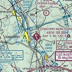
|
| Airport distance calculator |
|---|
|
|
| Sunrise and sunset |
|---|
|
Times for 06-May-2026
| | Local
(UTC-4) | | Zulu
(UTC) |
|---|
| Morning civil twilight | | 05:02 | | 09:02 |
| Sunrise | | 05:34 | | 09:34 |
| Sunset | | 19:52 | | 23:52 |
| Evening civil twilight | | 20:23 | | 00:23 |
|
| Current date and time |
|---|
| Zulu (UTC) | 06-May-2026 17:43:13 |
|---|
| Local (UTC-4) | 06-May-2026 13:43:13 |
|---|
|
| METAR |
|---|
| KCON | 061651Z AUTO 20018G28KT 10SM BKN039 BKN049 OVC070 21/12 A2972 RMK AO2 PK WND 24028/1649 SLP062 T02110117 $
|
KMHT
16nm S | 061653Z 21011G21KT 10SM SCT050 OVC060 22/12 A2971 RMK AO2 SLP070 T02220117
|
|
| TAF |
|---|
| KCON | 061120Z 0612/0712 18007KT P6SM SCT100 BKN250 FM061300 19010G20KT P6SM BKN100 OVC150 FM061900 19012G23KT 3SM RA OVC020 FM070400 29006KT P6SM SCT025 BKN060
|
KMHT
16nm S | 061120Z 0612/0712 18010KT P6SM SCT100 BKN250 FM061300 19010G20KT P6SM BKN100 OVC150 FM061900 19012G23KT 3SM RA OVC020 FM070400 29006KT P6SM SCT025 BKN060
|
|
| NOTAMs |
|---|
NOTAMs are issued by the DoD/FAA and will open in a separate window not controlled by AirNav.
|
|


